R01 TR: Tableland/Alta Meadow Loop - 08/14 2015
Posted: Sat Apr 16, 2016 6:40 pm
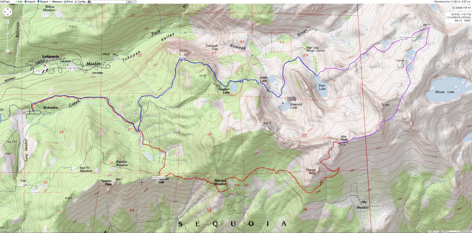
Finally getting around to sharing some trips. I was looking for a short trip (2 nights) with easy access to higher country and no crowds. This loop through Tableland in Sequoia NP fit the bill. Started from Wolverton and went clockwise:
Took the trail past the Watchtower and began the cross country portion near the Pear Lake ranger station. Spent the first night maybe a mile past the ranger station in complete solitude. The next day continued up to Tableland. Here is a view looking back on the enjoyable cross country route after gaining Tableland:
Upon climbing up to Tableland, I was surprised to see another soul. It turned out to be the gentleman who maintains http://sierrahiker.com/, and, who I think was surprised to see me. After chatting for a bit with this super-knowledgeable fellow, we parted ways. I strolled across Tableland to go sit on the Kings-Kaweah Divide and see what I could see. I'll only provide a picture of Tableland while heading that direction, and not the view from the Divide:
From the Divide, crossing back over Tableland, I picked out a route to Moose Lake. Standing on the shore of the lake creates an infinity pool-type effect, with the Mineral King area providing the backdrop. From articles I came across, apparently a celebrity got lost trying to find her way to Moose Lake about a decade ago.
From Moose Lake, my planned cross country route took me over to Alta Meadow. Apparently a maintained trail used to exist between these two areas, and I even found a report that a good use-trail was still in existence. However, my track record with "good use-trails" proved consistent, and I couldn't find it. Maybe it's just me...Anyway, the big deal is to go west from the lake. One definitely does not want to be drawn into heading south down Buck Canyon - which is reported impassable and is really gnarly-looking when viewed from the High Sierra Trail. Here is the point where I crossed over a little ridge, this point is south-south-west of Moose Lake:
Shortly after crossing that little ridge, Alta Meadow can be seen. I still had no luck finding a use-trail and probably took a more difficult route than necessary in an attempt not to lose too much elevation while traversing:
Spent the night at Alta Meadow, where I believe another party had camped as well. I had used up a lot of daylight enjoying Tableland and the Divide, which resulted in setting up camp as darkness fell. Easy trail walk out the next day.
- Route
- image.jpeg (169.91 KiB) Viewed 338 times
- Looking Back
- image.jpeg (159.91 KiB) Viewed 338 times
- Looking toward the Kings-Kaweah Divide
- image.jpeg (88.52 KiB) Viewed 338 times
- Moose Lake
- image.jpeg (96.22 KiB) Viewed 338 times
- Crossing over
- image.jpeg (136.63 KiB) Viewed 338 times
- Traverse to Alta
- image.jpeg (87.97 KiB) Viewed 338 times