R01 TR: High Sierra Trail to Mt Stewart 10/11/2015
Posted: Tue Oct 13, 2015 9:14 pm
I haven't been running in the Sierras since August! The Rough Fire kept me going elsewhere. This weekend, I was thinking of going to the Southwest, but the weather forecast suddenly warmed 5-10 degrees. So I decided to do a more casual run up the High Sierra Trail. Two of the easy peaks are Eagle Scout Peak and Mt Stewart. I like the looks of Stewart better. While I'd earlier considered looping around the north side of Mt Stewart to come down by Tamarack Lake, this weekend I wanted more on-trail running. So I just planned on an out-and-back up to Mt Stewart, dawn to dusk.
Car-camping at Lodgepole Saturday night, I honestly felt uncertain. This would be my tenth trail run this season, and one of the easier ones. But still, it's not trivial. And I'm in poor shape and recovering from injuries… I decided to run heavy, with trekking poles and lots of gear, prepared to go after dark if needed.
Sunday morning, I started at 6:20am, as it was starting to get light. I used my flashlight to help navigate the rocks for the first few miles. It was warm.
I moved steadily to Bearpaw Meadow (11.1 miles, arrived at 8:10am). The camp there has been disassembled and the water at the ranger station turned off. (I didn't go down to the campground to check the faucets there.) Continuing on, descending the switchbacks from Lone Pine Creek to Hamilton Creek, I found a small bear in a tree. I grabbed a photo before it startled, going downhill. I unpacked my trekking poles! And for the rest of the way to Hamilton Creek, called out "hey bear" before rounding any corners. (Curiously, on my way back, I found the bear in a tree in almost the exact same spot—but couldn't get another photo.)

 IMG_20151011_084834 by breic, on Flickr
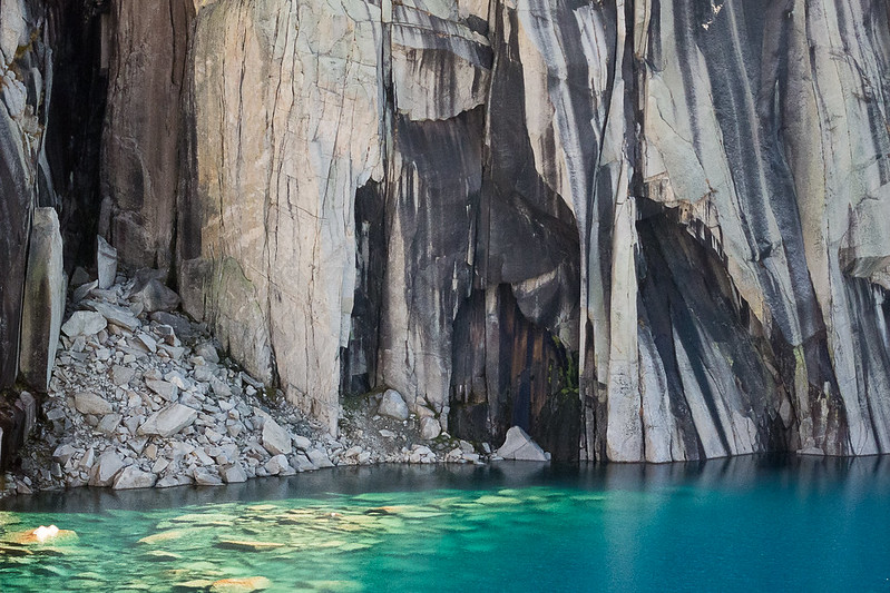
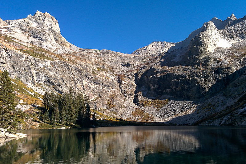
I got to Hamilton Lake around 9:10am. I refilled both my water bottles (.5L each), and kept going. The next three miles to Precipice Lake (passing through a tunnel halfway) is a tough climb, and I took it really slowly, not trying to push at all. I felt some wind coming down from the pass, so figured the reflections on Precipice wouldn't be great anyway.

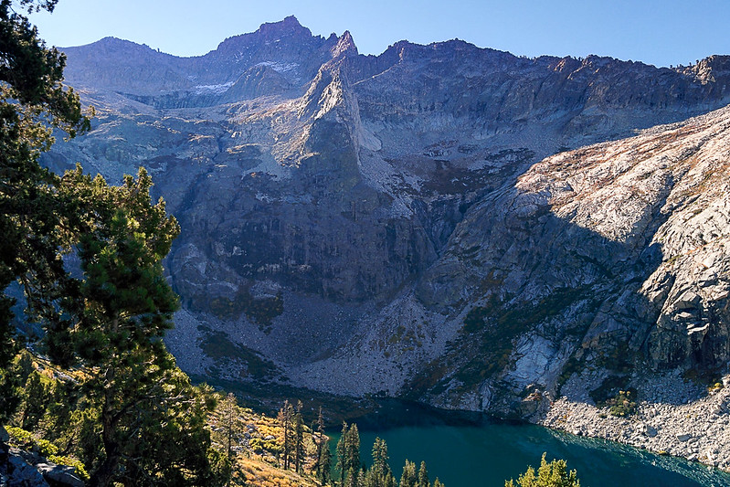 IMG_20151011_093024 by breic, on Flickr
I got to Precipice Lake about 10:15am, spent ten minutes taking photos, then continued to Kaweah Gap, arriving around 10:35.

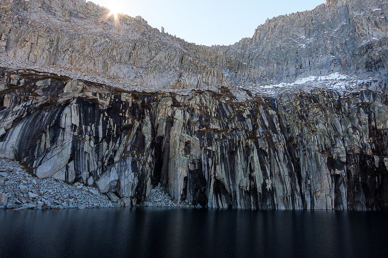 IMG_2073 by breic, on Flickr

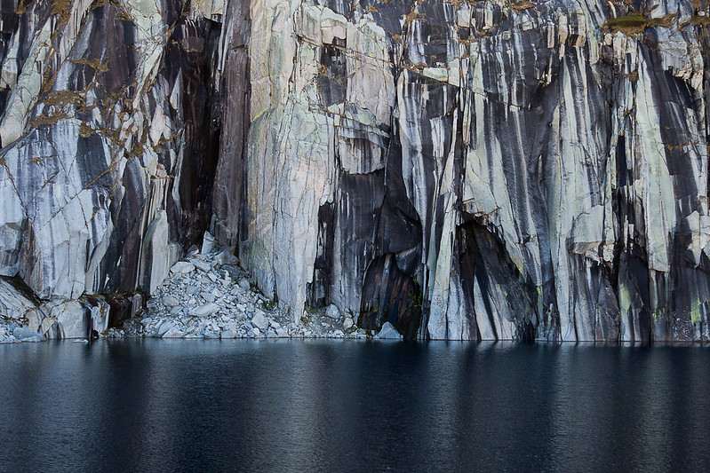 IMG_2074 by breic, on Flickr
Kaweah Gap

 IMG_20151011_103812 by breic, on Flickr
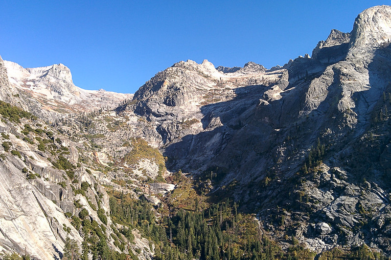
From the pass (elevation 10,689'), I followed the trail down for a switchback, and then cut off trail into Nine Lakes Basin. I stayed well above the lake, basically keeping right at the boundary between rough stacks of jumbled rocks (higher up) and grass with rocks. I didn't attempt to move quickly. I headed toward a grassy gully that goes up to the left diagonally. (This route is from Summitpost: http://www.summitpost.org/mount-stewart/154969 .) Going up the gully, there is eventually an exposed face to which you can go left or right. I stayed left (straight). (On the descent, I went the other way. It had more slabs, which in bad conditions could be slippery, and wasn't really any faster. Part of my problem is that I like to explore, so even when I realize that I'm going the wrong way, I want to keep going to see where this way goes!)


In this picture you can see the line of the gully, starting in the middle and heading up to the left. The peak straight ahead is not Mt Stewart!

 IMG_20151011_105914 by breic, on Flickr
The gully.

 IMG_20151011_110943 by breic, on Flickr
A decision point: Ascending I went left of the bulge, and I descended the right side. Left is better.

 IMG_20151011_110946 by breic, on Flickr
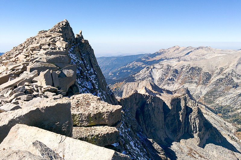
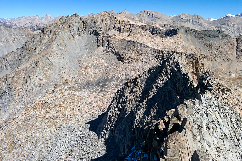
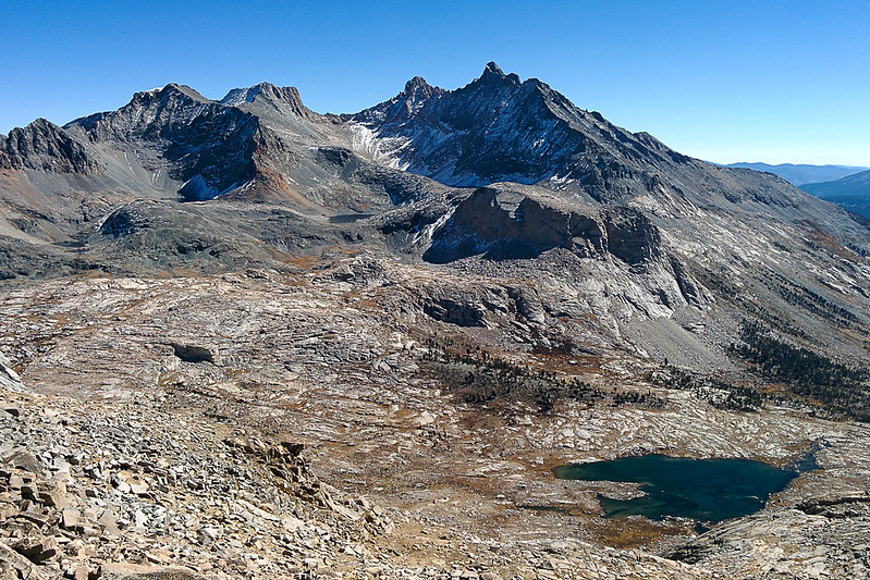
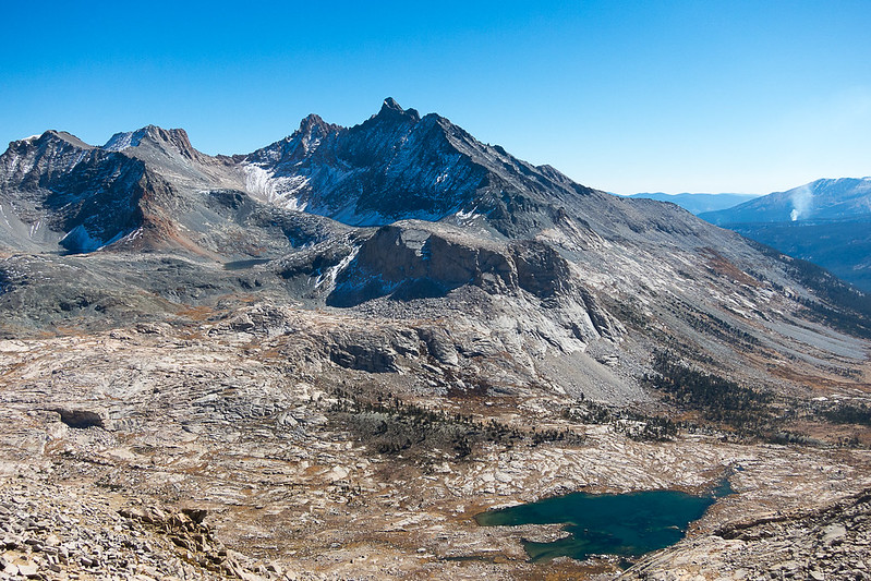
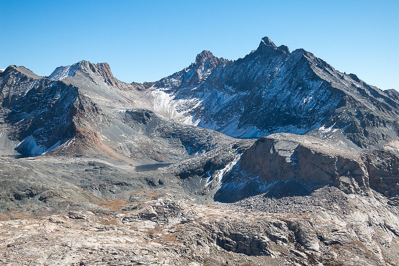
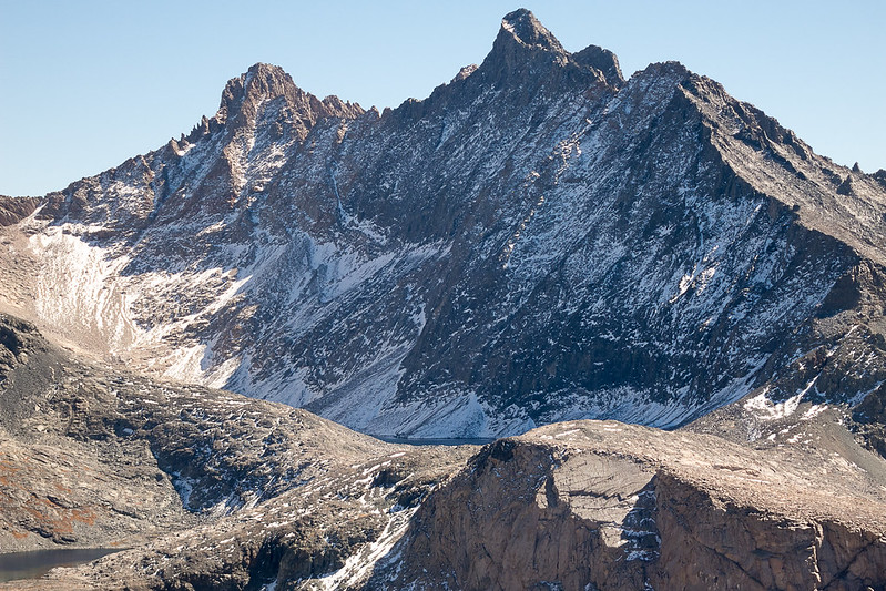
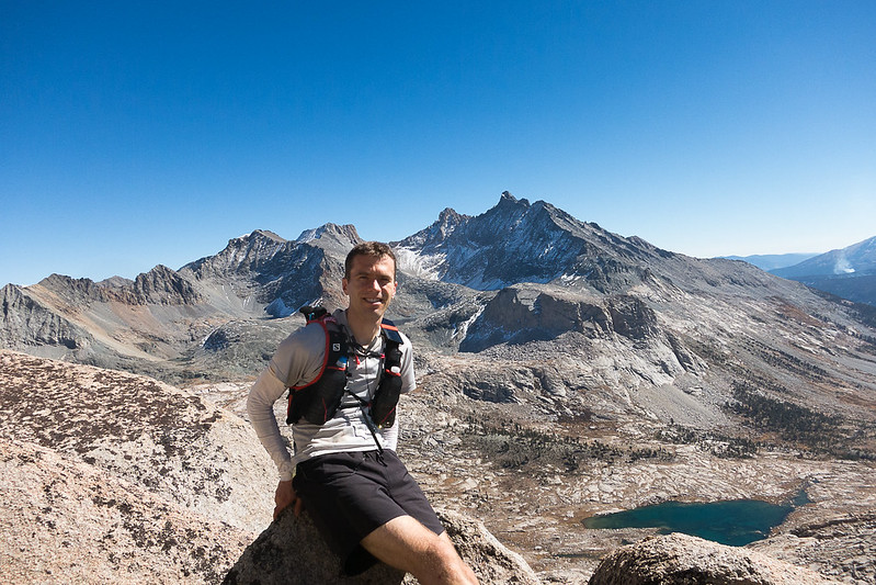
The gully ends in a basin. From there I climbed north easily to the most prominent peak, passing a few tiny patches of snow, arriving around 12:10pm. But this was not Mt Stewart! Oops. It looks equally high. Oh well, it was easy and did have nice views—even giving a glimpse of Mt Whitney, which is not visible from Mt Stewart's summit. I dropped back down a little below the ridge and headed to Mt Stewart. According to Summitpost, "The summit block itself is third class with some exposure, and is most easily climbed via a subsidiary block on its south side, or by a friction slab on its east side." It was very easy, and I didn't notice any exposure. I hung out and took photos all around.
Mt Stewart from the adjacent peak

 IMG_20151011_115527 by breic, on Flickr

 IMG_20151011_122234 by breic, on Flickr
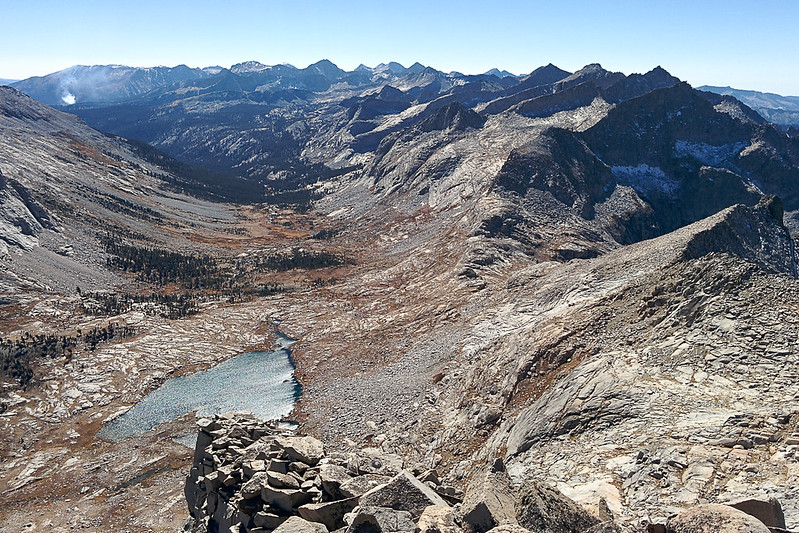
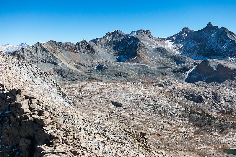
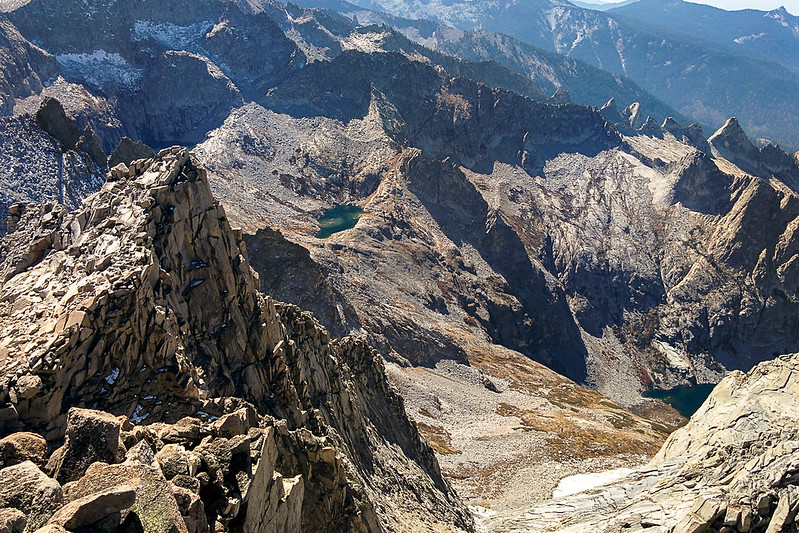
Nine Lakes Basin (south)

 IMG_20151011_120945 by breic, on Flickr
Tamarack Lake (north)

 IMG_20151011_121026 by breic, on Flickr
Zooming in on the route above Tamarack Lake

 IMG_2084 by breic, on Flickr

 IMG_2085 by breic, on Flickr
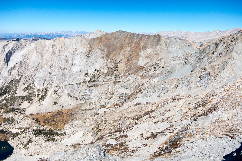
Ridge to Lion Rock

 IMG_20151011_121054 by breic, on Flickr
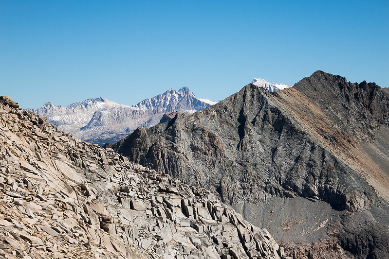
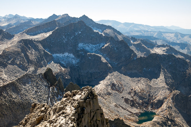
Whitney beyond the Kaweahs

 IMG_2087 by breic, on Flickr

 IMG_2086 by breic, on Flickr
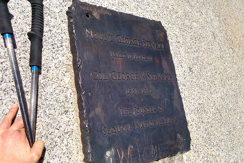
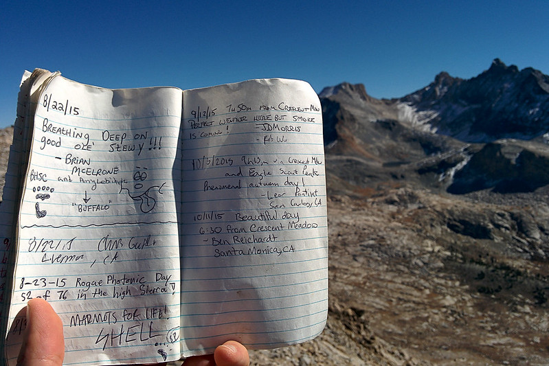
Summit register

 IMG_20151011_124933 by breic, on Flickr
Black Kaweah (Lawson and Kaweah Queen to the left)

 IMG_20151011_125043 by breic, on Flickr
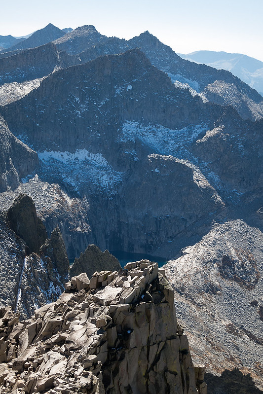
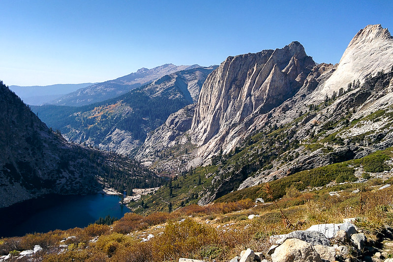
Precipice to Hamilton Lakes

 IMG_20151011_125103 by breic, on Flickr

 IMG_2075 by breic, on Flickr

 IMG_2089 by breic, on Flickr
Black Kaweah

 IMG_2079 by breic, on Flickr

 IMG_2078 by breic, on Flickr

 IMG_2077 by breic, on Flickr
Looking west; Hamilton Lake is in the lower left corner, Cherubim Dome and Angel Wings in the center, and you can see Moro Rock (by Crescent Meadow) in the far distance (center top)

 IMG_20151011_125146 by breic, on Flickr

 IMG_2101 by breic, on Flickr
Panorama south

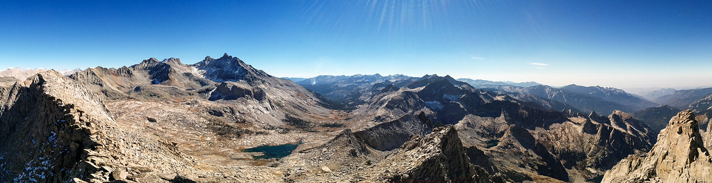 PANO_20151011_125256 by breic, on Flickr
Panorama west

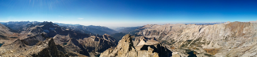 PANO_20151011_125224 by breic, on Flickr
Then, around 1pm, I dropped back down. This time I went all the way down to the lake, to refill my water again. At Kaweah Gap, I started running again, but Precipice Lake begged to be photographed, so I did not get far! Just below Precipice Lake I ran into a day-hiker from Buck Creek, the first person I'd seen since leaving Hamilton Lake in the morning. We chatted a bit.

 IMG_2122 by breic, on Flickr
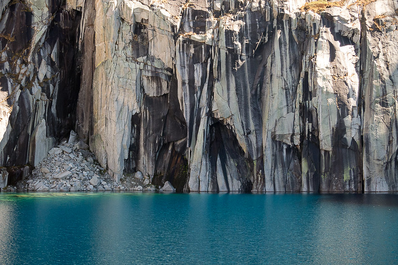 IMG_2132 by breic, on Flickr

 IMG_2141 by breic, on Flickr

 IMG_20151011_150512 by breic, on Flickr

 IMG_20151011_152429 by breic, on Flickr

 IMG_20151011_153702 by breic, on Flickr

 IMG_20151011_161826 by breic, on Flickr
I refilled my water bottles again at Hamilton Lake (3:30pm). I kept moving, and refilled one last time at Buck Creek (10 miles from Crescent Meadow). I was able to keep an easy pace. I guess since I'd taken the climb from Hamilton to Precipice Lake so easily, and then had a long break ascending Mt Stewart, I wasn't tired at all. In the last mile, I caught the sun dropping over the rise by Moro Rock.

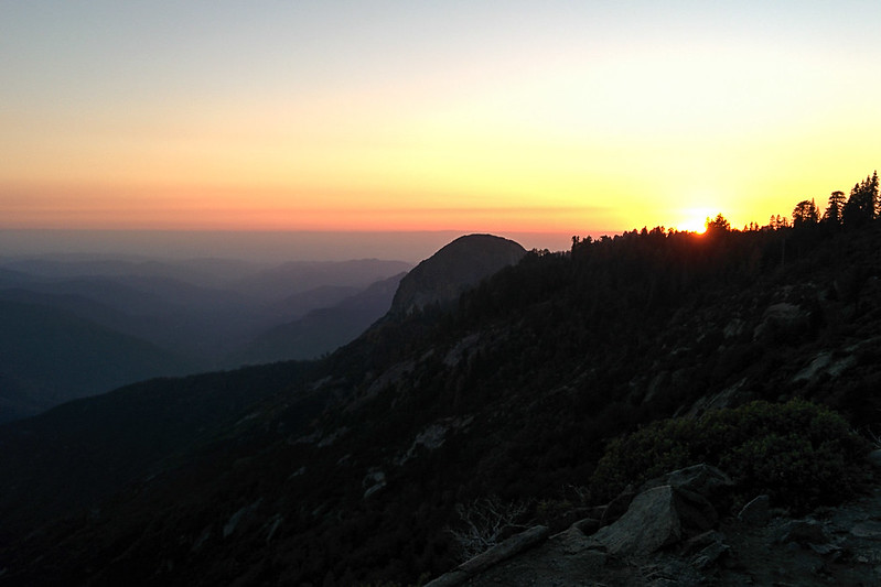 IMG_20151011_182736 by breic, on Flickr
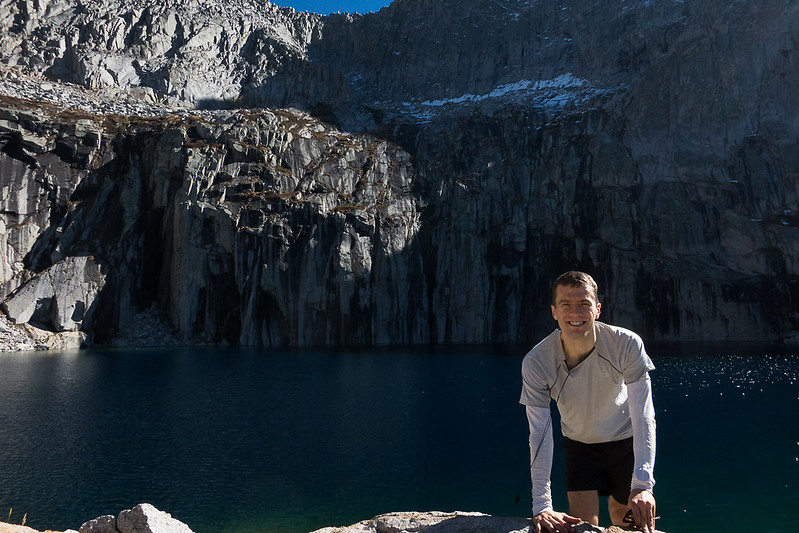
I ended at 6:20pm, which gave me time to take a selfie, stretch and eat in the last light, before driving home.

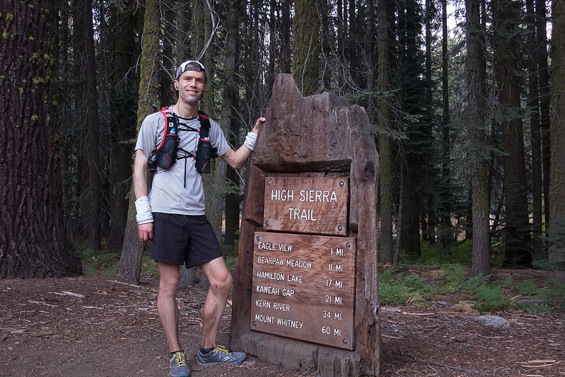 IMG_2143 by breic, on Flickr
Car-camping at Lodgepole Saturday night, I honestly felt uncertain. This would be my tenth trail run this season, and one of the easier ones. But still, it's not trivial. And I'm in poor shape and recovering from injuries… I decided to run heavy, with trekking poles and lots of gear, prepared to go after dark if needed.
Sunday morning, I started at 6:20am, as it was starting to get light. I used my flashlight to help navigate the rocks for the first few miles. It was warm.
I moved steadily to Bearpaw Meadow (11.1 miles, arrived at 8:10am). The camp there has been disassembled and the water at the ranger station turned off. (I didn't go down to the campground to check the faucets there.) Continuing on, descending the switchbacks from Lone Pine Creek to Hamilton Creek, I found a small bear in a tree. I grabbed a photo before it startled, going downhill. I unpacked my trekking poles! And for the rest of the way to Hamilton Creek, called out "hey bear" before rounding any corners. (Curiously, on my way back, I found the bear in a tree in almost the exact same spot—but couldn't get another photo.)

IMG_20151011_084834 by breic, on FlickrI got to Hamilton Lake around 9:10am. I refilled both my water bottles (.5L each), and kept going. The next three miles to Precipice Lake (passing through a tunnel halfway) is a tough climb, and I took it really slowly, not trying to push at all. I felt some wind coming down from the pass, so figured the reflections on Precipice wouldn't be great anyway.

IMG_20151011_093024 by breic, on FlickrI got to Precipice Lake about 10:15am, spent ten minutes taking photos, then continued to Kaweah Gap, arriving around 10:35.

IMG_2073 by breic, on Flickr
IMG_2074 by breic, on FlickrKaweah Gap

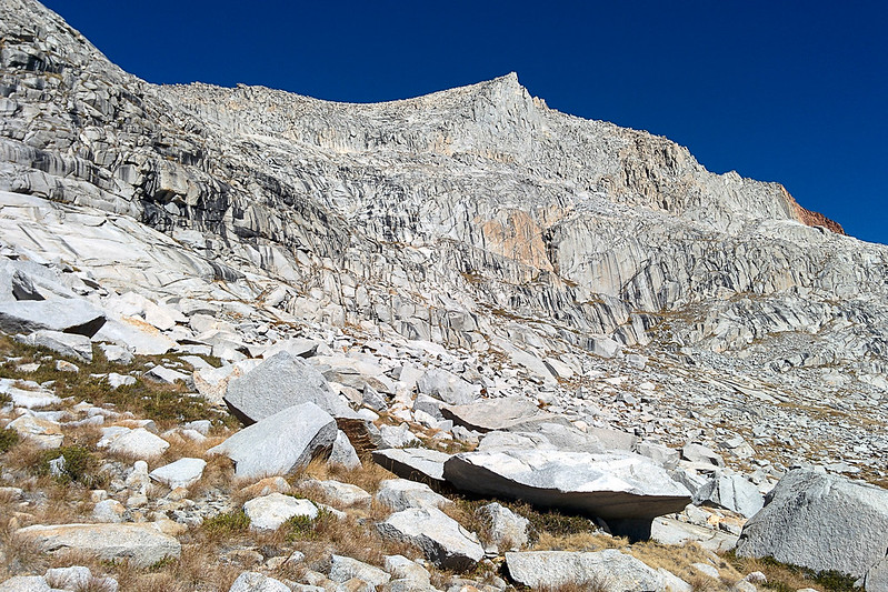
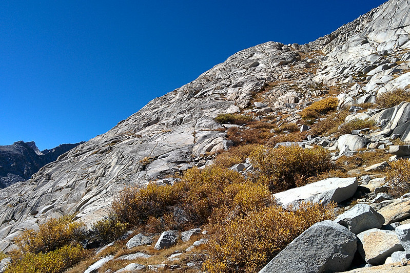
IMG_20151011_103812 by breic, on FlickrFrom the pass (elevation 10,689'), I followed the trail down for a switchback, and then cut off trail into Nine Lakes Basin. I stayed well above the lake, basically keeping right at the boundary between rough stacks of jumbled rocks (higher up) and grass with rocks. I didn't attempt to move quickly. I headed toward a grassy gully that goes up to the left diagonally. (This route is from Summitpost: http://www.summitpost.org/mount-stewart/154969 .) Going up the gully, there is eventually an exposed face to which you can go left or right. I stayed left (straight). (On the descent, I went the other way. It had more slabs, which in bad conditions could be slippery, and wasn't really any faster. Part of my problem is that I like to explore, so even when I realize that I'm going the wrong way, I want to keep going to see where this way goes!)

In this picture you can see the line of the gully, starting in the middle and heading up to the left. The peak straight ahead is not Mt Stewart!

IMG_20151011_105914 by breic, on FlickrThe gully.

IMG_20151011_110943 by breic, on FlickrA decision point: Ascending I went left of the bulge, and I descended the right side. Left is better.

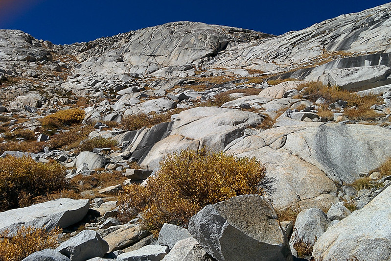
IMG_20151011_110946 by breic, on FlickrThe gully ends in a basin. From there I climbed north easily to the most prominent peak, passing a few tiny patches of snow, arriving around 12:10pm. But this was not Mt Stewart! Oops. It looks equally high. Oh well, it was easy and did have nice views—even giving a glimpse of Mt Whitney, which is not visible from Mt Stewart's summit. I dropped back down a little below the ridge and headed to Mt Stewart. According to Summitpost, "The summit block itself is third class with some exposure, and is most easily climbed via a subsidiary block on its south side, or by a friction slab on its east side." It was very easy, and I didn't notice any exposure. I hung out and took photos all around.
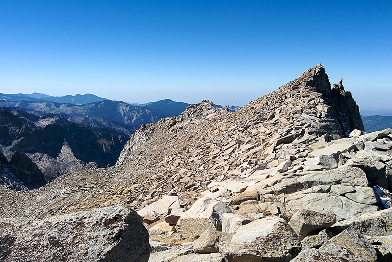
Mt Stewart from the adjacent peak

IMG_20151011_115527 by breic, on Flickr
IMG_20151011_122234 by breic, on FlickrNine Lakes Basin (south)

IMG_20151011_120945 by breic, on FlickrTamarack Lake (north)

IMG_20151011_121026 by breic, on FlickrZooming in on the route above Tamarack Lake

IMG_2084 by breic, on Flickr
IMG_2085 by breic, on FlickrRidge to Lion Rock

IMG_20151011_121054 by breic, on FlickrWhitney beyond the Kaweahs

IMG_2087 by breic, on Flickr
IMG_2086 by breic, on FlickrSummit register

IMG_20151011_124933 by breic, on FlickrBlack Kaweah (Lawson and Kaweah Queen to the left)

IMG_20151011_125043 by breic, on FlickrPrecipice to Hamilton Lakes

IMG_20151011_125103 by breic, on Flickr
IMG_2075 by breic, on Flickr
IMG_2089 by breic, on FlickrBlack Kaweah

IMG_2079 by breic, on Flickr
IMG_2078 by breic, on Flickr
IMG_2077 by breic, on FlickrLooking west; Hamilton Lake is in the lower left corner, Cherubim Dome and Angel Wings in the center, and you can see Moro Rock (by Crescent Meadow) in the far distance (center top)

IMG_20151011_125146 by breic, on Flickr
IMG_2101 by breic, on FlickrPanorama south

PANO_20151011_125256 by breic, on FlickrPanorama west

PANO_20151011_125224 by breic, on FlickrThen, around 1pm, I dropped back down. This time I went all the way down to the lake, to refill my water again. At Kaweah Gap, I started running again, but Precipice Lake begged to be photographed, so I did not get far! Just below Precipice Lake I ran into a day-hiker from Buck Creek, the first person I'd seen since leaving Hamilton Lake in the morning. We chatted a bit.

IMG_2122 by breic, on FlickrIMG_2132 by breic, on Flickr
IMG_2141 by breic, on Flickr
IMG_20151011_150512 by breic, on Flickr
IMG_20151011_152429 by breic, on Flickr
IMG_20151011_153702 by breic, on Flickr
IMG_20151011_161826 by breic, on FlickrI refilled my water bottles again at Hamilton Lake (3:30pm). I kept moving, and refilled one last time at Buck Creek (10 miles from Crescent Meadow). I was able to keep an easy pace. I guess since I'd taken the climb from Hamilton to Precipice Lake so easily, and then had a long break ascending Mt Stewart, I wasn't tired at all. In the last mile, I caught the sun dropping over the rise by Moro Rock.

IMG_20151011_182736 by breic, on FlickrI ended at 6:20pm, which gave me time to take a selfie, stretch and eat in the last light, before driving home.

IMG_2143 by breic, on Flickr