Hiking in a Storm on the PCT
Posted: Sun Apr 26, 2015 7:52 am
Had a fun four days hiking Section A of the PCT (109.5 miles from the US-Mexico border to Warner springs). Started 4/21 Tues morning and finished 4/24 Friday afternoon after continuously hiking 32 miles all day in order to get out. Here's a brief recap of the last day as a major storm moved into Calif:
From Scissors crossing (mile 77), the storm was strong enough that it was clearing the Laguna range and was making its way towards the San Felipe hills. The weather absolutely dictated a fleece/windshirt combo to stay warm even while hiking hard. There was an immediate climb out from 2,200 to 3,000 in the first mile just for starters. It was up/down and all around for the next 22 miles, including a drop down to 3,200 and then a final climb to 4,550. This is what the Half-mile map says:
The San Felipe Hills [miles 78-100] are steep rocky hills with great views but limited camping. I have marked most of the available camping spots. Some campsites in this area are very small. Just large enough for a bivy or small 1 person tent.
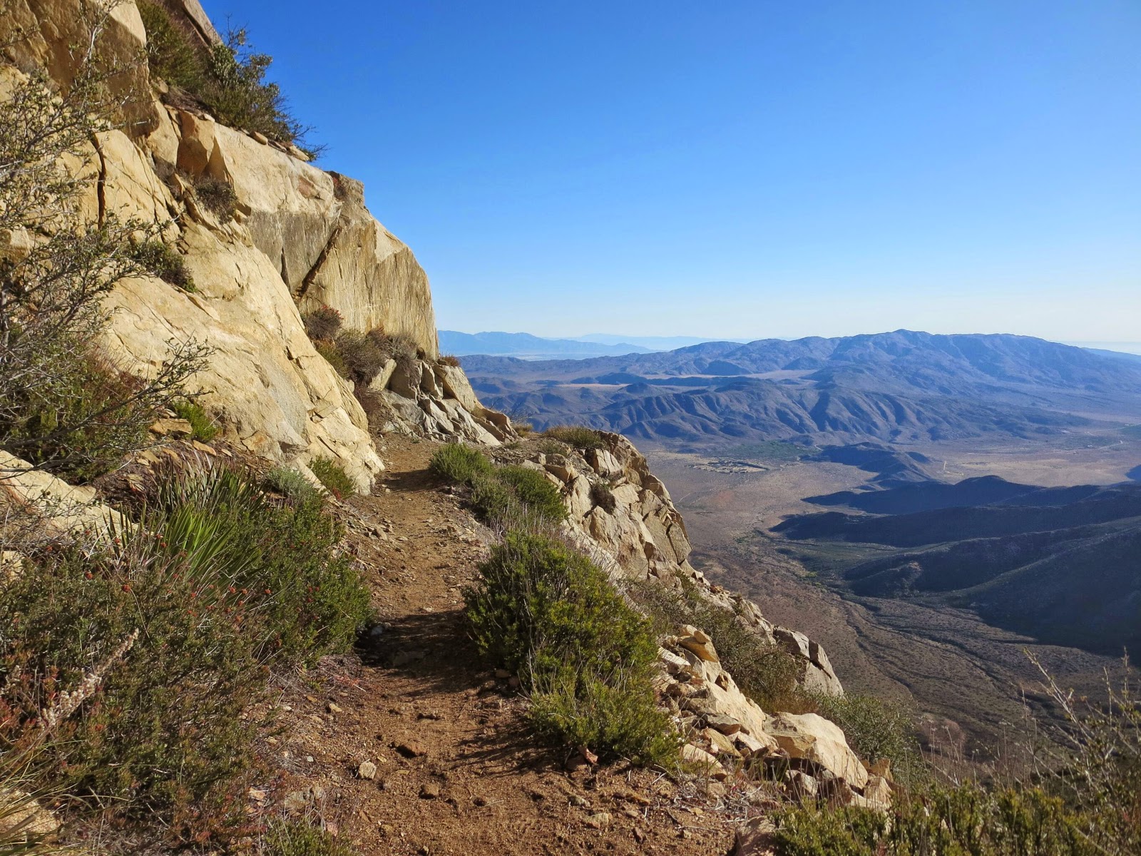
And here is the view - really spectacular, but with a very high admission price:

After leaving the Rodriquez spur tank @ marker 68.4 Thursday afternoon (the last water for 32.7 miles, requiring a 7 liter water carry), I had crossed the 2nd road under the bridge @ Scissors and made it to around marker 77.5: a 30 mile day from Mt Laguna @ 47.5. It was right before 8pm in the dark, so I finally threw down my stuff and crashed cowboy style in the wind blown sand just off trail. I have to confess I felt like some lonely, forlorn hobo as the cold desert wind kept ruffling/lifting my quilt all night long, along with gusts threatening to blow away some of my gear off into the wasteland. I think I might have gotten a few hours of sleep, if that.
I got going the next morning @ 6:15am and hiked very fast for 3 hrs to marker 86.6 - 9.1 miles or 3.3mph - I was in a hurry. The wind was very cold/strong on each north turn of the trail, but I noted it was (sort of) ok in the (tiny) southern lees. As I was hiking along, I was making mental preparations on how to pull off an emergency bivy if the situation really deteriorated, so I was calm & ready in my head on what to do in terms of how to lay out my tarp, which direction, protect my down, etc, if it came to it.
Finally, the trail dropped down to 3,200' at a wide sandy wash @ 86.6 with a perfect SE nook, so I decided to sit, wait and see what the weather was doing. I stayed there for 1.5 hrs till 10:45, and figured even if the storm arrived full force, I could top the ridge by 1pm - that is, the (relatively) warmest part of the day. I knew it was another hard 8.9 miles until the ridge topped out @ 4,550' at marker 95.5, so off I went hiking as fast as I could - head down, don't look at the views, watch your feet/trail, and monitor the time. The result? I think I must have set some kind of personal record for a steep/long hill climb: 3.5mph.
It was like hurricane force winds up there - on every turn of the trail spur to the west, I was constantly hoping/praying that the end was near. But I kept seeing the trail climb higher yet as the skies became progressively darker and the peaks were enveloped in clouds. In a situation like that, you could really lose heart/confidence if you didn't have faith in your capabilities & a good idea of where you were. Hence the training, studying the route/maps and preparing detailed mileage plans with specific waypoints. (I had hardcopies with me that I reviewed while hanging at the wash.) However, I was periodically peeking at my watch and knew the ridge point had to be nearing (ie I knew both the distance and my pace from my start @ the wash). Finally, the trail took a turn to the east and started going down the other lee side of the range to a dryer area to the east. I had made it - talk about relief. I continued the long walk down to Barrel springs elated I was getting off that mountain. It was another 5.6 miles, and I cranked up the pace again to 3.6mph.
I got into Barrel springs (mile 101.1) around 3:20 and hung out talking to some trail angels. I ate my refried beans and chilled as some other hikers got ready to head to Warner springs. They had only hiked down from 3rd gate, so it wasn't a big deal. After already hiking almost 24 miles over very rough terrain, I was pooped, so I certainly didn't have the energy to tackle any more grades. However, one of the angels assured me it was just a continuation of the rolling hills and (BLM) grazing pasture I could see from the spring, so I popped a Motrin and decided to go for the additional 8.4 miles @ 3:50.
Now, by hiking fast and wearing my fleece/windshirt combo, I had managed to both stay warm & beat the storm on the high ridge, and luckily avoided a potential wet-out and hypothermia situation. Not so for the hike to Warner springs - the storm finally moved in, but I knew it if I hiked really, really fast, I could get there just after 6pm (@ almost a 4mph pace). Since technically it was still daylight, and I had my car and warm clothes ready for me, after what I had just been through I knew even if I got thoroughly soaked and cold, I could physically & mentally handle "only" another 2+ hrs.
So off I went into the most surreal hiking experience of my life. It was way crazier than the snow storm on Whitney in terms of visibility (but of course not anywhere close to actually being dangerous) and eerily empty. I could only see clearly for maybe 50 yards, and max maybe 300-400 yards as the wind whipped the rain sideways. The trail just went off into the whiteout across the pasture lands. Every now and then there would be some low knolls, but after what I had been through as far as grades, it was a joke. I was becoming absolutely soaked even with my poncho, so I just kept my head down and charged. Every now and then I'd take a quick peek at my watch, so mentally I knew it was just another hour, another 15 minutes, another ... wait, I could hear the CDF radio crackling @ the road. I made it @ 6:05, for a new official record of 3.75 mph sustained over 8.4 miles. The grand total was 32 miles in 9.1 hours, or 3.5mph. That's what desperation can do for you - yipes.
Without doing anything else, I immediately found my key, started the car and turned the heat on full blast. I then went about changing out of my soaking wet clothes/shoes, put on my dry stuff (I always keep a change of clothes in my car), jumped into the car, did some quick texts to my wife/family/friends saying I was safe & ok, and took off for home.
Some other hikers posted short video clips that captured the situation during the Friday storm. Photos are better than 1k words, etc - click links for video:

https://instagram.com/p/16no1yIkbS/

https://instagram.com/p/16nzYbokbg/
From Scissors crossing (mile 77), the storm was strong enough that it was clearing the Laguna range and was making its way towards the San Felipe hills. The weather absolutely dictated a fleece/windshirt combo to stay warm even while hiking hard. There was an immediate climb out from 2,200 to 3,000 in the first mile just for starters. It was up/down and all around for the next 22 miles, including a drop down to 3,200 and then a final climb to 4,550. This is what the Half-mile map says:
The San Felipe Hills [miles 78-100] are steep rocky hills with great views but limited camping. I have marked most of the available camping spots. Some campsites in this area are very small. Just large enough for a bivy or small 1 person tent.
And here is the view - really spectacular, but with a very high admission price:
After leaving the Rodriquez spur tank @ marker 68.4 Thursday afternoon (the last water for 32.7 miles, requiring a 7 liter water carry), I had crossed the 2nd road under the bridge @ Scissors and made it to around marker 77.5: a 30 mile day from Mt Laguna @ 47.5. It was right before 8pm in the dark, so I finally threw down my stuff and crashed cowboy style in the wind blown sand just off trail. I have to confess I felt like some lonely, forlorn hobo as the cold desert wind kept ruffling/lifting my quilt all night long, along with gusts threatening to blow away some of my gear off into the wasteland. I think I might have gotten a few hours of sleep, if that.
I got going the next morning @ 6:15am and hiked very fast for 3 hrs to marker 86.6 - 9.1 miles or 3.3mph - I was in a hurry. The wind was very cold/strong on each north turn of the trail, but I noted it was (sort of) ok in the (tiny) southern lees. As I was hiking along, I was making mental preparations on how to pull off an emergency bivy if the situation really deteriorated, so I was calm & ready in my head on what to do in terms of how to lay out my tarp, which direction, protect my down, etc, if it came to it.
Finally, the trail dropped down to 3,200' at a wide sandy wash @ 86.6 with a perfect SE nook, so I decided to sit, wait and see what the weather was doing. I stayed there for 1.5 hrs till 10:45, and figured even if the storm arrived full force, I could top the ridge by 1pm - that is, the (relatively) warmest part of the day. I knew it was another hard 8.9 miles until the ridge topped out @ 4,550' at marker 95.5, so off I went hiking as fast as I could - head down, don't look at the views, watch your feet/trail, and monitor the time. The result? I think I must have set some kind of personal record for a steep/long hill climb: 3.5mph.
It was like hurricane force winds up there - on every turn of the trail spur to the west, I was constantly hoping/praying that the end was near. But I kept seeing the trail climb higher yet as the skies became progressively darker and the peaks were enveloped in clouds. In a situation like that, you could really lose heart/confidence if you didn't have faith in your capabilities & a good idea of where you were. Hence the training, studying the route/maps and preparing detailed mileage plans with specific waypoints. (I had hardcopies with me that I reviewed while hanging at the wash.) However, I was periodically peeking at my watch and knew the ridge point had to be nearing (ie I knew both the distance and my pace from my start @ the wash). Finally, the trail took a turn to the east and started going down the other lee side of the range to a dryer area to the east. I had made it - talk about relief. I continued the long walk down to Barrel springs elated I was getting off that mountain. It was another 5.6 miles, and I cranked up the pace again to 3.6mph.
I got into Barrel springs (mile 101.1) around 3:20 and hung out talking to some trail angels. I ate my refried beans and chilled as some other hikers got ready to head to Warner springs. They had only hiked down from 3rd gate, so it wasn't a big deal. After already hiking almost 24 miles over very rough terrain, I was pooped, so I certainly didn't have the energy to tackle any more grades. However, one of the angels assured me it was just a continuation of the rolling hills and (BLM) grazing pasture I could see from the spring, so I popped a Motrin and decided to go for the additional 8.4 miles @ 3:50.
Now, by hiking fast and wearing my fleece/windshirt combo, I had managed to both stay warm & beat the storm on the high ridge, and luckily avoided a potential wet-out and hypothermia situation. Not so for the hike to Warner springs - the storm finally moved in, but I knew it if I hiked really, really fast, I could get there just after 6pm (@ almost a 4mph pace). Since technically it was still daylight, and I had my car and warm clothes ready for me, after what I had just been through I knew even if I got thoroughly soaked and cold, I could physically & mentally handle "only" another 2+ hrs.
So off I went into the most surreal hiking experience of my life. It was way crazier than the snow storm on Whitney in terms of visibility (but of course not anywhere close to actually being dangerous) and eerily empty. I could only see clearly for maybe 50 yards, and max maybe 300-400 yards as the wind whipped the rain sideways. The trail just went off into the whiteout across the pasture lands. Every now and then there would be some low knolls, but after what I had been through as far as grades, it was a joke. I was becoming absolutely soaked even with my poncho, so I just kept my head down and charged. Every now and then I'd take a quick peek at my watch, so mentally I knew it was just another hour, another 15 minutes, another ... wait, I could hear the CDF radio crackling @ the road. I made it @ 6:05, for a new official record of 3.75 mph sustained over 8.4 miles. The grand total was 32 miles in 9.1 hours, or 3.5mph. That's what desperation can do for you - yipes.
Without doing anything else, I immediately found my key, started the car and turned the heat on full blast. I then went about changing out of my soaking wet clothes/shoes, put on my dry stuff (I always keep a change of clothes in my car), jumped into the car, did some quick texts to my wife/family/friends saying I was safe & ok, and took off for home.
Some other hikers posted short video clips that captured the situation during the Friday storm. Photos are better than 1k words, etc - click links for video:

https://instagram.com/p/16no1yIkbS/

https://instagram.com/p/16nzYbokbg/


