Page 1 of 1
R03/R04 TR: Silver Divide ~ 10/17 - 10/20/2013
Posted: Mon Oct 28, 2013 4:46 pm
by Bluewater
Re: TR: Silver Divide ~ 10/17 - 10/20/2013
Posted: Mon Oct 28, 2013 5:02 pm
by maverick
Very nice Bluewater. How thick was the ice on Summit? Love the Laurel Lake
area, especially Grinnell Lakes. Nice comparison shot of the two backpacks.
Looking forward to the next installment.
TR: Silver Divide ~ 10/17 - 10/20/2013
Posted: Mon Oct 28, 2013 5:10 pm
by Bluewater
(continued)
I wasn't fully acclimated so I had to stop a few times on the way over Bighorn Pass. As I looked at the north and northeast facing slopes in the area I started to consider some alternates to the north side of Shout of Relief Pass. Most of the chutes and boulder fields on the north facing slopes were holding snow, not enough to make it easy but just enough to make route finding a challenge.
I decided to stick to the passes on the south side of the Silver Divide. From Bighorn Lake I could take Walton Col into the next drainage and Warrior Ridge over to Silver Pass.

- view from bighorn pass
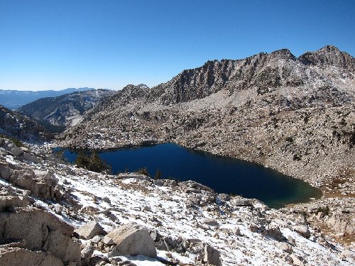
- rosy finch lake

- route down the west side of the pass
I contoured along the north and west shore of Rosy Finch Lake and followed the granite benches to the outlet of Bighorn Lake. Along the way I could see that the northeast facing chutes leading to Walton Col were holding a lot of snow. I decided to try the route over the ridge at a lower elevation (10,600) that looked like it would lead into the next drainage and eventually Warrior Ridge.
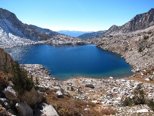
- rosy finch lake
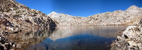
- bighorn lake

- bighorn lake
After crossing the small tarn just below Bighorn Lake I found what looked like a use trail along the ridge at about 10,400 feet. Unfortunately it ended with a big dropoff just to the west of Mott Lake. I was forced to bushwhack down a dry riverbed to the trail below. I searched the ridge above for a good way over but it mostly looked like shear granite walls. I remember reading a TR about a route over this ridge at about 10,600 feet, but I wasn't finding anything from the Mott Lake Trail. Eventually it started to get dark so I took a detour to the JMT, then the Mono Creek Trail junction and camped on one of the large flat rocks on the promontory overlooking Quail Meadows. I got there just in time for an amazing sunset, which seemed like a good consolation considering my lack of route finding along the Silver Divide.
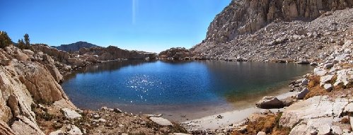
- tarn below bighorn lake
TR: Silver Divide ~ 10/17 - 10/20/2013
Posted: Mon Oct 28, 2013 5:38 pm
by Bluewater
(continued)
The next morning I decided to hike back up the Mono Creek Trail and explore Pioneer Basin. Although I was looking forward to exploring the lakes in Pioneer Basin I kept getting distracted by the fall colors.
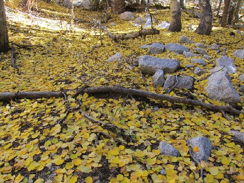
- fall along the mono creek trail
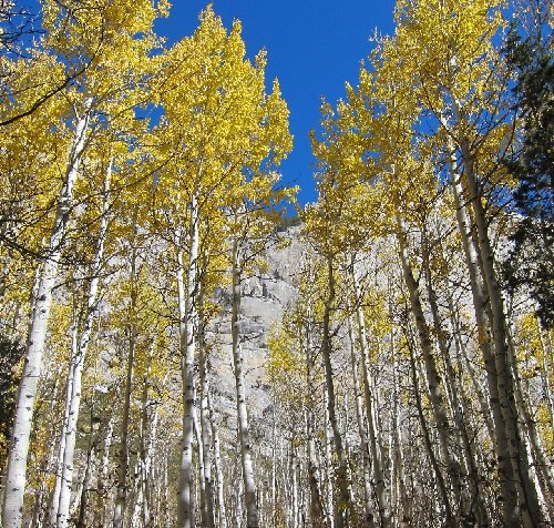
- golden aspens
I made good time and soon I was making dinner and relaxing along one of the lakes with amazing views across the canyon.
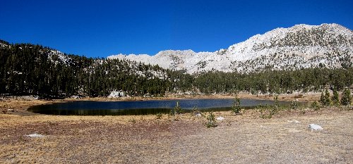
- pioneer basin

- mono divide from pioneer basin
The temperature plummeted as soon as the sun dropped behind the Mt. Hopkins. I setup camp on a plateau with great views of the aplenglow on Mt. Huntington, Mt. Standford and the peaks and ridges along the Third & Fourth Recesses across the canyon.
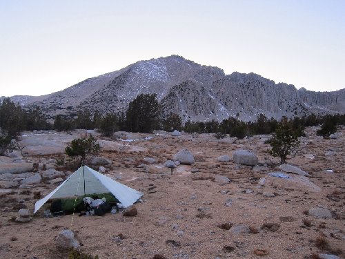
- plateau camp in pioneer basin
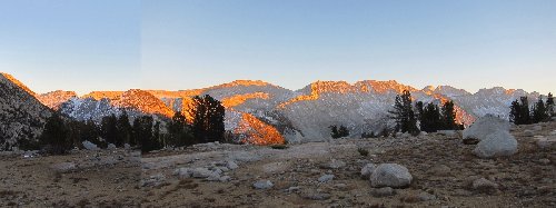
- sunset on mono divide
On the way out the next day I made an unplanned detour to Golden Lake. Fortunately I found a good use trail that contours above the lake at about 10,200 feet and leads up toward Mono Pass. Some of the trail was covered with snow and the angle down to the lake got steep with some slightly uncomfortable exposure.

- golden lake
After breaking through the ice for some crystal clear (and great tasting) water I took a break in the sun along the shore of Summit Lake.
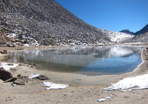
- summit lake
By 4:00 pm the sun was already disappearing behind Mt. Mills and Mt. Abbot and there were some long shadows in Little Lakes Valley. I got back to the car just in time to change clothes, warm up and get a cheese burger in town. On the way home Art and I exchanged stories about our last adventures of the summer. Art bagged Mt. Starr and Mt. Morgan and still had time to go into town for a real breakfast on Sunday. Nice.
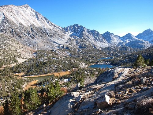
- little lakes valley
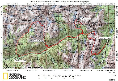
- silver divide loop
Re: TR: Silver Divide ~ 10/17 - 10/20/2013
Posted: Mon Oct 28, 2013 5:41 pm
by Bluewater
Thanks Maverick! The ice was getting thick in the center of Summit Lake, but it was easy to break through along the sides. Probably not solid enough for ice skating yet

.
Re: TR: Silver Divide ~ 10/17 - 10/20/2013
Posted: Tue Oct 29, 2013 6:58 am
by KathyW
Great report and photos. I want to go to Big Horn Lake after seeing your photos. Maybe a trip to Big Horn Lake / Mount Izaak Walton is sometime in the future for me. Thanks so much for sharing.
Re: TR: Silver Divide ~ 10/17 - 10/20/2013
Posted: Tue Oct 29, 2013 9:42 am
by Ryanoa
Nice report and photos...the Silver Divide is one of my favorite areas. My first major x-country hike was a traverse of the divide from Graveyard Lakes to Pioneer Basin. Lots of memories. The Laurel Creek valley below Red and White Mountain is stunning.
Re: TR: Silver Divide ~ 10/17 - 10/20/2013
Posted: Tue Oct 29, 2013 7:55 pm
by freestone
Bluewater, nice report and pictures. I could feel the chill. Looks like you were SUL, with the long nights and short days, did you stay warm enough to be comfortable?
Re: TR: Silver Divide ~ 10/17 - 10/20/2013
Posted: Tue Oct 29, 2013 10:11 pm
by Bluewater
Thanks KathyW, Ryanoa and freestone!
It definitely got cold on this trip. Freestone, I think my base weight was around 10 lbs so probably just 'UL' this time

. I stayed warm and brought most of my go-to winter gear. Also, to avoid carrying a lot of extra layers I usually have dinner in the afternoon while it's still warm and then hike right until setting up camp for the night.
I brought silk long johns, down vest, down booties, down mitts, w/b outer mitts, rain/snow pants and a dryducks jacket. I've been using a homemade 20 degree quilt with a down beanie, a wool balaclava and head band (to keep my face warm) at night. Just in case I threw in microspikes and gaiters, but never used them.
There's a picture of Mono Pass on the HST Facebook page that looks like the entire area got some serious snow yesterday!
Re: TR: Silver Divide ~ 10/17 - 10/20/2013
Posted: Wed Nov 20, 2013 5:17 pm
by orbitor
Great report, I'm glad you had a nice autumn outing!
Thanks for sharing.