Re: The least visited lake.
Posted: Sun Feb 09, 2014 9:31 am
Yes Sparky, the last one. Good on ya for visiting the one in the Nfk. I had my eye on that one as well. Is the peak in your photo on the divide between N and middle fk?
Sierra Nevada related information; backpacking, camping, hiking, snowboarding, skiing, fishing, photography, and more!
https://www.highsierratopix.com/community/
https://www.highsierratopix.com/community/viewtopic.php?t=7416
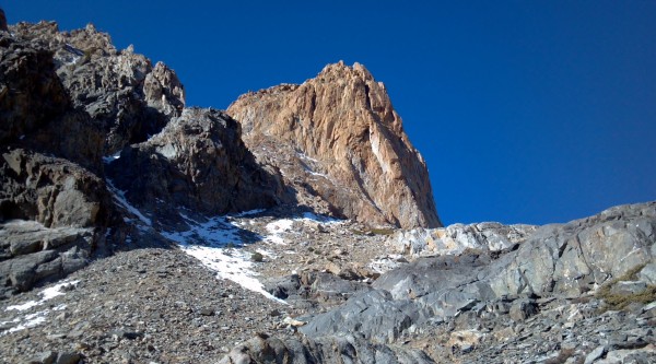
I took my kids camping to the Lost Lakes SW of Koip Crest in about 1994. The cross-country route was written up in a Wilderness Press guidebook, so I am sure many others have been there, too.Wandering Daisy wrote:Below 11,000, not a "tarn" which I take to mean not a little pond, and a lake that I have camped at, elimitates many of my remote locations. Here is what is left:
...
Lost Lakes SW of Koip Crest
There are obsidian "flakes" (small pieces) all over the high sierra for many miles radius around the Mammoth Mountain area. I found them all over the ground in the Mono Pass (Yosemite) area, for example. I asked a geology professor I know about them. She said they are due to a major volcanic explosion from one of those volcanoes south of Mono Lake a few thousand years ago. They are NOT from native americans dropping them everywhere. Now, if you find an actual worked arrowhead, that is another story. We found one in the Tuolumne River in Lyell Canyon once. I made the kids put it back.Ikan Mas wrote:I have found obsidion many places in the Sierras. Although the numbers of Native Americans in the mountains was probably never large, they were there for 10,000 to 20,000 years, depending on what theory you subscribe to. Of course for some of this time the mountains were under glaciers, but they were here for a long time. They knew all the major passes and probably roamed quite widely.
Two years ago as my brother and I hiked down Kerrick Meadows we noted that we found obsidion at every place we stopped. So we began to think about it more deeply. We liked to stop a places with a nice view and water nearby. We also liked to find a nice smooth rock to sit on. We realized that our needs were the same as theirs. Think about about this a you pull over for a break. The somewhat sparse grass cover in Kerrick made finding the obsidion very easy.
Last summer at Summit Lake above the San Joaquin River, one end of the lake was thoroughly covered with obsidion. I took this spot as a trading or rendevous point. There must of been lots of people here over the years.
So it is just coincidence that there is a concentration of flakes (with no actual points)at obviously attractive sites?They are NOT from native americans dropping them everywhere. Now, if you find an actual worked arrowhead, that is another story. We found one in the Tuolumne River in Lyell Canyon once. I made the kids put it back.
I don't know whether Funston has fish or not, but Funston is a nice lake and has a remote feel. Two of us hiked from Rocky Basin lakes (we took the trail from Big Whitney Meadow to the lakes), dry camped on the ridge above the lakes, hiked to Funston, and back to the PCT across the Siberian Plateau. Another small lake is on the cross country route as you drop off the ridge above Rocky Basin lakes on the way to the Siberian Plateau. We walked around the meadows of the plateau, crossed the trail to Siberian Pass, and climbed to the PCT. It wasn't soggy in mid-July. The only water after the small lake was in a spring near the PCT junction, but we didn't need it. I remember talking with someone about this small lake and they said fishermen on horseback occasionally cross the plateau to fish and camp there. We didn't see any sign of a use trail on our plateau route, though. I loved that walk across the plateau. Beautiful views of the Miter Basin area and peaks to the north. But I love high, open country.Hobbes wrote:Funston?
I'm always going out of Horseshoe, either via Cottonwood or (New) Army passes, to hit Calipedder's planned destination. (And to paraphrase Terry Hatcher, "it's real and spectacular".) Funston just sits out there all by itself (I don't count the proximity to Rocky Basin lakes), around 6 miles x-country off the PCT.
I'm thinking of adding an extra day to loop the 12 miles in/out the next time I'm up there this summer. I searched HST, and all I came across was an old rumor that while it might not be on the gill net list (like the GT watershed to the south ie Chickenspring, Rocky) it may now be non-maintained.
Does anyone know if this is true? Or whether it matters? It's a nice size lake - about the same as Sky Blue - so it might be self-sustaining. OTOH, by the looks of things, there ain't much/any water the whole way there or back towards Rock Creek across Siberian. And given this dry year, it could be a slog.