Topics covering photography and videography of the flora, fauna and landscape of the Sierra Nevada mountains. Show off your talent. Post your photos and videos here!
fishmonger
Topix Fanatic
Posts: 1252Joined: Fri Jun 13, 2008 10:27 amExperience: Level 4 ExplorerLocation: Madison, WI
Contact:
Post
by fishmonger Sun Feb 11, 2018 11:53 am
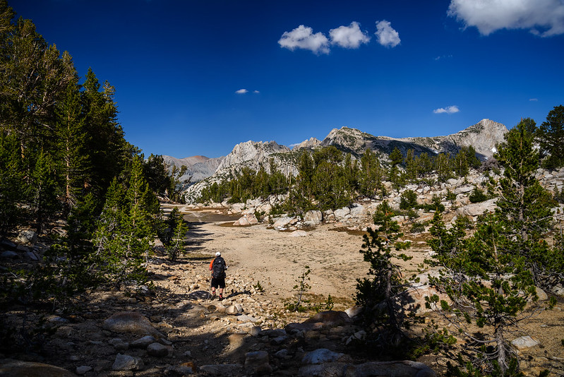
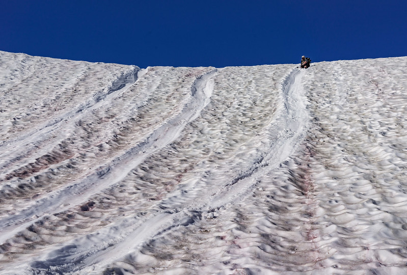
July 4 2016 vs. July 15, 2017 - same place on the Goodale Pass trail, on the high point between Grassy Lake and Lake of the Lone Indian
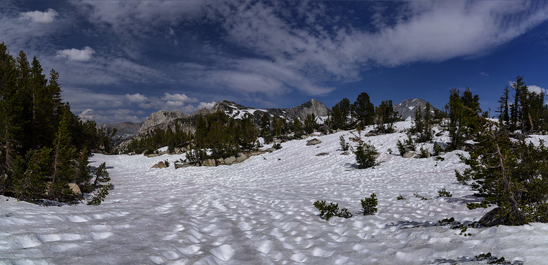
Just below the high point
this is a multi-frame panorama, but the left half is about the same view as above, just taken from a few steps further back
Snow where there usually is a granite desert
fishmonger
Topix Fanatic
Posts: 1252Joined: Fri Jun 13, 2008 10:27 amExperience: Level 4 ExplorerLocation: Madison, WI
Contact:
Post
by fishmonger Wed Feb 14, 2018 6:36 am
Ritter Range from near Silver Pass on a clear morning, July 2017. 4 frame panorama stitch with 85mm lens
Ritter Range and Cascade Valley
fishmonger
Topix Fanatic
Posts: 1252Joined: Fri Jun 13, 2008 10:27 amExperience: Level 4 ExplorerLocation: Madison, WI
Contact:
Post
by fishmonger Fri Feb 16, 2018 6:25 am
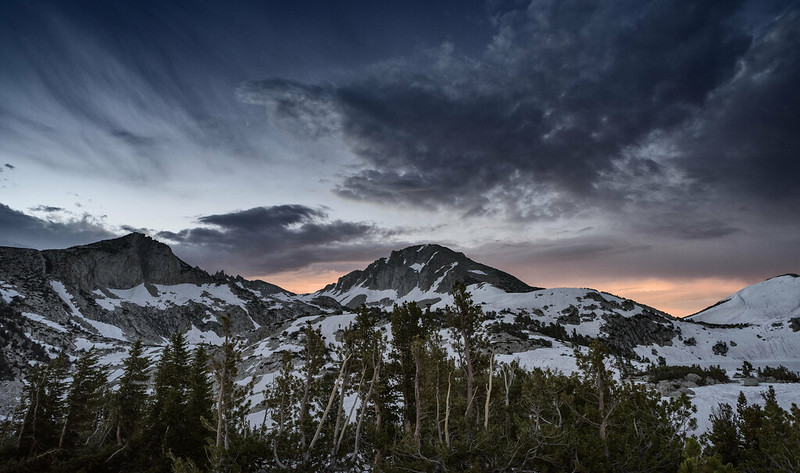
following a 3am storm, the morning clouds over Silver Pass were still looking rather threatening. July 16, 2017
Ominous skies above Silver Pass
fishmonger
Topix Fanatic
Posts: 1252Joined: Fri Jun 13, 2008 10:27 amExperience: Level 4 ExplorerLocation: Madison, WI
Contact:
Post
by fishmonger Fri Feb 16, 2018 6:37 am
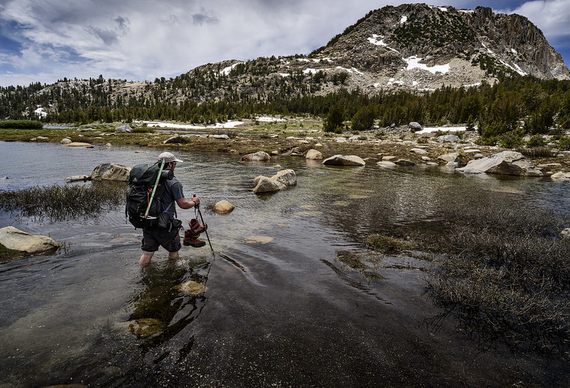
Crossing fast moving streams, one of my least favorite things about early season. At least there are no worries about water, anywhere.
High Water at Sharktooth Creek
wildhiker
Topix Fanatic
Posts: 1213Joined: Tue Jul 26, 2011 4:44 pmExperience: Level 4 ExplorerLocation: Palo Alto, CA
Contact:
Post
by wildhiker Fri Feb 23, 2018 12:24 pm
P1070688.jpg (106.91 KiB) Viewed 166 times
Mt Lyell and glacier (far left) from tarn near Maclure Creek, Yosemite, Aug 22, 2014
fishmonger
Topix Fanatic
Posts: 1252Joined: Fri Jun 13, 2008 10:27 amExperience: Level 4 ExplorerLocation: Madison, WI
Contact:
Post
by fishmonger Thu Mar 01, 2018 12:39 pm
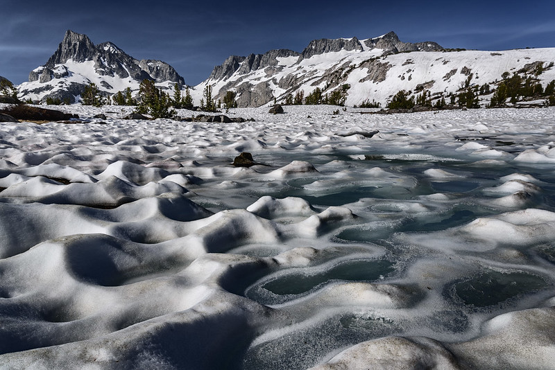
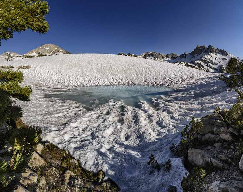
Between Silver Pass and Goodale Pass, July 2017
Snow pond
Harlen
Topix Addict
Posts: 2390Joined: Sat Mar 11, 2017 9:13 amExperience: Level 4 ExplorerLocation: Santa Cruz Mountains
Post
by Harlen Thu Mar 01, 2018 1:08 pm
Amazing photos! What are the dark mountains to the right? Thanks for posting all the great photos.
Properly trained, a man can be dog’s best friend.
fishmonger
Topix Fanatic
Posts: 1252Joined: Fri Jun 13, 2008 10:27 amExperience: Level 4 ExplorerLocation: Madison, WI
Contact:
Post
by fishmonger Mon Mar 05, 2018 7:34 pm
Harlen wrote: Amazing photos! What are the dark mountains to the right? Thanks for posting all the great photos.
Thanks - that dark peak is unnamed - point 11424 on the topo map, seen from the north east. It is in the center of this Gmap4 link. My position was just to the right of the "Indian" of the Lake of the Lone Indian label, where you can see a small tarn on the map just left of the JMT intersection
https://mappingsupport.com/p/gmap4.php? ... &z=15&t=t4
fishmonger
Topix Fanatic
Posts: 1252Joined: Fri Jun 13, 2008 10:27 amExperience: Level 4 ExplorerLocation: Madison, WI
Contact:
Post
by fishmonger Wed Mar 07, 2018 11:19 am
DaveDill
Topix Acquainted
Posts: 37Joined: Wed May 31, 2017 7:55 amExperience: Level 4 Explorer
Contact:
Post
by DaveDill Mon Mar 26, 2018 1:22 pm
Hi All,
Attachments
Users browsing this forum: No registered users and 4 guests