Sorry, re-read my post and I did NOT imply that you, Hobbes, put up any cairns. The "shame on you" applied to that person who put up the cairns many years ago. I think there was a lengthy discussion on another thread about cairns vs no cairns for off-trail routes.
Also I am a bit late in this discussion. I just saw this post, since I was gone most of the summer.
1000 Island -> Tuolumne via SHR trip record
-
Wandering Daisy

- Topix Docent
- Posts: 7055
- Joined: Sun Jan 24, 2010 8:19 pm
- Experience: N/A
- Location: Fair Oaks CA (Sacramento area)
- Contact:
-
Hobbes
- Topix Fanatic
- Posts: 1120
- Joined: Wed Apr 27, 2011 8:09 am
- Experience: N/A
- Location: The OC
Re: 1000 Island -> Tuolumne via SHR trip record
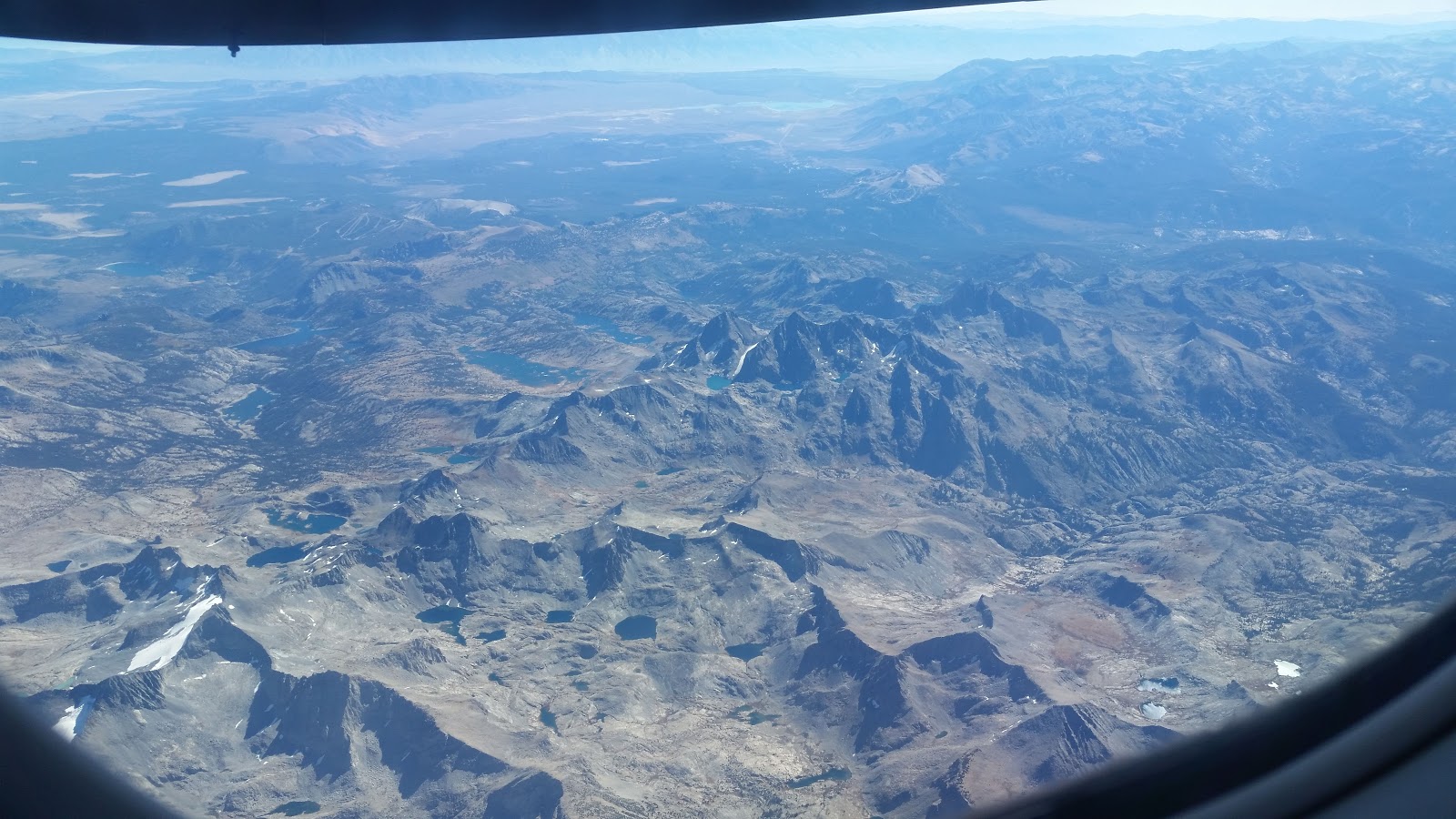
My wife gave me a heads up that the flight from John Wayne to Reno went right over the Sierra crest. I was thinking maybe Walker or Carson pass - little did I suspect that with the prop flying @ only 22k, it was only a few thousand feet right over Ritter/Banner! I didn't have my phone out/ready, but vowed to get some shots on the way back. The return was a little more west, so I was able to get a better perspective.
In this shot, you can see Lyell + glacier, Electra, Adams & Foerster, with Ritter/Banner in the background. The 2016 HST meet-up lake was at the very bottom middle of the photo (Ansell Adams directly above @ 1 o'clock). To the right of Foerster (just above the window frame in lower right of photo), you can see the two shimmering Blue lakes - Blue lake pass is just to the right of Foerster. The SHR follows the contour from Catherine (below Ritter/Banner) to Blue lakes.
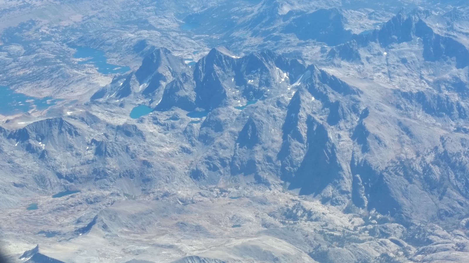
This shot is a little closer: you can see the canyon/cascade below Catherine. To the left is the unnamed lake above the Twin Island lakes. Even better, you can see the elusive 10.2k tarn in the middle/bottom of the photo, with just the slightest peak of the upper Twin island lake over the ridge line that is contoured around from the south.
In this shot, you can see Lyell + glacier, Electra, Adams & Foerster, with Ritter/Banner in the background. The 2016 HST meet-up lake was at the very bottom middle of the photo (Ansell Adams directly above @ 1 o'clock). To the right of Foerster (just above the window frame in lower right of photo), you can see the two shimmering Blue lakes - Blue lake pass is just to the right of Foerster. The SHR follows the contour from Catherine (below Ritter/Banner) to Blue lakes.
This shot is a little closer: you can see the canyon/cascade below Catherine. To the left is the unnamed lake above the Twin Island lakes. Even better, you can see the elusive 10.2k tarn in the middle/bottom of the photo, with just the slightest peak of the upper Twin island lake over the ridge line that is contoured around from the south.
-
Rockyroad
- Topix Regular
- Posts: 287
- Joined: Tue Aug 17, 2010 9:05 pm
- Experience: Level 3 Backpacker
Re: 1000 Island -> Tuolumne via SHR trip record
Very nice photos for perspective. Thanks for posting!
-
Shhsgirl
- Topix Regular
- Posts: 110
- Joined: Thu Mar 08, 2012 11:44 am
- Experience: N/A
Re: 1000 Island -> Tuolumne via SHR trip record
Cool aerial photos! I can look at these and impress myself all over again at what we did! 
Who is online
Users browsing this forum: No registered users and 4 guests