Day 4 –Tunemah Basin to Lake 10,232. 6.7 miles - 1900’ elevation gain
I woke up early, happy I wasn’t mauled by bears over night, but thinking about fish and headed over to Lake 10,458 to wet a line.

- Fishing in lower Tunemah basin
I caught a few rainbows to maybe 12” or so, but soon realized I would much rather be fishing Tunemah. I quickly packed up my things and got a head start on the group up to Tunemah.

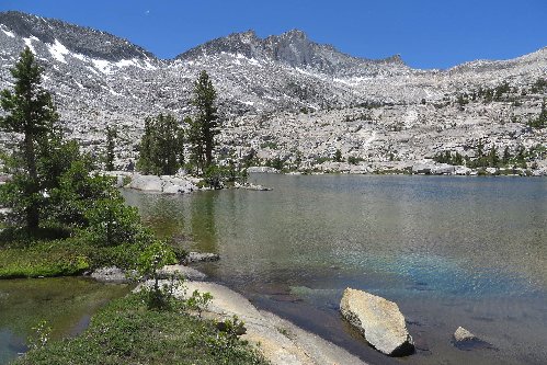
- Tunemah
I fished for an hour without a single strike, follow or sighting. The rest of the group made their way up to the outlet and I sadly admitted defeat – Tunemah would yield nothing to me on this trip. From Tunemah, we headed up the grassy gully on it’s north shore to the saddle just east of Peak 11,920. Initially, I was a bit nervous about this pass as I could find no reports of anyone descending it. I found a few pictures and a reference that it looked “doable” but no confirmation. Luckily another member of the group had printed out a few pages from Secor and to my surprise it had a name “Libbey Pass” and was Class II. Excellent. The views from the pass were incredible, with nearly 360 views and serrated peaks everywhere.

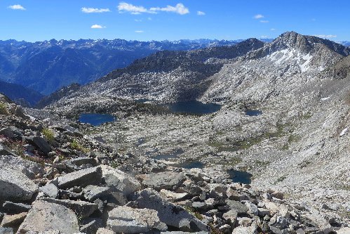
- Lakes of Tunemah Basin - from whence we came

- Basin east of Blue Canyon Peak
The basin to our north had two little lakes perched on a bench before it plunged over the edge into Goddard Creek canyon. We peaked over the north side of the pass, and it looked steep but as the report said “doable”. We took turns descending the loose sand/scree as to not knock rock on each other and in no time we were down to more stable talus. This pass, while a bit challenging, was no way as near as difficult as MacLeod Pass – the crux of last years trip.

- Loose sand/scree on Libbey Pass
We descended talus to about the 11,000’ level, where I debated continuing on down to the lakes to investigate for fish. No one else in the group wanted to go, and the lakes looked quite shallow so I was content with knowing that if there were fish they were probably quite small. From 11,000’ we ascended 200’ up a steep nose to the north and then traversed over to another unknown saddle leading to Finger Peak Basin. It proved to be pretty tame, and we named the saddle “Flemish Gap” after the two Belgians in our group. From Flemish Gap we descended on granite slabs 1,300’ down to lake 10,240+ in Finger Peak Basin to stop for lunch. This lake, while having excellent views of Finger Peak and a lovely waterfall flowing in on its north shore, was infested with mosquitoes. We had almost forgot about our little friends after enjoying a day and half without them.

- Finger Peak Basin
After lunch, we continued down the West Fork of Goddard Creek through lovely granite and pine country and traversed around the bend to join the main branch of Goddard Creek. I was anticipating amazing views here in the meadows but was a little disappointed. Perhaps the bugs tainted my opinion but it was very nice nonetheless.

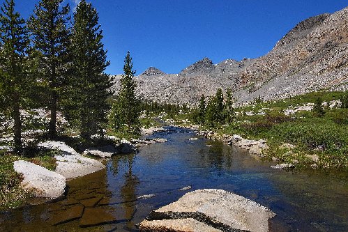
- Goddard Creek
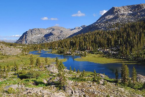
The views were much prettier from above the meadows looking down Goddard Creek.

- Meadows below Lake 10,232
From there it was an easy jaunt up to Lake 10,232 – an incredible lake sitting in an enormous bowl with countless waterfalls pouring into the lake. It was loaded with smallish rainbows in the 8”-10” range so I hooked a couple fish, but quickly lost interest. Sadly, this lake too was infested with mosquitoes which detracted from its amazing setting.

- Outlet creek of Lake 10,232
We set up camp, and then donned our headnets, waiting for an intermittent breeze to give us momentary relief.
to be continued...