Questions and reports related to Sierra Nevada current and forecast conditions, as well as general precautions and safety information. Trail conditions, fire/smoke reports, mosquito reports, weather and snow conditions, stream crossing information, and more.
Too soon? My profession is water, and unfortunately I'm gong to have to say it's not.
Quoting maverick's thread from last season's related thread:
maverick wrote:Hopefully this thread will not get a lot of usage! Please report any existing wildfire & smoke that is effecting the Sierra. Also report whether these conditions affected your trip in any way.
Six fires were reported or found over the weekend within Yosemite National Park. Most fires were due to thunderstorms and lightning activity. The storms were accompanied with rain, hail and light snow.
- Boundary near Boundary Peak (8,000’) – single tree in red fir, is being monitored and has low potential for growth.
- South Fork near Cascade Creek (8,100’) – red fir and brush, is being monitored and low to moderate potential for growth.
- South Landing (6,100’) – ponderosa pine; this low elevation was put out.
- Yosemite Creek near the Yosemite Creek campground Road (8,020’) – red fir and is being monitored.
- Parsons within Tuolumne Meadows (8,500’) – single lodgepole pine, is being monitored, and has low potential for growth.
Smoke from these fires may be visible from many locations within the park. Thunderstorm activity is predicted through the coming week and other fires may occur or be found.
The May Fire near May Lake was an out of bounds camp fire and was put out. All visitors are urged to use established campgrounds for fires. When departing please be sure all fires are out.
Additionally, the Fox Fire, near Mariposa, was visible throughout the area. CAL FIRE crews remain on the fire.
Professional Sierra Landscape Photographer
I don't give out specific route information, my belief is that it takes away from the whole adventure spirit of a trip, if you need every inch planned out, you'll have to get that from someone else.
Have a safer backcountry experience by using the HST ReConn Form 2.0, named after Larry Conn, a HST member:http://reconn.org
Acres Burned: 500 Structures Threatened: 200
Containment: 30% Structures Destroyed: 0
Fire Started: June 18, 2014 Injuries: 0 (ignore this. someone obviously fat fingered it on the year)
Cause: Vehicle Fire
Total personnel assigned to the Fire: 650
Summary
Today crews will continue building and reinforcing containment lines around the perimeter of the fire. Fire crews
will still face hazardous conditions on the fire line. Hot spots along the fires edge and interior, dangerous snags,
stump holes, heavy fuels, steep slopes, rolling materials and smokey conditions will make for a tough shift for all
personnel.
A Sky Fire information phone number has been established for further infromation about the fire. That number is
(559) 877-4074.
Evacuations
-Several Forest Service and private campgrounds were evacuated yesterday for public safety concerns.
-The American Red Cross has set up the following evacuation centers in Oakhurst:
Sierra Vista Church, 39696 Highway 41, Oakhurst
Oakhurst EV Church, 50443 School Rd, Oakhurst
**Both evacuation centers also have a small animal evacuation shelter for household pets**
Closures
The Sky Ranch road remains closed as are all roads leading into the fire area until further notice.
MARKLEEVILLE, CA - The lightning-caused Washington Fire, started 45 miles south of Carson City, has grown to about 9,500 acres since it broke out Friday night, June 19. Firefighters say high wind and severe drought conditions made the fire spread quickly.
According to Sierra Front Interagency Dispatch, about 300 personnel are assigned to the incident with more to arrive Monday. Fire officials will use air and ground support to fight the fire, which is 10% contained as of Sunday night.
The fire is burning southeast of the mountain community of Markleeville, California. Several campgrounds along Highway 4 to the north end of Markleeville have been evacuated. In addition, Highways 4 and 89 in the Monitor Pass area are closed. As a precaution, Markleeville residents have been advised to prepare for an evacuation; however, no mandatory evacuations are in effect for Markleeville at this time.
The weather forecast calls for another day of high winds which will hamper containment efforts. While the winds are expected to subside after Monday, high temperatures are forecast for later in the week along with possible thunder storms that can cause erratic localized winds later in the week.
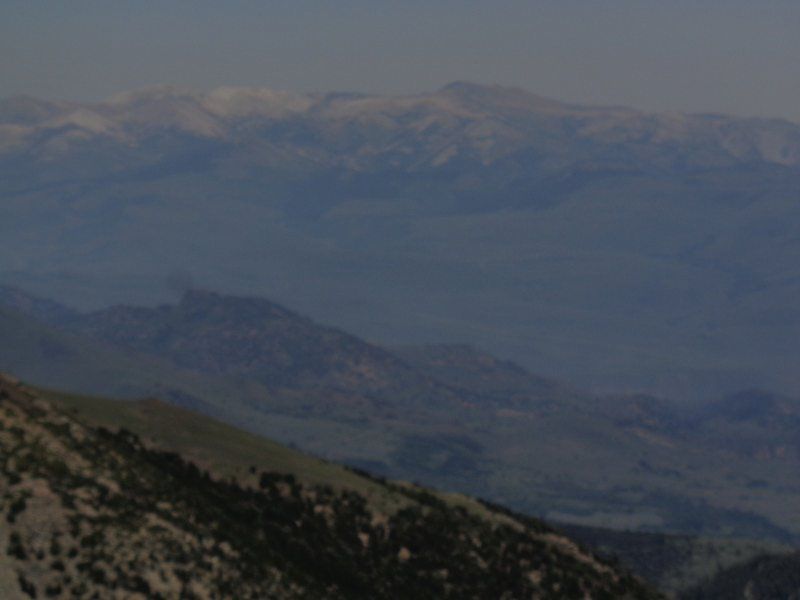
Did an overnight from St. Mary's Pass over Sonora Peak and then down to Wolf Creek Lake for the night. There was no smoke in the area but this is what it looked like to the north on Tuesday.
It seemed that the smoke had moved off more to the East on Wednesday but the rangers were recommending that no one head North on the PCT. Of course no one was listening. I'm sorting through pictures and will post a TR soon.
I don't give out specific route information, my belief is that it takes away from the whole adventure spirit of a trip, if you need every inch planned out, you'll have to get that from someone else.
Have a safer backcountry experience by using the HST ReConn Form 2.0, named after Larry Conn, a HST member:http://reconn.org