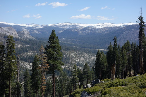
This past weekend I took a short backpacking trip from Glacier Point to Clouds Rest and beyond. I descended the peak along its NE route, and then followed the Merced River through Echo Valley and Little Yosemite Valley to return to GP. The Clouds Rest summit is basically snow free, except a few trivial patches among shaded rocks. The summit views into higher backcountry revealed snow levels that seem very low for this time in April. Rather, it feels like mid-June of a normal year. Many (most?) south facing slopes, including Mount Hoffman, are essentially snow free. The snow line is about 10,000' on north slopes, such as the Buena Vista Crest. Assuming the weather stays nice, I think it is reasonable to attempt higher elevation trips much sooner than normal (with an ice axe and caution).
My route passed through the fire devastation from the 2014 Little Yosemite Valley wildfire (a.k.a. "The Meadow Fire"). The fire was apocalyptic, especially between Moraine Dome and Bunnell Point. Lost Valley is essentially toast, and the really nice campsites below Point 7683 are now a mess of ashen charcoal stags. Sigh, nothing lasts forever.
Fire devastation is very sad. I cannot find information on the Yosemite website. Is the campground at Little Yosemite Valley burned? If so, what does this mean for camping for permits to Little Yosemite Valley?
@WanderingDaisy - the campground at Little Yosemite Valley is fine, untouched by the fire. The devastation begins approx. 1 mile east, on the SE slopes of Clouds Rest and along the Merced River to Bunnell Point. Further upstream -- Echo Valley and Merced Lake -- were not damaged by the fire.
Thanks for the report and pictures. I've been wanting to see some pictures of the burned area. Now I almost wish that I hadn't. That is a good sized snake.
"On this proud and beautiful mountain we have lived hours of fraternal, warm and exalting nobility. Here for a few days we have ceased to be slaves and have really been men. It is hard to return to servitude."
-- Lionel Terray
Thanks for the trip report and those are some great pictures. In response to the picture labeled "ptarmigan?" I'd say female blue grouse based on its location. Ptarmigan are going to still have a lot of white on them at this time of year and are found up above the tree line.
"Let no man be ashamed to kneel here in the great out-of-doors. Remember the woods were God's first temples." Ernest Hemingway, The Sun Also Rises
"There's nothin' better than a boy and his dog just out travelin' 'round the backcountry" -Some Old Hippie
Thanks V for the TR and pictures, the lack of snow for April is striking, especially the views towards Conness, but also on CR itself.
Professional Sierra Landscape Photographer
I don't give out specific route information, my belief is that it takes away from the whole adventure spirit of a trip, if you need every inch planned out, you'll have to get that from someone else.
Have a safer backcountry experience by using the HST ReConn Form 2.0, named after Larry Conn, a HST member:http://reconn.org
Nice photos. The lack of snow is a little shocking, isn't it? It's surreal.
The funny thing is your photos look almost identical in terms of snow coverage as the ones I took five weeks ago. In between there was a lot more melting but also a little new snow. Clouds Rest was already dry and Tenaya Lake completely melted in mid-March this year.

 Buena Vista Crest, from Glacier Point
 Clouds Rest, Tenaya Lake, Mount Conness, and beyond
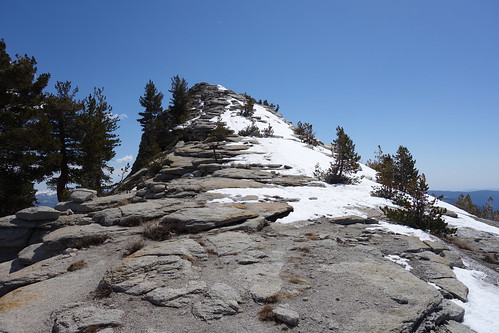 Clouds Rest NE Foot Trail
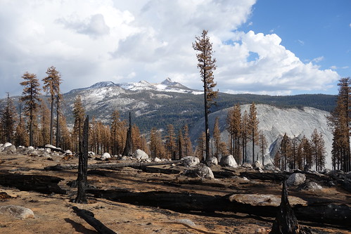 Fire Damage on the SE slopes of Clouds Rest
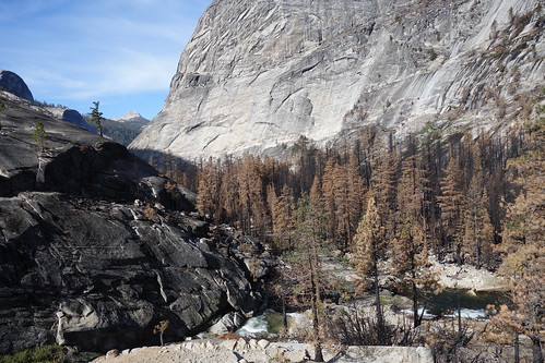 Lost Valley, Merced River
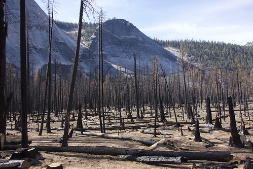 Little Yosemite Valley
 Good Night
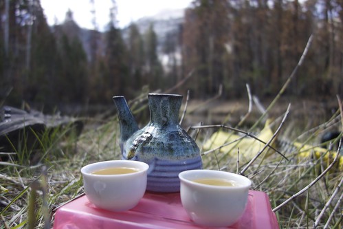 Tea Time along the Merced River
 Storms over Clouds Rest and Half Dome


