
I headed up the trail from Onion Valley at about 10:00 a.m on Saturday morning. I took my time heading up the trail because I slept at sea level the night before. I made stops along the way at Gilbert Lake and Flower Lake to check out the scenery.
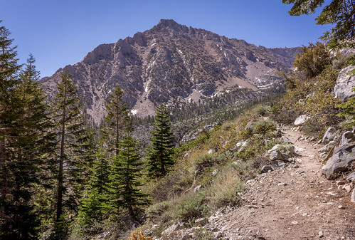 Looking Up At Independence Peak
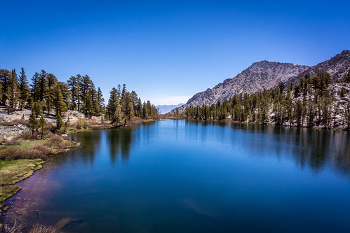 Looking Down At Gilbert Lake
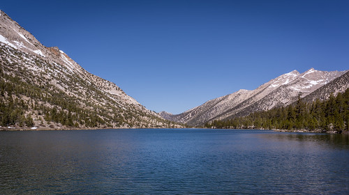
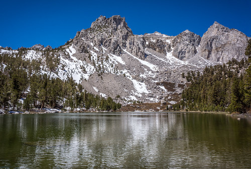 Flower Lake
 I made it to Kearsarge Pass at about 1:45 p.m. The climb up was not as bad as I was expecting, the gain was steady and moderate the whole way up with no particularly steep sections. For some reasons there was no sign marking the top of the pass even though I have seen the sign in other people's pictures.
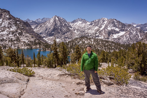
 Me At Kearsarge Pass
 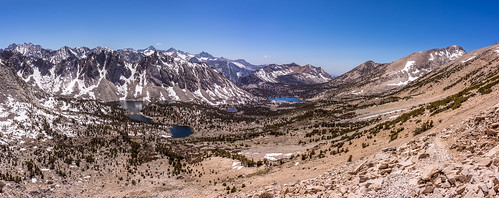 Panorama Of The View From Kearsarge Pass
 After enjoying the views at the pass, I headed down to Kearsarge Lakes to make camp for the night. I set up camp on a small hill above where the second lake meets the third lake.
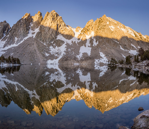
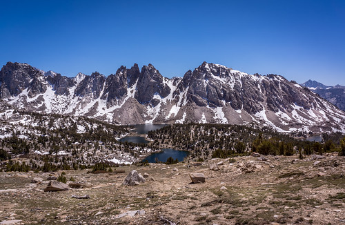 Kearsarge Pinnacles and Kearsarge Lakes
 I then wandered around the lakes and found a good place to watch the sunset. There is a bend in the third lake, so that you can watch the sunset over the lake in one direction, and then turn around and walk a few feet in the other direction to see the peaks above the lake light up.
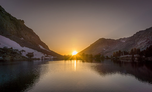 Kearsarge Lakes Sunset
 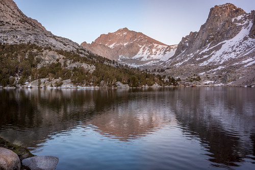 University Peak From The Lakes
 It was pretty cold that night, my tent completely froze on one side, but my feathered friends sleeping bag was up to the challenge and kept me warm. In the morning, I took a few more pictures while waiting for my tent to thaw. Once dry, I headed back on the trail and hiked down to Bullfrog Lake.
 Kearsarge Pinnacles At Dawn
  Bullfrog Lake
 From Bullfrog Lake, I hike to the JMT and started making my way up to the junction with the trail down to Charlotte Lake. On the way up to the junction, I was treated to a pretty good albeit brief view up Bubbs Creek. I then hiked down to Charlotte Lake, took a short break, and then started the uphill climb back to Kearsarge Pass.
 Charlotte Lake
 About halfway up the pass, the trail offered some great views down at Bullfrog Lake and the surrounding area. I made it back to Kearsarge Pass around 2:00 p.m., about the same time as the day before although I was a lot more tired this time.
 Me Above Bullfrog Lake
 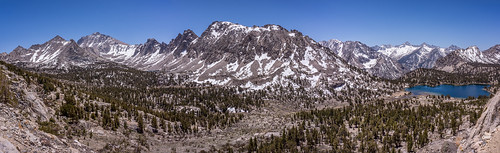 University Peak, Kearsarge Pinnacles, and Mt Brewer
 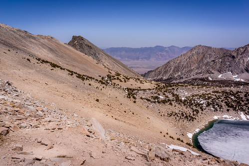 Independence From Kearsarge Pass
 I then headed down to Flower Lake and start hiking up the trail to Matlock Lake. I was hoping to sleep at Matlock Lake, so I could have more solitude, but there was a decent amount of snow on the trail to Matlock Lake that required postholing and/or rock hopping. I made it about halfway to Matlock Lake, but decided I was too tired, and I just went back to Flower Lake to set up camp.
Monday morning, I woke up, took some sunrise pictures and then headed back down the trailhead. I made it back to the car by 7:30 a.m. Good Memorial Day weekend.
 Flower Lake Morning Reflection
 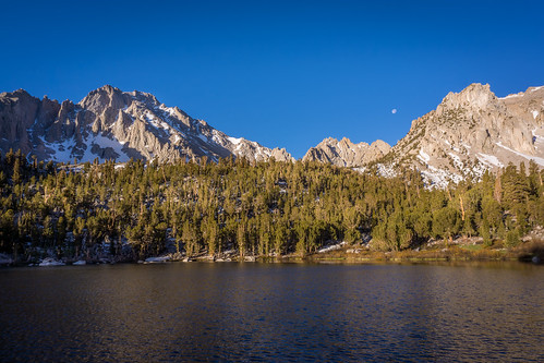 Gilbert Lake In The Morning
