sept 14'th
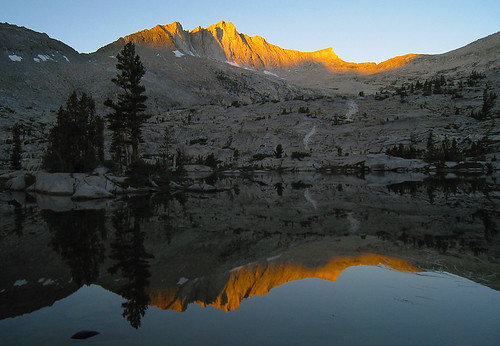
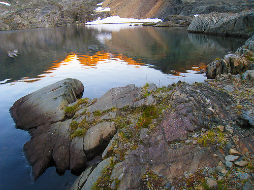
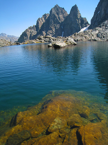
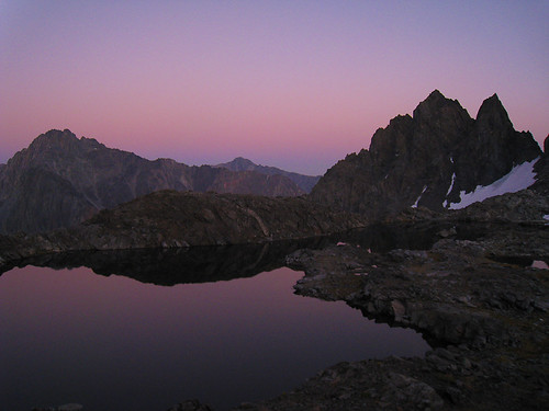
waking up early for no good reason, i lazed around lake 10280' for awhile taking pictures of finger peak reflected in this lake.
i had all the time in the world today cuz i was only going to take a short day to get up the goddard creek valley to lake 10232' (formerly lake 10212) and take another trip down memory lane. i had been in goddard creek five times before and each time, it was if i was walking though a beautiful valley as if i were in the heavens.
gathering up my gear, it wasn't long before i passed by an area where i had made a spectacular photograph back in 1990 with my 4x5 large format camera (posted in a previous post above) but i could not find the exact location. i believe i went a little too low in elevation and gave up looking for the exact trees after 15 minutes of backtracking. i wanted to see how the trees and shrubs had changed over the course of 20 years - didn't matter tho.
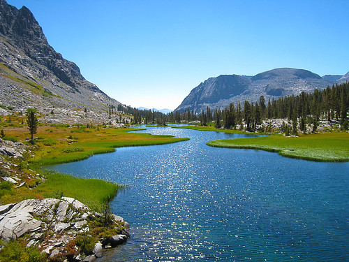
soon after that, i found myself in the most beautiful meadows in which goddard creek flows through just below lake 10232'. i spent a good 45 minutes just popping off frame after frame (easy to do with a point and shoot camera.)

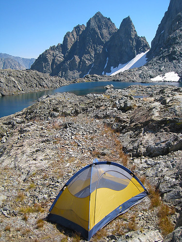
satisfied i got the shot i wanted, i arrived at the lake and set up my camp. i enjoyed yet another bath in the relatively warm waters and was even greeted by trout that would come within feet of my legs if i simply stood still. fishing has always been great here and even though i did not have fishing gear this time, i'd expect fishing to be just as good this time around.
 sept 15'th to sept 16'th
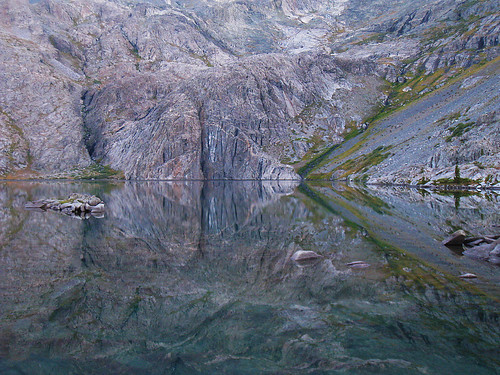
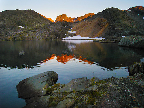
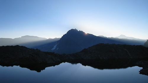
the next morning, lake 10232's surface turned to glass and i did some compositions of the reflection. i remember back in the early 90's when we were here during a rather intense thunderstorm. all of the creeks coming in from ionian and off the ragged spur had flash flooded. my friends tent got waterlogged and he bailed into mine. the next morning, we hiked back up to the end of the lake where the cliff dives into the lake just to see the waterfall of godadrd creek make its plunge. it was loud up close inside that gully.
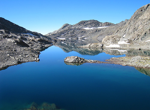
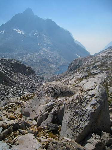
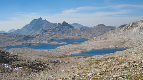
the climb into ionian basin went rather quickly. first, you skirt around the west side of the lake (you can skirt the east side but your boots will fill up with talus) and then begin to climb up to an elevation just above the cliffs. from there, you can begin to traverse across and upward to meet back up with goddard creek where it exits southwest ionian.
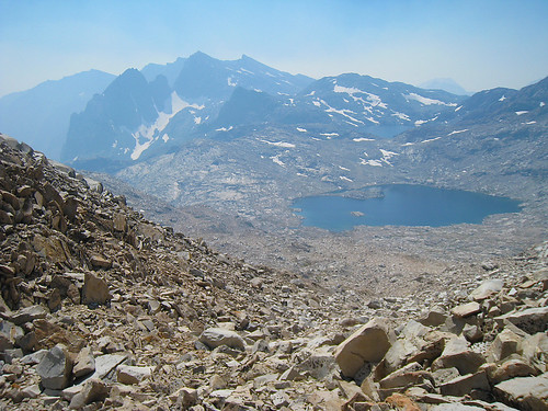
(note, for reference, what i call ionian basin is more than what is called ionian basin on the maps. on the maps, ionian basin begins at the large lakes 11837' and 11592' southwest of mt solomons and ends at lake 11828' southwest of the black giant. it includes chasm lake..... but i also consider lakes 11951' and 11818' southeast of goddard, scylla, the three sirens, and charibdis to be part of ionian basin - maybe i should call the latter ionian basin west?)
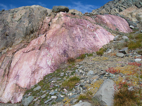
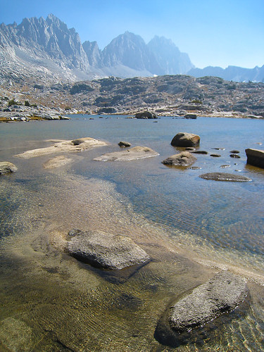
anyway, i had made it into the southern part of the basin well before midday and saw a really neat pinkish colored rock vein. perhaps some of you can identify the mineral?

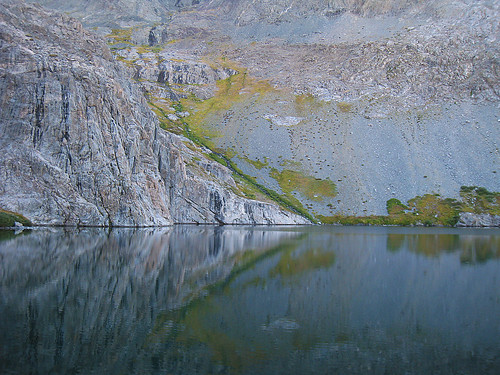
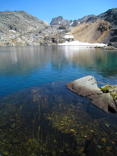
skirting around the west side of lower lake 11818' (actually like a twin lake seperated in elevation just by a foot or two) i set up camp for the day and spent the rest of the day just goofing off and daydreaming. later in the day, i was surprised to see two other guys headed towards me. i had not seen anyone since i left blackcap basin and when they finally looked up and saw me, i saw the surprise in their eyes when they realized they wouldn't have the place to their own as well. as it turned out, we camped near each other between the two lakes and shared a few stories. one of the guys is a member here, john dittli, and his backpacking companion, rob, had just come over echo col. i couldn't believe that when they told me where they came from for the day... for in comparison, i travel at a snails pace when off trail. they were both headed to tunemah.
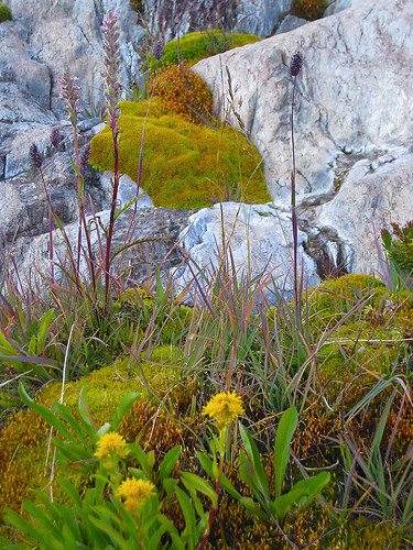
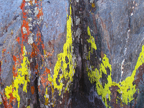
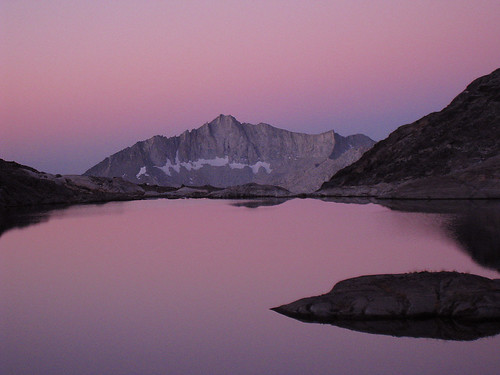
anyway, i popped off a few pictures before and at sunset as usual including the lake, lichen, and other stuff:
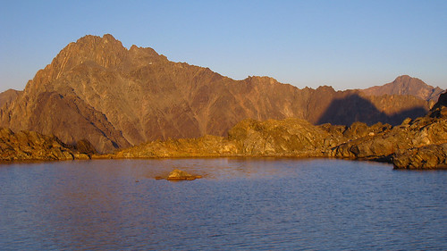
sunrise was spectacular, as the lower portion of this lake has a fantastic view back towards finger peak. after sunrise, i took a short dayhike to the backend of long lake 11951' and popped off a few shots there as well:
getting back to camp, i gathered up my backpack and continued on for another tremendously long day (~1.5 miles) to what i call "scylla lake" right at the north base of scylla. i really had to search around for a suitable place to pitch my tent, as everything around was really rocky including the grassy sections. at least i satisfied the 100 foot-away-from-water rule this time around.
as usual, i got busy around sunset again...
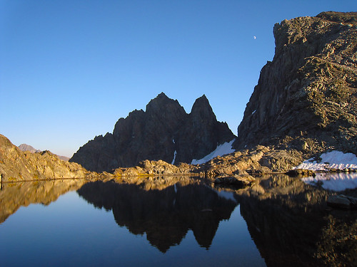

and then again at sunrise (over charybdis)
 sept 17'th
at sunrise, i once again smelled smoke. "oh just great" + a few choice words i said to myself. the smoke retrogrades during the nite and then when the sun gets things warming up, it begins it's upcanyon flow once again. during the retrograde, the smoke can easiliy access the middle fork split and ends up coming up tehipite/simpson and eventually, north through goddard creek and enchanted gorge.
by the time i hiked up and over to lake 11592' the smoke was really thick. so thick, i could barely see the face of charbydis and could not see very far down the enchanted gorge. i was originally going to head down to chasm lake and then out via black giant pass but i was really getting tired of all this smoke.... so i changed course and headed north over solomons pass once again to meet up with the muir trail on the other side. too bad, cuz i had never been over black giant pass - always came into ionian from solomons from north to south. maybe next time, i will have no smoke and storm clouds. all of these blue sky and/or smokey days make for boring photos anyway.
coming down the pass was tricker than going up because the north side of solomons pass has some rather loose rock and talus (or snowfields) and this time around, i managed to kick off a minor rock and talus slide. anyway, i got back to the trail and then my pace began to really accelerate. it wasn't long before i arrived at the muir hut.
the smoke even filtered over solomons pass and ended up infiltrating into the basin containing wanda lake. a half hour later, i ended up at helen lake and called it a day
 sept 18'th to sept 19'th
these days mark the end of my journey. simply follow the trail on down to the leconte ranger station and then back out over bishop pass. at this point in time, i was thinking of a nice soft bed, a great shower and some meat and fresh veggies. anyway, here are a few parting shots. thanks for reading my report. it was fun.
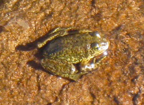
one of many frogs in upper leconte canyon (lake 10820')
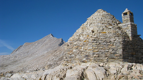
sharktooth rock - a great campsite at about the 9400' level
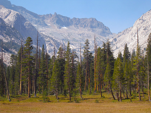
big pete meadow

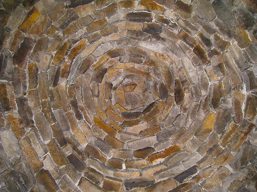
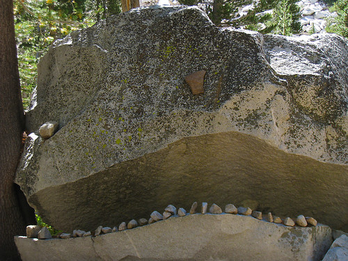
more rocks...
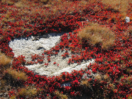
pinemat manzanita in it's fall uniform of red
and last but not least, dusy basin, the palisades, and more forest fire smoke.
it was a really windy last day - gusty winds up on top of bishop pass guessing to be between 50-70mph gusts.
the full set of pictures may be found here:
http://www.flickr.com/photos/12579619@N ... 001457536/" onclick="window.open(this.href);return false;
or if you prefer, a slideshow here:
http://www.flickr.com/photos/12579619@N ... 7536/show/" onclick="window.open(this.href);return false;


