
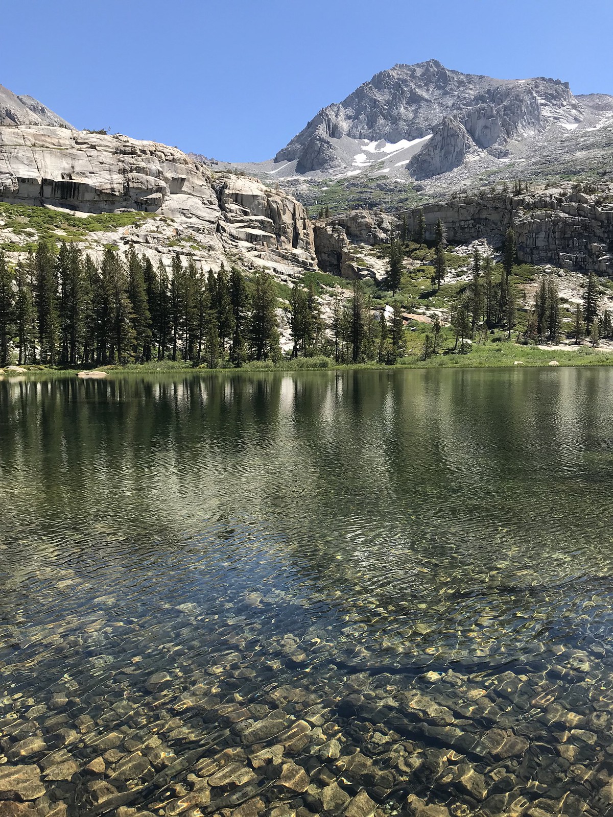
Day 1: this was WAY too long a day (for me), which could have ended up ruining my trip. Things were going great to Twin Lakes ...
 Twin Lakes (the larger one, anyway)
... and beyond. I almost stopped to camp a little below Silliman Pass. However, poor judgement caused me to press on, reaching the pass at 4:00. My knee was a little sore by now, but I enjoyed the views over the pass and toward Mt Silliman.
My descent to the east inflicted ever-increasing pain on my knee. As this side of the pass was bone-dry, I pushed on toward the lakes. Dropping to Beville Lake, I arrived to find it very nice, AND surrounded by a mosquito-choked swamp. After a 10-second-long visit, I retreated and headed to Ranger Lake. Finding a tent site, I was now quite exhausted and still harried by skeeters (though less than half as bad as Beville).
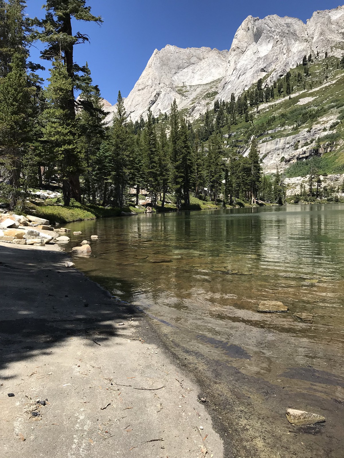
Day 2: After taking a last look at Ranger Lake ...
 Ranger Lake
... I rejoined the main trail north-bound. With my still-sore knee and a slow start, I decided to skip my planned visit to Lost Lake. Once on the Sugarloaf Creek trail, I found this gentle and sandy section (though a bit dull) gave my joints a rest while staying on the move. After this segment - with stops to soak my feet at creek crossings - my physical condition (and mood) was vastly improved. I stopped to camp just short of Ferguson Creek. I noticed a group of hikers (first seen at Ranger Lake) camped on the other side; little did I know that I would end up hiking with them two days later.
Day 3: I had an easy start today, and a nice visit at the Roaring River ranger station. My hike up Deadman Canyon got better and better, with ever-increasing wildflowers even before reaching Ranger Meadow. I paid the “grave marker” a visit. Some spots had so many different species of wildflowers in bloom that I lost count (after 15 or so). The creek also provided some nice moments -
 Copper Creek - Deadman Canyon
Ranger Meadow itself was quite beautiful -
 Ranger Meadow
It was a little late when I arrived to camp in a nice granite area just short of Upper Ranger Meadow, but by now my trip was solidly in the “win” column.
Day 4:
I talked to the group of six hikers (camped nearby) who I’d been trailing for three days, just as they were leaving. They had visited Big Bird Lake late the day before; their account - and a quick look up the slope - helped me decide it was beyond my ability, at least for this trip. I saw a Pika about 30 minutes after I got going, just a little beyond Upper Ranger Meadow (at a little lower altitude than expected). I soon saw the group a bit ahead of me; I caught up with them as they were doing some self-arrest practice on the first significant snow field I encountered, maybe an hour from my start. Normally, I would never include a “selfie” in a TR, but this accidental photo-bomb by the young man sliding into his demo just seemed too funny to omit:
 Slide!
... followed by this view showing perfect form on his arrest -
 Okay, that’s enough sliding
There were lots of nice views on the way up - including ones looking back down the canyon ...
 Cascade down Deadman Canyon
... and looking up -
 View up Deadman Canyon
 Elizabeth Pass (in the saddle on the left)
I was alternately ahead of (and behind) the group; they quite graciously invited me to join them. We traded route-finding and group-photo duties, and got to the top of Elizabeth Pass more or less together. The ascent, though strenuous, was not technically difficult; the snow patches higher up were easily crossed - no need for even microspikes. The descent on the south side of the pass was more tedious, given the less-maintained (and sometimes non-existent) condition of the trail. Again, I was glad to have some company; everyone helped each other and had a great time. There were still lots of flowers -
 Flowers - south of Elizabeth Pass
We reached a better part of the trail before Lone Pine Creek; heading down, we turned off toward Tamarack Lake and made camp a bit after the junction.
Day 5:
In the morning, I said goodbye to the group - they headed toward the HST and I headed up to Tamarack Lake.
 Tamarack Lake - view of east shore
 Tamarack Lake - looking southeast
Arriving at the lake, I told myself that the whole trip had been rushed, and there was NO WAY I was letting that happen now. I explored a little, first heading over to check out the lake outlet. I saw an osprey circle the lake a while (not unexpected; lots of ospreys at Sierra lakes). Then I saw a Great Blue Heron (quite unexpected) - I’m no bird expert, btw - I had to look it up. Anyway, it was quite beautiful. I turned south and found a nice granite “beach”; I decided to go for a quick dip.
 Tamarack Lake - “granite beach”
Two lessons learned:
1. When wading out on granite (not sand or gravel), WEAR SHOES! (Yes, I knew this but forgot because the water looked so inviting). It’s slippery out there!
2. Cold, wet shoes (my creek-crossing sneakers) can make an excellent pillow when sunning yourself on a granite slab.
From this area, I enjoyed watching (and listening to) the impressive waterfall - across the lake - that flows into Tamarack from Lion Lake. When you first arrive (from the trail), the waterfall is obscured from view, and you can only see the less-impressive lower cascade. Only when you walk a bit south will you see the upper falls:
 Tamarack Lake - inlet waterfall
I spent about two hours at this awesome lake - oh, almost forgot to mention I was (apparently) the only person there, in the middle of a Saturday ... in August. THIS, rather than the adventure of going over Elizabeth Pass, now seemed to be the highlight of my trip. Eventually, I turned back down the trail, heading past Bearpaw and ending another long day camped on the west fork of Buck Creek.
Day 6:
Making the final mistake of my trip, I decided (after miscalculating the elevation gain from my topo map) to take the “Wolverton cutoff” trail, rather than ending at Crescent Meadow - thus adding almost 1,800’ of unnecessary gain to the end of my trip. A couple of nice shuttle rides later, I was finally back to my starting point at Lodgepole.
I learned a lot on this trip; especially about my own physical limits. I had a fantastic time, but hopefully I’ve learned just how hard I can push and still feel good, both at the end of every hiking day, AND once the trip is done.


