GENERAL OVERVIEW: This col provides a cross country route between Desolation Lake in Humphrey's Basin and Star Lake above French Canyon.
CLASS/DIFFICULTY: Class 1-2.
LOCATION: Sierra National Forest/John Muir Wilderness. Star Col on the HST Map
ELEVATION: ~12,120 ft
USGS TOPO MAP (7.5'): Mount Tom, CA
ROUTE DESCRIPTION: Starting from the outlet of Desolation Lake, head north past Wedge Lake and ascend the easy slopes toward (and past) the small tarn's below the pass. The pass is the low point between peak 12225 and 12350. From the pass, head northwest down the boulder field towards the south end of Star Lake. North slopes class 2. South slopes class 1.
PHOTOS:
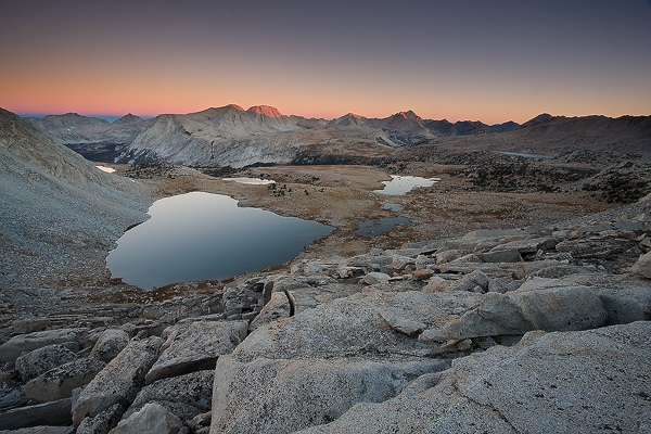
Looking northwest from the summit of Star Col at sunrise. The northwest boulder field leading down to Star Lake can be seen in the foreground.