Page 12 of 22
Re: 2014 Member Meet-up 7/22-7/27
Posted: Sun Feb 23, 2014 4:56 pm
by rlown
Ladd,
thanks for the pointer.
Re: 2014 Member Meet-up 7/22-7/27
Posted: Sun Feb 23, 2014 9:26 pm
by The hermit
Please give contact info for a shuttle from cotton wood th to shepherd pass trail head. Also rate crab tree vs. other xc passes
Re: 2014 Member Meet-up 7/22-7/27
Posted: Mon Feb 24, 2014 10:55 pm
by The hermit
I probably won't make it to the meet up.thanks for the route info.how does this route compare to rae col and 60 lakes pass? Specifically oap-miter basin & crabtree pass
Re: 2014 Member Meet-up 7/22-7/27
Posted: Fri Feb 28, 2014 6:44 pm
by calipidder
I stayed two nights in Wright Lakes basin last summer and we feasted each night. They weren't the biggest I've caught, but they were biting well enough to make it easy to catch dinner. Some lakes were easy, a bite with every cast, and others appeared to be barren. We camped in between one of each and it was only a 5 minute walk between them.
Re: 2014 Member Meet-up 7/22-7/27
Posted: Tue Apr 15, 2014 1:27 pm
by maverick
Bumping this up because I still have the 4 permits I have reserved for the Meet-up. If
no one wants them by the end of this month I will let them go so other backpackers
can take advantage of them.
2014 Member Meet-up 7/22-7/27
Posted: Tue May 13, 2014 1:42 pm
by Hobbes
Jimr wrote:Hobbes, I added a red line and modified the blue line. Which way around Crabtree Meadow are you suggesting?
Hi Jim, sorry for the very late reply - looks like this thread got a little bit buried.
In reference to your TOPO map here:
http://caltopo.com/map?id=686O" onclick="window.open(this.href);return false;, I would suggest looking to go due west to the PCT starting around the area between the 3300 meter topo line and the large capital N of "national" by aiming for the trail just above the BM 3148.2 mark.
Hope that makes sense. LOL
Seriously though, if you drew a line from the Crabtree trail to the PCT right on top of the italic lettering "Crabtree", you'll see that you would skirt a small uprise/cliff to your left. If you hit it right, you'll walk through a flat meadow directly to the PCT through the lower, not upper, meadow.
I think I mentioned upstream that I'm going to try and do the "perfect hike". LOL again. To that end, I'm bringing my compass, and I'm measuring/timing my sections so that I can dead reckon with some confidence from specific spots. I'm going to do it up the Langley shoulder while shooting for upper Soldier, then down Crabtree meadow & finally my x-c route from Wallace to WLB.
It's probably a matter of no more than a few minutes/distance, but I'm pursuing the 'zen' aspect of no mistakes, just flow.
Re: 2014 Member Meet-up 7/22-7/27
Posted: Tue May 13, 2014 1:53 pm
by Hobbes
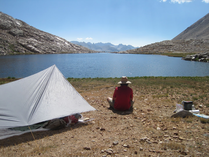
Jim, I was just looking @ your TOPO route up through Miter. I might suggest skirting lake WL 3697 to the left, not right. In fact, I would aim directly for the 3 tarns from topo line 3700 @ the 3700 label.
Here's what the terrain looks like between the unnamed lake to the left of lake WL 3697. WL 3697 is peeking in the background - note the cliffs on the right shoreline:

Re: 2014 Member Meet-up 7/22-7/27
Posted: Tue May 13, 2014 2:11 pm
by Jimr
That's funny. I had both lines basically where you suggested, but changed them later. The actual paths I take will be decided once I get there. I really had doubts on the upper lake above SBL as I originally had myself going west of the lake, but after a trip report that suggested the east side, I decided to move the line, but make my decision when I'm there. The topo heavily suggests west side over east.
Re: 2014 Member Meet-up 7/22-7/27
Posted: Tue May 13, 2014 2:13 pm
by Jimr
when in zen, there are no mistakes. Everything is unfolding just as it should.
Re: 2014 Member Meet-up 7/22-7/27
Posted: Tue May 13, 2014 2:43 pm
by Hobbes
Jimr wrote:The topo heavily suggests west side over east.
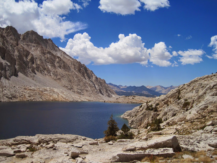
Yeah, it's a walk up. I've found the hardest (and slowest) part of the hike is getting around the unnamed upper CL. Lots of sharp, loose, small/medium talus along the northern shoreline. Can't go high (ie the notorious Discovery sand hill), don't wanna get your feet wet.

After you clear that, it turns into really bitchin' ramps that follow the stream down to the named upper lake. Some people advise against following the cascade all the way down to the lake due to the cliffs on the right, but it's a great view and a very easy hike to get around to the beach:
Zen, baby, zen.