Page 1 of 2
Pryor Lake trailhead
Posted: Sat Jun 15, 2013 3:23 pm
by bsd
So at end of May, we tried hiking to this lake, but couldn't find the "cross forest' route my buddy used to know about. Ended up on a trail/road about 1 mile from the lake. The road was blocked by a very wide river of snow run off, and we were unable to get to the lake. Anyone have the GPS coordinates to the trail head to see if we were on the right track?
http://www.fs.usda.gov/wps/portal/fsint ... Lake+Trail" onclick="window.open(this.href);return false;
Re: Pryor Lake trailhead
Posted: Sat Jun 15, 2013 6:53 pm
by Shawn
Well I had to have a look at it out of curiosity. Attached is a Google Earth image. Assuming you intended to hike from north to south, it looks to be about a mile from the nearest dirt road. Of course the place is a jumble of dirt roads, so it's anyone's guess how passable they might be.
The attached image is "zoomed out" quite a bit, when I zoom in I see no evidence of any trail or trail head. In any event, it looks like a neat place to explore - probably not traveled much. Maybe someone else on here has been to the lake?
Re: Pryor Lake trailhead
Posted: Sat Jun 15, 2013 7:05 pm
by rlown
First, is it this Pryor Lake?
Capture.JPG
Re: Pryor Lake trailhead
Posted: Sat Jun 15, 2013 11:49 pm
by bsd
Yes, both maps above are the correct lake. I was on that road, it is the one which was blocked by the water. But where is the trail head, possibly at the end of this road? The link I provided has road numbers, but no GPS coordinates.
Re: Pryor Lake trailhead
Posted: Sat Jun 15, 2013 11:57 pm
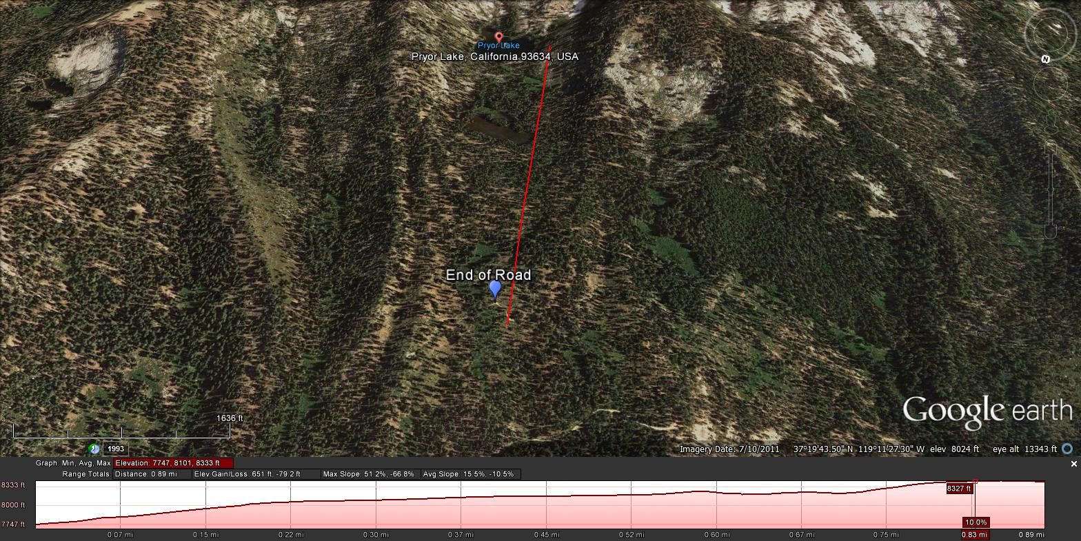
by bsd
Pin is where we stopped hiking. To the left of this you can see the road end. Like I mentioned earlier there is a non-trail route somewhere...
Re: Pryor Lake trailhead
Posted: Sun Jun 16, 2013 12:28 am
by Shawn
Not too sure what you mean by a non-trail route", other than just bringing a compass and heading south to the lake? Looks to be straightforward otherwise.
Also have a look hear:
viewtopic.php?f=1&t=5170" onclick="window.open(this.href);return false;
Re: Pryor Lake trailhead
Posted: Sun Jun 16, 2013 11:28 am
by rlown
where on the road were you blocked? It's not like you need a trailhead or trail for a mile hike, maybe.
you obviously have a GPS. what were the coords?
Re: Pryor Lake trailhead
Posted: Sun Jun 16, 2013 1:01 pm
by bsd
With our packs, the hill was way too steep and shrub grown to hike up, at least at where we were at. We also didn't want to attempt walking across the river. It was probably 30 yards wide, never seen anything like it from snow melt. Total mystery because I've been to the lake about 3 or 4 times, never had a problem. When I read there was a trail head, I wanted to find it. In the past, a buddy of mine knew where to park, and we would walk straight up, but only at a specific spot.
Re: Pryor Lake trailhead
Posted: Sun Jun 16, 2013 6:28 pm
by rlown
i'll ask my question again. where did your GPS tell you you came in and where did you get blocked by the river? If you didn't have a GPS, then we won't know anyway.
Re: Pryor Lake trailhead
Posted: Sun Jun 16, 2013 9:05 pm
by bsd
Parked car at 37 20.026 119 11.766
Stopped at around 37 19.796 119 11.591
Might go back and drive through the creek or just hike it now that it is probably low and narrow; or just find another way up.