During the night it did rain intermittently, which didn't exactly allay my concerns, and it continued like this until sometime after 6:00 am. I had a short day planned today--just a couple off-trail miles down to Lake 9735--so I could afford to take my time and see what happened with the weather.
I had my usual coffee & Clif bar breakfast, read a while, wandered around the area, took some photos. Still overcast; still not raining. So I started packing up, tent last just in case, and finally got moving around 9:00 am.
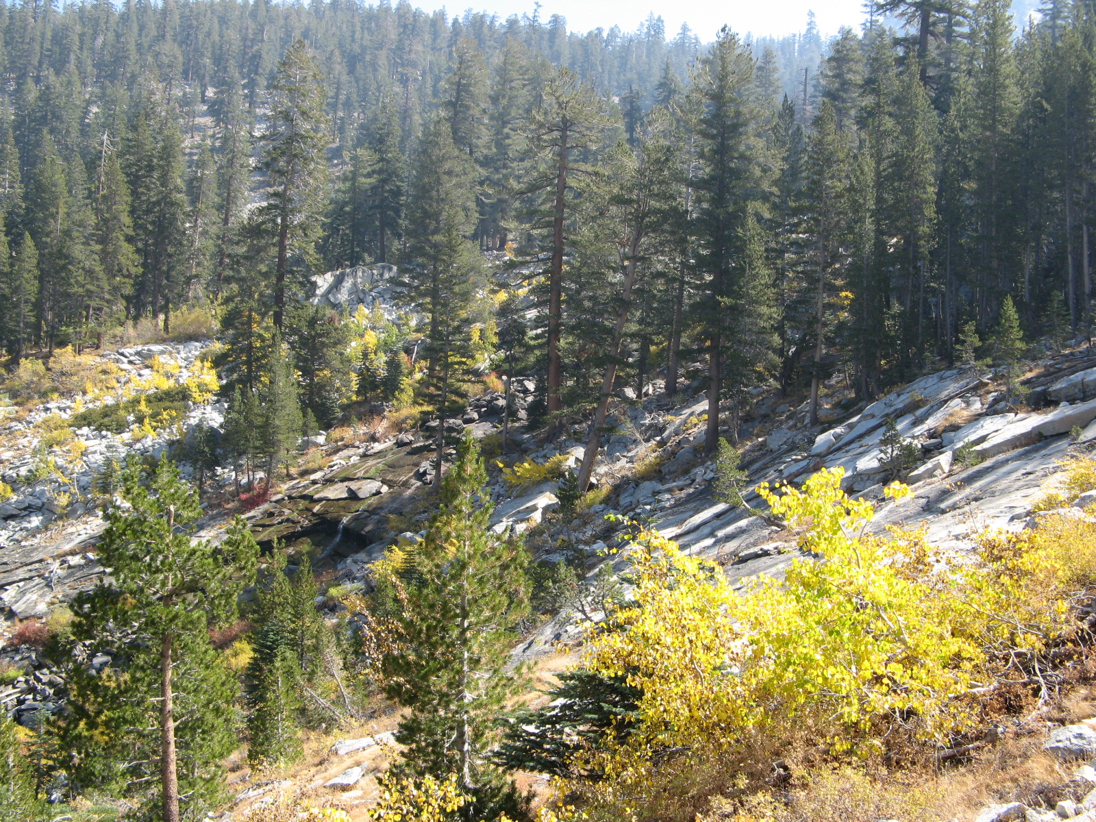
The descent from Big Brewer was pretty straightforward, and there are probably lots of acceptable ways to go. I stayed on the north side of the creek; I cut away from the creek and bypassed Little Brewer Lake, and at about 10600' level I cut north a bit to avoid some talusy stuff closer to the creek--and lower down, when I didn't, I started running into brushy side ravines that pushed me back toward it--but mostly I followed the creek at a respectful distance.
And almost before I knew it, certainly before I expected it, about an hour after leaving Big Brewer--whoa! there's a big-ass lake
right in front of me!
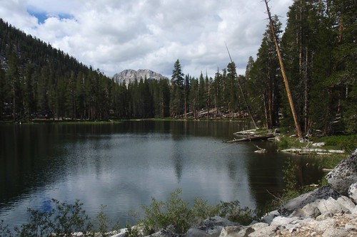
This lake, Lake 9735 (since nobody ever bothered to name it), was the location that more or less dictated my route--the one spot I was determined to get to and get some photos. Those of you who are familiar with my
Brewer blog may already know the reason: the Brewer party camped near this lake for 5 days in early July of 1864. This is the camp from which they made the first ascent of Mount Brewer. It's sort of their gateway to the truly alpine terrain of the Kings River Sierra.
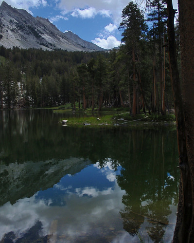
So, immersed as I currently am in the Brewer, getting to this spot I first read about over a decade ago was hugely satisfying.
At the same time, there were decisions to be made. It hadn't cleared up; the weather was just as threatening as it had been when I got up. If it was going to get ugly over a sustained period, I'd be better off getting closer to the trailhead before it hit. It was still early in the day, so I had the potential to make some mileage yet. Conversely, if I camped here, it would be a long day in a nice spot but with not much to do.
So I decided, in the short term, not to decide: I'd spend a while here, exploring the lake, shooting it, and (again, still), waiting to see if the weather cleared up at all. And that's what I did. I had a very pleasant hour walking around the lakeshore, shooting the various angles, and just generally enjoying the beauty and the history of the place.
At the end of which, with no change in the weather, I decided to head to the next potential campsite near Moraine Creek.
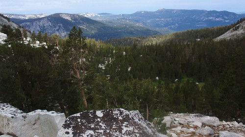
This was some fun and interesting cross-country navigation. My plan was to catch the northwest-trending moraine ridge and follow the ridgeline all the way down to Moraine Creek. First I headed west across the flats and the shallow valley west of Lake 9735. Then I angled right up a low ridge and found myself face to face with the depression north of Point 9785--deeper and uglier (talus-and-timber-choked) than it looks on the map. I continued along the ridge south of the depression, which was relatively easy going.
Coming out on the northwest facing slopes beyond the depression, I started descending while trying to bear left (toward the ridge). Palmer Mountain appeared, and served as a useful directional guide. Somewhere around the 9300' level I encountered a trail traversing the slope, and figured I'd follow it to the left (southwest). After a very short distance I saw the ridge I wanted just below me, and dropped down to it.
Now, sometimes moraines can be a real pain in the neck to follow, with all kinds of rock and debris making things difficult. This one was not. This was practically a freeway. The stretch atop this ridge was, in fact, the easiest hiking of the entire trip, including any trail.
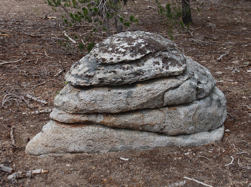
Plus, I finally got to see the world-famous Jabba the Rock.
The ridge ends in a little granite knob (outlined in the 7920' contour). Descend the other side of the knob, cross a small (maybe seasonal) stream, cross Moraine Creek a little further on, and bingo--you're at the trail. This was a sweet cross-country route all around, and I got there by noon--just an hour from the lake.
There's a good campsite right by the trail about 50 yards to the left of where I came out, and it looks like there might be other good spots further from the trail as well. I put down my pack and had a nice leisurely lunch, while figuring out what to do.
On the one hand, there was a decent campsite, and it would be a solid 4+ miles to the next certain site (Sphinx Creek). On the other hand, it wasn't that interesting a place; I had all afternoon; and the weather was still threatening. (There--I just felt a couple of drops.) If I really was facing several days of crappy weather, which looked likely, it would be advantageous to get to where I could hike out in a short day.
In truth, I had already made my decision back at Lake 9735. Once I left the lake I was out of the really interesting country, and without even noticing it was shifting to an end-of-trip frame of mind. Now, at Moraine Creek, there was nothing but trail between me and civilization, and nothing very exciting along the way.
So I saddled up and began the long slog up to Avalanche Pass.
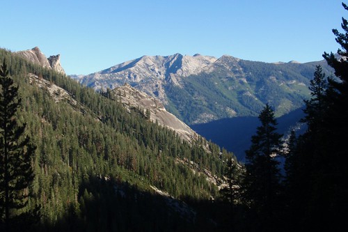
One thing I'll say for the cloud cover, is it did keep the heat down. This was most welcome as the easy-ish grade of the first section shifted to the steeper climb up the gully toward the pass. As I got higher the wildflowers got more profuse, and I started getting some tree-screened views back toward the Kings-Kaweah Divide.

Soon, I was within sight of Avalanche Pass.
Or...not. A good long climb later, I could see the pass above me, looking about the same distance it had before. Except that before it hadn't really been the pass.
Which, in fact, it wasn't this time either. Or the next time.
And the trail kept switchbacking more than was really necessary, and I got to a point where it looked like the pass (or the "pass", since Avalanche Pass isn't really the high point) was maybe 20 feet higher than where I was on the trail and
here's another damn switchback. And the trail gets to the start of gentle country at the saddle but instead of heading straight for the higher but it has to cross it just kind of...
meanders.
"Are you f***ing SERIOUS?"
Again, the trail did not respond.
But soon--not as soon as I'd have liked, but as soon as the trail deemed permissible--I was at the high point. Where someone had laid out an oddly elaborate marker.

Then a speedy drop over the next couple of miles down to Sphinx Creek. Back to my old campsite, more
War and Peace, borscht for dinner, and an early bed.
Next morning I was up and on the trail before 7:00 am. Happily, it was a lot less smoky than it had been 4 days ago, so I was able to get some better shots of the stuff I had admired on the way up.
The granite steps were again a pain in the neck. I like a trail I can sail down; if you have to carefully place every single step, you might as well be off trail altogether. But I got through it in decent time, and once I hit the Bubbs Creek Trail I could really make some time.
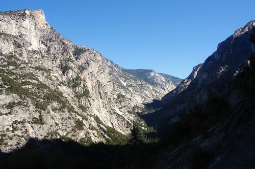
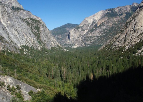
There are some swell views of Paradise Valley from the Bubbs Creek switchbacks, and for my money the best view of Kings Canyon--at least, the view that gives you the best sense of Kings Canyon as a yosemite.
I started running into people at the bottom of the switchbacks (first I'd met since the first evening), and by the time I got to the Paradise turnoff there was a steady trickle of backpackers. All friendly, and I stopped for a quick where-you-going-where've-you-been chat with every group I ran into. (Dayhikers, not so much; the friendlier ones might nod and mumble in response, while the others (figuratively) crossed the street to avoid me.)
It was getting good and hot by the time I reached the trailhead--just about 10 am, a day earlier than I had planned. Which was fine: I had done the route I wanted to do, and (except for Mt. Brewer) had seen everything I intended to see.