trip advice: Blue Canyon from the north?
Posted: Sun Feb 06, 2011 7:02 pm
preliminary info:
my level of experience: numerous backpacking trips, some x-country travel
comfortable with: class 2, river crossings, snow travel
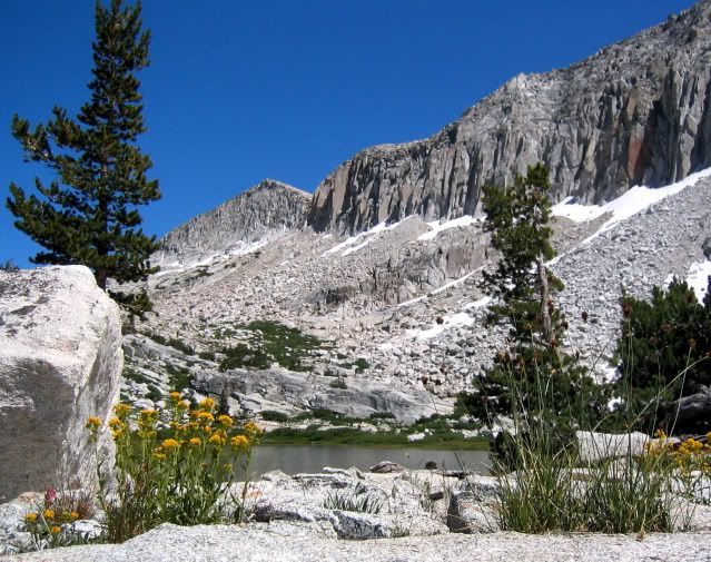
main interest: big mountain scenery
Trip is 5-10 days (depending on route, which will depend on conditions), probably 20 mi/day in areas where it's straightforward trail hiking.
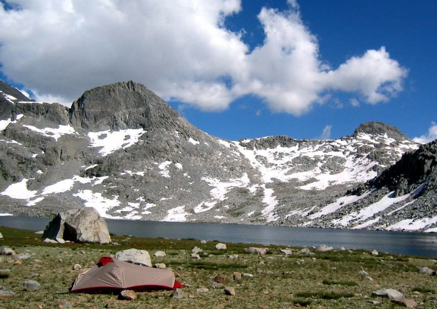
I'm interested in seeing Tehipite Valley and Blue Canyon this summer, probably solo, in late July. Some folks here have already been very generous with their time by answering my questions about creek crossings. Thanks!
--Plan A--
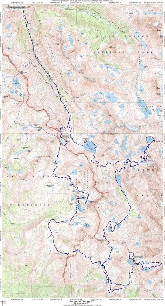
If this turns out to be an average or below average snow year in the southern Sierra, my plan is to go from Crown Valley trailhead to Blue Canyon, then back out of Blue Canyon, head down to Tehipite Valley, then follow the middle fork of the Kings to the JMT, exiting over Bishop Pass. Folks here have advised me that is is probably doable if it hasn't been a heavy snow year.
--Plan B--
If it does turn out to be a heavy snow year, I've tried to come up with a plan B that still lets me cross the Sierra with visits to Blue Canyon and Tehipite while avoiding some of the higher crossings. What I've come up with is this: Crown Valley trailhead, Tehipite Vy, backtrack to Crown Valley Ranch, Crown Pass Trail, Woodchuck Trail, Blackcap Basic Trail, Portal Lake, "Midway Pass" (named that by Secor, see below), Blue Canyon, backtrack over Midway Pass, Hell For Sure Pass, Goddard Canyon Trail, JMT north, exit at North Lake or Pine Creek.
I'd be grateful for any comments on Plan B. It involves a lot of backtracking, the purpose being to avoid crossing the middle fork of the Kings or Crown Creek, which are supposed to be bad when the water is high.
Has anyone done what Secor refers to as "Midway Pass?" This is a route that connects Portal Lake with the north end of Blue Canyon, going over Kettle Ridge. Secor describes it as class 2, 11600'. It's a cross-country route, almost all above tree line. I'd probably bring an ice ax and instep crampons for use with lightweight running shoes.
Any other comments on the practicability of the plan-B route in a heavy snow year? I'm trying to be conservative, since I'll probably be alone. Am I not noticing any other crossings that would be dangerous?
Re either plan A or plan B, does anyone have any recent info on the conditions of any of these trails? In this era of budget cuts, am I going to find myself bushwhacking at the lower elevations due to lack of trail maintenance?
Thanks in advance!
-Ben
my level of experience: numerous backpacking trips, some x-country travel
comfortable with: class 2, river crossings, snow travel
main interest: big mountain scenery
Trip is 5-10 days (depending on route, which will depend on conditions), probably 20 mi/day in areas where it's straightforward trail hiking.
I'm interested in seeing Tehipite Valley and Blue Canyon this summer, probably solo, in late July. Some folks here have already been very generous with their time by answering my questions about creek crossings. Thanks!
--Plan A--
If this turns out to be an average or below average snow year in the southern Sierra, my plan is to go from Crown Valley trailhead to Blue Canyon, then back out of Blue Canyon, head down to Tehipite Valley, then follow the middle fork of the Kings to the JMT, exiting over Bishop Pass. Folks here have advised me that is is probably doable if it hasn't been a heavy snow year.
--Plan B--
If it does turn out to be a heavy snow year, I've tried to come up with a plan B that still lets me cross the Sierra with visits to Blue Canyon and Tehipite while avoiding some of the higher crossings. What I've come up with is this: Crown Valley trailhead, Tehipite Vy, backtrack to Crown Valley Ranch, Crown Pass Trail, Woodchuck Trail, Blackcap Basic Trail, Portal Lake, "Midway Pass" (named that by Secor, see below), Blue Canyon, backtrack over Midway Pass, Hell For Sure Pass, Goddard Canyon Trail, JMT north, exit at North Lake or Pine Creek.
I'd be grateful for any comments on Plan B. It involves a lot of backtracking, the purpose being to avoid crossing the middle fork of the Kings or Crown Creek, which are supposed to be bad when the water is high.
Has anyone done what Secor refers to as "Midway Pass?" This is a route that connects Portal Lake with the north end of Blue Canyon, going over Kettle Ridge. Secor describes it as class 2, 11600'. It's a cross-country route, almost all above tree line. I'd probably bring an ice ax and instep crampons for use with lightweight running shoes.
Any other comments on the practicability of the plan-B route in a heavy snow year? I'm trying to be conservative, since I'll probably be alone. Am I not noticing any other crossings that would be dangerous?
Re either plan A or plan B, does anyone have any recent info on the conditions of any of these trails? In this era of budget cuts, am I going to find myself bushwhacking at the lower elevations due to lack of trail maintenance?
Thanks in advance!
-Ben