Page 10 of 23
Re: Maverick's 2015 Annual HST Meet-Up 7/22-7/24/15
Posted: Fri Dec 05, 2014 6:05 pm
by Jimr
That was the longest meadow hike I'd ever done.
Re: Maverick's 2015 Annual HST Meet-Up 7/22-7/24/15
Posted: Fri Dec 05, 2014 10:37 pm
by Hobbes
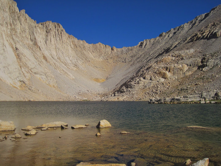
'Versteeg' lake (3645) [has 8-9" generic rainbow/GT hybrids]:
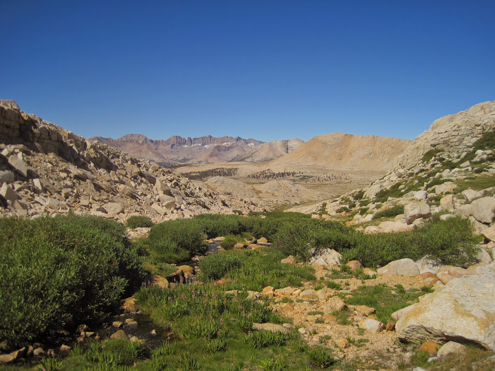
Looking the other way all the way down WLB from the 3645 outlet [photo @ 5:57 post is 2/3 down the meadow]:
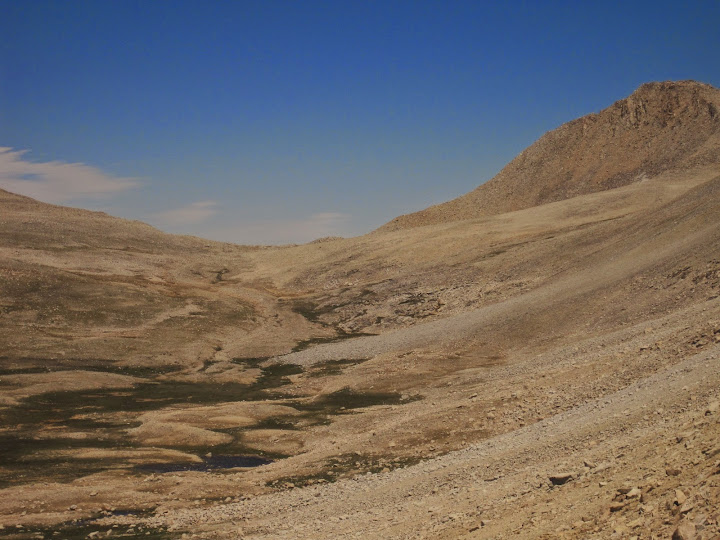
Looking all the way up WLB after leaving the PCT by a few hundred yards:

The last person I saw was my wife (asleep) @ 1am when I left OC. I didn't see anyone from the TH @ 5:30am* until the meet-up 3 days later, and saw no one on the return until dropping over the mini-ledge @ Shepherd and coming across 4 hikers resting on their way up.
As Jim mentioned, I think this might be the longest meadow hike in the Sierra; definitely x-country. The scale of the region is immense. Here's a fuller image from just below Rockwell looking back & down:

*As everyone knows, you have to physically pick-up your permit if entering a park, but I was on Mav's group permit, so I was able to book it directly up the trail in the semi-dark without stopping once along the way during the drive up.
Re: Maverick's 2015 Annual HST Meet-Up 7/22-7/24/15
Posted: Fri Dec 05, 2014 11:01 pm
by austex
Once you leave the "OC" it's all good and forgotten. BUT till you drive south through North County where it's supposedly better than the "O.C." Then the "O.C." isn't so grandiose.

Re: Maverick's 2015 Annual HST Meet-Up 7/22-7/24/15
Posted: Fri Dec 05, 2014 11:03 pm
by austex
Posting from Austin and head

in Encinitas/ Malibu.
Re: Maverick's 2015 Annual HST Meet-Up 7/22-7/24/15
Posted: Sat Dec 06, 2014 7:51 pm
by SSSdave
easier than hiking but not as inspiring


Re: Maverick's 2015 Annual HST Meet-Up 7/22-7/24/15
Posted: Sat Dec 06, 2014 9:51 pm
by freestone
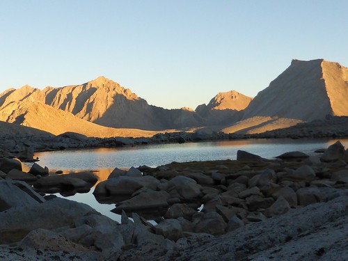
in the very unlikely event late afternoon breezes are calm, might climb to get a Williamson and Tyndall image from lake 3800+ meters nw of the pass.
SSSDave, you will not be disappointed. I was looking for fish not light.
[
Re: Maverick's 2015 Annual HST Meet-Up 7/22-7/24/15
Posted: Mon Dec 08, 2014 9:44 pm
by KathyW
I see the Shepherd Pass Trail mapped going all the way down to the Kern River on some maps (Route 2 on the Map). I may try going down that way - satellite images show the trail is mostly still there.
http://kathywing.smugmug.com/Other2/Oth ... hxF4bPb/X2" onclick="window.open(this.href);return false;
I guess the water level in the Kern might be an issue. If we get a good amount of snow this winter, crossing creeks/rivers might still be an difficult in July. I guess I'll have to wait and see if coming in this way and crossing the Kern is an option as we get closer. I might wait to explore this area when I can do it in August or early September.
Re: Maverick's 2015 Annual HST Meet-Up 7/22-7/24/15
Posted: Wed Dec 10, 2014 10:47 am
by Hobbes
KathyW wrote:I see the Shepherd Pass Trail mapped going all the way down to the Kern River on some maps (Route 2 on the Map). I may try going down that way - satellite images show the trail is mostly still there.
Kathy, funny that you mention this trail - I was considering using it myself on the way out. (It looks like Jim and I are going to hike up the Kern river from Volcano falls in the Golden trout wilderness.)
I asked Tom K about it - he's been up/down Shepherd to get to the Milestone/Kaweah region countless times. Here's his response from yesterday:
The trail up Tyndall Creek past the Tyndall Creek RS is a beauty, and not often done. The rangers consider it their own little private trail, and don't like regular hikers using it. To that end, they have obliterated a couple hundred yards or so of the trail down in the canyon before it intersects the Kern Canyon trail, and the same up near the RS. I came down it back in the mid 2000's, and had trouble picking it up near the RS. I ended up hiking down stream on the south side of Tyndall Creek for about a mile, before giving up and fording Tyndall Creek. And there it was, a few yards up from the north bank of the creek.
From there it was a delightful hike down to where it drops precipitously down to the floor of Kern Canyon. The upper 200 or so feet vertical is really steep and loose, the rest is just rocky footing much of the way. The trail does not follow Tyndall Creek closely once it starts dropping down into the canyon, as it detours north around a buttress and then switchbacks westerly down to the Kern Canyon floor, before heading due west toward the KC trail. As I said, it peters out before reaching the trail.
Coming up from Junction meadow, you will want to hike a maximum of about 1/2 mile north of the Tyndall Creek crossing, then head east off the trail until you get near the canyon wall. At that point, head north again until you pick up the trail. Otherwise, you will almost certainly miss the Tyndall Creek trail. I have been down the canyon en route to Kaweah Basin as late as 2011 and looked for the turnoff, but was unable to find any trace, which is why I have given you the above information.
My reply was that I'll probably just follow the main trail up to Milestone, then cut over to the PCT. It's around 2-3 miles longer, but I definitely do not want to be pecking around trying to find a trail in a steep loose section when I'm trying t make time hiking out.
Re: Maverick's 2015 Annual HST Meet-Up 7/22-7/24/15
Posted: Wed Dec 10, 2014 11:44 am
by SSSdave
Nice heads up Hobbes. On my way out of my Wrights Creek base camping on day 5, I'm actually planning on vectoring off the trail just east of the ranger building at 3320 meters then heading west to cross Tyndall Creek and then will wander up the other side of the canyon wall into what I call the ignored Foxtail Meadows Creek hills. Down along the river, anyone map savvy ought not have an issue if they are used to doing this kind of thing. But I do understand why it is otherwise tricky because there are a lot of big shady pines along the river that block views up towards canyon walls. Once just a bit away from the river trees become more scattered on the brush dominated steep canyon walls of the trench.
http://mapper.acme.com/?ll=36.61046,-118.41337&z=15&t=T" onclick="window.open(this.href);return false;
On the topo tab, the hidden trail shows on the map as a broken line 1.1 miles north of the Tyndall Creek crossing but as noted has been camoflaged to not be easily seen. Put the map center crosshairs where the old trail crosses 2980 meters at a bend. Switch to the satellite tab and hit the + zoom control 3 times. That will bring the trail into obvious view. Move the view down to the river and notice how the river trail is visible just a bit south of the junction in a narrow open section. A bit south of that stretch is an open view to the east canyon wall from this crosshairs point:
http://mapper.acme.com/?ll=36.61458,-118.42084&z=15&t=T" onclick="window.open(this.href);return false;
(Note the topo tab which will automatically zoom out 3 times) Switch back to the satellite tab and zoom back in 3x. One ought to be able to see the buttress and the ravine the trail goes through above. Thus at that point one can prepare to wander off the trail just a bit north where the river trail goes into forest.
I'd bet the main trail has been rerouted to be close to the river. I did look at the ravine area on Google Earth and that shows the trail on the topo different from the satellite view. As though the actual trail crosses the over to south of the ravine higher up. The sketchy terrain has likely been eroded during big thunderstorms to the point it is no longer a horse trail thus is probably why they discourage use.
Re: Maverick's 2015 Annual HST Meet-Up 7/22-7/24/15
Posted: Wed Dec 10, 2014 3:35 pm
by Hobbes
Nice detailed instructions. After browsing around following your links, my next big issue would be the point where the trail disappears to the north-east above the switchbacks. To make matters worse, that section looks totally sketch-ville from the satellite view.
It almost looks like a repeat of the Shepherd wash-out, with the exception that the Shepherd trail probably gets 10-20 hikers per day who are both forging a new use trail, and are around if something happened. That Tyndall section looks like bad news all around - it could be ok if you had time to explore, but not if you're trying to make time coming or going.
Besides, that's just what I need on my way out, where I need to hike approx 22 (6.1+3.0+3.4+9.5) miles from Junction to the Shepherd TH @ Symmes creek. If I use your 10.5 for Shepherd, I'm at 23, not counting the 3.5 miles - and dropping 2.5k - from the meet-up lake.
So, with around 26-27 (hard) miles, it looks like I will be stopping @ Anvil. Tom K said he'd be pretty impressed if I could hike out in 1 day from Kaweah basin - the guy likes to sandbag the sh!t out of me. LOL