TR: JMT Kearsarge -> Whitney 6/9-11
Posted: Thu Jun 12, 2014 2:24 pm
Just got back from a quick 3 day, 2 night trip from Onion to Portal:
D1 - 14.5 miles, Onion to 11.4k plateau 2.2 miles north of Forester
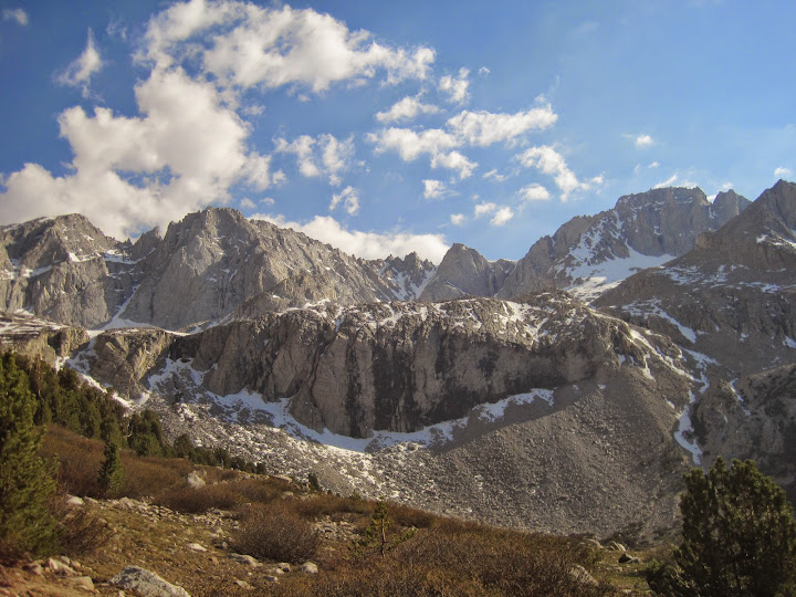
Left OC a little after 4am Monday morning and got to the visitor center just after 8am. It was a little backed up, but got my permit, got changed/prepped, met my ride & parked my car in Lone Pine by 9am. (Drop me a PM if you want some shuttle contact info.) Got dropped off and hit the trail @ 10am. Crossed Kearsarge @ 12:20 and hung out for a bit to have lunch. Took the Kearsarge lakes/Bullfrog junction to the PCT and pulled in for the night @ 5:40pm. View of the Kings-Kern divide from the campsite with only me and some marmots for company.
D2 - 16 miles, campsite to Crabtree RS.
I had been reading some PCT blog reports about poor snow/ice conditions on Forester, so I decided at the last minute to take my micro-spikes - best decision I've made in some time. Got going at 6:30am and hit the snow fields @ 7am. Made the pass @ 8:30am, which made for a very slow ascent, but the spikes (along with poles which I always take) worked like a charm for these particular conditions.
The snow was still icy, so I was able to easily walk alongside the existing postholes & boot tracks created by the northbound PCTers. Only near the top did I posthole myself up to my waist. Going up/down even an hour later could produce the kinds of horror stories being reported by PCTers hitting the pass in the afternoon. What ever happened to 'passes & peaks in the morning'?
Anyway, my guess is that these conditions could persist for a few more weeks; not just on Forester, but all the other usual suspects as well ie Glen, et al. If you're heading out, I would try and deal with snow crossings before 8am.
The snow fields continued for 2.5 miles south of Forester along the PCT until the Tyndall watershed nears the x-c shoulder to LSA. I didn't bother wearing my spikes since I simply walked through the snow free light talus alongside the trail covered with snow/ice patches. I couldn't see the actual trail for about a mile, but I knew it was between me and the still frozen lakes. I got back on the PCT @ the bluff overlooking the Tyndall basin (with a good view of Rockwell) and headed on out.
It had taken me 4.5 hrs to go 7 miles, but I still needed to make another 9 miles to get where I wanted to be for my last day. Pulled in across Whitney creek from the ranger station before 4pm, made camp; all in all, a long day.
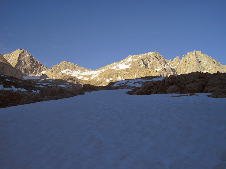
Forester 2 miles way (notch with snowfield underneath):
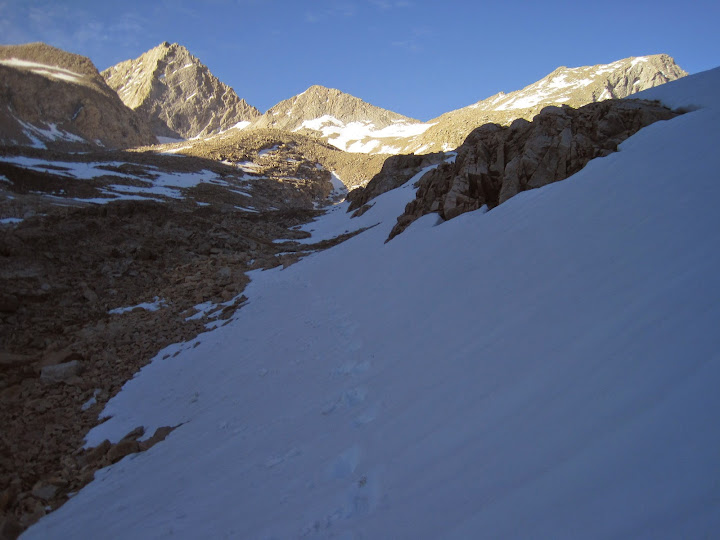
Getting closer:
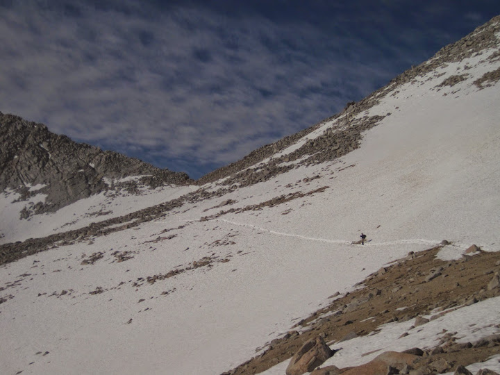
Final traverse:
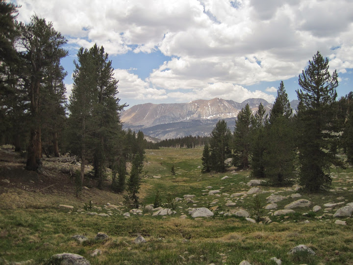
Lower Wright/Wallace meadow looking down towards Kern Cyn (HST meet-up is the other way):
D3 - 18 miles, Crabtree RS to Portal, via Mt Whitney
It had started to cloud up around 2pm the day before, and sure enough right after I set up camp, the Sierra put on a weather spectacular: wind, hail, thunder & lightning. I cozied up and began reading my book, but I must have fallen asleep, because I woke up @ 9pm and is was perfectly clear with an almost full moon just coming up and lighting up everything. Pretty bitchin'.
I had another big day ahead of me, so I just went back to sleep and hit the trail once again before 6:30 am. It turned out to be sort of an eventful day, which I posted an account over @ the Whitney zone for those interested in my little 'adventure'.
http://www.whitneyzone.com/wz/ubbthread ... #Post37400" onclick="window.open(this.href);return false;
PS - Water crossings (I just wade through with my shoes on - I wear trail runners that drain & dry very quickly):
1. The first major water crossing was the drainage coming from Center basin in Upper Vidette. A PCTer got there at the same time as me from the other side, and tried for a rock about 1/3 the way in a semi narrow section with the hope of getting across dry, but got stuck, and decided to plunge from there at about waist high water. I said forget that and went back to the washed out trail point and waded through around mid-calf to knee.
2. Tyndal was running at a pretty good clip. Some hikers were drying their feet & pull their shoes back on, but once again, I just waded on through with my poles fully extended. Water was mid-thigh to crotch high (I'm 6'1").
3. Wright - for a little creek, this one was around mid-calf.
4. Wallace - more water, wider crossing, around knee high.
Lots of other crossings of course, but all were doable with a little patience, trekking poles fully extended, and careful stepping/leap frogging.
PPS - A note about mosquitoes. Unfortunately, I'm the worst person to ask about mosquitoes since I take along my nuclear DEET (Ben's + 3m). So, even though some PCTers were complaining about the pests, especially in Vidette, they never landed on me even though I could see them flying around. However, according to others, they seem to think they're bad, so there's a second hand report.
D1 - 14.5 miles, Onion to 11.4k plateau 2.2 miles north of Forester
Left OC a little after 4am Monday morning and got to the visitor center just after 8am. It was a little backed up, but got my permit, got changed/prepped, met my ride & parked my car in Lone Pine by 9am. (Drop me a PM if you want some shuttle contact info.) Got dropped off and hit the trail @ 10am. Crossed Kearsarge @ 12:20 and hung out for a bit to have lunch. Took the Kearsarge lakes/Bullfrog junction to the PCT and pulled in for the night @ 5:40pm. View of the Kings-Kern divide from the campsite with only me and some marmots for company.
D2 - 16 miles, campsite to Crabtree RS.
I had been reading some PCT blog reports about poor snow/ice conditions on Forester, so I decided at the last minute to take my micro-spikes - best decision I've made in some time. Got going at 6:30am and hit the snow fields @ 7am. Made the pass @ 8:30am, which made for a very slow ascent, but the spikes (along with poles which I always take) worked like a charm for these particular conditions.
The snow was still icy, so I was able to easily walk alongside the existing postholes & boot tracks created by the northbound PCTers. Only near the top did I posthole myself up to my waist. Going up/down even an hour later could produce the kinds of horror stories being reported by PCTers hitting the pass in the afternoon. What ever happened to 'passes & peaks in the morning'?
Anyway, my guess is that these conditions could persist for a few more weeks; not just on Forester, but all the other usual suspects as well ie Glen, et al. If you're heading out, I would try and deal with snow crossings before 8am.
The snow fields continued for 2.5 miles south of Forester along the PCT until the Tyndall watershed nears the x-c shoulder to LSA. I didn't bother wearing my spikes since I simply walked through the snow free light talus alongside the trail covered with snow/ice patches. I couldn't see the actual trail for about a mile, but I knew it was between me and the still frozen lakes. I got back on the PCT @ the bluff overlooking the Tyndall basin (with a good view of Rockwell) and headed on out.
It had taken me 4.5 hrs to go 7 miles, but I still needed to make another 9 miles to get where I wanted to be for my last day. Pulled in across Whitney creek from the ranger station before 4pm, made camp; all in all, a long day.
Forester 2 miles way (notch with snowfield underneath):
Getting closer:
Final traverse:
Lower Wright/Wallace meadow looking down towards Kern Cyn (HST meet-up is the other way):
D3 - 18 miles, Crabtree RS to Portal, via Mt Whitney
It had started to cloud up around 2pm the day before, and sure enough right after I set up camp, the Sierra put on a weather spectacular: wind, hail, thunder & lightning. I cozied up and began reading my book, but I must have fallen asleep, because I woke up @ 9pm and is was perfectly clear with an almost full moon just coming up and lighting up everything. Pretty bitchin'.
I had another big day ahead of me, so I just went back to sleep and hit the trail once again before 6:30 am. It turned out to be sort of an eventful day, which I posted an account over @ the Whitney zone for those interested in my little 'adventure'.
http://www.whitneyzone.com/wz/ubbthread ... #Post37400" onclick="window.open(this.href);return false;
PS - Water crossings (I just wade through with my shoes on - I wear trail runners that drain & dry very quickly):
1. The first major water crossing was the drainage coming from Center basin in Upper Vidette. A PCTer got there at the same time as me from the other side, and tried for a rock about 1/3 the way in a semi narrow section with the hope of getting across dry, but got stuck, and decided to plunge from there at about waist high water. I said forget that and went back to the washed out trail point and waded through around mid-calf to knee.
2. Tyndal was running at a pretty good clip. Some hikers were drying their feet & pull their shoes back on, but once again, I just waded on through with my poles fully extended. Water was mid-thigh to crotch high (I'm 6'1").
3. Wright - for a little creek, this one was around mid-calf.
4. Wallace - more water, wider crossing, around knee high.
Lots of other crossings of course, but all were doable with a little patience, trekking poles fully extended, and careful stepping/leap frogging.
PPS - A note about mosquitoes. Unfortunately, I'm the worst person to ask about mosquitoes since I take along my nuclear DEET (Ben's + 3m). So, even though some PCTers were complaining about the pests, especially in Vidette, they never landed on me even though I could see them flying around. However, according to others, they seem to think they're bad, so there's a second hand report.
