Thanks to Maverick's help, here's the finale
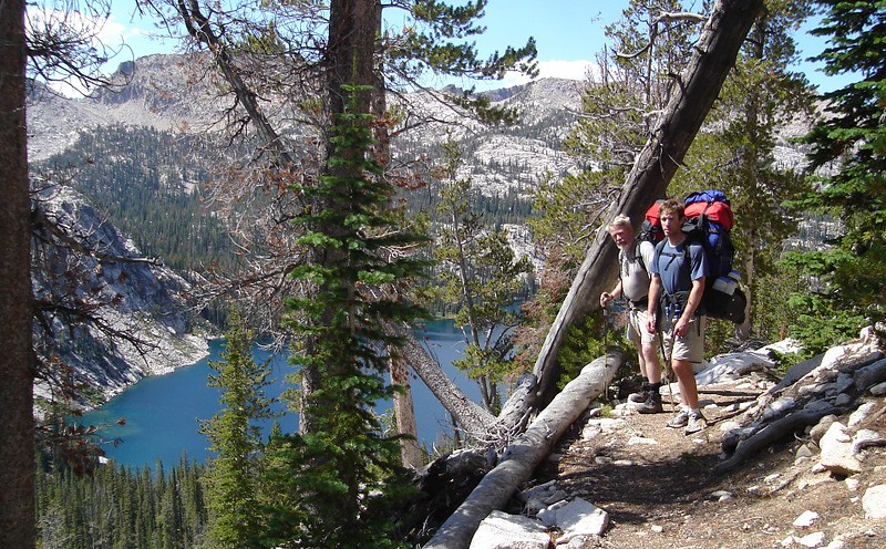
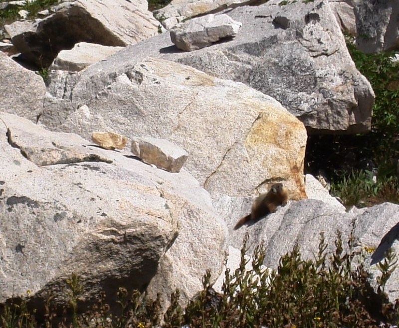
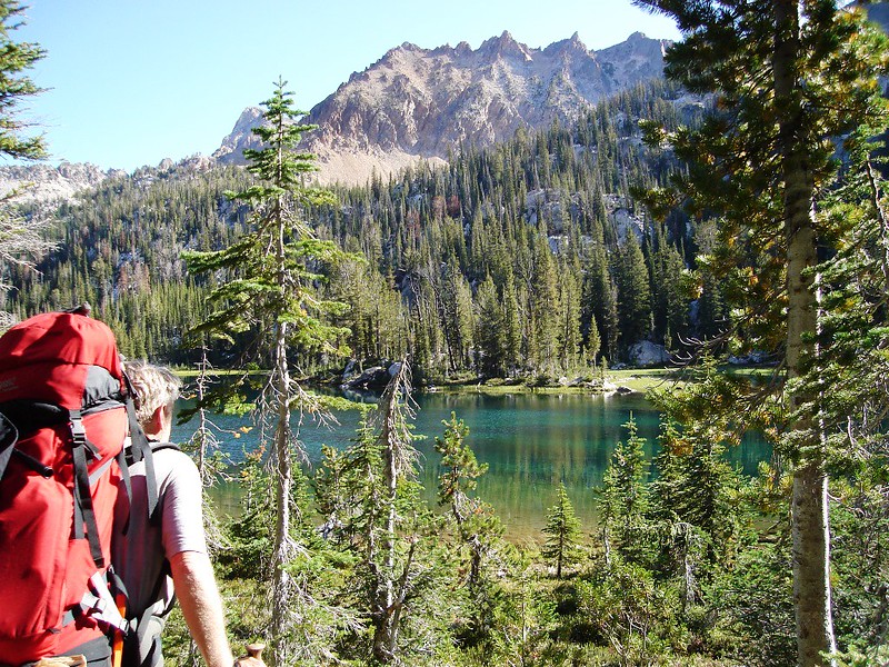
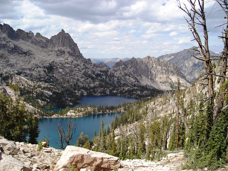
We descend quickly through switchbacks to Vernon Lake, where we explore a number of campsites. By map, Vernon Lake is the highest and furthest lake from the Yellow Belly and Petit Lake trailheads, so we think it will be the cleanest, nicest, least abused place to camp. But we discover the outlet stream is an elk wallow, the forest an anemic stand of lodge pole pine, and the campsites are wide open to the strong, gusty wind. We continue to Edna Lake, passing a marmot den on the way.
At first Edna Lake seems little better. First up is the horse camp on the lake’s South shore, complete with an old sign indicating horse pasturage and a privy, but the area is beaten down and over used. Inexplicably the trail climbs significantly above the lake to a trail junction. When it finally comes back to the lake, there is another camp area, also dark and abused, so we push on to the broad expanse of hard granite that dams the lake.
This we like! The granite is largely free of trees, giving us both light and views. We find a good place to put up the tent right next to a tennis court sized expanse of glacially polished granite, which we use as a lounge. Dave sets up the kitchen in the lee of a convenient clump of trees, and soon has a dinner of Spring Vegetable Soup (with extra freeze dried veggies and parmesan cheese) and Beef Stew, which tastes surprisingly good for ordinary ole beef stew thanks to the generous amount of beef.
Soon the stars were out and it quickly becomes too cold to hang in the lounge, so we slip into our cozy down bags!! .
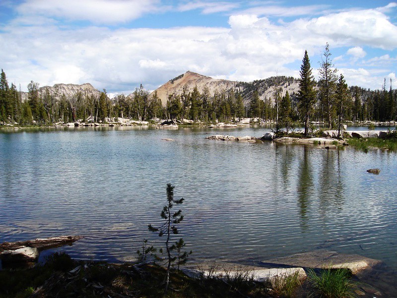
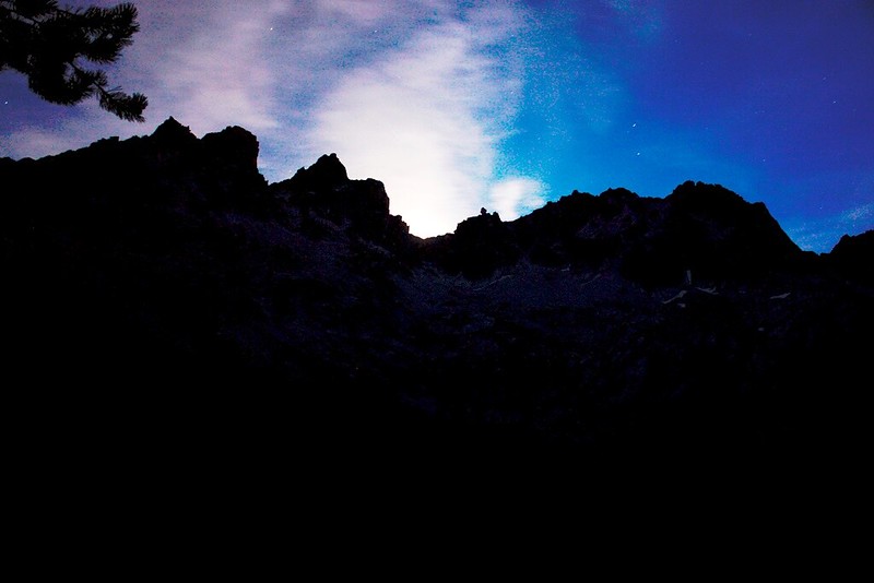
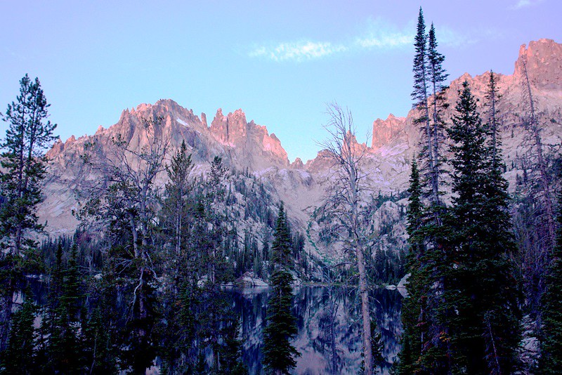
Today we traveled past many lakes and over three passes. Spangle Lakes were inspiring, and Ardeth Lake is a blue, rock-rimmed, trout-filled beauty. The view North from Edna Lake’s granite dam, (photo below) shows part of our next day’s journey—past Virginia Lake (foreground), over the baby South Fork Payette river, and through the shadowy notch left of Payette Peak to Hidden Lake and beyond.
 Day 5 Edna Lake to Upper Cramer Lake 7.2 Miles.
Rousing as soon as I could see my watch, we prepare coffee and breakfast and are soon on the trail. We passed Virginia Lake and then entered forest, which offered only an occasional glimpse of a view. The trail gently descended to the South Fork Payette, here a very small creek, and then contoured thru a wooded area before turning North and climbing some gentle switchbacks.
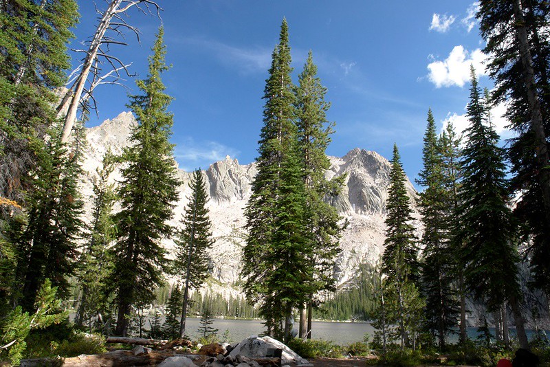
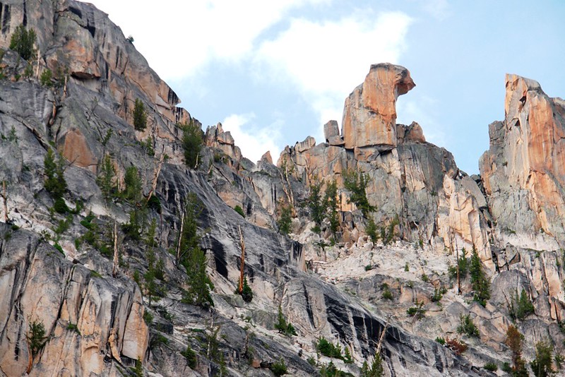
Finally the scenery opens up with a meadow area and pond-like extension of Hidden Lake to our right. The valley opens more and more as we were skirt Hidden Lake. We explored a couple great camp sites at lake’s edge. Half way along the lake the trail starts a gentle climb into a broad, open valley with grand views of the cirque carved ridge connecting Payette Peak and Mount Cramer. Right where the trail crosses the creek, a rock outcrop of atypically dark rock occurs. Looks like someone dug a test pit but the prospect must not have panned out. Other outcrops of unusually dark rock dot the canyon’s west wall.
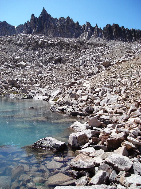
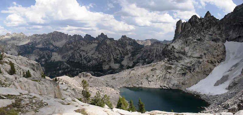
We then enter a sparse forest of scrubby trees and the trail climbs more earnestly up switchbacks before straightening to parallel the top of Cramer Divide. Below us on our left is an unnamed lake colored an unusual teal blue. Suddenly, we are at Cramer Pass. Here we stop for lunch and admire the views. The Temple is to our right and straight in front of us is the Arrowhead, the mass of Mt. Cramer lying between.
We descend many switchbacks thru talus to a small tarn. Below the tarn the trail follows a drainage thru small timber, finally bottoming out at the South side of Upper Cramer lake. An old horse camp is to the left, but the trail stays away from the lake. You get most of the way around the lake before dropping to the shore. We take a use trail that follows the lake’s edge, because the main trail pulls away from the lake almost immediately.
We find that the established campsites on the rock band separating Upper and Middle Cramer Lakes are full, so we come back to a large campsite with a good cook area. It is nice to see some people, but they remind us we are close to Redfish Lake and its hiker shuttle.
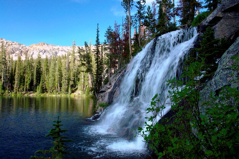
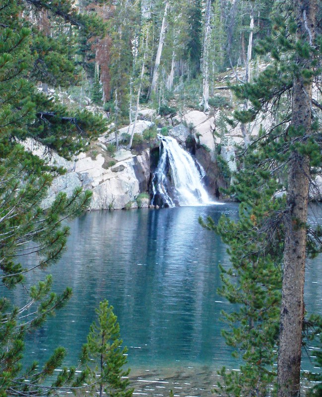
In addition to the spectacular cirque walls, Cramer Lakes feature a waterfall from Upper Cramer Lake into Middle Cramer Lake. We clamber around the waterfall, but none of us feels the need to jump in.
After exploring and loading up on water, we return to camp. Unfortunately one hiker’s dog wants to apprentice as sous chef, so meal preparation is delayed while his owner is hailed. He was a very nice puppy but his enthusiasm exceeded his abilities.
Dinner was Miso Soup followed by Kung Pao Chicken supplemented with a pouch of chicken breast and cashews. The Kung Pao Chicken was fantastic, but the Miso was a little too seaweedy, if you know what I mean.
Ever since arriving at the lake, I’ve had a persistent feeling, a premonition, that tonight’s full moon will rise directly behind the Arrowhead right at our camp. I don’t feel tired, and stay up with camera and tripod waiting for moonrise. I’m not disappointed. To my night adjusted eyes the photos look extraordinary in the backlit display of my camera—WOW, Nat Geo here I come. Unfortunately, the photos are under-exposed and way less impressive when I view them at home. That is what I get for trying to set exposure and focus at night with no prior experience. These are the best:
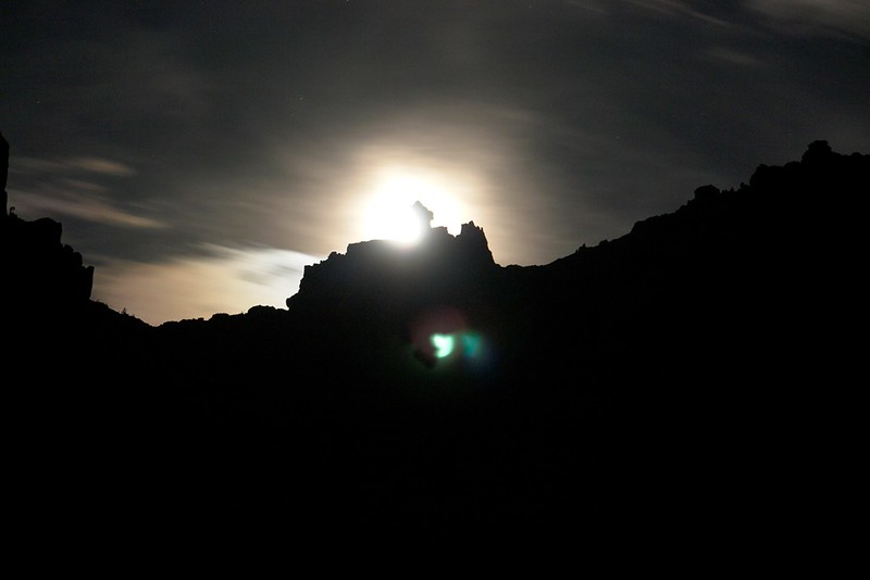

At midnight I crawl into my bag.
Day 6 Upper Cramer Lake to Baron Lake 8.7 Miles
While we don’t have a big day, we rise as soon as I can read my watch. Maybe it was the staying-up-late-to-shoot-the-moon, but for me today is one of those days where everything seems out of synch and difficult.
As we often do, we split up--Susan heads down the trail while Chris and I finish packing. Since she’s ahead we push along fast, but I’m struggling. Even tho it is downhill, it takes forever to catch her. At least the high wall to our East keeps us in shade most the way to Flat Rock Junction where we ford Redfish Lake Creek and stop for a snack.
The next section of trail, which leads to Alpine Lake, traverses an open, South facing slope. It is hot trudge in the sun but we make reasonable progress to Alpine Lake. Susan and Chris proceed to the second switchback above the lake, where there is good water, while I walk the lake shore. While no one is at the lake, the camping area looks like it has accommodated hundreds of people. A huge area is beaten smooth. I guess this is the price of accessibility—only 5.4 miles from the Redfish Lake hiker shuttle dock.
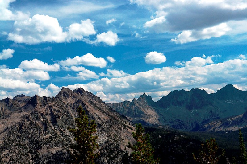
After I rejoin the others, we have a small snack, pump water, and proceed past some small tarns to Baron Pass. The views from Baron Pass are fantastic—to the east the basin below Mt Cramer and the Arrowhead are visible, as are Braxon Peak and other high points of the divide between Baron Creek and Redfish Lake Creek. To the West Monte Verita, Silicon Tower, Big Baron Spire, La Pima, and Baron Peak are equally, if not more, dramatic.
After another snack and a photo session, we descend to Upper Baron Lake where we meet a group of college women doing the same route in the opposite direction. We proceed to Baron Lake, which is deserted. We poke around for a camp site we like, settling for a huge rock outcrop affording a view of lake and sky.
Camp set up, we scout the adjacent rocky areas, till we get a view of Little Baron Lake below. Not feeling too ambitious I don’t go far and soon return to get dinner underway—onion beef soup with extra vegies followed by lasagna with meat sauce with added chipped beef and blueberry cheesecake. Yum.
After dinner we watch the light change as we discuss our plans for tomorrow. Chris does some rock climbing and scares us by sliding, accidentally, down a rock face. Fortunately there was a lot of duff at the bottom and his clothing took the gaff during the slide.
I sleep on top of the big rock, my camera and tri-pod ready.
Predawn time exposure of Baron Lake, Monte Verita, Silicon Tower (right of center) and La Pima (right).
Day 7 Layover Day at Baron Lake

We enjoy a very leisurely start to the day. We have a scrambled egg and bacon breakfast and lay about savoring extra coffees.

Chris and I decide to day hike to lake 9020. We follow the stock trail around Baron Lake. We leave the stock meadow and follow low angle slabs SW. Our route takes us right under La Pima, and we break out onto a shelf above lake 9020 where we see a mama mountain goat and her baby.
La Pima
We decide to scramble our way toward the saddle between Silicon Tower and the main massif, and are almost there when a clap of thunder changes our plans.

Silicon Tower
Lake 9020 on the North side of Monte Verita
We never get to look to the West, but the view East is impressive. We can see the White Cloud Mountains in the far distance.

Back at camp we set about dinner, which is onion soup augmented with extra vegies and parmigiano regiano cheese followed by grilled chicken breast with potatoes. The chicken turns out juicy, but bland. No one complains and there isn’t one scrap left.
Evening is spent pre-packing as much as possible. We have a long hike out to be followed by a longer drive home.
Day 8 Baron Lakes to Grandjean Trail Head 10.7 Miles
We are all business in the morning, getting on the trail before the sun catches us. The trail descends thru small trees past Little Baron Lake and gives us views of the craggy ridge terminating in Baron Peak. There is supposed to be a trail junction at the creek into Braxon Lakes, but this was an unofficial trail, and we never spot it. The main trail goes along Baron creek for a ways, then swings North to switch back down gentler terrain to get below Baron Falls. We can look into a great hanging valley on the back side of Big Baron Spire as we descend. This valley is the access route for intrepid climbers accessing the Black Crystal Route on Warbonnet.
We enter a wooded area and CRASH one of the many dead trees falls over. Eerie as there is no wind. After that, the trail follows the creek down thru increasingly brushy and hot country with considerable detours around many down logs. Funny, we haven’t noticed it being warm the past few days, but we do now.
Just shy of the North Fork we pause to take a photo of the trail junction sign. There is no bridge, and the creek is in a steep sided gully so we cross on a log downstream.

The rest of the hike was tedious. We met several horse parties, which explained why the trail segment from Grandjean to Baron Creek was so broad, dusty, and heavily used.
It being Labor Day weekend, we find Grandjean camp ground, Sacajawea Hot Springs, and the forest service summer home areas packed with people. There are people whizzing about on four wheelers, bicycles, motorbikes everywhere. The hot springs are swarmed—so much for a dip--and we can hardly squeeze our car by the bathers’ parked vehicles. People were camping everywhere and anywhere they could pull their RV’s off the road. Idahoans do love their back country!
Epilogue: We had a wonderful trip. The Sawtooths share many of the attributes that make the Sierra fantastic. I hope you’ve found this trip report entertaining and informative. Thank you for sharing your trip experiences on HST and please regard this as payback for your generosity.