Yep my mistake, not west but east of 3267.FeetFirst wrote:... Did you mean just east of 3267, which is where a small pond is shown on the map? I hope to go over Whitebark Pass next summer, but it's good know I have other options close by. From the pictures I've seen, checking out Nydivers is worth it. ...
TR: Ansel Adams Wilderness Aug. 23rd - 26th
-
SSSdave

- Topix Addict
- Posts: 3524
- Joined: Thu Nov 17, 2005 11:18 pm
- Experience: N/A
- Location: Silicon Valley
- Contact:
Re: TR: Ansel Adams Wilderness Aug. 23rd - 26th
-
FeetFirst

- Topix Regular
- Posts: 304
- Joined: Fri Apr 22, 2011 11:35 am
- Experience: Level 4 Explorer
- Location: West Sacramento, CA
- Contact:
Re: TR: Ansel Adams Wilderness Aug. 23rd - 26th
Thank you, giantbrookie. Very cool that you have your Dad's B&Ws of this area. I hope my son catches the Sierra bug as he grows so we can share its grandeur together.
Kpeter, Thanks for the kudos. The High Trail definitely rewards with full views of the Ritter Range, but I equally enjoyed coming back on the River Trail, which felt more intimate with plenty of interesting spots to explore. I don't think you can go wrong either way and it's easy to make a loop out of both. I'm actually planning a trip back next summer, but probably entering from Tuolumne Meadows/Lyell Canyon/Donohue Pass.
SSSDave, That's what I figured, but wanted to make sure. Thanks again!
Kpeter, Thanks for the kudos. The High Trail definitely rewards with full views of the Ritter Range, but I equally enjoyed coming back on the River Trail, which felt more intimate with plenty of interesting spots to explore. I don't think you can go wrong either way and it's easy to make a loop out of both.
SSSDave, That's what I figured, but wanted to make sure. Thanks again!
I'm still rather convinced that you can achieve more than you've ever dreamed of if you just lower your standards.
-
dreamer1
- Topix Acquainted
- Posts: 32
- Joined: Wed Feb 24, 2010 1:37 pm
- Experience: Level 3 Backpacker
- Location: Montreal, Canada
Re: TR: Ansel Adams Wilderness Aug. 23rd - 26th
Thanks Feetfirst for the detailed report. I particularly enjoyed reading your day by day account (as well as the lovely pictures) since I will be headed that way in mid September. Will keep camping spot recommendations in mind as I make my way through the various lakes. I noticed that the skies were clear while you were up there whereas smoke from the RimFire appears to be more pronounced in the area these past few days.
Thanks again for sharing!
Thanks again for sharing!
-
FeetFirst
- Topix Regular
- Posts: 304
- Joined: Fri Apr 22, 2011 11:35 am
- Experience: Level 4 Explorer
- Location: West Sacramento, CA
- Contact:
Re: TR: Ansel Adams Wilderness Aug. 23rd - 26th
You're welcome, dreamer1. Yes, we had clear skies the entire time due to the winds pushing the smoke north. Have fun and hopefully things will be clear for you too.
I'm still rather convinced that you can achieve more than you've ever dreamed of if you just lower your standards.
-
FeetFirst
- Topix Regular
- Posts: 304
- Joined: Fri Apr 22, 2011 11:35 am
- Experience: Level 4 Explorer
- Location: West Sacramento, CA
- Contact:
Re: TR: Ansel Adams Wilderness Aug. 23rd - 26th
Shortly after this trip my hiking partner demanded that this trip became an "annual." Not necessarily the exact route, but something that at least included the heart of the Ritter Range. Not one to disappoint, I agreed and followed through. In August of this year we returned to the area and had an amazing trip. Unfortunately, on the last night of our journey I broke my ankle (avulsion fracture of the fibula), but was still able to hike out on my own with high spirits (yeah Motrin!). I wanted to post a trip report by now, but due to medical appointments and a busy home life that is now managed by a significantly slower me, well things just haven't gone as planned. So, I hope to have a proper report with pictures soon, but until then here's the short of it.
Day 0: Sacramento to Mammoth via HWY 50>89>395; Day 1: Mammoth to Tuolumne Meadows to Donahue Pass via YARTS>Lyell Canyon TH>JMT; Day 2: Donahue Pass>Island Pass>Thousand Island Lake>Garnet Pass to far west end of Garnet Lake via all Xcountry; Day 3: Garnet Lake south over Whitebark Pass>Nydiver>Ediza Lake to north side via all Xcountry; Day 4: Ediza Lake>Shadow Lake>River Trail>Agnew Meadows back to home.
Pics:
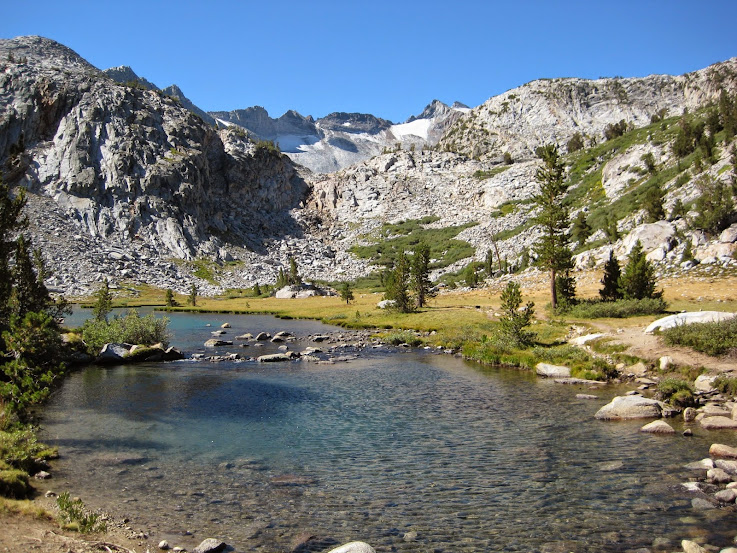
Upper Lyell Canyon on route to Donahue Pass
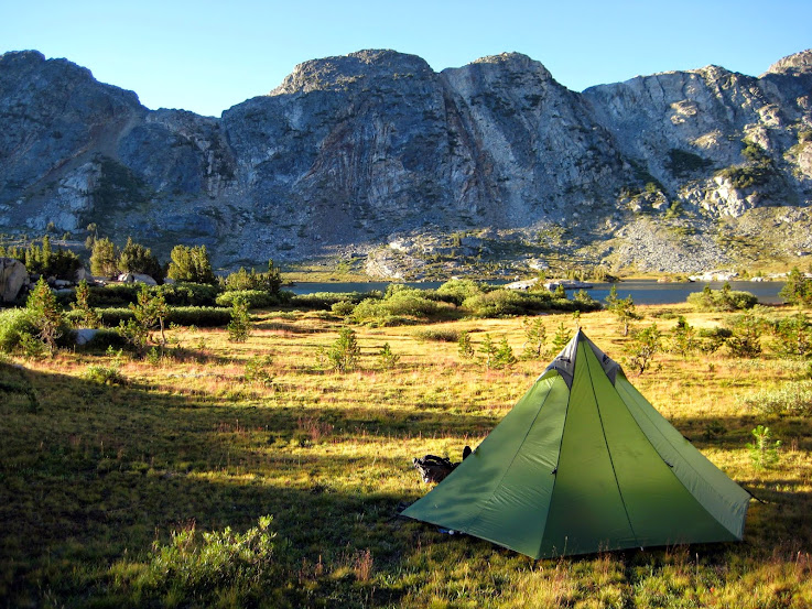
Garnet Lake camp
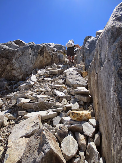
Up Whitebark Pass
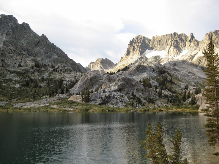
Enjoying Ediza Lake
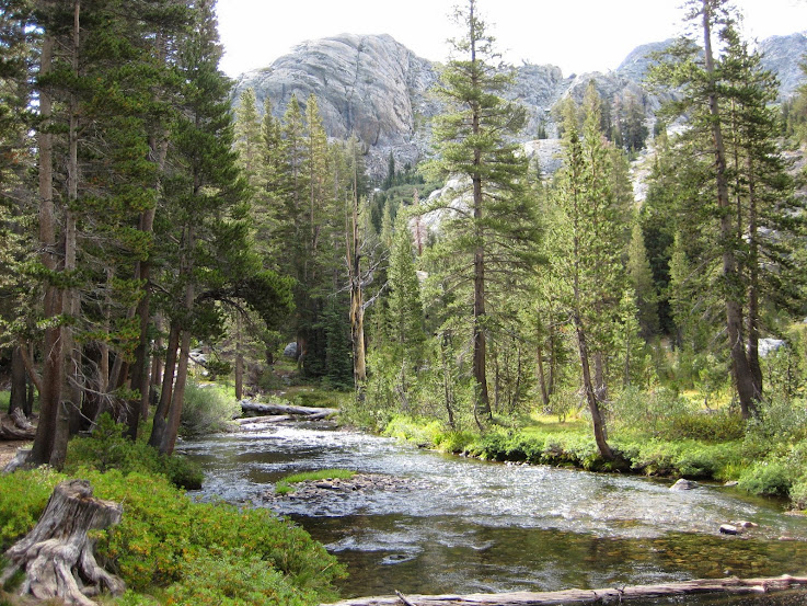
Shadow Creek

Exit strategy
Day 0: Sacramento to Mammoth via HWY 50>89>395; Day 1: Mammoth to Tuolumne Meadows to Donahue Pass via YARTS>Lyell Canyon TH>JMT; Day 2: Donahue Pass>Island Pass>Thousand Island Lake>Garnet Pass to far west end of Garnet Lake via all Xcountry; Day 3: Garnet Lake south over Whitebark Pass>Nydiver>Ediza Lake to north side via all Xcountry; Day 4: Ediza Lake>Shadow Lake>River Trail>Agnew Meadows back to home.
Pics:
Upper Lyell Canyon on route to Donahue Pass
Garnet Lake camp
Up Whitebark Pass
Enjoying Ediza Lake
Shadow Creek
Exit strategy
I'm still rather convinced that you can achieve more than you've ever dreamed of if you just lower your standards.
Who is online
Users browsing this forum: Google [Bot] and 226 guests