WEEK 3
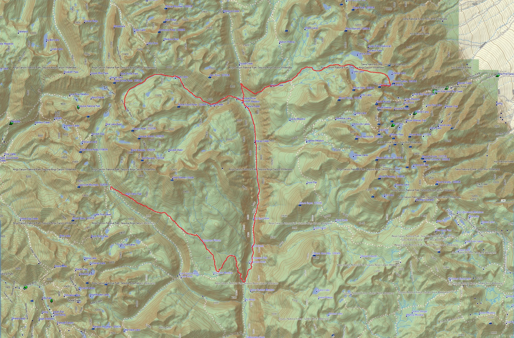
MAP
Packing up in the morning Riley took to the trail long before Blake and I. As we ground up the long hill side leaving the Big Arroyo I felt heavily fatigued. I just didn't seem to have much energy and Blake shared the same sentiments. I think both of us were in a poor mood also. After we had topped out on this hill we took a break over about an hour and half having deep and relatively negative conversations. I suppose it's nice to have another head to input into the deeper philosophies of life. Reaching the junction that takes you either past Moraine Lake or directly to the junction beyond Sky Parlor Meadow I gave Blake the option of going either way. I told him I could meet him at the junction if he wanted to hike past Moraine Lake. Since I had never taken the Eastern route I wanted to and he ended up joining me. This ultimately was a mistake as this route was completely boring, hot and dry as we climbed over down trees in a small burn zone. I thought this route would at least give you some views of Sky Parlor Meadow but it does not. I certainly will never take that way again!
Beginning down I was zoned out when I suddenly heard a rattle to my left as a fairly large rattlesnake let me know he did not like me. Startled I jumped back and admired it since it was the first rattlesnake of this trip. Being just over 9000 feet it also was the highest I had seen a rattlesnake.
In 2010 a trail crew had told me this section of trail was getting a reroute to avoid the burn zone but I could not see any evidence of it. The grind down this long hot trail was everything I had remembered. By the time we hit the bottom of the Kern Canyon I was beat. Approaching the drift fence we met another rattlesnake in the middle of the trail marking the 2 rattlesnakes I would see for this entire trip. We arrive at the Kern Hotspring with Riley setting up camp. We joined him once again and were the only 3 people at the spring.
This was my first trail layover day. Riley went on his way and Blake hung around awhile thinking he was going to head out today but ultimately he stayed for another night. In another odd twist we were joined by another man that happened to be a counselor in the field of issues that Blake was having so we sort of had a back country private session.
Come morning Blake had wanted to get going earlier then I wanted to so he took off ahead on his way to Whitney and his own destiny. He would be the final person to hike with me for any length of time on this hike.
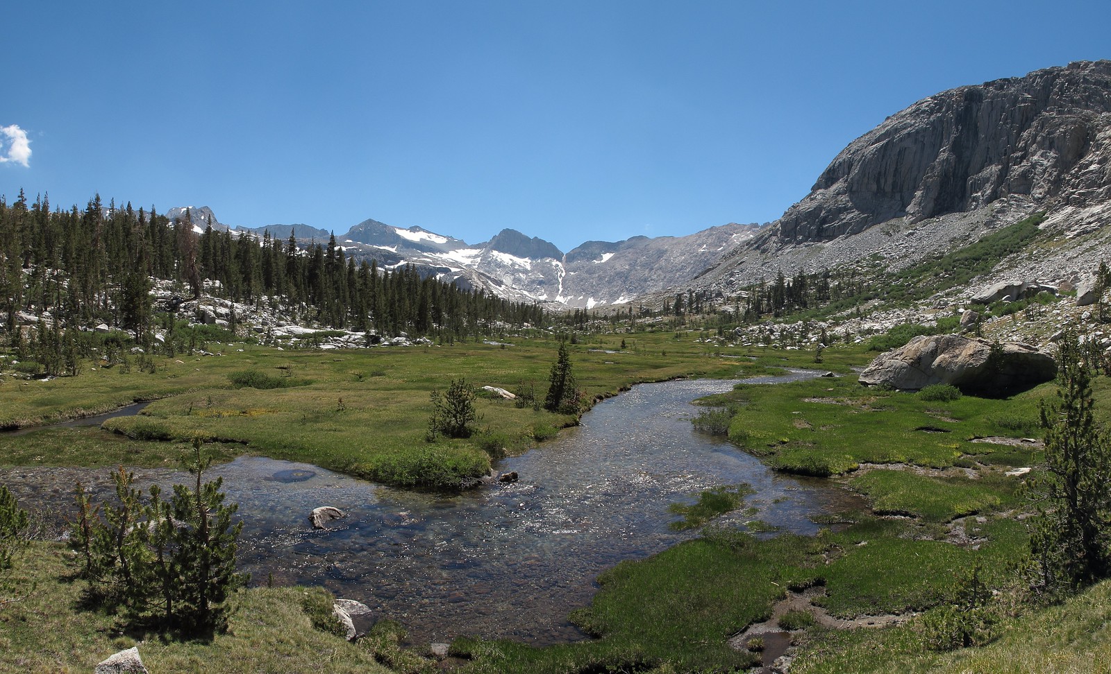
As for me I was still on a casual hike so my goal for the day was only to hike the 7 miles to Junction Meadow which I arrived at in only about 3 hours.
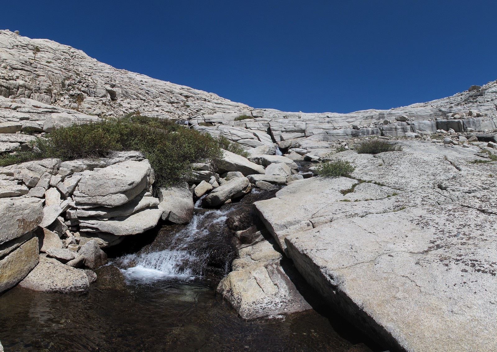
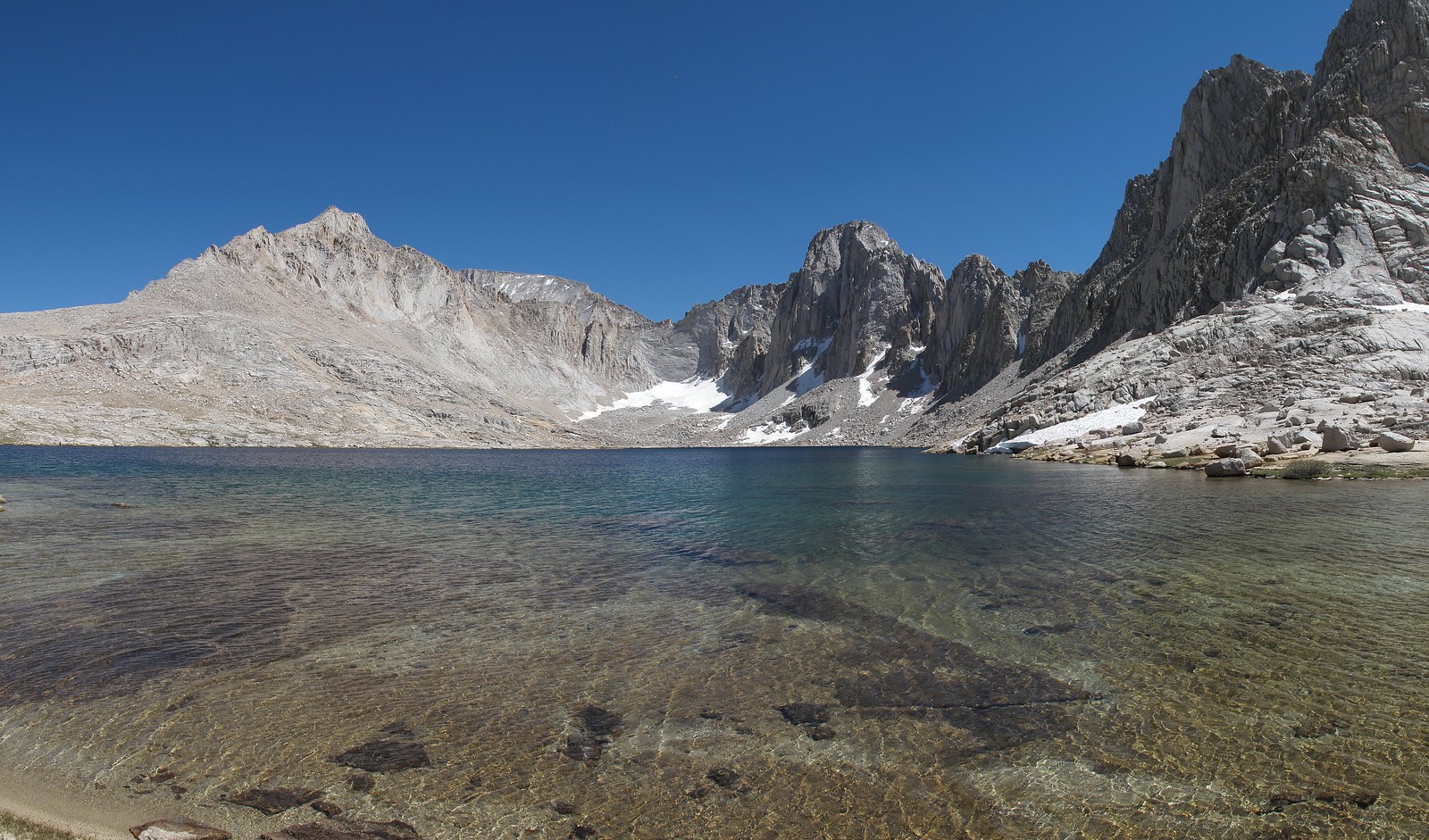
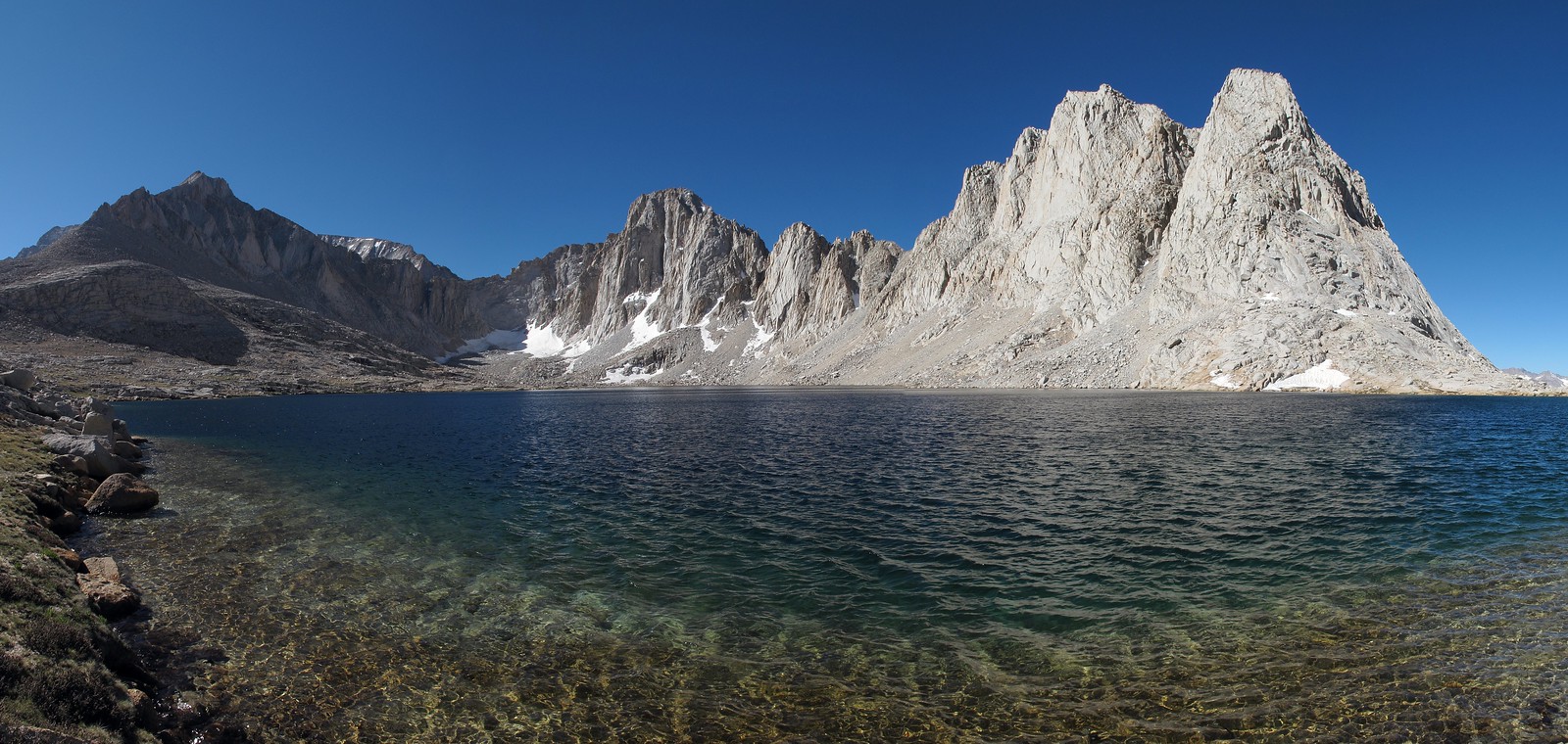
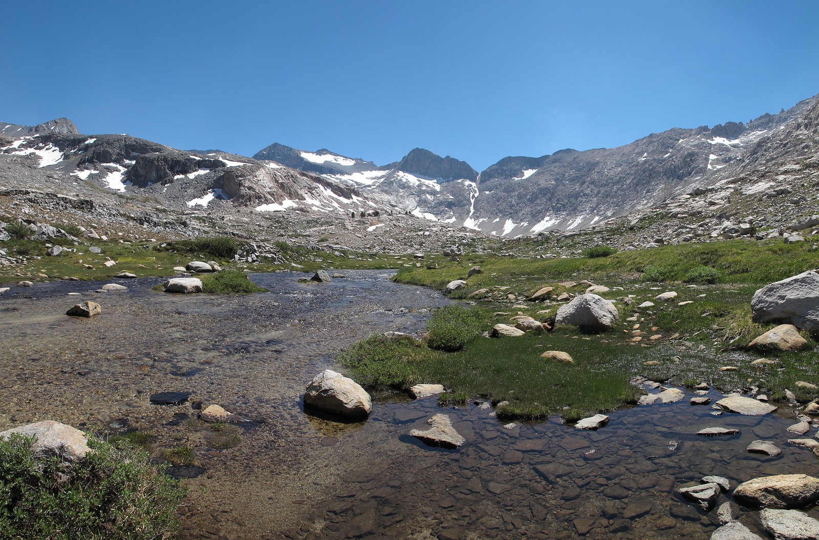
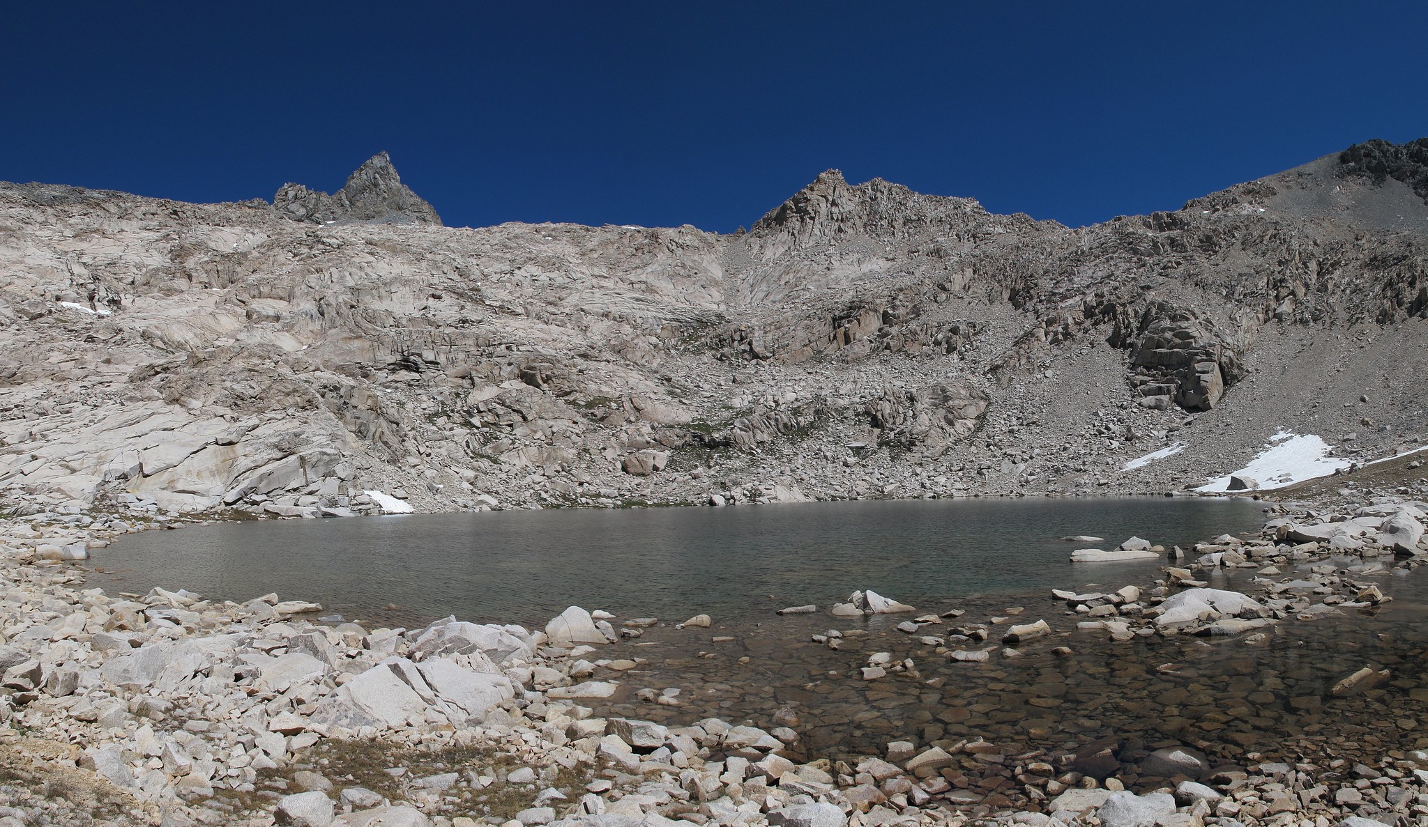
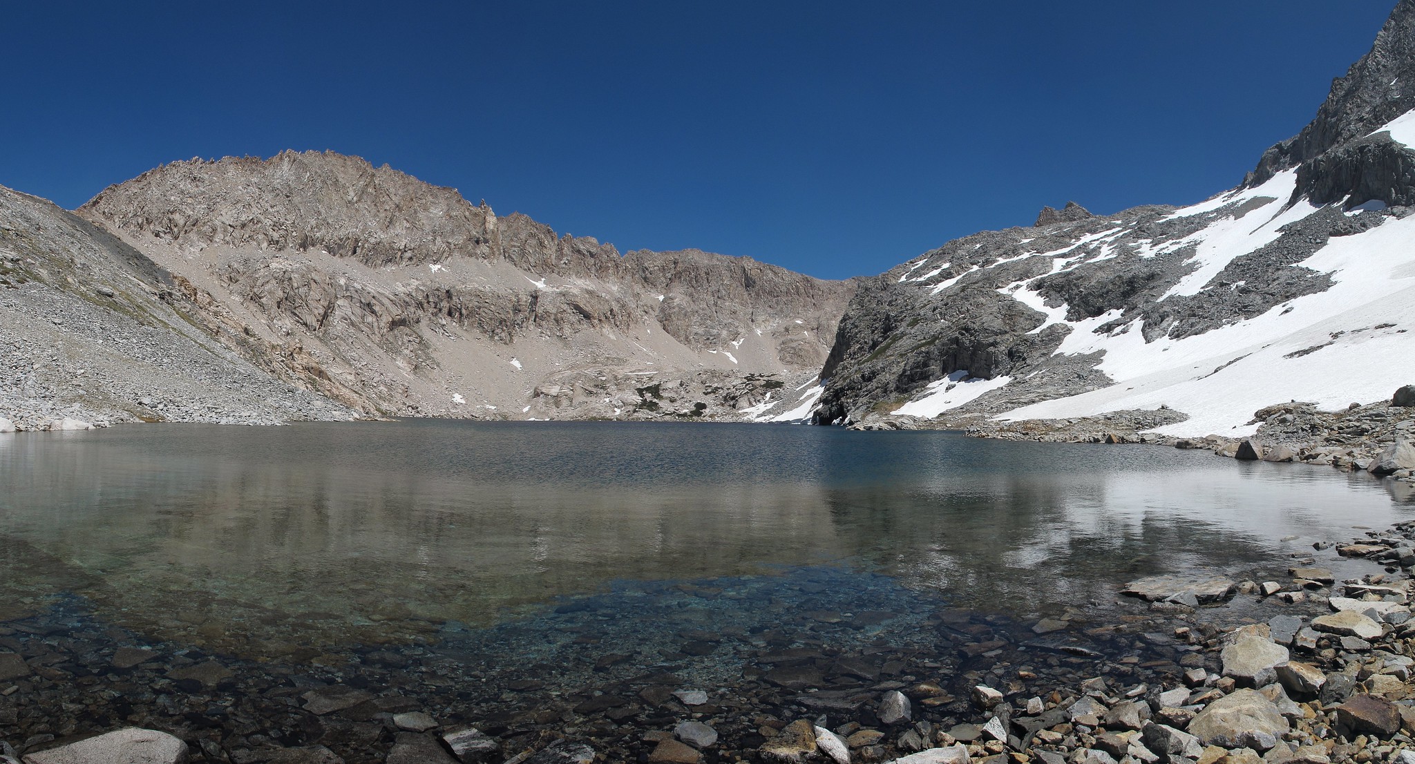
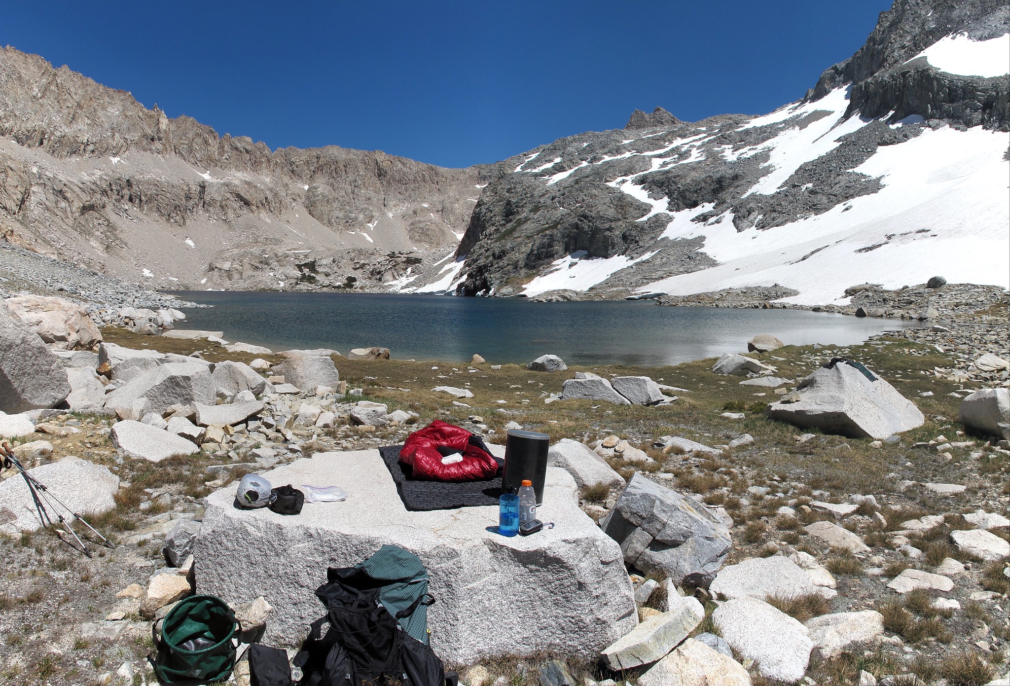
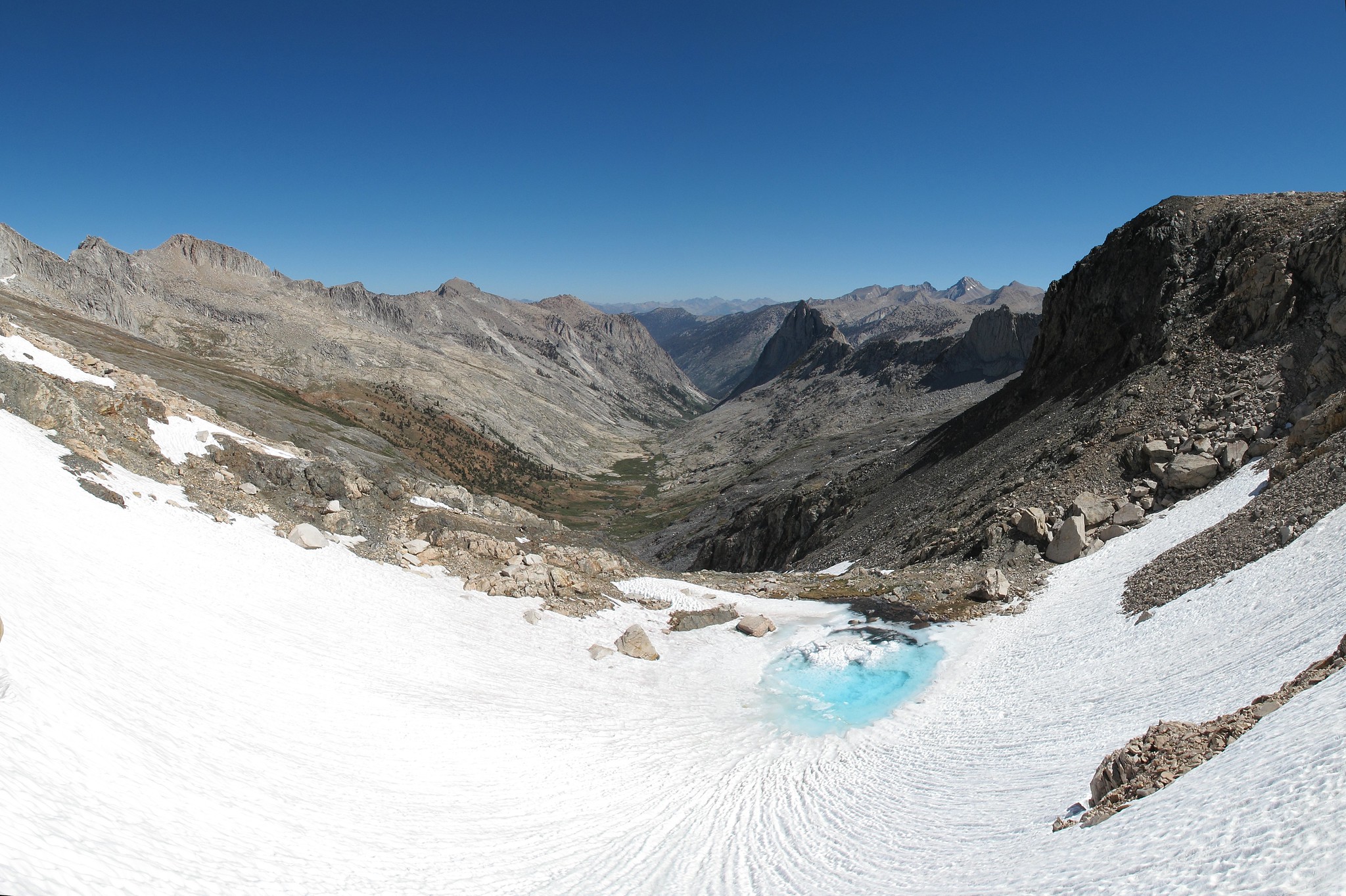
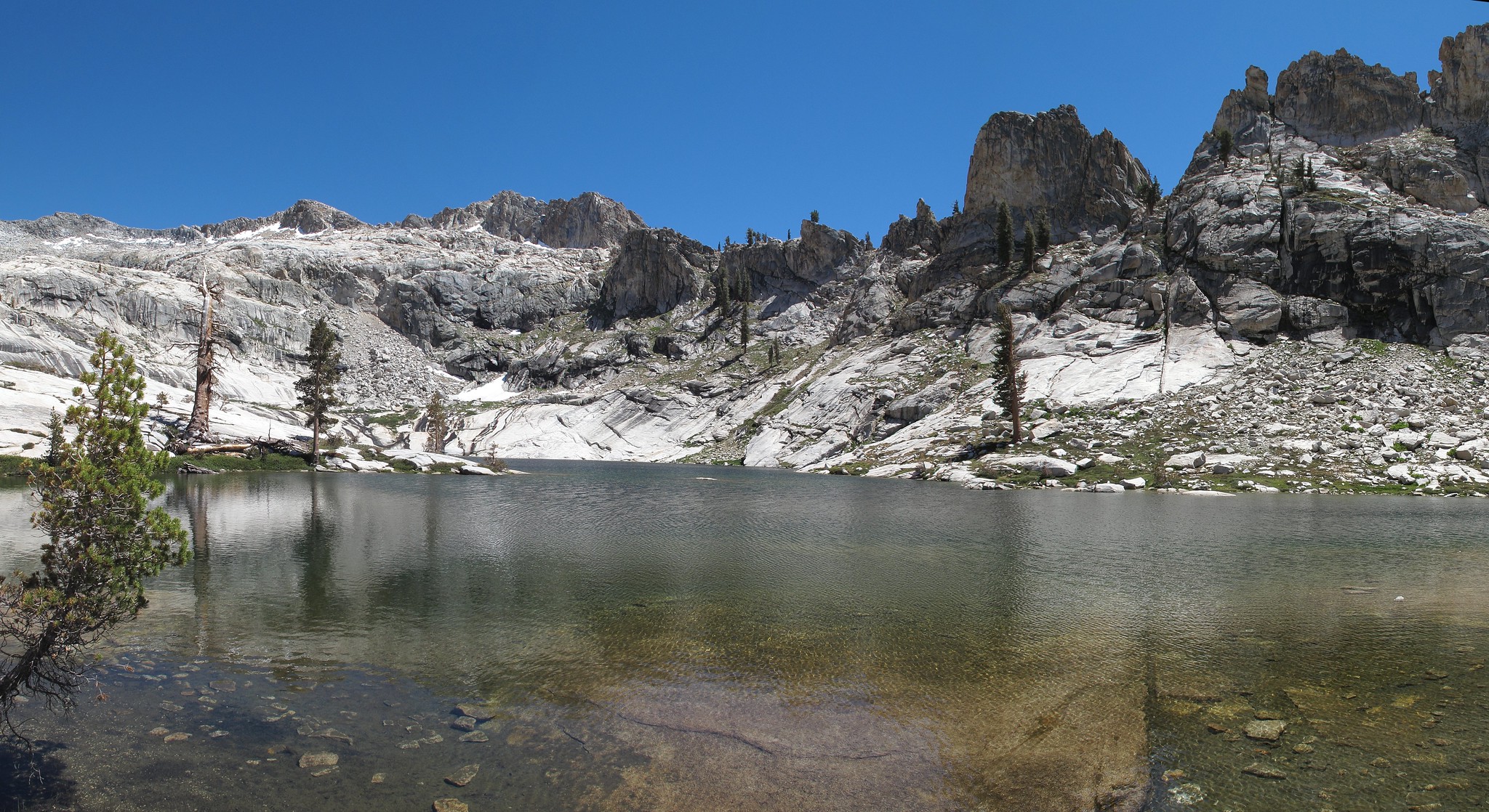
Leaving Junction I was a bit worried that I would not be able to reach Wales Lake because of it being about 3700 feet up and I still didn't seem to be getting into shape but I was able to make it well up Wallace Creek to where the use trail crosses a meadow outlet by lunch. This area was infested with mosquitoes which was one of the first locations for this to be true so far in the trip. I continued along easily until I had scaled the final granite slabs to Wales Lake. The sand showed no one had been to the lake yet this year and was a decent place to set up camp. The wind was ripping though which made the epically cold dip in the lake that much worse.
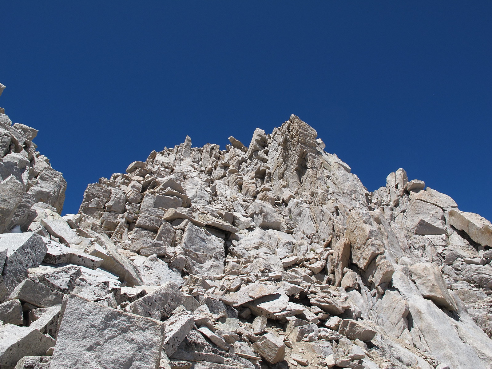
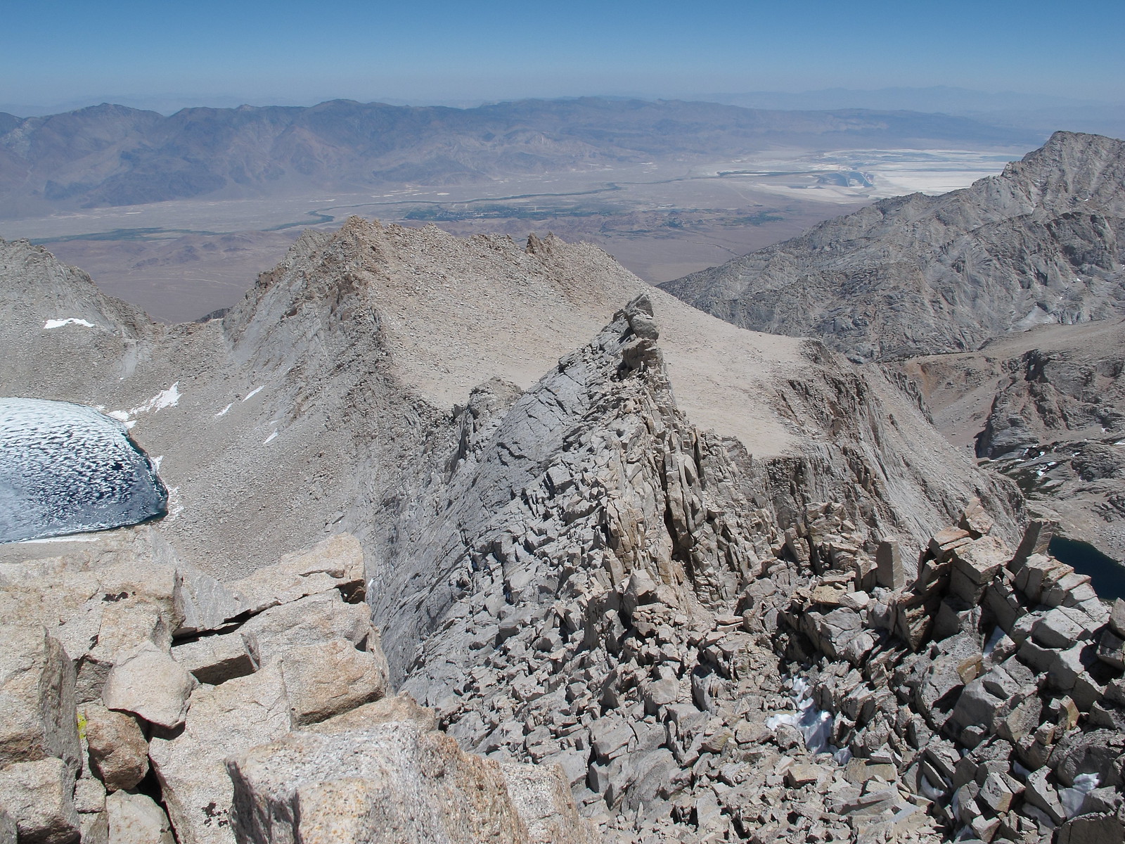
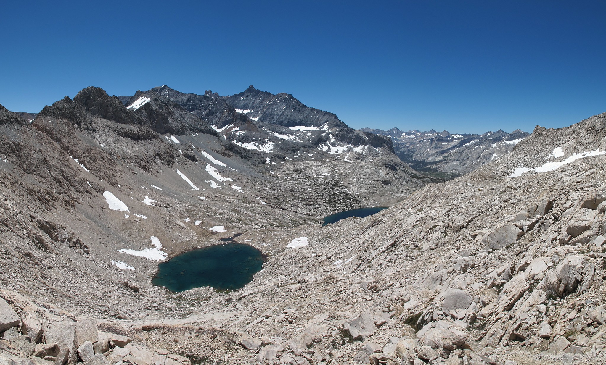
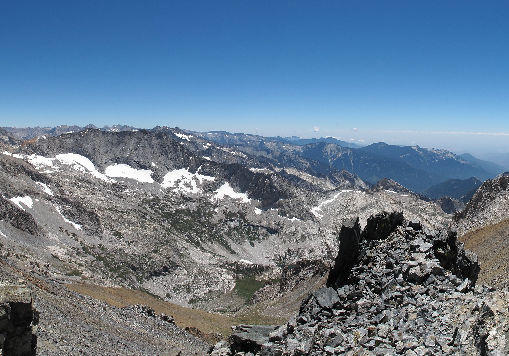
Heading out to climb Mt. Russell I had picked what looked like a small ledge that could take me to the more level terrain towards Tulainyo Lake. When I reached it however it turned out to be a wide ramp that made getting past the steeper slopes a breeze.
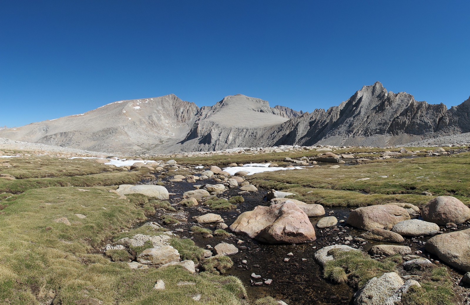
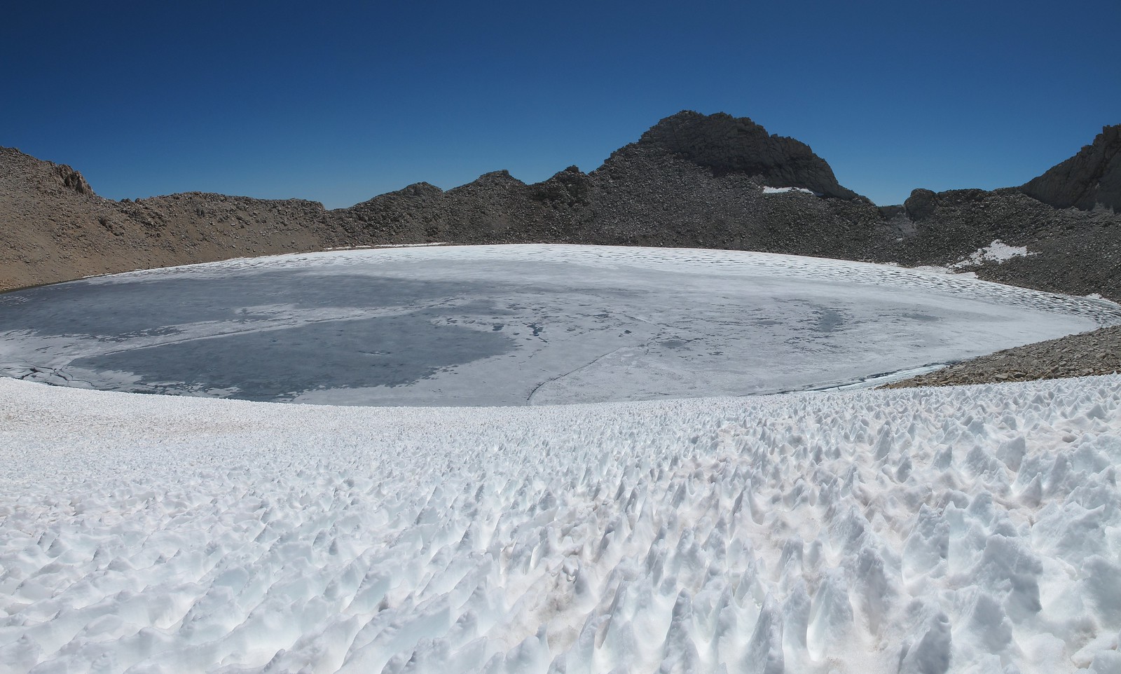
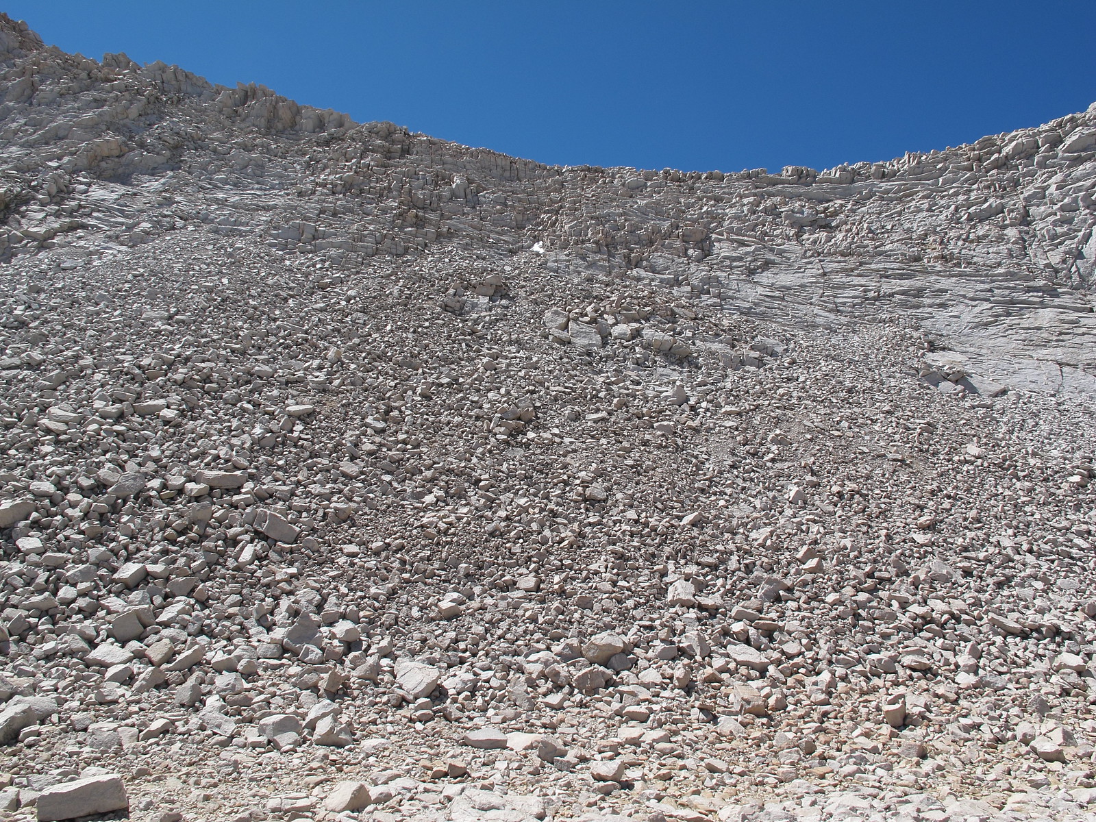
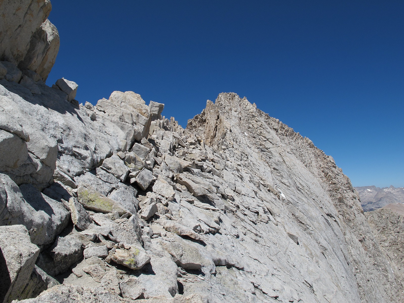
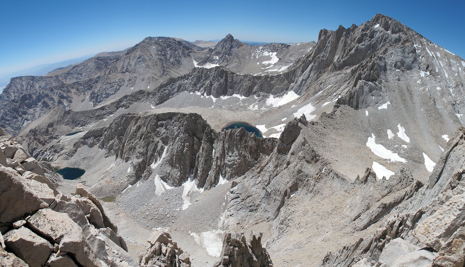
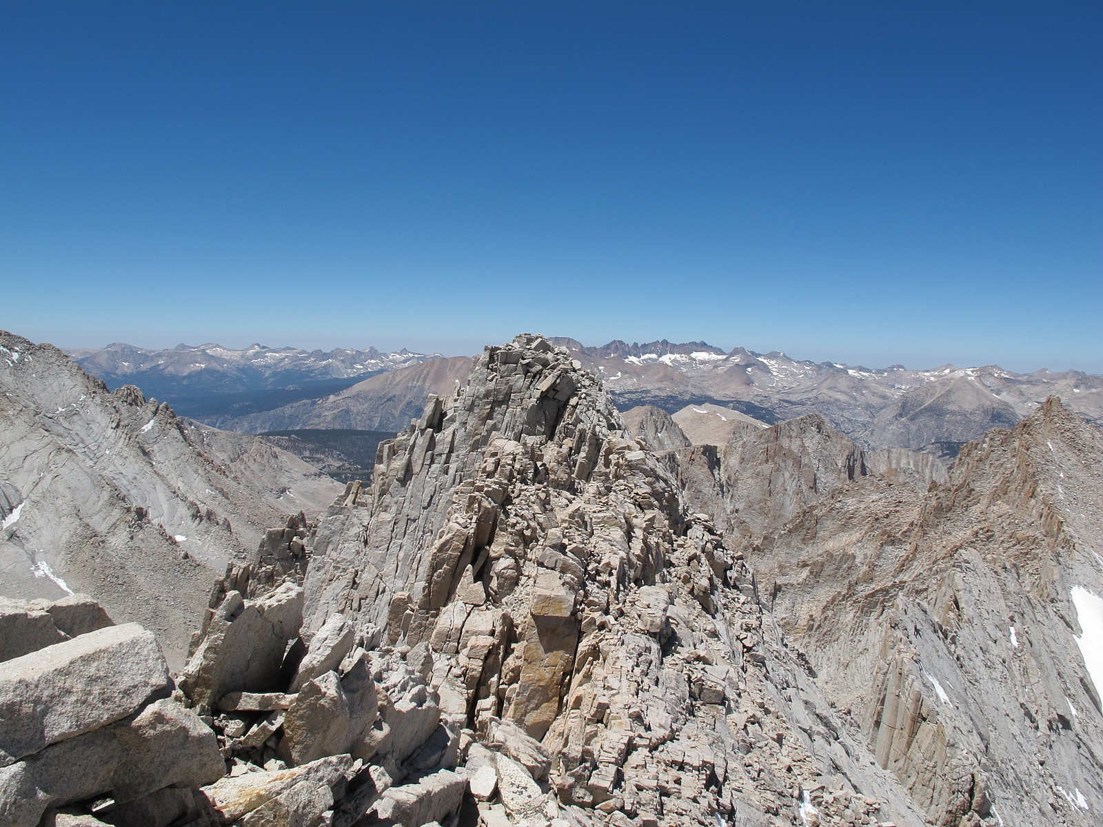
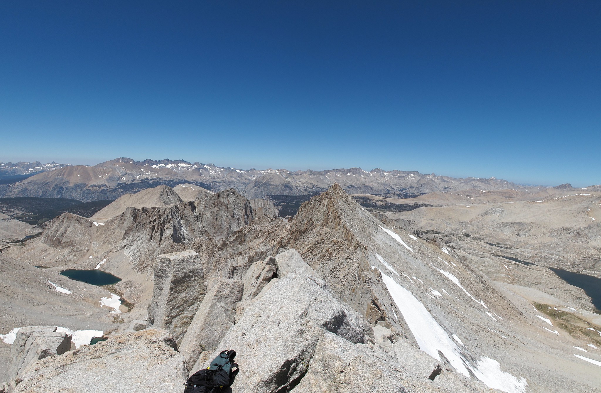
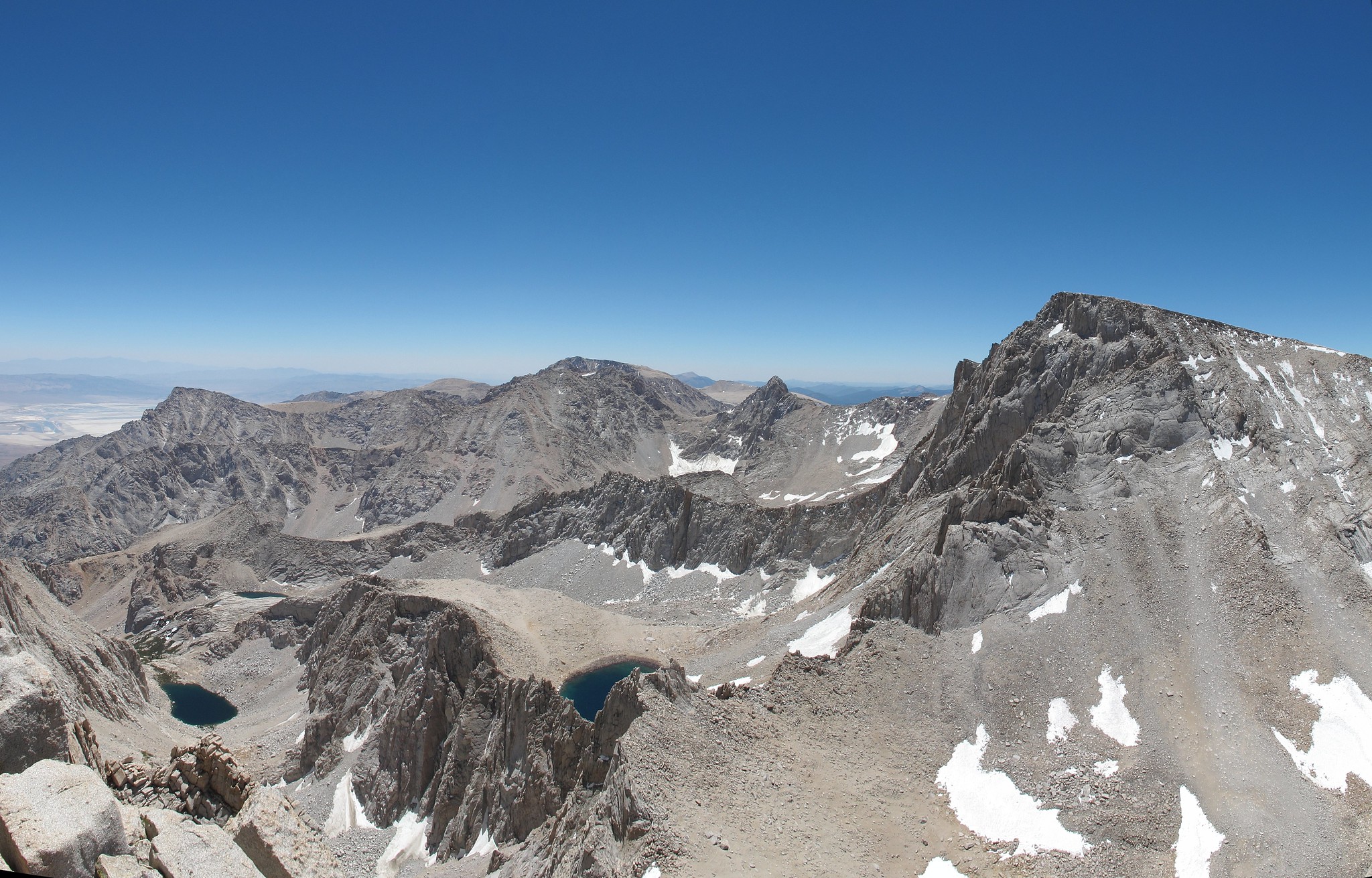
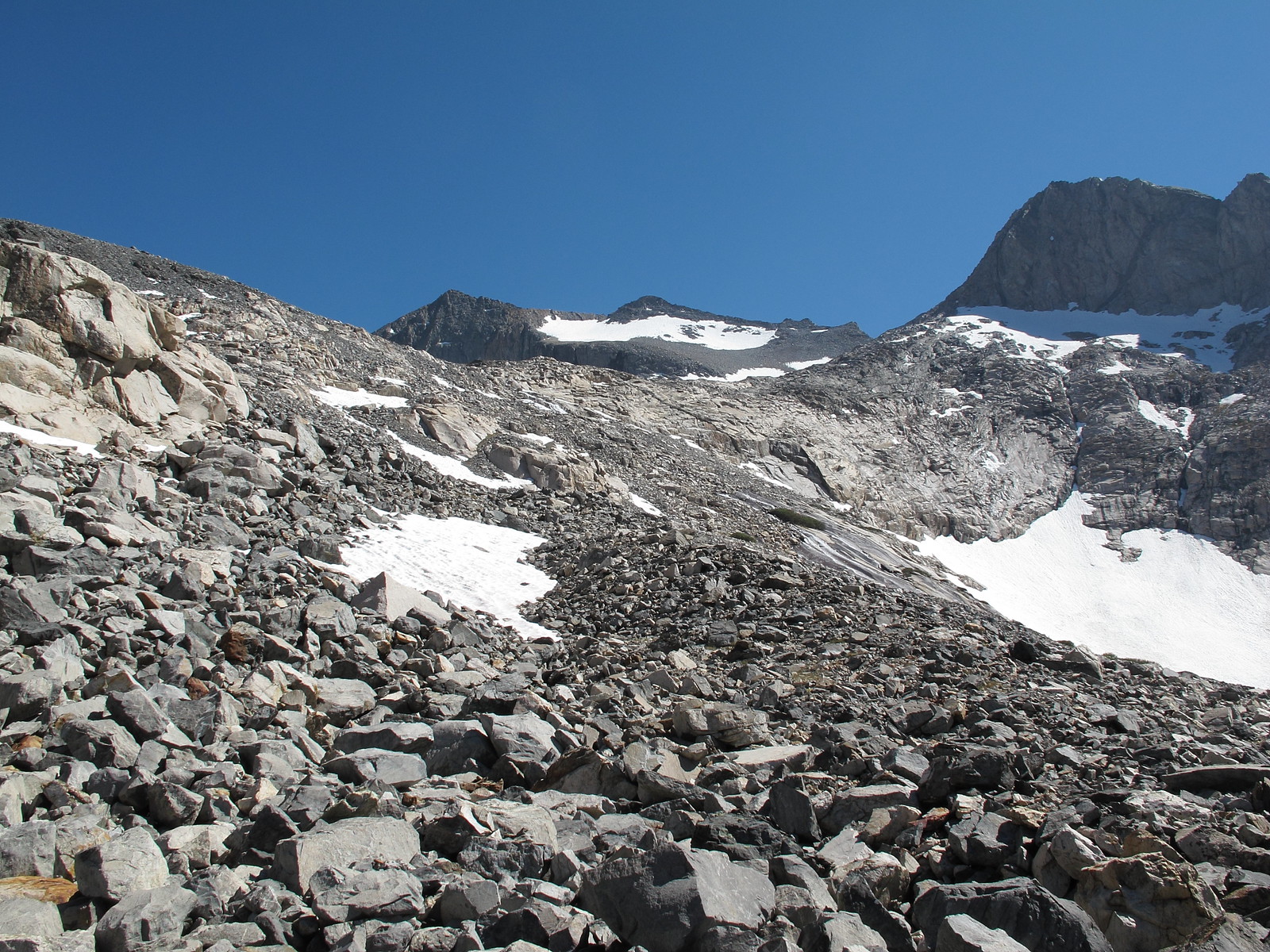
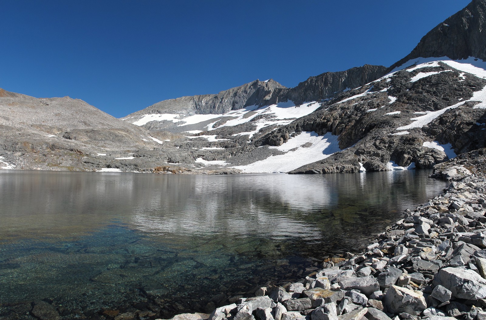
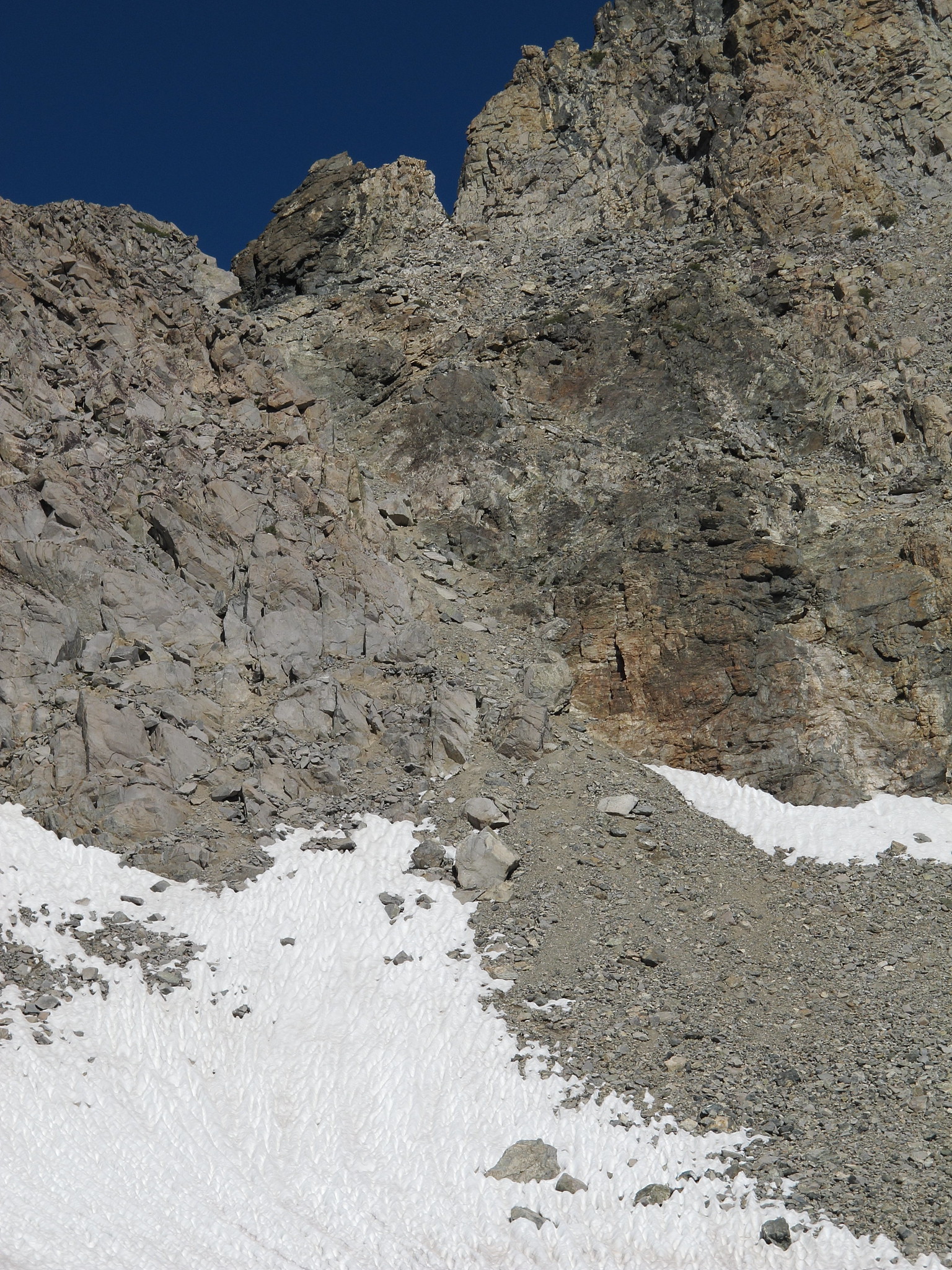
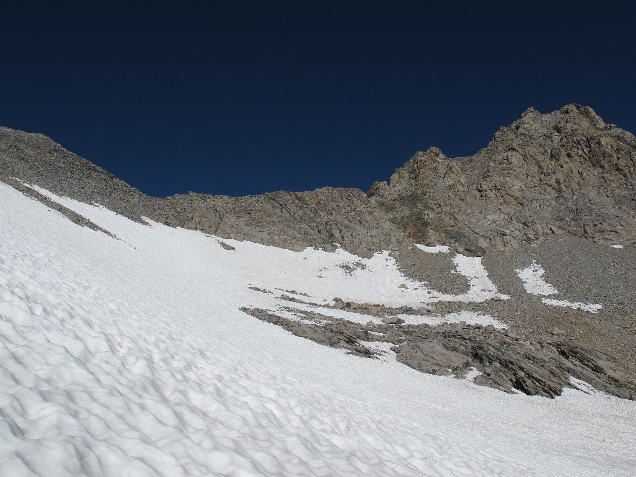
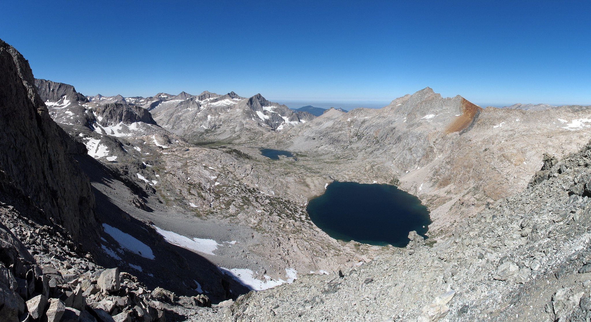
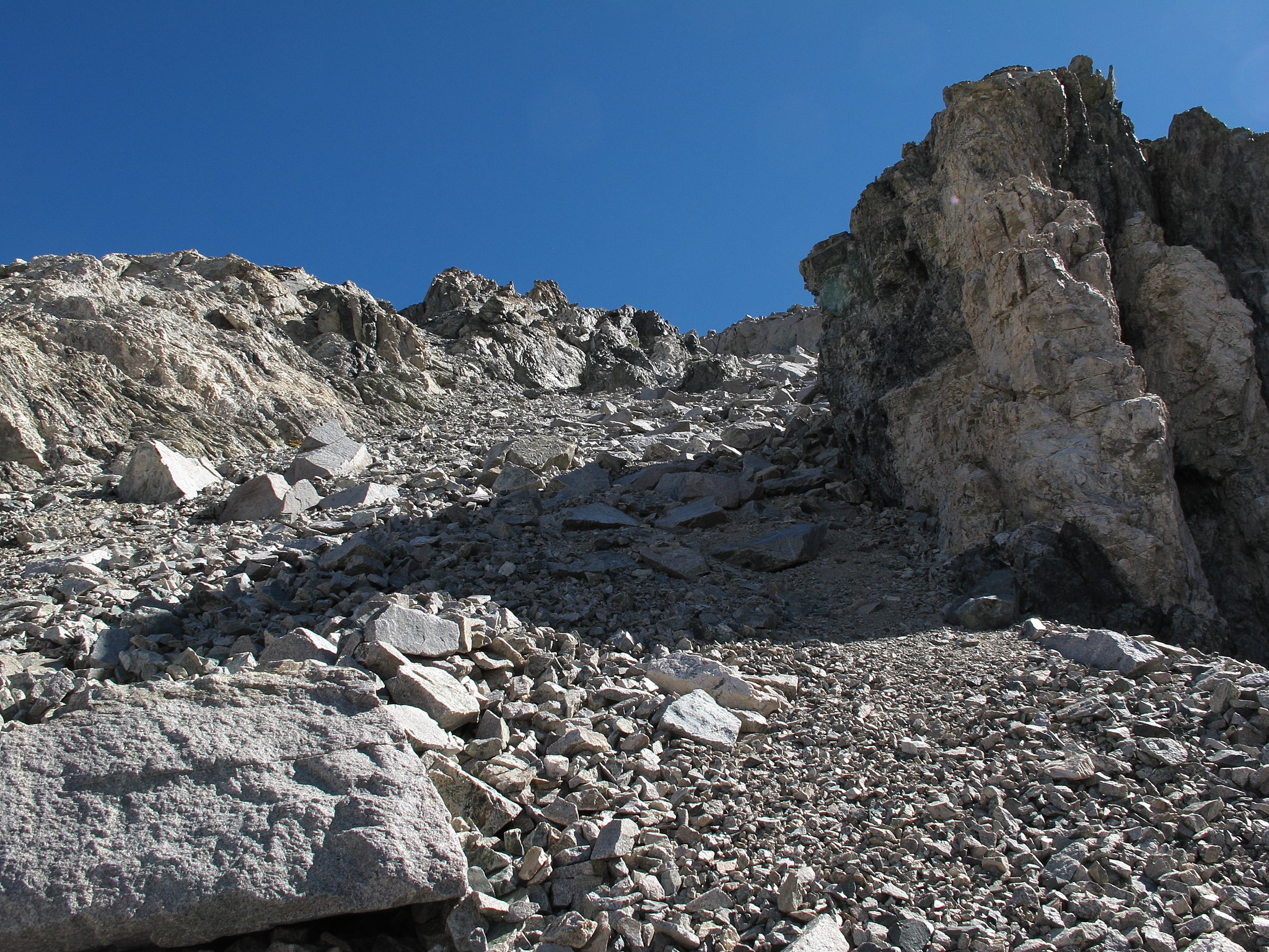
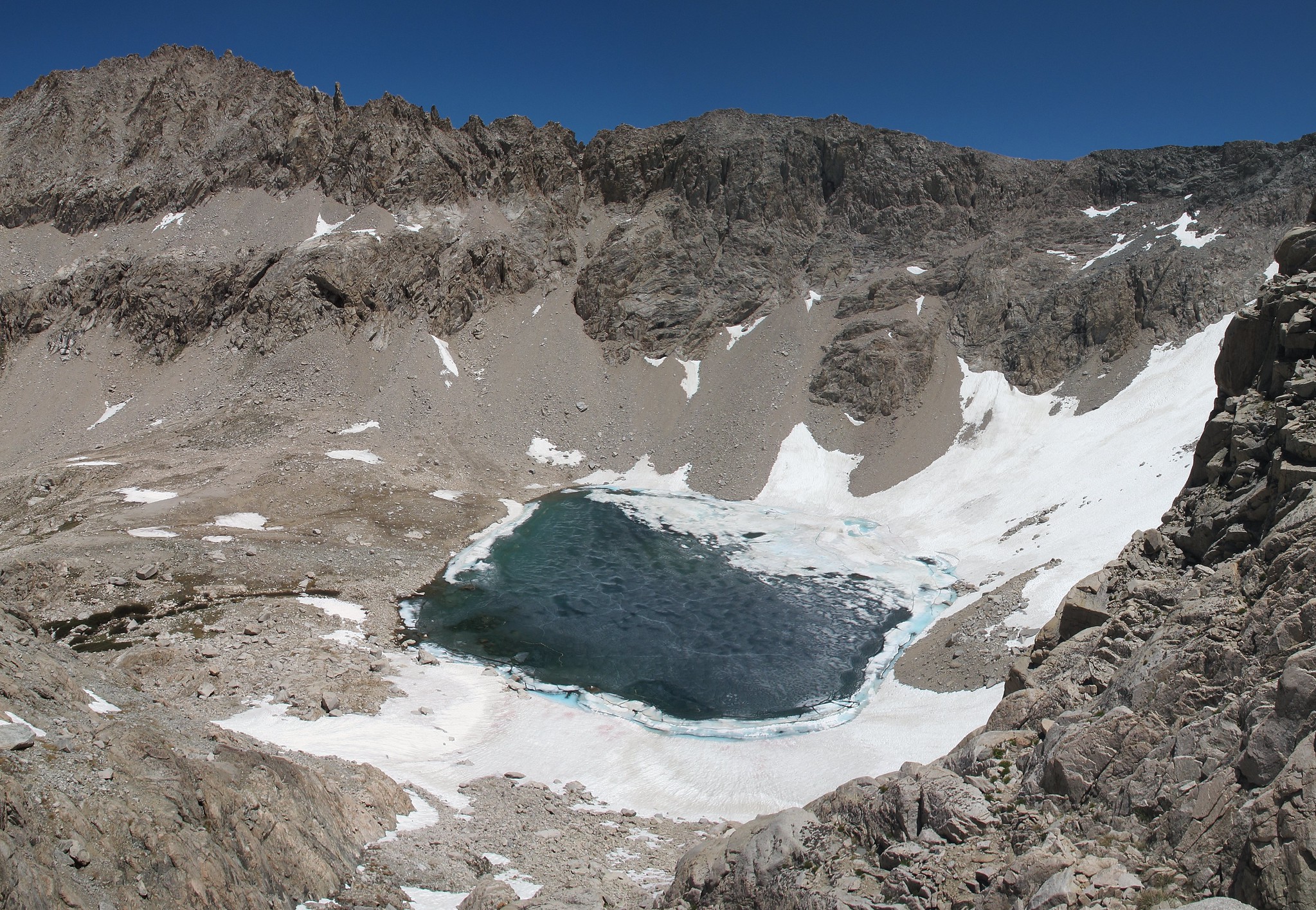
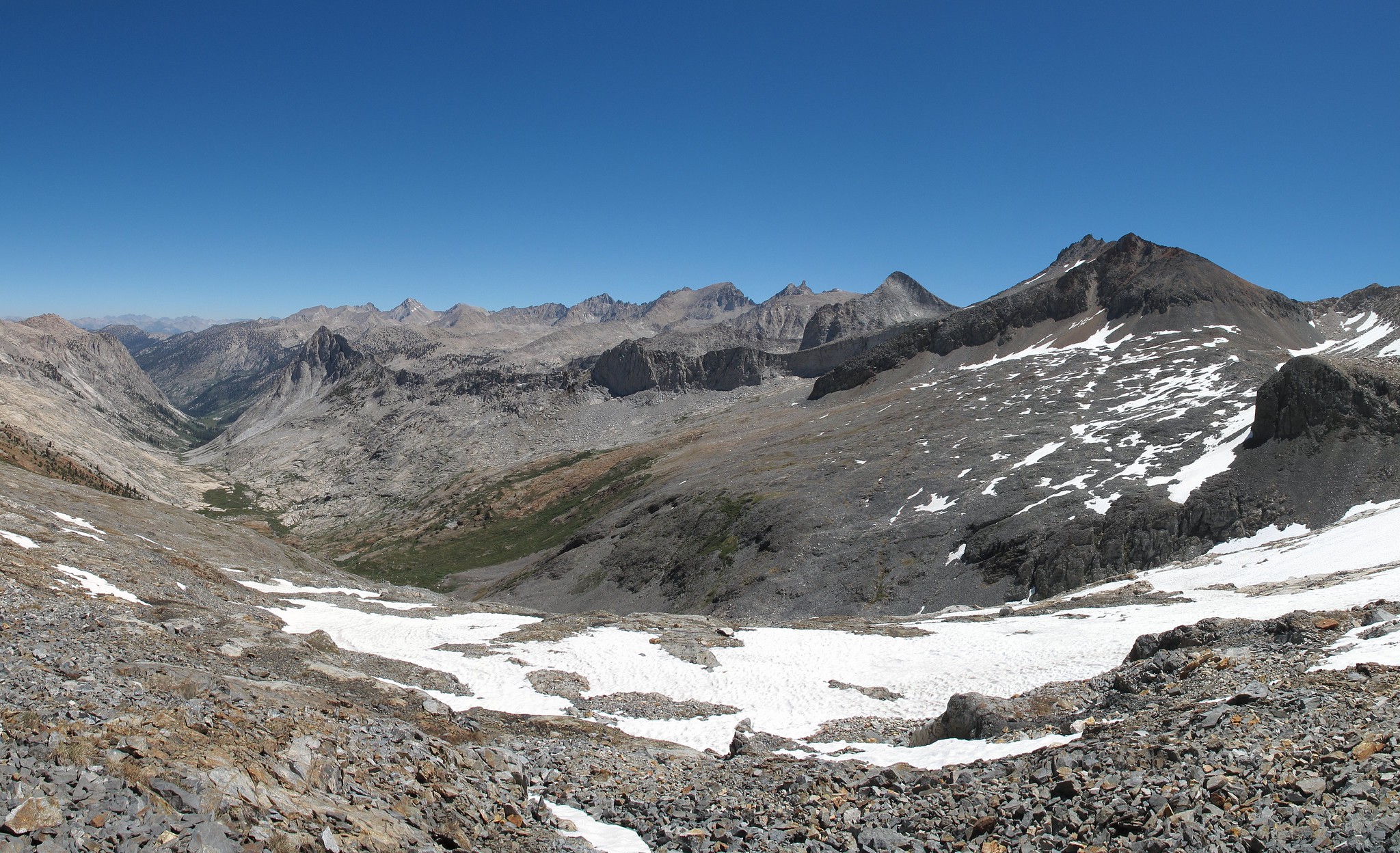
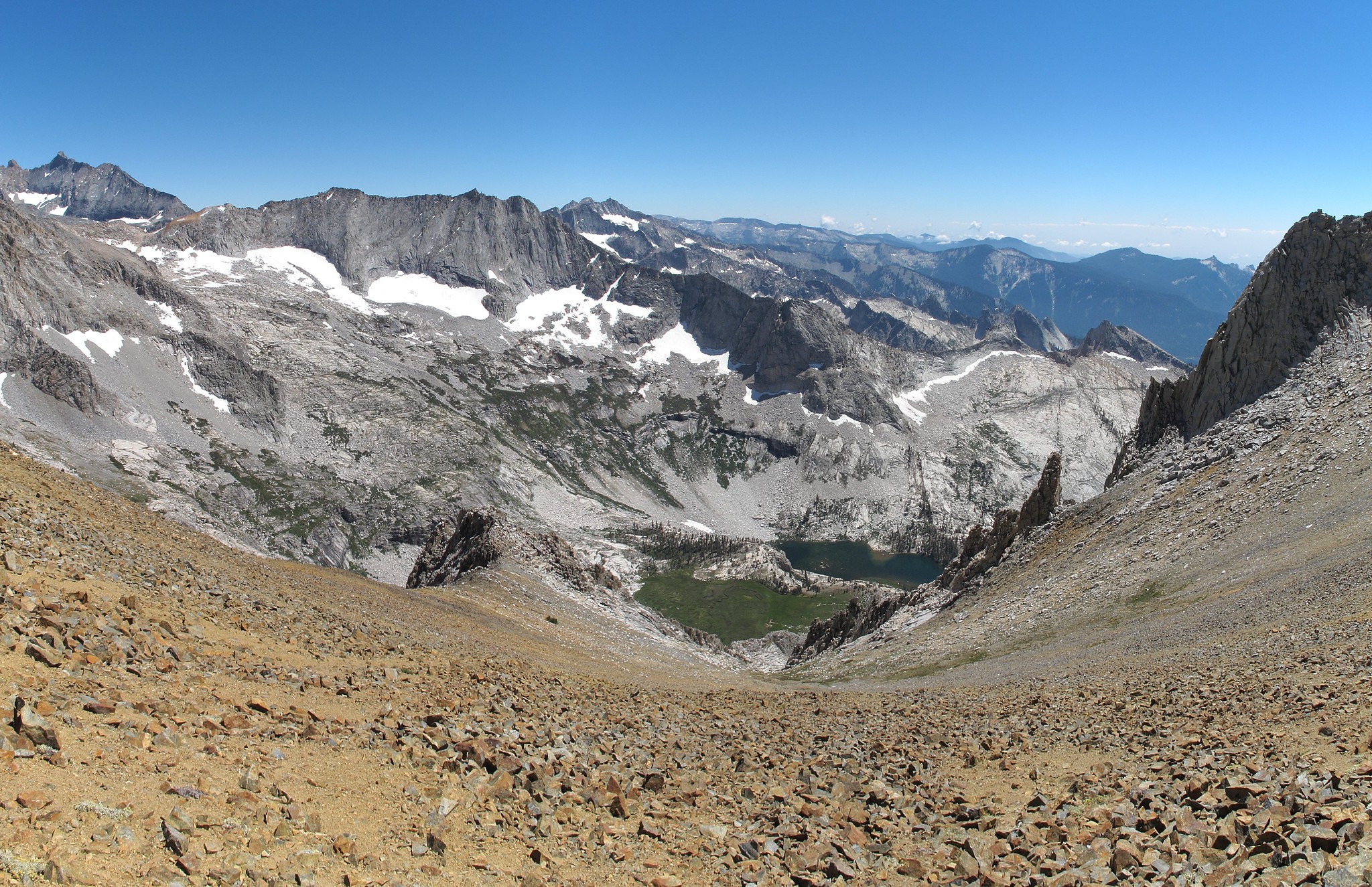
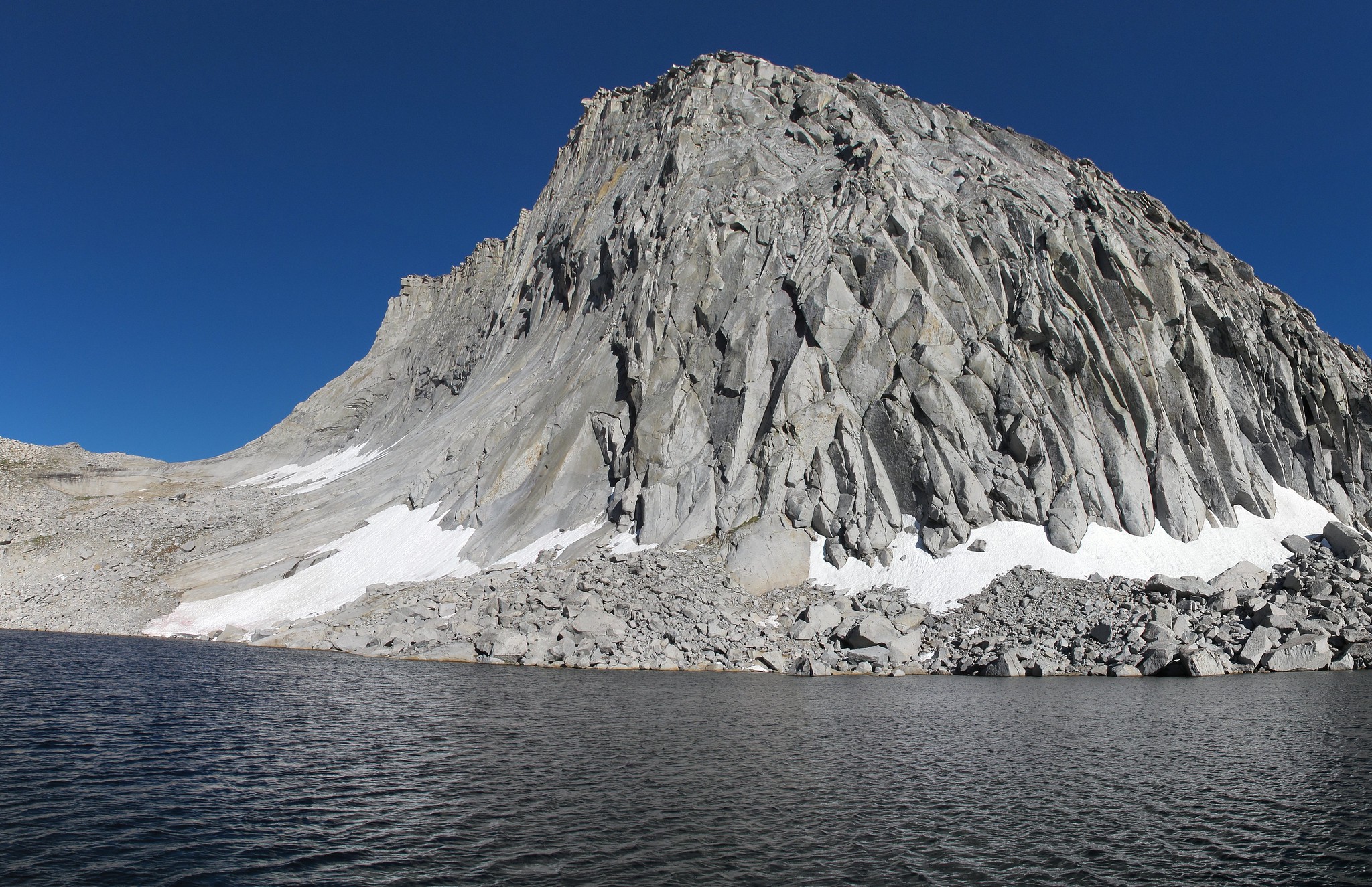
Slogging along and slowly up I finally reached the harsh terrain of Tulainyo Lake. The area did not seem to support camping of any kind. Perhaps if your lucky you might find a rock big enough to fit your body. Hooking towards Russell / Carillon Pass I had to cross a single large snow field that was extremely cupped. This early in the day it was mostly solid so I made good time across it. Arriving at the base of the pass the way up seemed fairly straight forward. I began hoping up the rocks very quickly sometimes making using of all fours like a monkey. The talus was beautifully stable and the right size to have fun running up it. Nearing the top some class 3 had to be climbed with some loose rock but without trouble I was standing on top. I had been speaking to myself out loud about the beautiful views when a head popped up near by. I was slightly disturbed suddenly since I had been so in my own world and I never expected to see someone. I set out up the ridge with the couple not far behind. I tried to set a good pace which was a mistake because while climbing a large rock I slipped bashing my knee and scratching a wrist. After a few moments of major pain I kept going up. Slowly I made my way up the ridge with many difficult maneuvers with decent exposure. Closing in on the false summit the climb had become much steeper. By the time I had huffed my way onto the summit I was greatly disappointed to see the real summit. My GPS showed more then 14,000 feet for this point. After the last ridge traverse I was finally on top around lunch time enjoying a fine views on this clear day. The couple that had been following me up finally topped out and took my photo. They quickly went back down as I sat and relaxed. Finally it was time for me to go so I retraced my steps back. While climbing along a slim rock dislodged and fell bashing me in the ankle leaving a bloody scrape cut. After I was done groaning I made my way back to the pass and down to the lake. The snow field was more difficult later in the day but I still made ok time on it. As I made my way down the nice class 1 terrain the wind was ripping with a fury. Suddenly I stumbled. Stumbles occur so often while hiking that they become second nature. You stumble, correct your near fall and keep walking like nothing happened. Due to this I was half way to the ground before I realized I did not correct myself. I smashed hard onto my left arm bashing the crap out of it and scratching my wrist up. For the third time I fought off the pain picked myself up, dusted myself off and went on my way although I considered myself lucky that I did not break my arm. Arriving back in camp with with 2 scraped wrists, 1 bashed knee, 1 bashed arm and one bashed and scraped ankle I couldn't be happier, besides my solar charger had brought my media player back to 100% power while I was gone!
I made quick work getting back down to the High Sierra trail. As I reached Wright Creek I ran into the 3 Hookah carrying guys from Hamilton Lake. We had a nice chat and I gathered they had stayed at Junction Meadow the night before which was my destination for the night. Again I was in camp at this location early. I held my hand over the fire pit and plenty of heat was coming out of it. Down at the creek a large amount of couscous was dumped into the water along the shore. Yep I found their camp! Still not changing their habits. Later a couple set up near by and I had a chat with the guy and he was a man I had met before known around Lodgepole by the name "Yogi". The two of them had been out since around the 22nd of May and were planning to do 120 days in the Sierra so I wasn't alone out here. He also gave me some ideas of a way he liked to cross the Whaleback which I would use later.
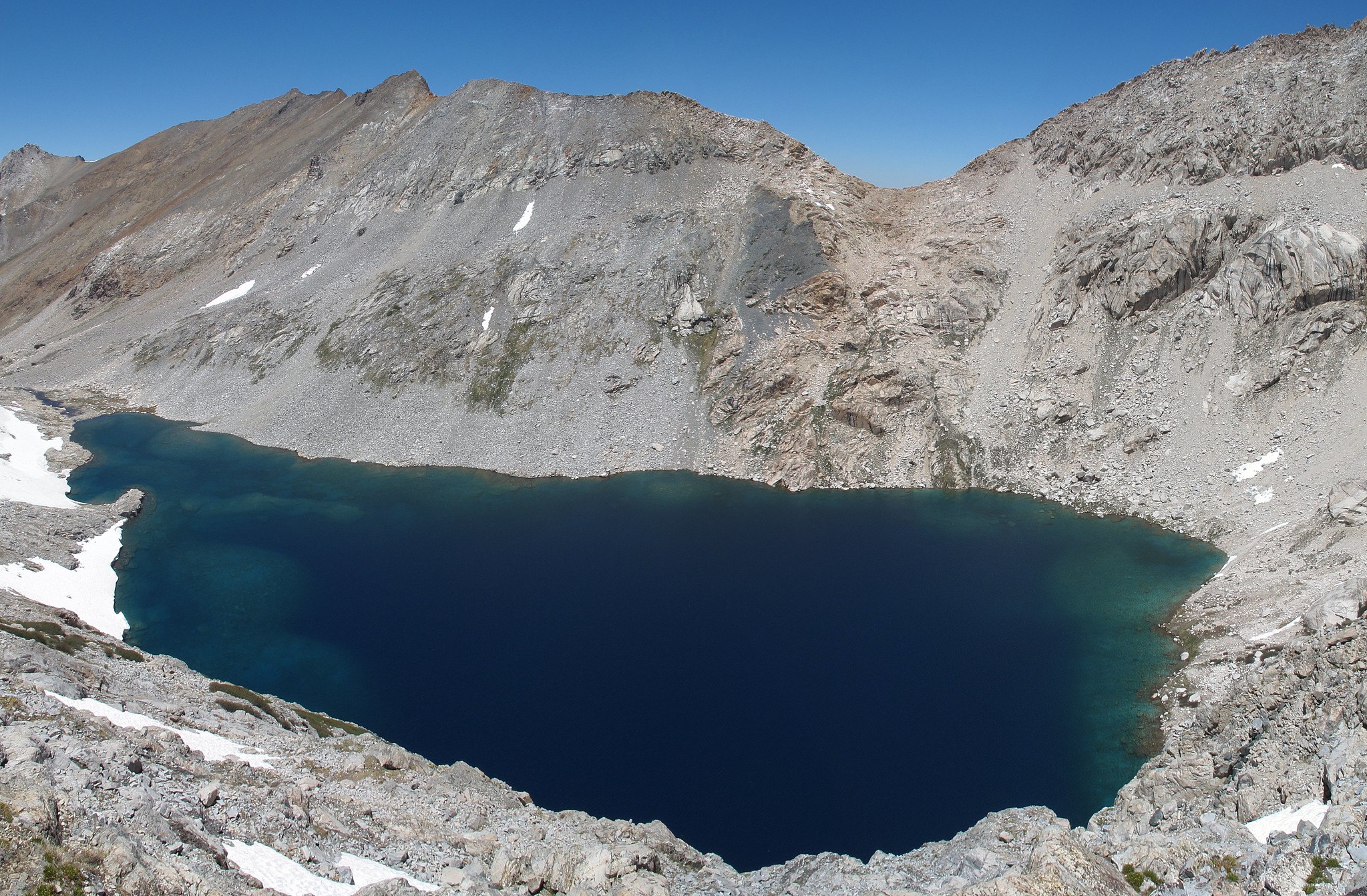
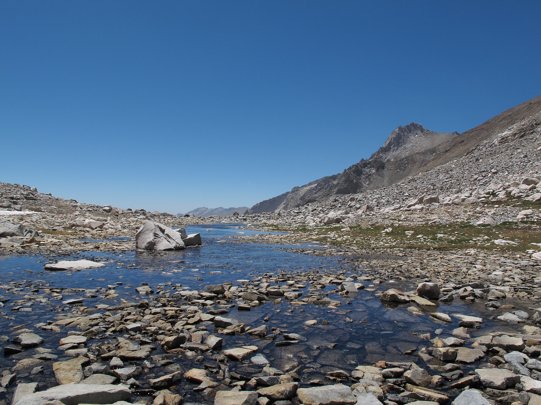
After fording the Kern I began up the Kern-Kaweah River trail. Once again I did not have much energy and the heat was oppressive. Most of this trail was irksome at best and I did not enjoy myself at all. A nice view or two did show themselves and while trekking along I was slightly startled by a large bearded face smiling at me. The Gallats Lake area didn't impress me like I had hoped but it was certainly a welcome place to be after the miserable climb up to it. Finally it was time to leave the trail again and I picked a random location to start up canyon. The easy cross country travel through this meadow ridden valley was great but the mosquitoes were pretty thick when ever the wind would let up. Here and there were bits of a use trail but they never lasted long. Reaching the slope leading to Lake 11,400 the terrain shifted from smooth valley meadows to harsh loose rock that was much slower to navigate. Reaching the lake it turned out to be much nicer then I had expected. That is the scenery was. The camping situation on the other hand was non existent. I checked all about and finally settled on a small spot that was just big enough for my body. A cold breeze blew most of the night ending my third week in the Sierra.
111 Days In The Sierra
-
RoguePhotonic

- Topix Fanatic
- Posts: 1693
- Joined: Thu Mar 24, 2011 9:52 am
- Experience: Level 4 Explorer
- Location: Bakersfield CA
- Contact:
-
austex

- Topix Expert
- Posts: 552
- Joined: Mon May 21, 2012 11:51 am
- Experience: N/A
- Location: Austin, Texas
Re: 111 Days In The Sierra
The smiley face tree took me a minute...Looks like Clint Eastwood from High Plains Drifter with a cigarette.
-
sekihiker

- Founding Member
- Posts: 958
- Joined: Sun Dec 18, 2005 2:47 pm
- Experience: Level 4 Explorer
- Location: Fresno
- Contact:
-
RoguePhotonic
- Topix Fanatic
- Posts: 1693
- Joined: Thu Mar 24, 2011 9:52 am
- Experience: Level 4 Explorer
- Location: Bakersfield CA
- Contact:
Re: 111 Days In The Sierra
WEEK 4
MAP
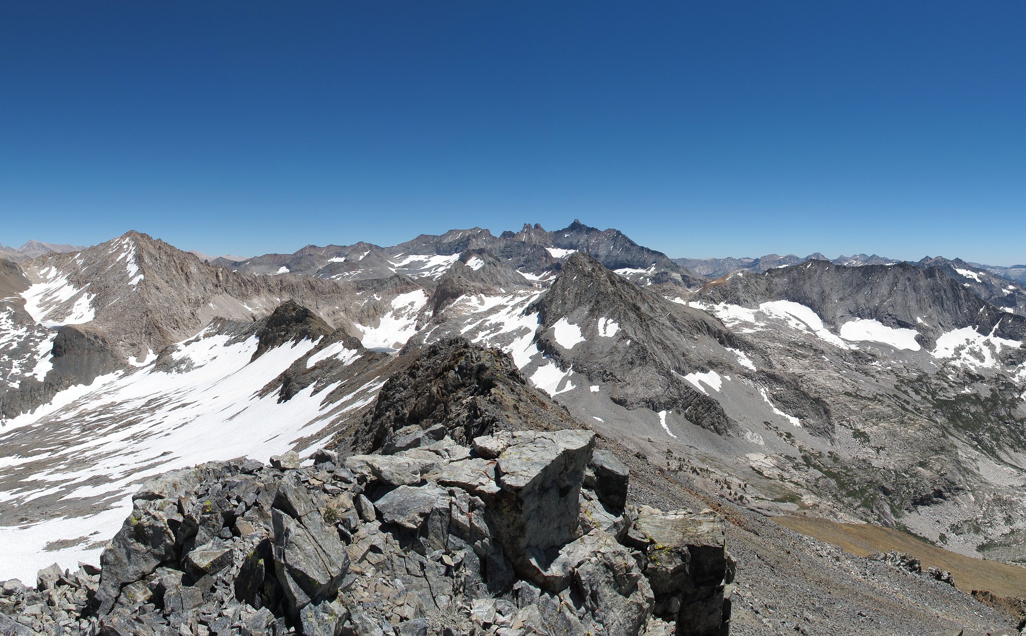
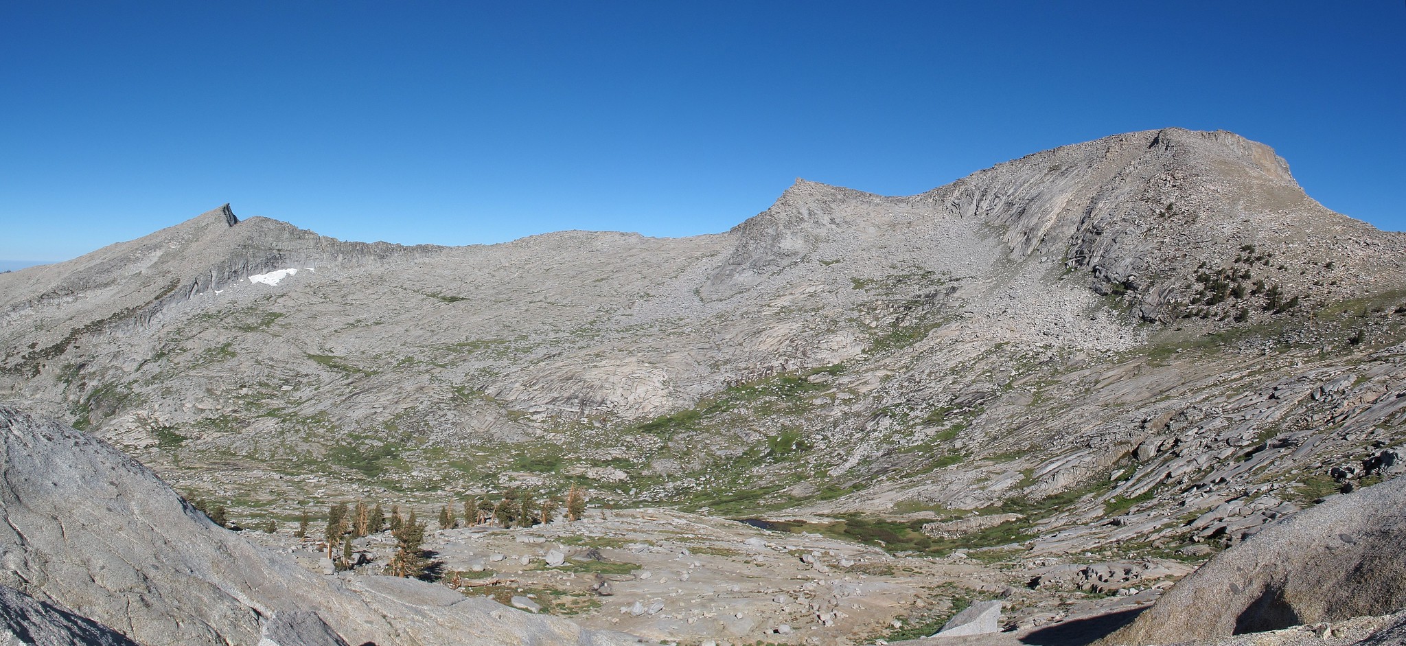
After a chilly night I began out towards Pants Pass. I had long decided to take the Southern ridge saddle and not hike up the East Col. which looked like a steep lose scree mess. The area had about 70% snow cover and the initial progress was easy on harder packed snow. Unfortunately I ran into many sections of knee deep post holing that slowed my progress significantly. After allot of huffing, puffing and cursing I finally reached the end of the snow line and made my way up to the ridge which offered beautiful views down on the Kaweah Gap. From here it was an easy 100 yards or so to dump onto the actual saddle of Pants Pass. Looking down the East slope of this pass and considering how easy the South Ridge is I couldn't imagine why anyone would go this way other than to say you had done it.
Beginning down the lose mess was immediately proving to be allot of fun. It was the type of scree that you can just mash your foot in hard pushing into a nice step. The only danger to this was keeping an eye out for areas that might have a rock just under the surface that will cause you to slip. After a couple hundred feet down riding the scree happily suddenly the whole hill side began to go on me. I looked up to see that besides all the scree this section was filled with large boulders and they were also riding in the slide. I quickly began to run across the slope while riding the avalanche. Thankfully I got out of the path of the slide and it stopped after another 20 feet. After a few good chuckles I continued down. At one point another slide took off on me but not as dramatic as the first. As the slope curved left and then back right I fell onto my butt and I was in another mini slide which I did everything I could to stop because my trekking pole was lodged in the rock above me. Finally the scree mess gave way to more manageable slopes and I made my way over to the small lake below the two Lion Rock Passes. From here both looked like an easy climb. I hooked directly left and began angling up the slope. This pass was nothing more then picking your way up a mix of grass ramps, small talus fields and large glacier polished slabs. I made it on top of Lion Rock 2 Pass in time to sit and eat lunch. As I began down the snow cover was about 90%. The snow cupping made it no good for a nice slide to the bottom. Instead I began sliding down being beat up as I went. By the time I was far enough down to continue on foot my hand was bleeding from the ice crystals on the surface of the snow.
I made quick work down the rest of the pass and began to angle to the right following the drainage. When it ended at a steep cliff side I looked down it but could not see far enough to judge if this class 3 route could be taken. Not wanting to have to climb back up I hooked left and began down the slope on the South shore of Lion Lake. This route took allot of micro route finding down small shelves that were littered with smaller lose rock. Without any real difficulty I was strolling along the shores of Lion Lake. I crossed the outlet and found a nice large rock to lay out on for the night. A local Marmot eyed me with great suspicion but decided I could stay for the night. I took a miserably cold dip in the lake and began down the outlet towards Tamarack Lake in an effort to find some vistas. I did find a camp site but nothing that great for views. Closing the night a cold wind was blowing hard. Maybe it had always been blowing since the wind never seemed to stop for this trip. My Western Mountaineering Summerlite was a bit smaller then my Versalite
 and nights like this I was reminded of it as I could never fully close off the draft and as I would roll and adjust a couple times the wind blew my bag off me completely. ARRRGGG!!! stupid wind!!!
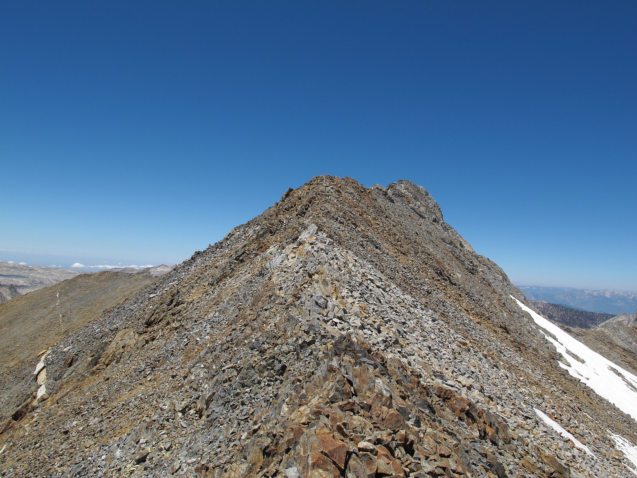
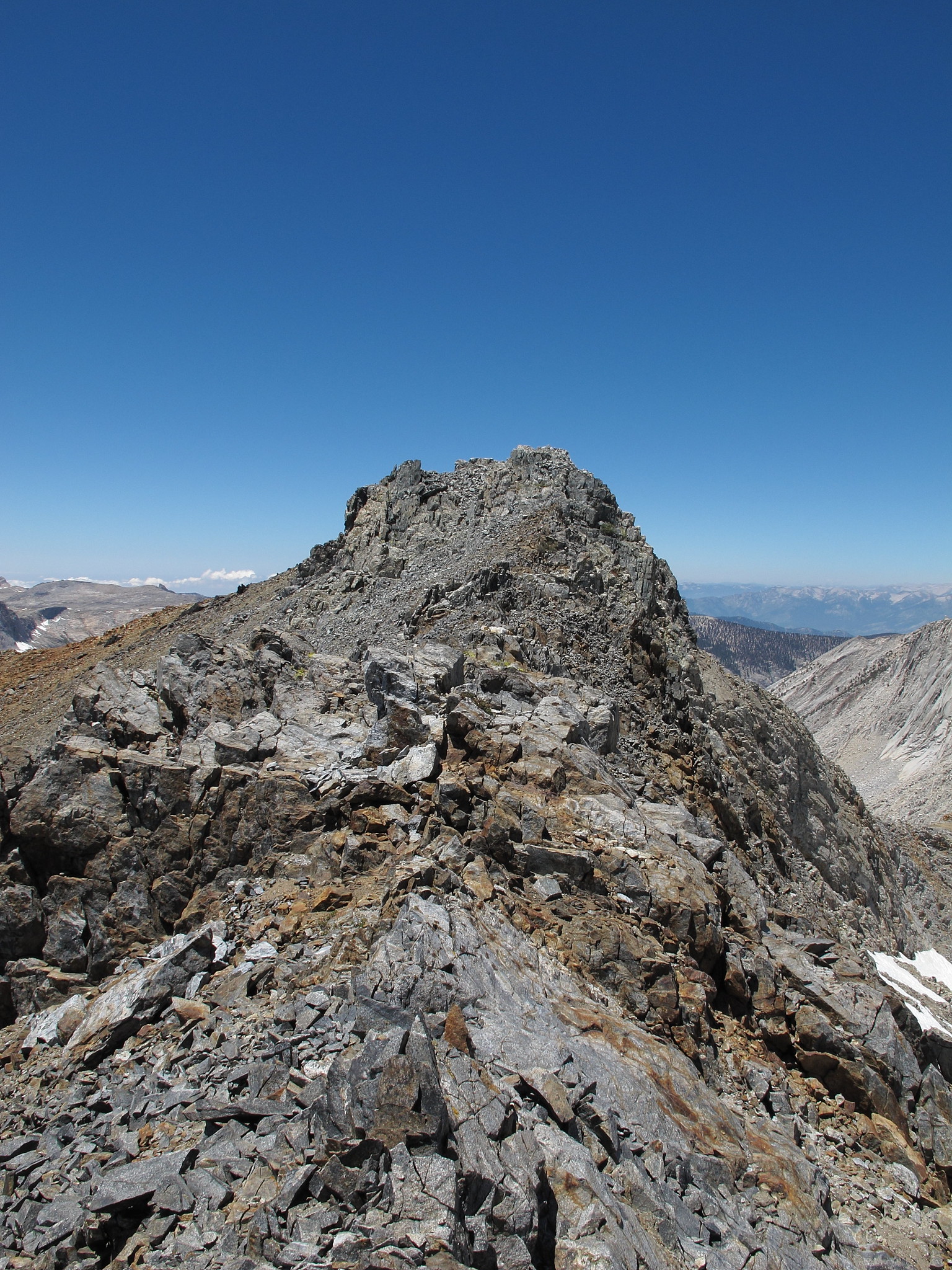
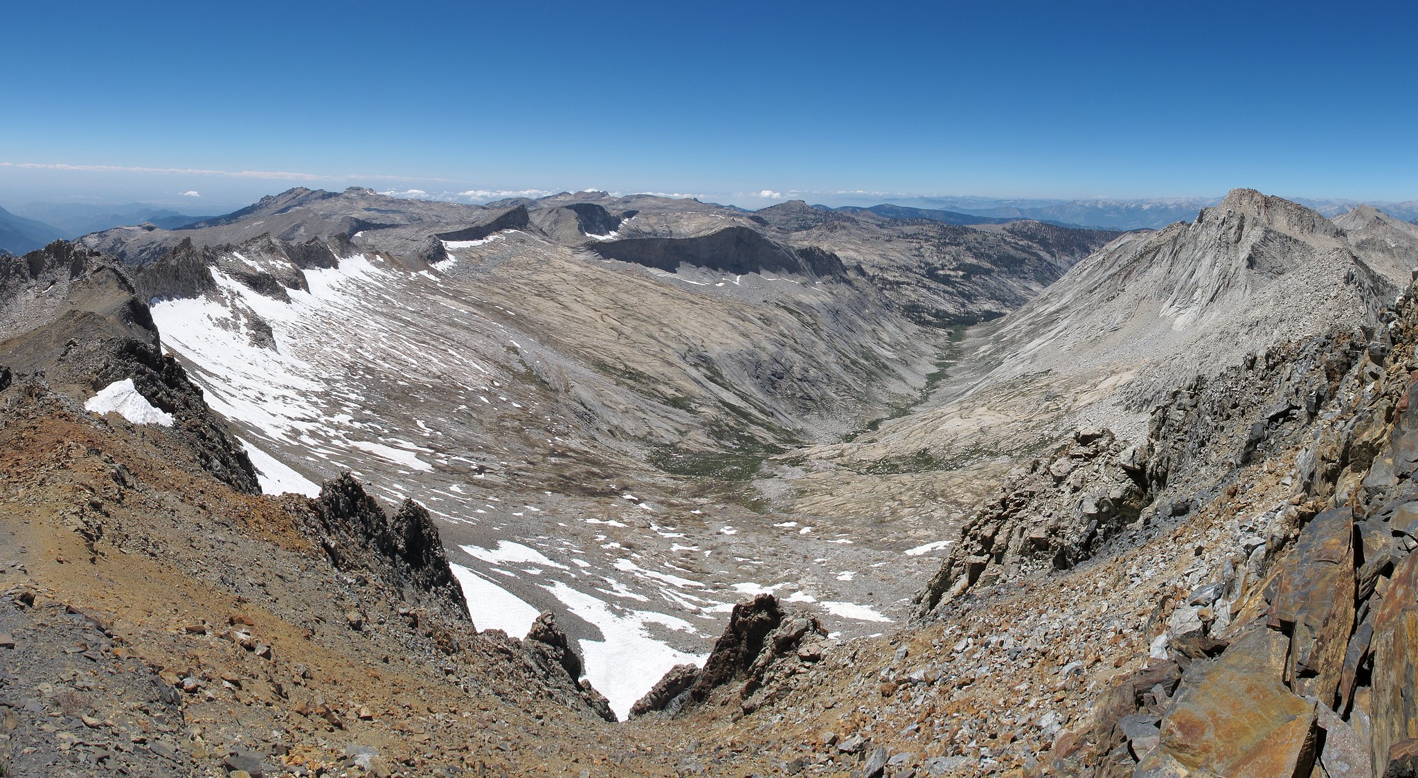
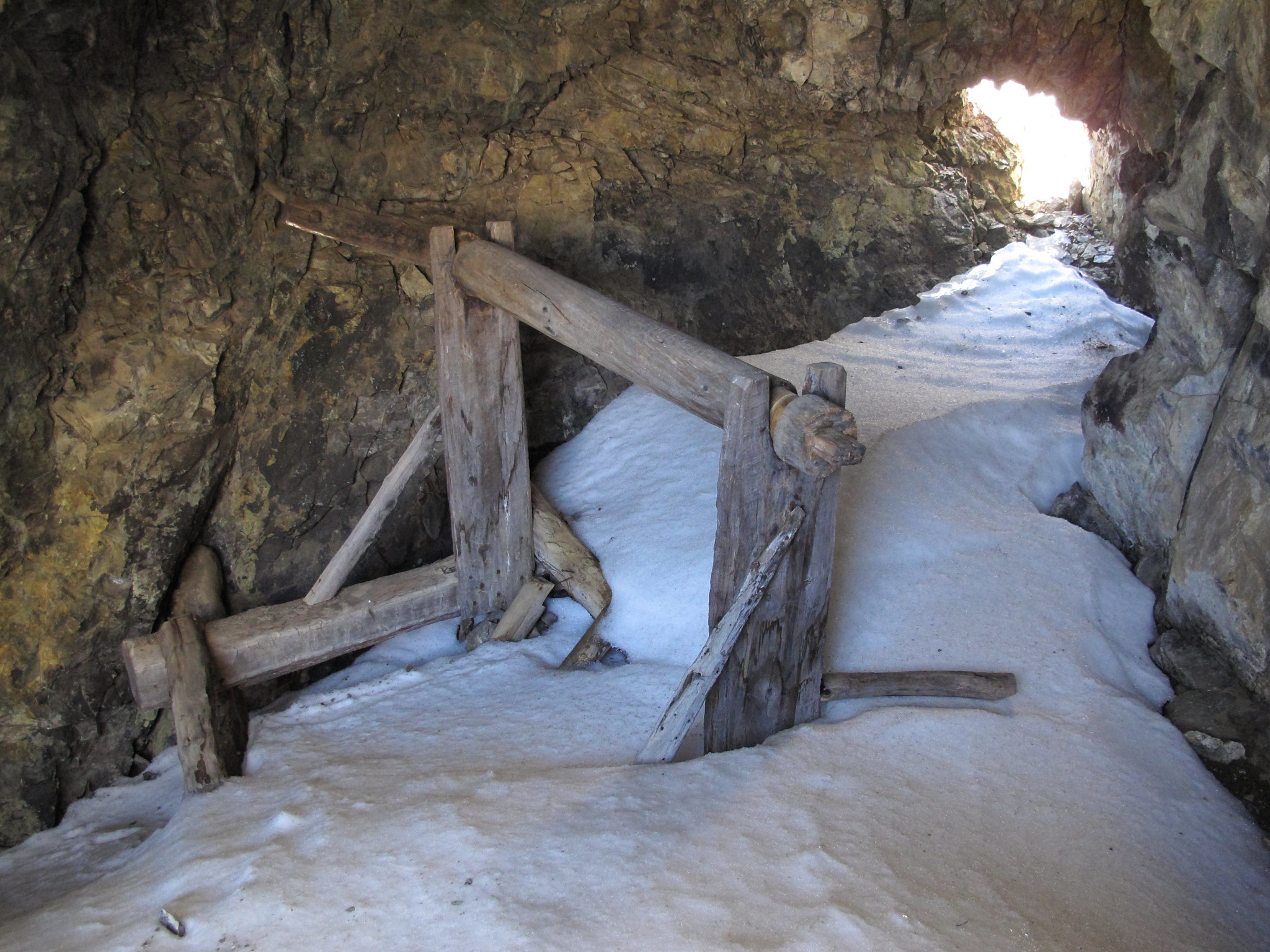
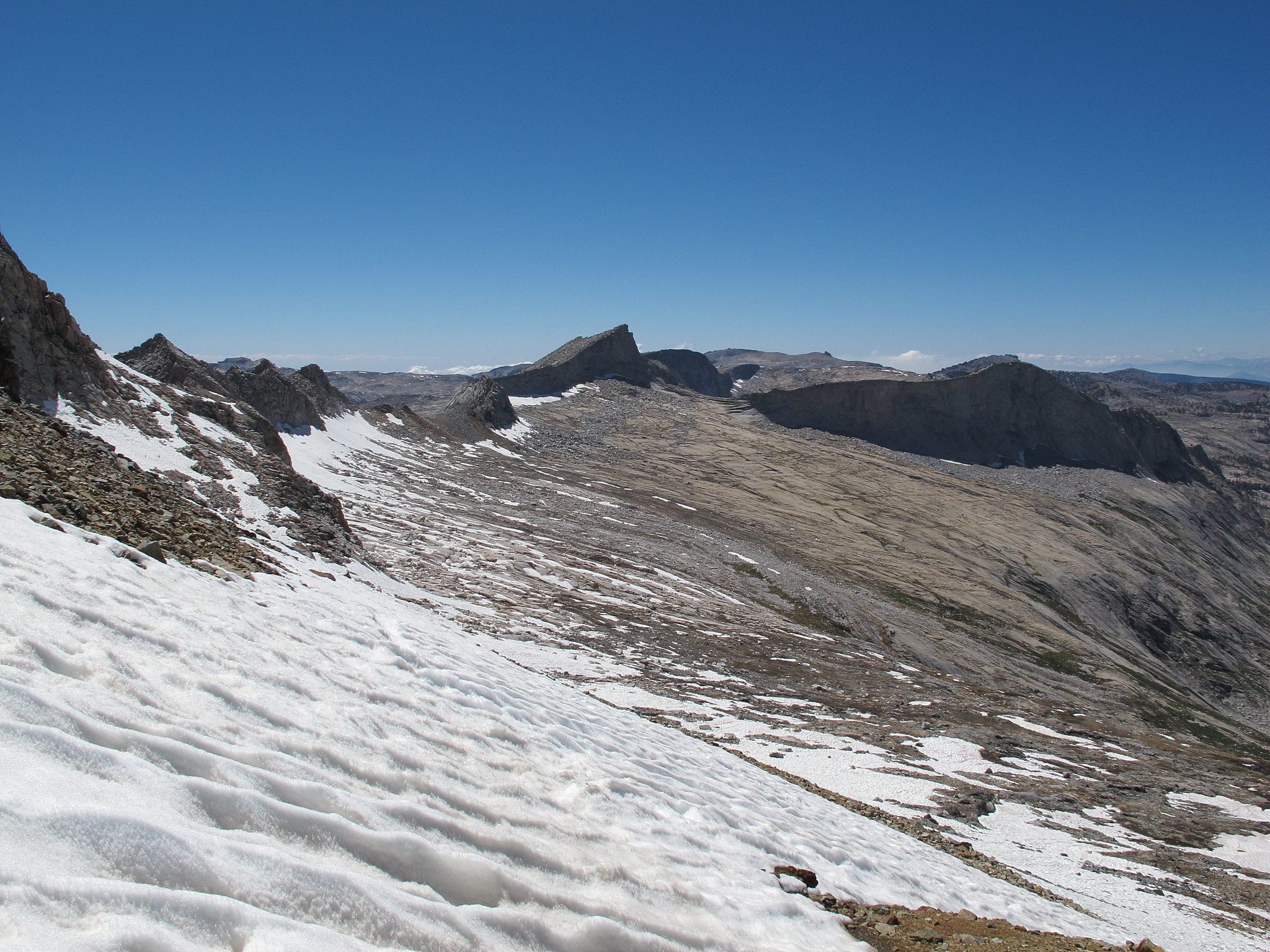
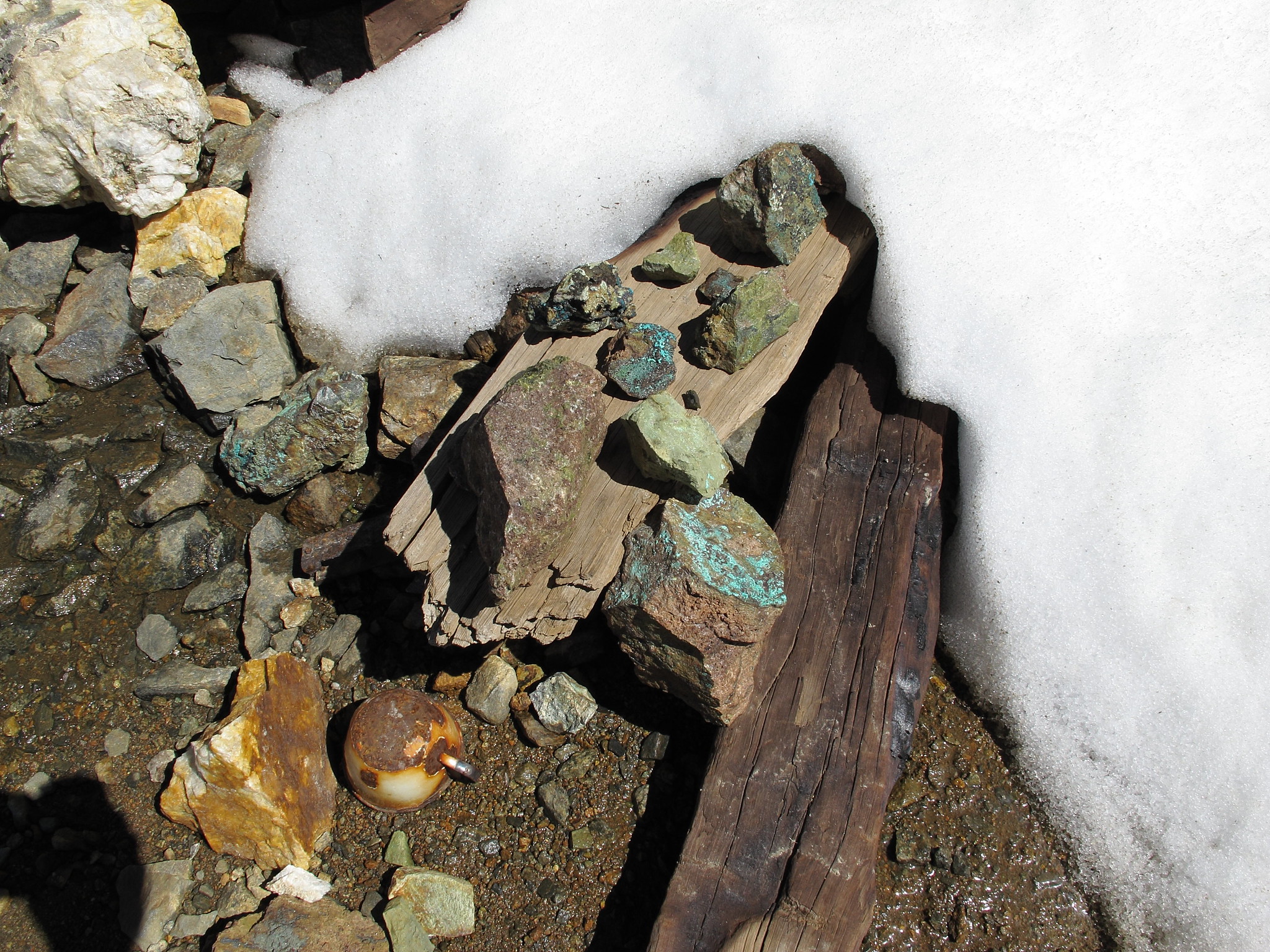
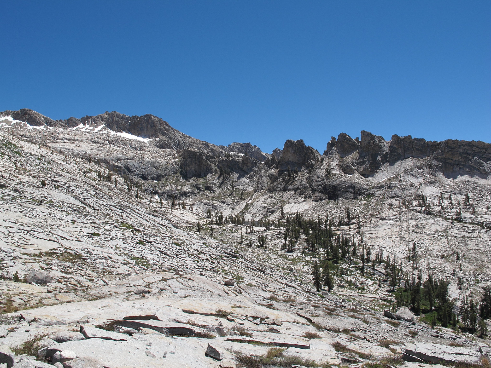
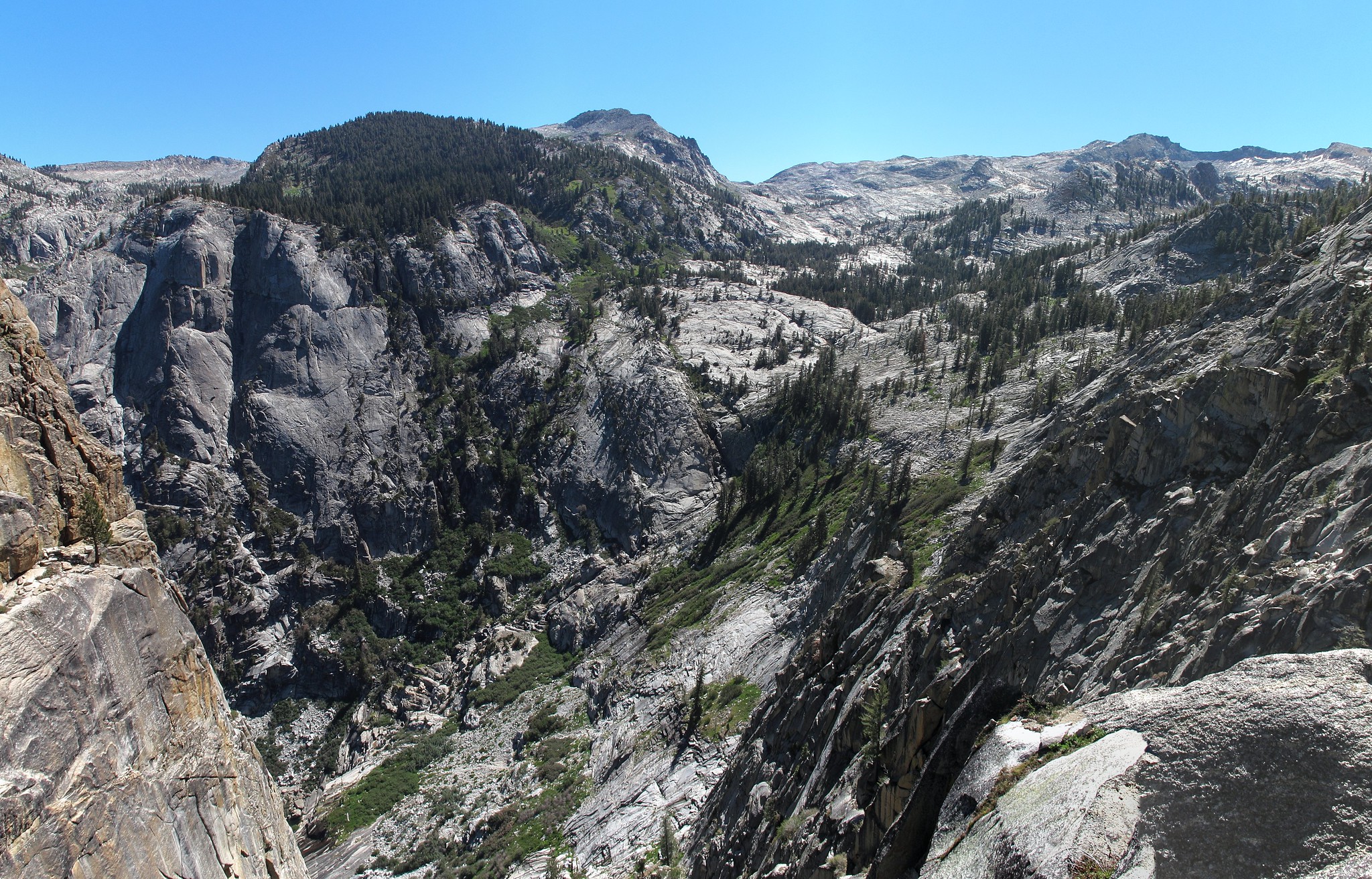
As I set out around the Northern side of the lake I began angling up towards Lion Lake Pass before I was below it which worked out well enough. Yet again this was an easy pass on it's South side following small glacier carved sections of rocks lined with grass. By the time I had reached it's top however the icy wind was ripping over the ridge. I hunkered down and took a break before tackling the slope below. Once again it was about 95% snow coverage but this time much steeper. The early morning snow was hard packed and I could barely maintain any footing. I was outside my comfort zone at this point and wished I had my ice axe. This was the only time on this trip I would feel this way. I slipped once and had to use my trekking poles to self arrest. Once again my hand was bleeding this time due to digging my finger nail into my skin. I could barely stand back up so I began a system of lowing myself down by stabbing my trekking poles into the snow at about my knee level and then lowering my body down some. When I had made it far enough to resume on foot I began angling across the head wall of Cloud Canyon. What at times was a pleasant scenic climb turned into a miserable nightmare of post holing. First it was unstable snow where you never knew if you were going to hold or fall in slightly. Then knee deep snow which was extremely difficult to move forward in. Then the snow gave way to thigh deep post holing and I could no longer walk. Cursing, kicking and fighting in despair I was forced to crawl on all four using my trekking poles in front of me in an effort for solid ground. Inch by inch I made my way up the slope until I was swearing I would never ever EVER!! come back onto this head wall with snow! RAWWWRRRRRRRR!!!! The last 50 feet of progress probably took me 30 minutes. Finally like a ship wrecked refugee I staggered onto the lose rock and stumbled up to the ridge line offering wonderful views. As I made my way up the ridge the icy wind continued to rip with a fury. 50 yards or so before being below Peak 12,345 I found the old mining trail and followed it along then bailing off to make the summit. Despite all the hardship the views did not disappoint. Checking the register I was the first to sign it for the season and I began down to the West. Not very far down the ridge line I spotted a mine adit near by so I climbed out to it on some difficult scree slopes. It was a shallow opening with snow and ice inside but had some interesting mine relics inside. I climbed out the rear opening but it did not lead anywhere interesting.
Back on the ridge the trail was easy to follow and I made my way down admiring Deadman Canyon once again. Moving down the North side was a slushy and muddy mess but was not difficult. I passed by another mess of relics where any other evidence of the mining was covered in snow.
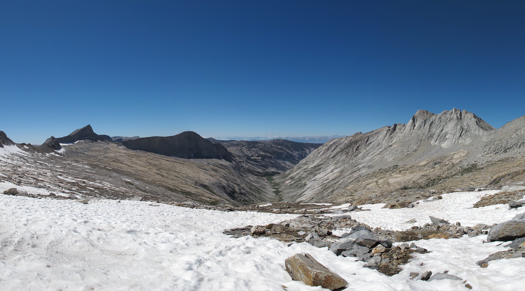
I began angling across the head wall but it proved more difficult then I would have thought from all the times I have seen it. It was a mess of soft snow fields, micro cliffs and slick water covered granite. After longer than I would have liked I crossed over the trail here and began up towards Horn Col.
Climbing this pass was easy as proverbial pie especially compared to last year when it had been all snow. After plenty of huffing I made my way on top of the 3rd pass for the day. The year before I had climbed along the talus on the North Ridge but this time I dropped slightly down onto the granite slabs and made my way along the talus here. It took a bit more caution as the talus was sitting directly on top of smooth granite slabs and could be easily knocked down hill. After the last slopes down I was back at Lonely Lake again. I set up in the same camp as the year before and closed a difficult yet rewarding day.
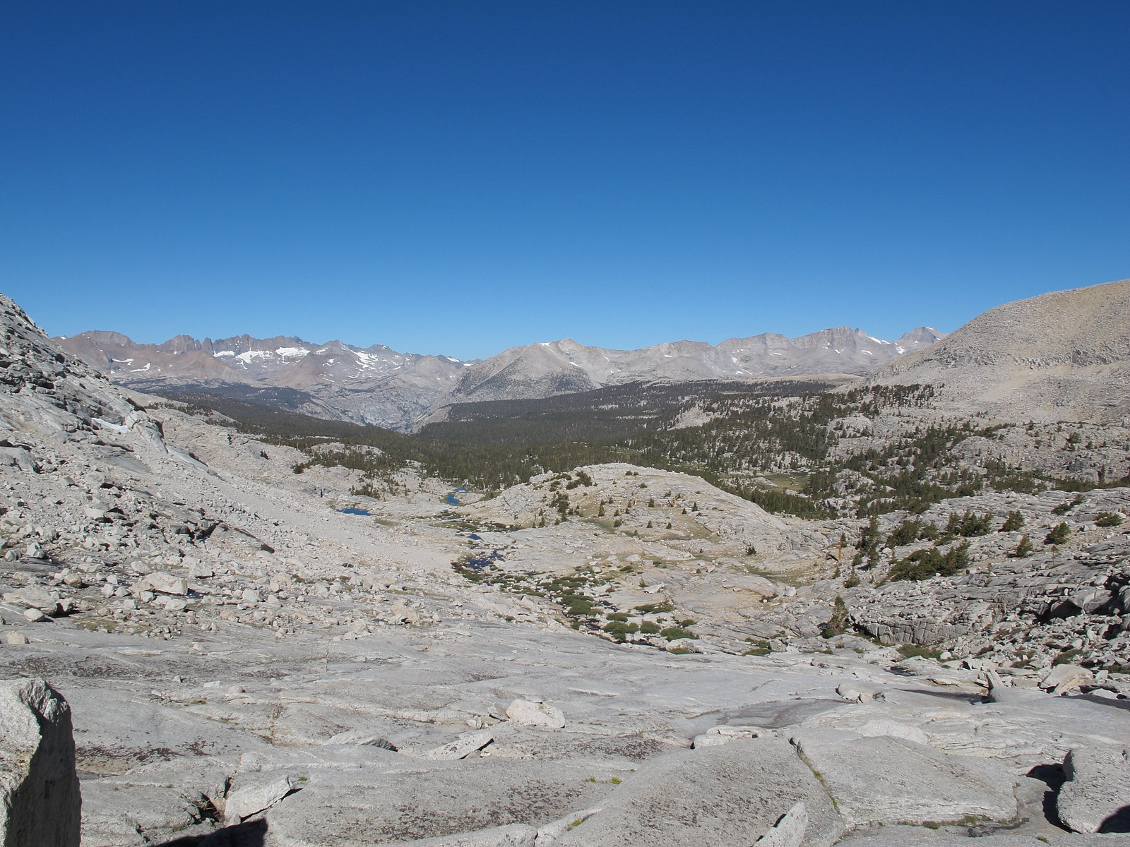
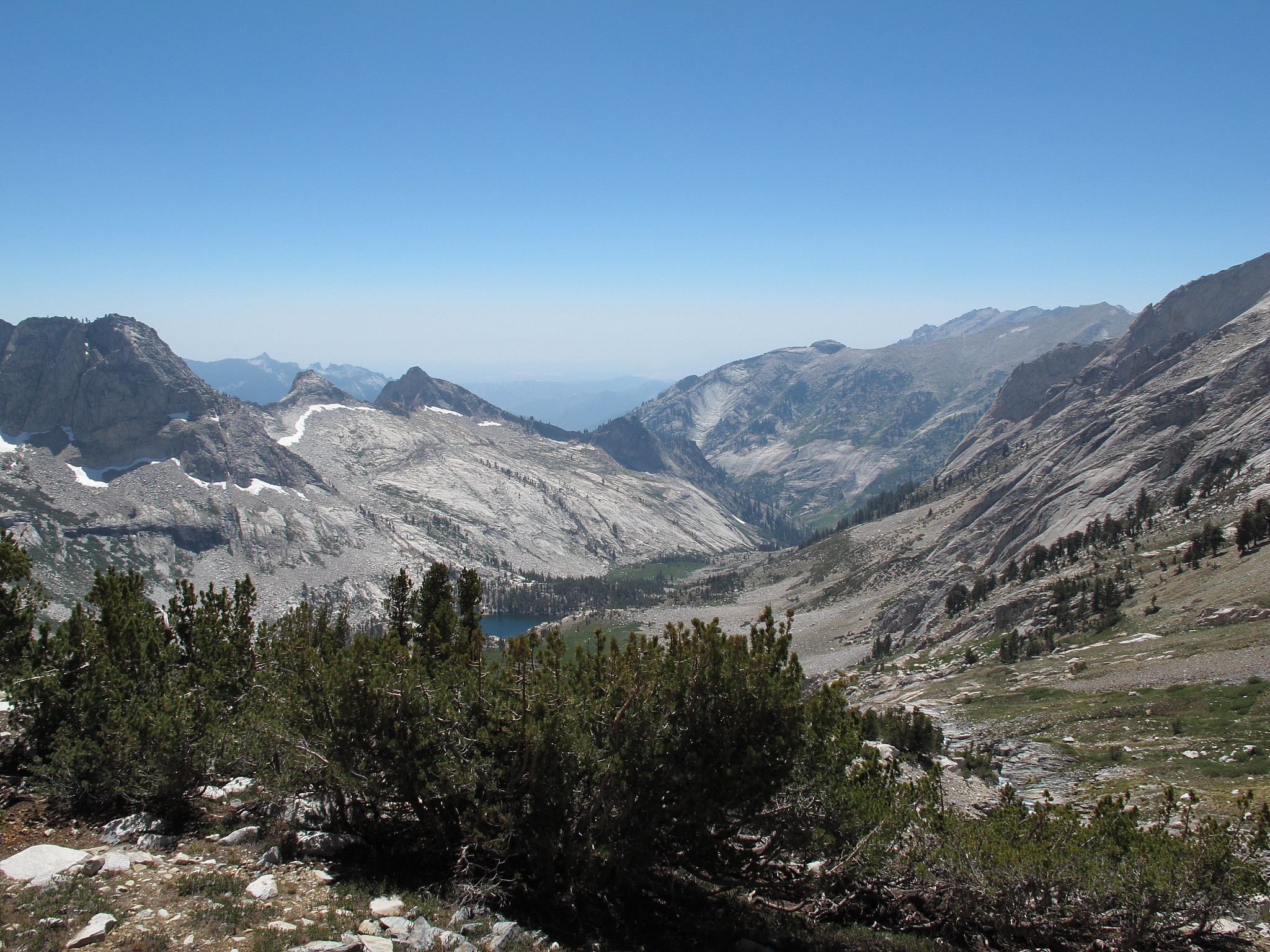
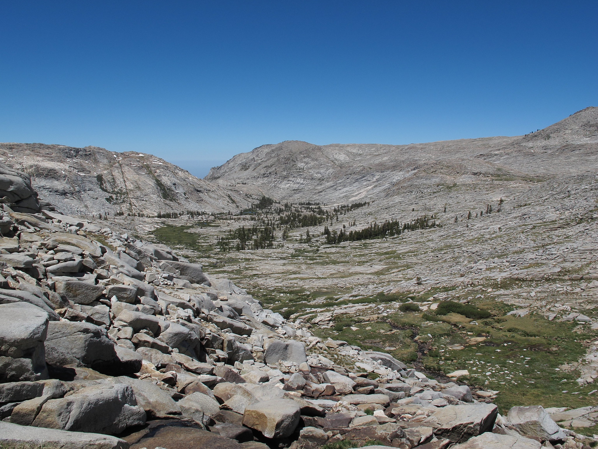
Leaving camp I was a bit torn on the best way to Pterodactyl Pass. I considered hooking out around the bowl in front of me to avoid loosing altitude but after more detailed surveying of the terrain I decided that dropping directly down and crossing was the best way to go. After a few steep granite slabs and crossing by some mosquito encouraging tarns I was on my way up. This past couldn't be much easier. Zig zagging along granite avoiding all talus and with little effort I was on top. From the pass I hooked right moving North West in a wide arch avoiding more intermixed terrain littered with some tarns. The area had more nasty mosquito pits and for one of the first times on this trip I was mounting my head net. The Tablelands are an unusual place to travel. A wide expanse of barren landscape offering some vistas but generally is dull to travel. Easy yet irksome at times. I would mostly regard it as a connector zone that is best traveled quickly. After zig zagging and going over the small ups and downs I reached the edge looking down on Table Meadows. As I made my way down this steeper bit of terrain I saw a man below making his way up. I figured our paths would cross but he seemed to make a point to stay away from me so I continued on my way down the valley.
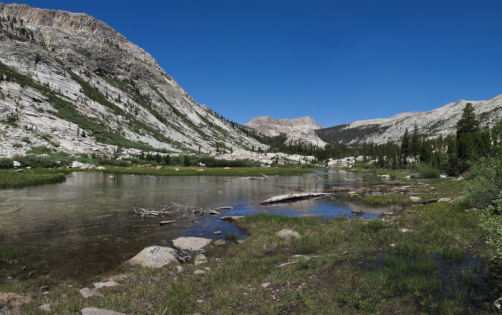
Traveling down the Marble Fork of the Kaweah River proved to be a bit more difficult then I might have expected. The terrain was so mixed with granite micro cliffs and brush that I followed the creek through several more difficult areas which would not have been possible in higher water. Finally after an uneventful stretch I hooked left and over a small hump to get my first look at Pear Lake. I began left across this granite area until I was walking on some steep slabs. I wondered what I must look like from a distance. Arriving at the lake however I found it to be abandoned. I had noted the poor Ranger cabin that for some reason and been placed far below the lake. I wanted to go down and say hello but I was too lazy. I got set up and wandered around taking pictures as a few more people began showing up. I quickly learned this area was a repeat of Franklin Lakes as the Marmots began assaulting my camp so I could have no rest. I attempted to teach a Marmot not to chew on my solar panel by stopping it every time it tried to do it. After the 15th time the Marmot wandered off to terrorize someone else's camp.
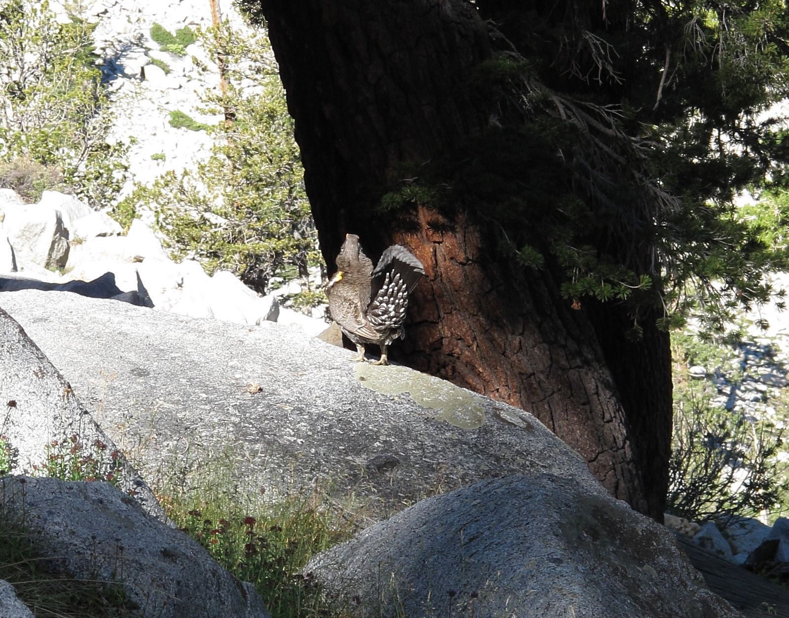
As I made my way out of the area I heard that familiar deep sounding call. As I came around the corned I finally caught my first view of the culprit. I was completely amazed to find that it was a Grouse! A STUPID GROUSE! For the last four years I had been hearing that call and never knew what it was. I had been asked by countless people what it was and I had asked countless people and no one had an answer. It was nothing more then the mating call of a Grouse... I marched along quite happy that such a long running mystery had been solved.
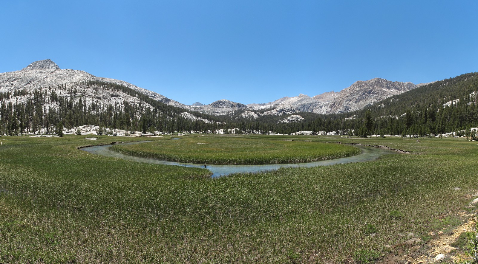
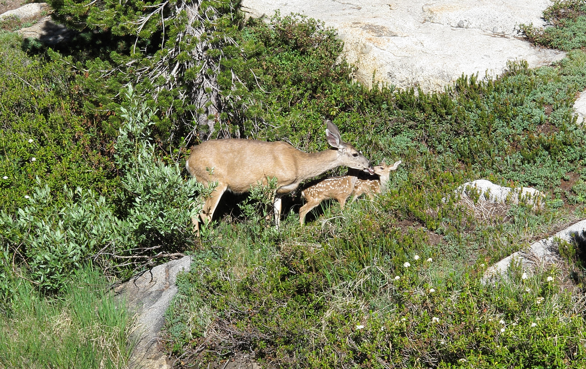
As I reached the creek that runs between Emerald & Aster Lake I spotted a Deer and her two babies. I watched them for a bit as they happily grazed. Then suddenly one of the fawns plopped down into the grass. I chuckled to myself that the poor little thing was so small it could not get it's head above the grass but time passed and it did not come out. I stood and watched as the curious mother searched the ground where her baby had fallen. She was upset and began digging at the ground. This went on for about 10 minutes when I realized that I was going to have to do something so I took my pack off and approached the mom slowly talking to her softly. The baby was crying and she clearly did not want to leave as by the time I got to where it had fallen she was about 6 feet away from me. I looked down to see that a deep cut water channel was running through the grass. The fawn was up to it's neck in water and was caught under some roots. I could tell it's struggle was futile and it would never make it out alive. I reached in and with a scream from both the baby and the mother I picked the poor thing out and set it into the grass. The mother had backed off 15 feet and just stood and stared at me cold. The fawn stayed collapsed in the grass shaking both from fear and the freezing water it had spent the last 10 minutes in. I stood and waited as the mother made no move towards her baby and only stared at me like I had killed it. Finally after about a minute the fawn slowly got to it's feet and the mother immediately was excited to see that her baby was ok. They went to each other and she began cleaning her baby up. The mother and I exchanged one last glance and I got my pack back on and resumed the trail. I was so moved by the experience I could hardly express myself. It became one of the best experiences I have ever had hiking the Sierra.
As I neared the junction that goes to The Watch Tower I was confused to find a rough trail leading off into the forest. I thought it was the junction I wanted although it was not marked. The trail did how ever have cut logs on it. I followed it for about a hundred yards and lost it completely. Maybe this was a reroute or some trail used by trail crews I thought so I back tracked and found the proper way. As I reached the Watch Tower I climbed the steeper sides of it from the trail and got some views from the top. From here it was all down hill to Lodgepole. Before I got there however I ran into a mother, her daughter and niece. They chatted me up a bit and were amazed with my hike. They offered to feed me dinner and gave me their camp site number.
Reaching Lodgepole I again considered the idea of how long I would stay. And for what ever reason I decided to do two layover days. That night I joined the 3 girls at camp for a nice dinner and exchanged stories.
The following day I kept running into them again everywhere I went like we were stalking each other. They fed me dinner again and we did a hike to Tokopah Falls which was one of the only hikes I had not done in this area.
When all was said and done it was time to get moving again. I took the trail towards Silliman Pass and ran into a couple that where headed the same way but were much slower than me. As I had learned in 2010 this trail was uneventful as I went past Twin Lakes and over Silliman Pass. When I reached Ranger Lake I began looking for a site with a Bear Box since I had heard there was one here. I couldn't find it though and settled with an ok camp on the Northern side of the Lake. I had long taken a dip in the lake, ate my dinner by the fire and retreated to my tent to escape the mosquitoes as the last light of the day was coming to an end when the couple I had run into earlier came stumbling into camp. I offered them my camp which they accepted. By about 1am we finally went to bed.
MAP
After a chilly night I began out towards Pants Pass. I had long decided to take the Southern ridge saddle and not hike up the East Col. which looked like a steep lose scree mess. The area had about 70% snow cover and the initial progress was easy on harder packed snow. Unfortunately I ran into many sections of knee deep post holing that slowed my progress significantly. After allot of huffing, puffing and cursing I finally reached the end of the snow line and made my way up to the ridge which offered beautiful views down on the Kaweah Gap. From here it was an easy 100 yards or so to dump onto the actual saddle of Pants Pass. Looking down the East slope of this pass and considering how easy the South Ridge is I couldn't imagine why anyone would go this way other than to say you had done it.
Beginning down the lose mess was immediately proving to be allot of fun. It was the type of scree that you can just mash your foot in hard pushing into a nice step. The only danger to this was keeping an eye out for areas that might have a rock just under the surface that will cause you to slip. After a couple hundred feet down riding the scree happily suddenly the whole hill side began to go on me. I looked up to see that besides all the scree this section was filled with large boulders and they were also riding in the slide. I quickly began to run across the slope while riding the avalanche. Thankfully I got out of the path of the slide and it stopped after another 20 feet. After a few good chuckles I continued down. At one point another slide took off on me but not as dramatic as the first. As the slope curved left and then back right I fell onto my butt and I was in another mini slide which I did everything I could to stop because my trekking pole was lodged in the rock above me. Finally the scree mess gave way to more manageable slopes and I made my way over to the small lake below the two Lion Rock Passes. From here both looked like an easy climb. I hooked directly left and began angling up the slope. This pass was nothing more then picking your way up a mix of grass ramps, small talus fields and large glacier polished slabs. I made it on top of Lion Rock 2 Pass in time to sit and eat lunch. As I began down the snow cover was about 90%. The snow cupping made it no good for a nice slide to the bottom. Instead I began sliding down being beat up as I went. By the time I was far enough down to continue on foot my hand was bleeding from the ice crystals on the surface of the snow.
I made quick work down the rest of the pass and began to angle to the right following the drainage. When it ended at a steep cliff side I looked down it but could not see far enough to judge if this class 3 route could be taken. Not wanting to have to climb back up I hooked left and began down the slope on the South shore of Lion Lake. This route took allot of micro route finding down small shelves that were littered with smaller lose rock. Without any real difficulty I was strolling along the shores of Lion Lake. I crossed the outlet and found a nice large rock to lay out on for the night. A local Marmot eyed me with great suspicion but decided I could stay for the night. I took a miserably cold dip in the lake and began down the outlet towards Tamarack Lake in an effort to find some vistas. I did find a camp site but nothing that great for views. Closing the night a cold wind was blowing hard. Maybe it had always been blowing since the wind never seemed to stop for this trip. My Western Mountaineering
As I set out around the Northern side of the lake I began angling up towards Lion Lake Pass before I was below it which worked out well enough. Yet again this was an easy pass on it's South side following small glacier carved sections of rocks lined with grass. By the time I had reached it's top however the icy wind was ripping over the ridge. I hunkered down and took a break before tackling the slope below. Once again it was about 95% snow coverage but this time much steeper. The early morning snow was hard packed and I could barely maintain any footing. I was outside my comfort zone at this point and wished I had my ice axe. This was the only time on this trip I would feel this way. I slipped once and had to use my trekking poles to self arrest. Once again my hand was bleeding this time due to digging my finger nail into my skin. I could barely stand back up so I began a system of lowing myself down by stabbing my trekking poles into the snow at about my knee level and then lowering my body down some. When I had made it far enough to resume on foot I began angling across the head wall of Cloud Canyon. What at times was a pleasant scenic climb turned into a miserable nightmare of post holing. First it was unstable snow where you never knew if you were going to hold or fall in slightly. Then knee deep snow which was extremely difficult to move forward in. Then the snow gave way to thigh deep post holing and I could no longer walk. Cursing, kicking and fighting in despair I was forced to crawl on all four using my trekking poles in front of me in an effort for solid ground. Inch by inch I made my way up the slope until I was swearing I would never ever EVER!! come back onto this head wall with snow! RAWWWRRRRRRRR!!!! The last 50 feet of progress probably took me 30 minutes. Finally like a ship wrecked refugee I staggered onto the lose rock and stumbled up to the ridge line offering wonderful views. As I made my way up the ridge the icy wind continued to rip with a fury. 50 yards or so before being below Peak 12,345 I found the old mining trail and followed it along then bailing off to make the summit. Despite all the hardship the views did not disappoint. Checking the register I was the first to sign it for the season and I began down to the West. Not very far down the ridge line I spotted a mine adit near by so I climbed out to it on some difficult scree slopes. It was a shallow opening with snow and ice inside but had some interesting mine relics inside. I climbed out the rear opening but it did not lead anywhere interesting.
Back on the ridge the trail was easy to follow and I made my way down admiring Deadman Canyon once again. Moving down the North side was a slushy and muddy mess but was not difficult. I passed by another mess of relics where any other evidence of the mining was covered in snow.
I began angling across the head wall but it proved more difficult then I would have thought from all the times I have seen it. It was a mess of soft snow fields, micro cliffs and slick water covered granite. After longer than I would have liked I crossed over the trail here and began up towards Horn Col.
Climbing this pass was easy as proverbial pie especially compared to last year when it had been all snow. After plenty of huffing I made my way on top of the 3rd pass for the day. The year before I had climbed along the talus on the North Ridge but this time I dropped slightly down onto the granite slabs and made my way along the talus here. It took a bit more caution as the talus was sitting directly on top of smooth granite slabs and could be easily knocked down hill. After the last slopes down I was back at Lonely Lake again. I set up in the same camp as the year before and closed a difficult yet rewarding day.
Leaving camp I was a bit torn on the best way to Pterodactyl Pass. I considered hooking out around the bowl in front of me to avoid loosing altitude but after more detailed surveying of the terrain I decided that dropping directly down and crossing was the best way to go. After a few steep granite slabs and crossing by some mosquito encouraging tarns I was on my way up. This past couldn't be much easier. Zig zagging along granite avoiding all talus and with little effort I was on top. From the pass I hooked right moving North West in a wide arch avoiding more intermixed terrain littered with some tarns. The area had more nasty mosquito pits and for one of the first times on this trip I was mounting my head net. The Tablelands are an unusual place to travel. A wide expanse of barren landscape offering some vistas but generally is dull to travel. Easy yet irksome at times. I would mostly regard it as a connector zone that is best traveled quickly. After zig zagging and going over the small ups and downs I reached the edge looking down on Table Meadows. As I made my way down this steeper bit of terrain I saw a man below making his way up. I figured our paths would cross but he seemed to make a point to stay away from me so I continued on my way down the valley.
Traveling down the Marble Fork of the Kaweah River proved to be a bit more difficult then I might have expected. The terrain was so mixed with granite micro cliffs and brush that I followed the creek through several more difficult areas which would not have been possible in higher water. Finally after an uneventful stretch I hooked left and over a small hump to get my first look at Pear Lake. I began left across this granite area until I was walking on some steep slabs. I wondered what I must look like from a distance. Arriving at the lake however I found it to be abandoned. I had noted the poor Ranger cabin that for some reason and been placed far below the lake. I wanted to go down and say hello but I was too lazy. I got set up and wandered around taking pictures as a few more people began showing up. I quickly learned this area was a repeat of Franklin Lakes as the Marmots began assaulting my camp so I could have no rest. I attempted to teach a Marmot not to chew on my solar panel by stopping it every time it tried to do it. After the 15th time the Marmot wandered off to terrorize someone else's camp.
As I made my way out of the area I heard that familiar deep sounding call. As I came around the corned I finally caught my first view of the culprit. I was completely amazed to find that it was a Grouse! A STUPID GROUSE! For the last four years I had been hearing that call and never knew what it was. I had been asked by countless people what it was and I had asked countless people and no one had an answer. It was nothing more then the mating call of a Grouse... I marched along quite happy that such a long running mystery had been solved.
As I reached the creek that runs between Emerald & Aster Lake I spotted a Deer and her two babies. I watched them for a bit as they happily grazed. Then suddenly one of the fawns plopped down into the grass. I chuckled to myself that the poor little thing was so small it could not get it's head above the grass but time passed and it did not come out. I stood and watched as the curious mother searched the ground where her baby had fallen. She was upset and began digging at the ground. This went on for about 10 minutes when I realized that I was going to have to do something so I took my pack off and approached the mom slowly talking to her softly. The baby was crying and she clearly did not want to leave as by the time I got to where it had fallen she was about 6 feet away from me. I looked down to see that a deep cut water channel was running through the grass. The fawn was up to it's neck in water and was caught under some roots. I could tell it's struggle was futile and it would never make it out alive. I reached in and with a scream from both the baby and the mother I picked the poor thing out and set it into the grass. The mother had backed off 15 feet and just stood and stared at me cold. The fawn stayed collapsed in the grass shaking both from fear and the freezing water it had spent the last 10 minutes in. I stood and waited as the mother made no move towards her baby and only stared at me like I had killed it. Finally after about a minute the fawn slowly got to it's feet and the mother immediately was excited to see that her baby was ok. They went to each other and she began cleaning her baby up. The mother and I exchanged one last glance and I got my pack back on and resumed the trail. I was so moved by the experience I could hardly express myself. It became one of the best experiences I have ever had hiking the Sierra.
As I neared the junction that goes to The Watch Tower I was confused to find a rough trail leading off into the forest. I thought it was the junction I wanted although it was not marked. The trail did how ever have cut logs on it. I followed it for about a hundred yards and lost it completely. Maybe this was a reroute or some trail used by trail crews I thought so I back tracked and found the proper way. As I reached the Watch Tower I climbed the steeper sides of it from the trail and got some views from the top. From here it was all down hill to Lodgepole. Before I got there however I ran into a mother, her daughter and niece. They chatted me up a bit and were amazed with my hike. They offered to feed me dinner and gave me their camp site number.
Reaching Lodgepole I again considered the idea of how long I would stay. And for what ever reason I decided to do two layover days. That night I joined the 3 girls at camp for a nice dinner and exchanged stories.
The following day I kept running into them again everywhere I went like we were stalking each other. They fed me dinner again and we did a hike to Tokopah Falls which was one of the only hikes I had not done in this area.
When all was said and done it was time to get moving again. I took the trail towards Silliman Pass and ran into a couple that where headed the same way but were much slower than me. As I had learned in 2010 this trail was uneventful as I went past Twin Lakes and over Silliman Pass. When I reached Ranger Lake I began looking for a site with a Bear Box since I had heard there was one here. I couldn't find it though and settled with an ok camp on the Northern side of the Lake. I had long taken a dip in the lake, ate my dinner by the fire and retreated to my tent to escape the mosquitoes as the last light of the day was coming to an end when the couple I had run into earlier came stumbling into camp. I offered them my camp which they accepted. By about 1am we finally went to bed.
-
sekihiker
- Founding Member
- Posts: 958
- Joined: Sun Dec 18, 2005 2:47 pm
- Experience: Level 4 Explorer
- Location: Fresno
- Contact:
Re: 111 Days In The Sierra
Read the report and viewed the slideshow. Your pics are taken close enough to each other to really give a feel for the country. The quality of your photos is great as usual. Thanks for posting. It's almost like being there.
-
oldranger

- Topix Addict
- Posts: 2861
- Joined: Fri Jan 19, 2007 9:18 pm
- Experience: N/A
- Location: Bend, Oregon
Re: 111 Days In The Sierra
Rogue,
Damn you made me homesick!
Mike
Damn you made me homesick!
Mike
Mike
Who can't do everything he used to and what he can do takes a hell of a lot longer!
Who can't do everything he used to and what he can do takes a hell of a lot longer!
-
DoyleWDonehoo
- Founding Member
- Posts: 480
- Joined: Wed Dec 14, 2005 2:06 pm
- Experience: N/A
- Location: San Jose, CA
- Contact:
Re: 111 Days In The Sierra
An interesting read, and great pictures as usual. It is always interesting to see the choices people make and impressions found in places you have been to.
"As I made my way out of the area I heard that familiar deep sounding call. As I came around the corned I finally caught my first view of the culprit. I was completely amazed to find that it was a Grouse! A STUPID GROUSE! For the last four years I had been hearing that call and never knew what it was. "
When me and two others were doing the JMT long ago, we heard that sound. Dave and I knew what it was, but Kevin did not. When he asked what it was, we told him it was his water bottle. After several futile attempts to silence his water bottle, we let him in on our little joke.
Doyle W. Donehoo
Sierra Trails:
http://www.doylewdonehoo.com" onclick="window.open(this.href);return false;
Sierra Trails:
http://www.doylewdonehoo.com" onclick="window.open(this.href);return false;
-
oleander
- Topix Expert
- Posts: 480
- Joined: Wed Aug 18, 2010 10:15 am
- Experience: N/A
Re: 111 Days In The Sierra
Beautiful photos, and very helpful as the x-country route you took from Nine Lakes back to Pear Lake has been on my bucket list.
It's true, there is a short section about halfway between Table Meadows and Pear Lake that is frustrating and slow, all the more so because Tablelands are universally characterized as "very easy travel" and you are expecting "easy."
How is the camping at Lonely Lake?
It's true, there is a short section about halfway between Table Meadows and Pear Lake that is frustrating and slow, all the more so because Tablelands are universally characterized as "very easy travel" and you are expecting "easy."
How is the camping at Lonely Lake?
-
maverick

- Forums Moderator

- Posts: 11834
- Joined: Thu Apr 06, 2006 5:54 pm
- Experience: Level 4 Explorer
Re: 111 Days In The Sierra
PM sent Oleander
Professional Sierra Landscape Photographer
I don't give out specific route information, my belief is that it takes away from the whole adventure spirit of a trip, if you need every inch planned out, you'll have to get that from someone else.
Have a safer backcountry experience by using the HST ReConn Form 2.0, named after Larry Conn, a HST member: http://reconn.org
-
SweetSierra

- Topix Regular
- Posts: 303
- Joined: Mon May 16, 2011 12:23 pm
- Experience: Level 4 Explorer
- Location: Tucson, Arizona
Re: 111 Days In The Sierra
Thanks Rogue for another interesting write-up and for all of your photos! How far along the headwall of Cloud Canyon did you go before you decided to ascend to the ridgetop? Did you have to hike far along the ridge before hitting the Miner's Trail at Copper Mine Pass? That's no small feat! I looked at that ridgeline and I wouldn't have wanted to thread it.
Last year, our group's leader hit the Miner's Trail at the headwall almost directly above the huge granite feature as you're crossing that vast Cloud Canyon headwall area about a mile and half after leaving the tarn under Lion Lake Pass (you can see it in your photo as just a blip in the distance but when you're there, it's very prominent.) We found a switchback at this spot (it took a while, though, but our group's leader guessed at the right spot after seeing a portion of the Miner's Trail way in the distance from our camp at Glacier Lake) which was the main trail leading up to Copper Mine Pass. Where did you leave the trail to descend into Deadman Canyon? Just after your peak climb? It looked pretty steep in that area. What was that like? We followed the trail to its end at the saddle at Deadman's Canyon's head and then descended to the Elizabeth Pass Trail on the way to Big Bird Lake.
The tablelands are unusual and I've liked our hikes there. But I like vast open areas. We had to race through about a three-mile section to Moose Lake because of a thunderstorm. The streambeds and tarns were all dry until we reached the outlet of Moose Lake.
Who is online
Users browsing this forum: balzaccom, Bing [Bot] and 58 guests