Sept 18-21, 2012
Last week I did a 40-mile lake-hopping loop from Leavitt Meadows up into the headwaters of the West Walker River, in Emigrant Wilderness, CA. There are several ways to get to the headwaters. In retrospect, going in from Twin Lakes and paying the stupid parking fee would be a better trip. I had never been all the way up the trail to from Leavitt Meadows, so I decided to go this way instead. I will never take this trail again. The combination of natural sandy soil and heavy horse use have made this route miles upon miles of working hard for every step – like walking on soft beach sands. That said, the horsemen were very friendly and polite and do not trash the area – the natural soils just are susceptible to degradation.

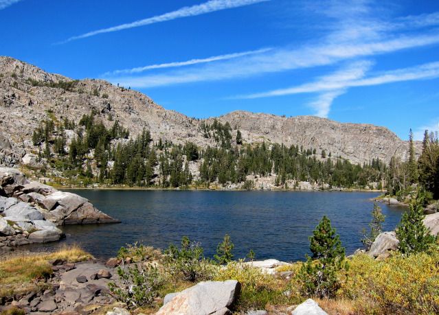
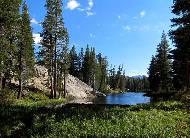
Lake Roosevelt
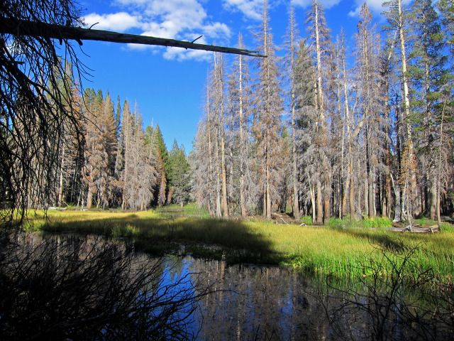
As usual getting out of town was slow so I did not get on the trail until noon. Guidebook says it is 12 miles to the cabin at Upper Piute Meadow; my map program says 11 miles, 2000 feet elevation gain. At any rate – a long ways! It was horribly hot and I really had to push it so the first day was a bit miserable, with only two short rest stops. Good thing I has some left-over acclimation from my summer’s Wind Rivers trip. I reached Upper Piute Meadow at 5:30, where my campsite was already in the shadows. Sunset views were great.

Sunset at Upper Piute Meadows
It frosted early next morning – the cold air really settles into this meadow. I packed up and left by 8:30 heading up the trail. There used to be a trail of sorts from the south end of Upper Piute Meadow up the drainage through “Rainbow” Valley. I never found a trail, but did run across spotty paths. I basically went straight up the drainage, following a beautiful little creek that cascaded down over small cliffs. When hit the upper meadows at 9,100 feet I ran into three guys with horses. They were surprised to see me. The route in with horses is a “secret” and I promised not to divulge it. I continued upstream to the small lakes right under Hawksbeak Peak. I had been in here many times before from upper Thompson Canyon. The fall colors were fabulous and I spent nearly an hour running around taking photos.
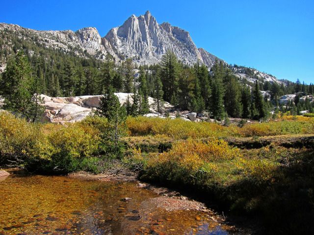
Hawksbeak Peak

Looking west towards Tower Peak
I had planned to camp here but it was still early afternoon so I decided to cross-country over to Tower Lake. I had done part of this route before when I climbed Tower Peak. I traversed a complex but beautiful bench to the drainage northeast of Tower Peak. There was plenty of snow-melt water still running. The continuing short traverse to the trail to Tower Lake was horrible. I reached Tower Lake at just before 5PM and had enough sunlight to take a quick bath and set up. I cooked dinner and while sitting on a rock eating dinner, a day-hiker passed. After dinner I walked to the southwest side of the lake. Most of the 8.2 miles and 2330 feet gain of the day was off-trail and very enjoyable.

View back to Hawksbeak from bench traverse

Spire south of Tower Peak – more impressive than Tower Peak itself!

Sunrise at Tower Peak Lake
My third day would be a lake-hopping journey. I left camp at 8AM and lucked out, finding the marked route to the pass to Lake Helen. It is a pretty well-worn path, probably as much to do with animals traveling over the pass as people. There are lots of deer in this area. I hopped from Lake Helen, to Lake Ruth, to the southern Stella Lake, to Dorothy Lake, to the northern Stella Lake, to Bonnie Lake, then to Lake Harriet. I decided not to go up to Cora Lake because it was noon by the time I got to Lake Harriet.

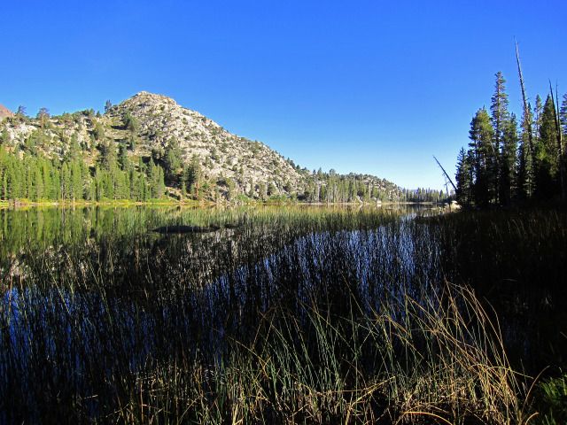
Lake Helen

Lake Ruth

Dorothy Lake

Stella Lake
Bonnie Lake
Then it was a mile or so of trail walking until I left the PCT and did a short off-trail romp past several unnamed lakes/ponds (rough country!) before connecting with the trail to Cinko Lake. It was about 2PM when I left Cinko Lake. I wished I could have camped here – it is a beautiful lake full of fish and has fantastic campsites. But camping here would make too long a next day. I had packed light on food and was nearly out so really needed to be sure to be able to get back to my car in one day.
Cinko Lake
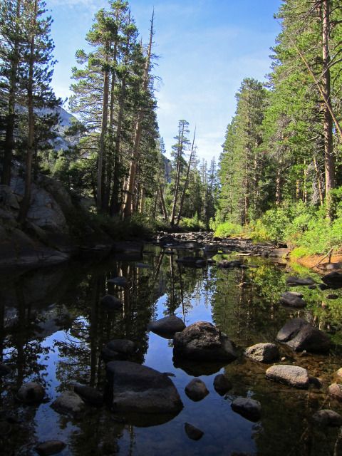
The walk down the upper West Fork of the Walker River was nice- the water was still flowing and clear, unlike much of the algae-choked water in the shallow lakes. I was getting tired and it seemed like a long walk to Upper Long Lake. Now I had to decide whether to camp here or continue to Fremont Lake. In 20/20 hindsight, I should have camped here and day-hiked the Chain of Lakes for photos.
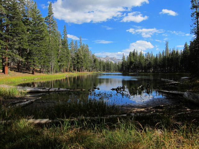
Upper Long Lake
Lower Long Lake
One of the Chain of Lakes
I continued to Fremont Lake, making for a long (13-mile) day and Fremont Lake was not great. I arrived at 5:30 and set up in a large established campsite at the end of the trail on the northwest shore. The water was really gross- I poured water over myself for a bath, not wanting to even get my feet into the stuff. Upper Long Lake would have been a much better place to camp. I met two fellows at Upper Long Lake and they too continued to Fremont Lake. They camped at the other end of the lake but I did not know this until next morning when I ran into them as I left.
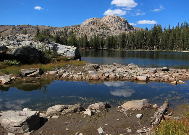
Fremont Lake
Crossing the West Walker River
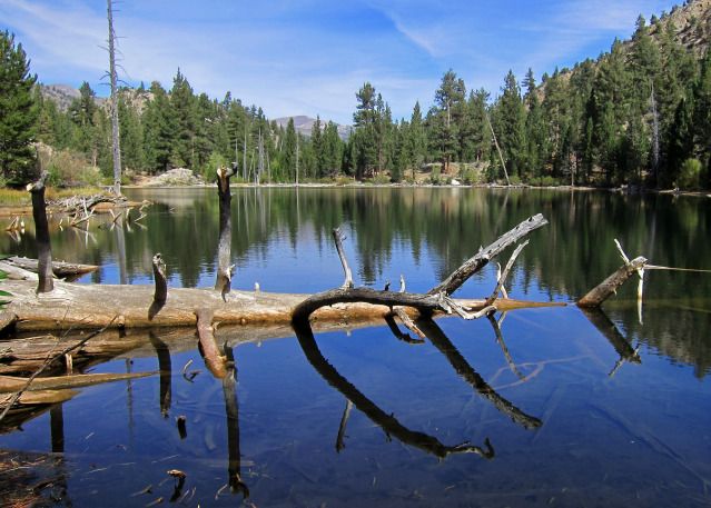
The last day was an 8.5-mile walk out to my car, repeating most of the miles on the trail that I had come in. I took more photos at Lane Lake and Roosevelt Lake. I decided not to take the side trip to Hidden Lake and Red Top Lake. I hopped on rocks across the river where a few years ago, in the late fall, I had to wade across. This year is really dry. But in spite of the dryness, there is still running water and some nice meadows and wet spots remaining. Fall colors were great in the headwaters, but the Aspen are just beginning to turn down at Leavitt Meadows. I reached the trailhead at 1PM and drove home, just in time to run into tons of traffic over Monitor Pass. A fire had closed Hwy 395 south of Minden.
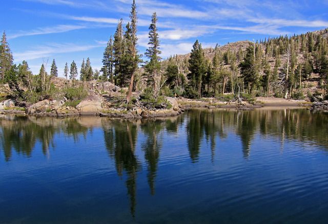
Lane Lake