
--------
I picked Jess up from work at 1:45pm, having spent all morning searching for and packing gear. We made great time until Jawbone Canyon, where there was an accident that completely closed the 14 freeway. We took the detour east, then north, and came out near Ridgecrest. We pulled into the ranger station in Lone Pine 15 minutes before close, and hit the trail to Cottonwood Lakes by 6:45pm.
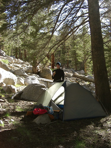
We hiked the rolling trail for two hours until the bugs forced us to make camp about a half mile up trail from the Golden Trout Camp. There wasn't much light left in the sky, but we had eaten dinner in the car so all we had to do was get in our sleeping bags. Once the tent was set up we walked about 100ft away, then sprinted towards it and madly threw all of our gear, and ourselves, inside. This technique was fairly successful as only a few mosquitoes made it inside with us. We both slept very soundly with the white noise of the nearby stream.
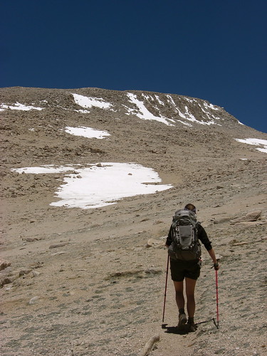
The next morning we awoke with lots of energy and were on top of New Army Pass by noon. Jess thought she had enough energy to summit Mt. Langley, so from the top of the pass we set off on the use trail. We were followed closely by a group of three that chased us for the rest of the day.
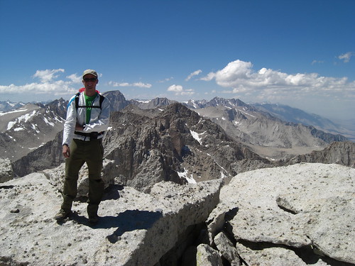
There were a few large groups descending as we climbed, and we were on the summit by 3pm. At 14,027', this was the highest either of us have ever been. We enjoyed the views of Whitney and the Owens Valley for 15 minutes before heading down, just as the group of three made it up. We retraced our steps until splitting off west on the unmarked but very nice trail to Upper Soldier Lake.
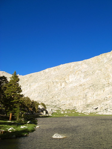
We ate dinner at the east end of the lake, then walked around and lounged on a large rock in the lake for nearly an hour. We set up the tent near a faint trail 100 yards from the northern shore of the lake.
The next morning we woke up baking in the tent as the bright sun streamed in. Again, we were on the trail by 9 and dropped down into Miter Basin under cloudless skies. We crossed the basin and headed up to Erin Lake, where we arrived at 10:30. Having no real plan for the day, I suggested climbing nearby Mt. Pickering. Persuaded by my assurances it would be easy, Jess agreed. She dropped her pack at the lake, and I shed most of my gear, taking only our water bladders and some snacks in mine.

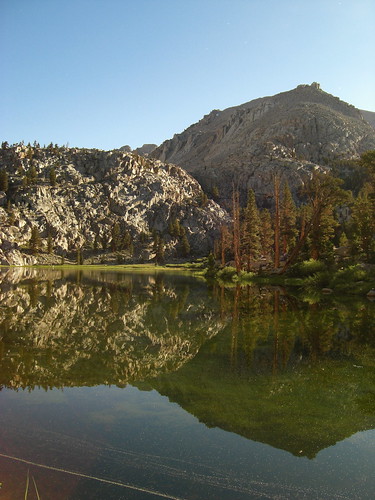
We circled Erin lake and ascended to the two unnamed lakes a few hundred feet above. The large was completely frozen while the smaller was wide open.
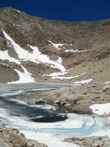
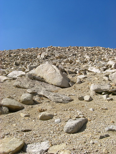
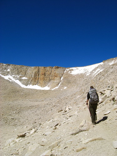
As we looked at the lakes we saw a fox dash over the rocks on the opposite shore, covering in 45 seconds what would have taken us 15 minutes. We walked to the opposite side of the large frozen lake and began to climb the sand/talus. The climb was not technically difficult, never more than class 2, but it was very strenuous. We stopped every 50 steps to catch our breath, then every 40, then every 25.
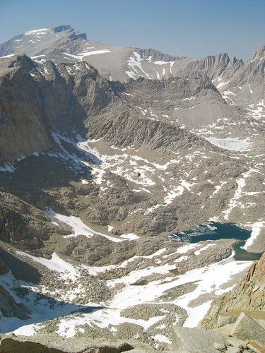
We labored up to the 13,485' summit, but the view was more than worth the climb. The views of the surrounding mountains were amazing, as was the view down into Miter Basin.
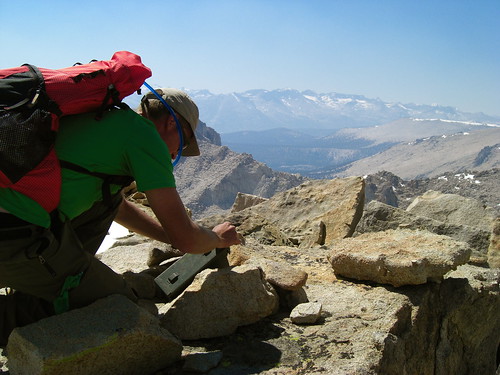
Surprisingly, we were only the 3rd and 4th people to sign the register in 2009, the 1st and 2nd having climbed from Sky Blue Lake just the day before. I signed for both of us with a used match (note to next visitor- bring a pen!):
7/4/09
Happy 4th!
-Trav & Jess
We descended in half the time and arrived back at our gear at 5:40pm, having summited at 3. I made some dinner while Jess napped, and we decided to head for Lower Soldier Lake.
Descending from Erin Lake was made more difficult by the onslaught of mosquitoes. They became extremely bad as we reached upper Rock Creek around 7. Rather than climb the hump and descend to Lower Soldier Lake, we followed the trail that parallels Rock Creek down to Rock Creek Lake before joining the main trail and heading to up to the nice campsites at Lower Soldier. We arrived cranky and exhausted around 8:15 but had an excellent view of the lake and the Major General as we set up camp and fell into our sleeping bags, less than 1/4 mile from our previous nights camp.
The next morning I set an alarm, and we were on the trail for home by 7.
We made good time up the long slog back to New Army Pass. The snow patch on the eastern side of the pass was much more difficult to descend than it was coming the other way. I mostly walked backwards while Jess slid on her butt, and we made it down safely.
Though it was only 9 months since I had descended from New Army Pass I forgot how long of a walk it is. We enjoyed the beautiful Cottonwood Lakes and passed many hikers and fishermen as we headed for the car. We passed our first night's campsite and continued on the dusty, rolling trail for what felt like hours and hours. Finally, out of water and totally out of energy, we reached the car and congratulated ourselves on a great trip.
----
Full photos here: http://www.flickr.com/photos/travistetz ... 044201260/" onclick="window.open(this.href);return false;