
Saturday was the day to see the view from the top down.
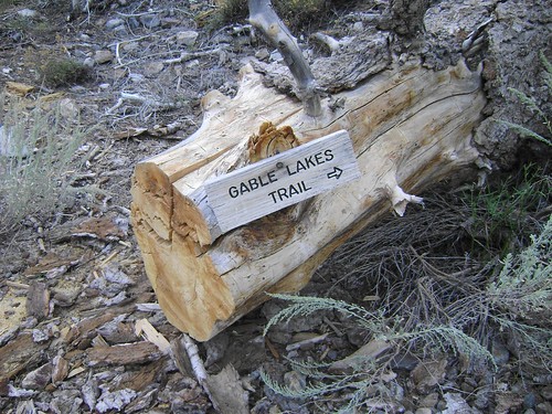
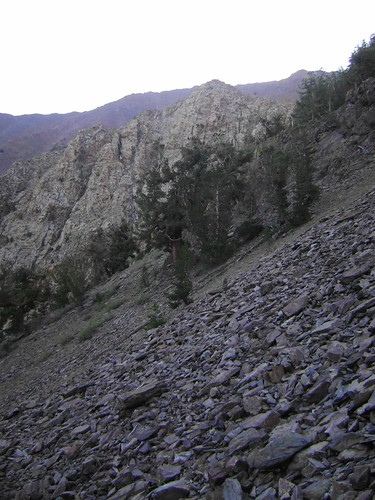
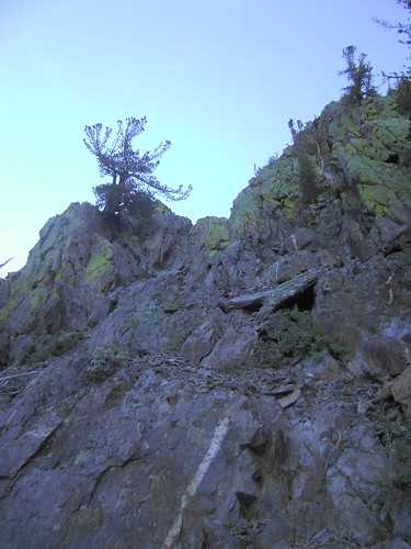
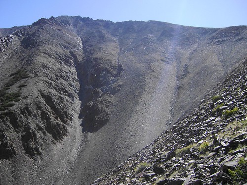
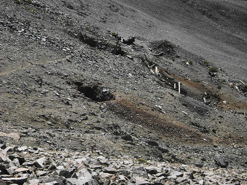
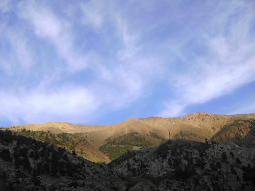
I had heard not so good things about the road into Horton Lakes, and since I was on my own (and didn't want to get stuck like at the Mono Craters a few weeks ago), I decided to head into Pine Creek Canyon and start from there. Rick Kent had told me about the beauty of Pine Creek, with its carved, towering walls of granite , so I was eager to explore a bit. I parked at the Pine Creek and Gable Lakes trailhead and headed south and, well, up, from there. The trail gains about 2200 vertical feet within the first 2 miles, paralleling the cascades of Gable Creek hundreds of feet below. I was trying to avoid descending to the creek, only to crawl back up the rocky and rotten slopes of the east side, so I stuck on the trail until it reached 9600ft, crossing at a meadow guarded at its head by Four Gables. Unfortunately, the plot didn't work: I ended up sidehilling across loose rock and dirt as I backtracked to the gulley, the rock above me on the ridge was chossy and breaking apart in my hands, and the face above the gulley kept cliffing out. So I wandered back down to the mouth of the gulley around 9400 ft and finally entered its enclosure.
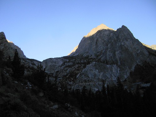
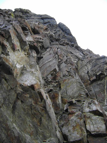
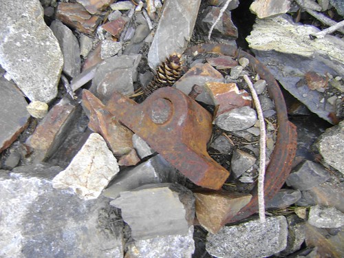
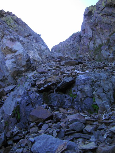
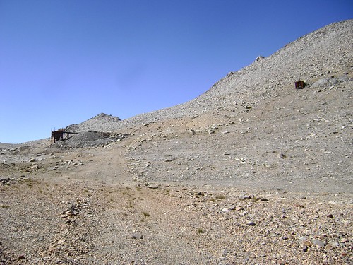
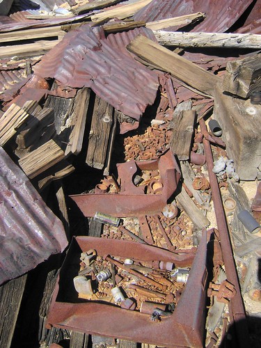
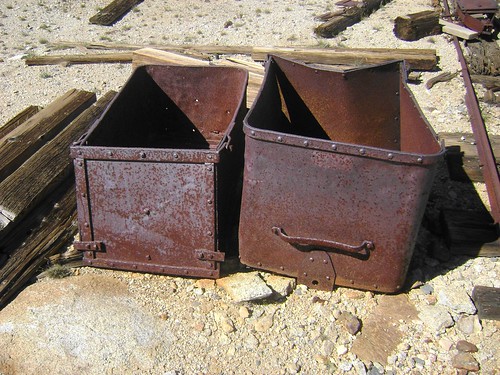
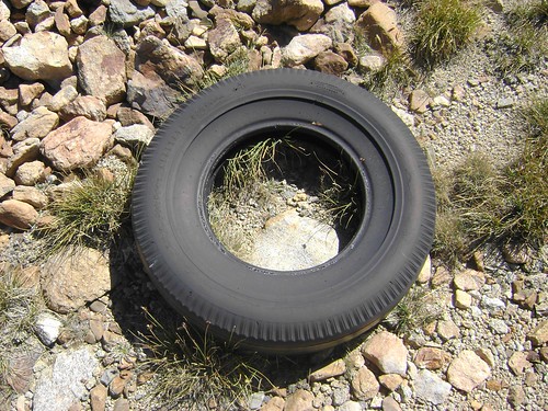
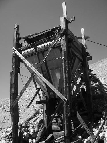
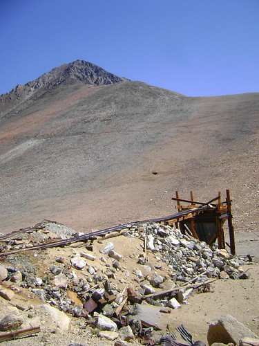
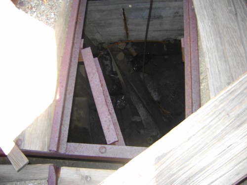
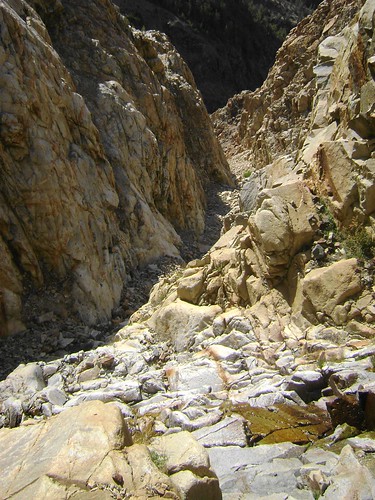
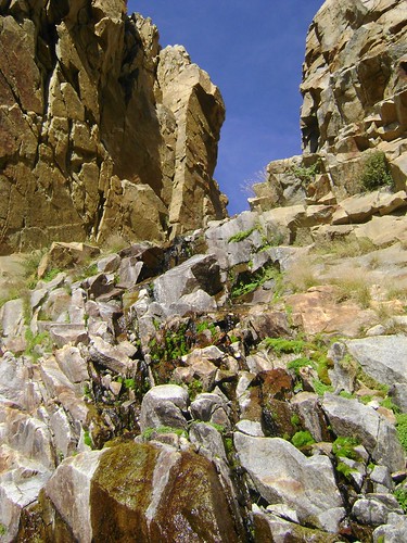
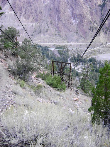
Slot canyons are cool: it was shaded as I scrambled up the rocks, the low rumble of water rolling somewhere under the stones. I stepped cautiously over remnants of the mines above me until I reached a fork where a lovely trickle of water tumbled, offering a cold drink on an otherwise dry day. Although I could see a trestle high above the top of the gulley to the left, I headed right up the cascade and to the ridge above. After scrambling up the broken rock, an excellent exercise in touch balance (don't pull on anything!), I got a full view of the west face of Mt. Tom towering another 3000 ft above me. I trudged up the ridgeline until I hit... a road . No really: the road that apparently connected the Hanging Valley Mine to the Tungstar mine is quite clear still, so I added a mine tour into the peak bagging for the day. I headed across the sandy flats to the ruins of the Hanging Valley Mine and scouted around a bit, finding rusted out parts , carts , pipes, and tires from the not-too distant past. The collapsed mine shaft frame and the silt collector (??) creaked a bit in the breeze, so I found a nice spot out of falling range to eat lunch and ponder my last stretch of climb to the summit.
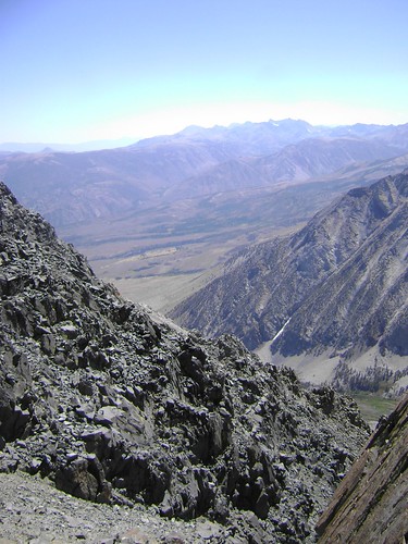
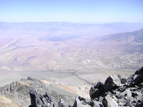
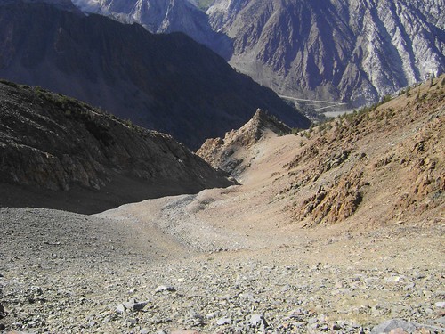
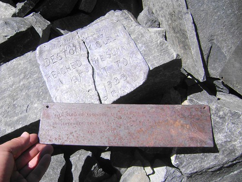
A direct approach seemed the most timely and would spare me a good bit of slogging up the loose rock and scree of the west face, so I essentially beelined it up to the ridge. It's mostly Class 2 with a few Class 3 moves if you want, definitely not spicy-dicey and lots of cool windows to gaze south doen to Horton Lakes, the west side of Basin Mountain, and into the Bishop Creek Drainage. After 2 hours of work I topped out as the Sierra fell away to the Owens Valley floor almost 10,000 feet below. Once again, the breeze stopped, and I was standing on top of the world. Smoke from the Tehipite Valley fire decreased the view somewhat, but besides the view from Brewer at the heart of the Sierra, I have to say that Tom has one of the best views up here. I perused the register , laying back among the rocks, savoring the summit. After an hour, I had to once again will myself to leave the comfort of the sun and rock and start the slog back down.
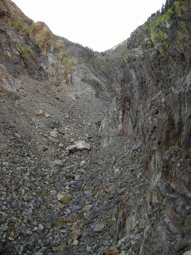
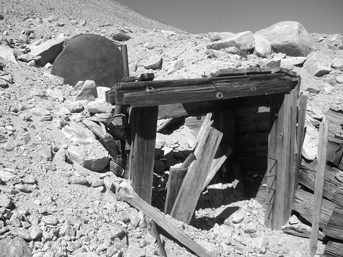
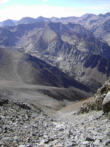
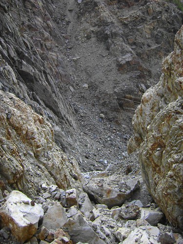
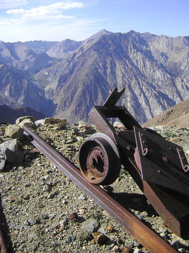
I tried staying on scree as much as I could, but the majority of the west side is just loose rock that has to be carefully picked through in order to descend. I angled down the gulley directly down (W-NW) from the summit, halting half way down to sidehill over to the Tungstar Mine . More ruins , great holes, and abandoned equipment presented themselves to pick through, and the cart (which I presumed to be what would ride on the trestles) creaked eerilie as I walked closer. I backed off quickly when I found there to be a huge hole under the cart! I dropped back into the gulley and proceeded down, choosing my route even more carefully since a fall on rusty parts would mean a tetanus shot (ouch). I knew I was headed to the slot that had been on the left hand side of the fork earlier in the day, and at first it was a simple task of stepping down, stepping down, stepping down.
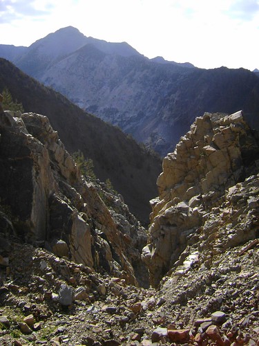
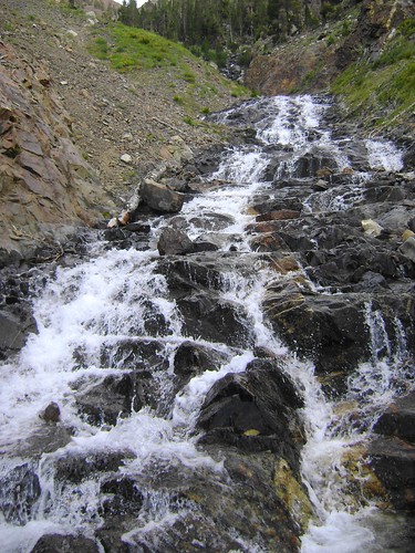
Slot canyons suck: I always get a bit nervous when I see the walls closing in, and this was no exception. All at once I was standing atop a 25 foot waterfall with what looked like some good Class 3 along the right hand side. After I looked at it for a moment, I decided to attempt the downclimb and, without thinking, tossed my poles to the base of the cascade. As soon as I let the second one fly I wanted it back: my poles were committed, but what if I got stuck and had to climb back up? Oh well, those are new poles and I'm not leaving them there. So it was a little dicey but not as bad as I thought, and some good hand and foot holds presented themselves. At the bottom of the fall I grabbed my poles and headed down again, only to see a big chockstone ahead. Son of a ... !!! I really didn't want to climb all the way back out of this beast (I really just wanted to go home at this point), so I scanned the walls, spotted what looked like a short up and over . Just like the morning, though, the rock was friable and sandy. Careful steps and a few whimpers and I was below the stone and falls, and I could see the fork with the cascade just ahead.
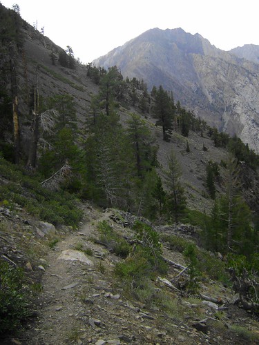
I emerged into the Gable Creek drainage about 30 minutes later, after filling up with water from the trickling cascade above, and having to go up/over or around two more waterfalls. A short scramble on the west side brought me back to the trail , and the GPS was unnecessary once the beer-dar had been activated. I strode down the final 1500 feet to the TOF, waiting patiently at the trailhead. My friend Ashley had been by and scribbled a note ... in the dust on the back of the TOF. Yup, time for a wash. As I drove down the winding road out of Pine Creek, the full moon hovered above the North Ridge of Mt. Tom. Maybe I can convice some of the guys to try that this winter...
A few other moments from the day:
Rest of the pics are here .
From the luckiest girl in the world: Climb Hard, Be Safe.
-L