
...
...
...
...
...
...
...
...
...
...
...
...
...
...As he drove me back to Onion Valley to pick up the TOF.
Onion Valley to Whitney Portal "Almost" Day Hike
I was going to have a pretty normal weekend. Maybe a Gould-Rixford traverse. Maybe a Gould-Dragon loop. Something out of Onion Valley. But then Richard asked if he could get a ride from the WP to OV so he could do this crazy thing. He'd had an idea to try it ever since reading a report by Scott McKenzie about running that distance, and he wanted to try it at the full moon of July. Next thing I know he's inviting me along. Well, OK, this would definitely fit in the realm of new challenge to my body and new territory to explore!
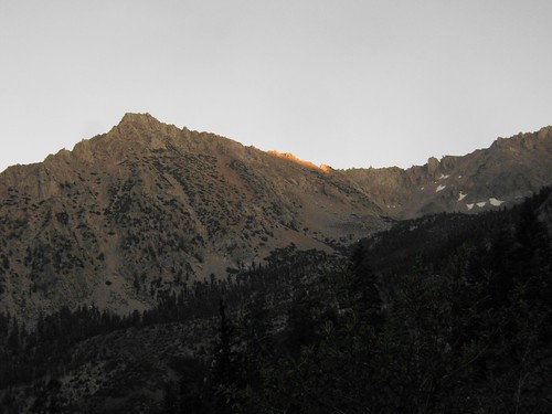
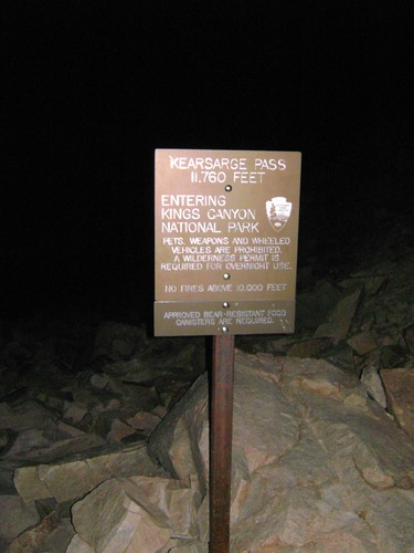
So I met Richard at the Portal Friday afternoon after work, where we feasted on burgers and fries before heading over to Onion Valley . We hit the trail around 7:40 or so, just as the last light faded, coloring Independence and University Peaks a brilliant orange. Shortly after the first star emerged above Independence Peak, a bright copper moon oozed over the ridge and brought the world back to life. The moonlight reflection off the bright granite made headlamps unnecessary as we climbed past Heart and Pothole Lakes to Kearsarge Pass . We made the Pass in just under two hours, and we were on our way.
Beyond the Pass, we used headlamps, sparingly at first, then more as we dropped below treeline once again. We stayed on the high trail to Charlotte Lake instead of dropping into Kearsarge and Bullfrog Lake, getting beautiful views in the bright moonlight of the Kearsarge Pinnacles, the Lakes, and the Videttes to the South. Hiking along in the moonlight would normally be high on my list of completely romantic activities, but this was, well, Richard.
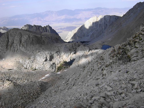
We stopped only once, a few miles south of Vidette Meadow, where the trail rises onto slabs near a grand cascade on the river. The mossies found us instantaneously, but we didn't find the tent 100 yards from us until we had already been talking at full volume for 15 minutes (sorry, gang!!). From there, we started the long haul up Forrester Pass in the dark, which is probably the best way to do it. It's not so bad. No, really, try hitting it between 2-4 a.m. when you're already delirious. It wasn't even that cold until a chilly wind came up about 3/4 of a mile from the top, when I finally put my jacket on (I was wearing a sports bra top and shorts the whole way there). The final 250 feet was agony, but then, there we were! One step across and we were beyond our turnaround point for the trip: committed.
The bright, full moon actually allowed for full depth perception below to the south, where terraced tarns fed golden cascades leading south to the Tyndall Creek Basin. While a steep dropoff exists, the trail is in excellent condition and is at least 3-4 feet wide, and the moon illuminated the switchers for us. Looking back, it's not really a "Pass" so much as a "Wall" that happens to have a squiggly line embedded in the stone.
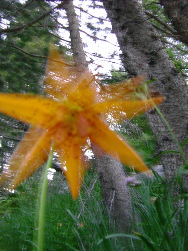
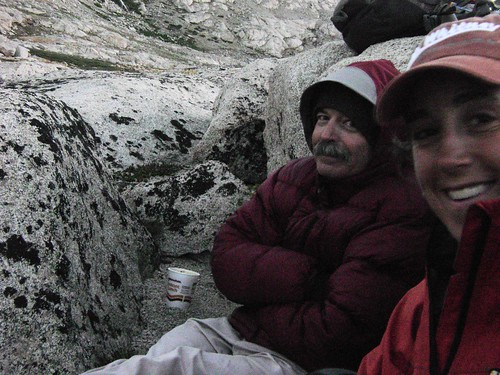
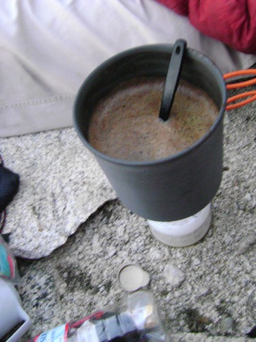
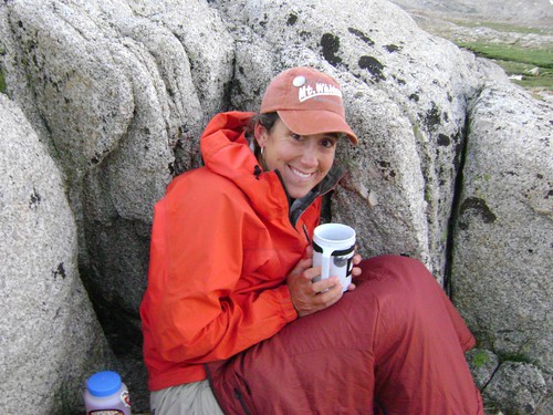
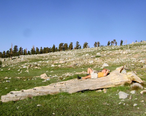
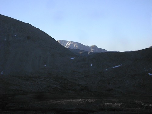
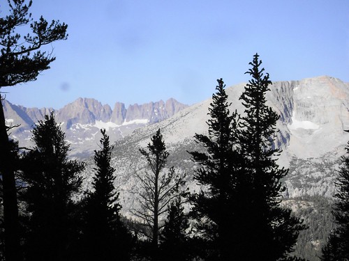
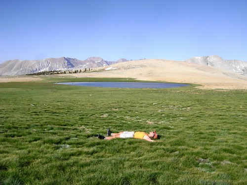
We stopped for breakfast around 0530, just above the Tyndall Creek Basin, when my hallucinations started to get pretty bad. I would wander off the trail to look closely at a rock, thinking that I saw someone's water bottles, or a bench with a plaque on it, dedicated to someone who loved that spot. Richard I had brought my Primus stove and less than half a small can of fuel for boiling water, and we both catnapped while waiting for it to come up to temp for his Cup-o-Noodles and my coffee . Yay, coffee (hazelnut cinnamon to be exact!)!! I wasn't very hungry, and probably should have eaten more, but try as I might I couldn't stomach it. But the coffee did it's trick, and I was energized to walk into the sun, finding a tree for the Moment of Bliss shot of the day. Then even more so as we caught our first glimpse of Whitney , still distant, over the ridge south of Tyndall .
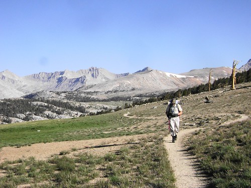
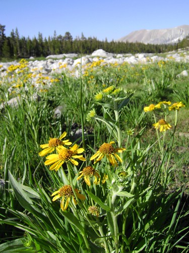
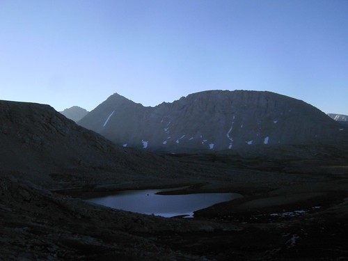
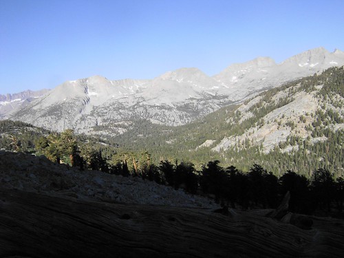
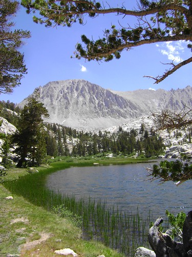
By 0800 we were heading up to the Bighorn Plateau, having forgone the visit to the Tyndall Creek Ranger station 1/2 mile south of the trail. The sun shone warm through the trees , and the Great Western Divide and the Kaweahs stood guard over the Westside. Above the trees once again, the green grass of the meadow covered the sand, and a lonely tarn shone blue in the early morning air. I was excited to be at the Wallace Creek Junction again, as it brought back many memories of my trek last summer. When last here, I didn't have my camera, and the smoky air obscured some of the grander views, so I was thrilled to be able to shoot some of the scenes as we continued south. I motored out of the drainage, knowing that we were headed for home, but it was also here that I started to feel some of the effects of fatigue. The uphills were slower, and my breath catching a bit faster. But my appetite was also returning, a hopeful sign that I could get enough energy for the big push out and away.
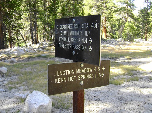
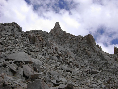
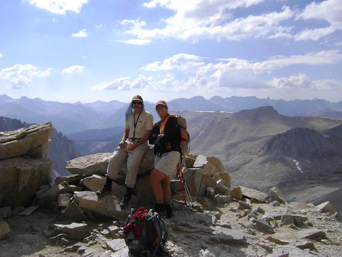
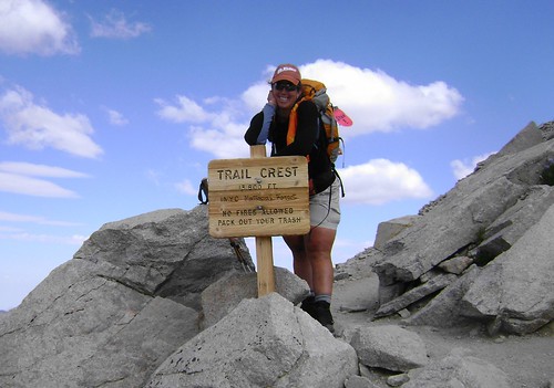
Richard and I rested at Upper Crabtree Meadow, near the Junction Sign, changing socks, munching as much as we could. The ground was starting to feel really comfortable as we put our packs together for the drive upward. We knew it would take at least 3-4 hours from that spot to reach the summit, and then the long walk home another 3. I wanted to keep it under 24 hours, but Richard was more interested in just finishing it in one single push without sleep. Hmmm... The trail to Guitar Lake wasn't bad, and we took my shortcut from Timberline Lake to avoid the up and over that the trail follows. We tanked up at the outlet of the tarn above Guitar, then both looked at each other and said, "This is gonna hurt." Just a bit above that, my body decided it had had quite enough, thank you, unless you get some sleep you silly girl. My energy drained (despite eating/drinking), I urged Richard ahead, knowing I would get there, but a LOT slower. I knew I should have packed the scotch: a shot was exactly what I needed for a recharge! I searched for the Sphinx Spire above that marks the JMT junction, and almost fell over when I saw how much elevation I still had to gain. I would catch glimpses of Richard, moving steadily up, and at one stop yelled to him that I was a long-shot for the summit. He had mentioned that he was jettisoning his pack at the Junction, so I knew he was going for it. After many fits and starts, then finally yelling at myself that "No one is getting you over Trail Crest but you, so MOVE IT!" I reached the Junction. Richard had headed up, so to avoid his pack being chewed up, I put it under my head, buried myself in my bivy, and fell asleep. I've never slept so hard! I awoke after about 45 minutes and continued to eat, watching for Richard to come down. By 1630 he was back at the Junction, and we got our " summit photo " there. Some energy had returned to my legs, so it made the ascent to Trail Crest a bit less painful.
The cruise down was slow, my legs agonizing over every stair, despite help from my upper body through my poles. We rested a few times next to the trail, and all we could do was look at each other and giggle. This had been a ridiculous quest, but an amazing day. We reached the Portal shortly before 2100, making a 25:20 time. So, ALMOST a day hike.
Today, was, well, painful. I just walked out to Carls Jr to meet some friends who came out from a trip to Four Gables, and it was the most normal thing I did all day. I even watched a movie this afternoon. Almost normal.
A few other observations:
I noticed a thread on a lighter pack (on the Whitney Portal Store Board), and wanted to list the items in mine for this trip. I don't think I would have changed much, based on current weather and other conditions.
Tom Harrison MT. Whitney High Country Trail Map
Tifosi Sunglasses and Hard Case
Black Diamond Headlamp
Sea to Summit iPood
1/4 bottle Kinesys Sunscreen
<1/4 bottle REI Jungle Juice
1/2 purse pack Kleenex
2/3 2 Fl. Oz bottle PUrell
Garmin GPSmap 60CSx
Sony DSC0S700 Camera
OR Synthetic Jacket
Black Diamond Powerstretch Fleece Gloves
REI Taku Rainshell
Red Ledge Rain Pants
Moose Hat (snow hat)
REI Minimalist Bivy
REI Insulated Mug
Primus Ti Stove
1/2 Small Can Fuel
Dry Socks
Platypus 3L bladder (only carried 1-2L at a time)
Old-style plastic Nalgene 1L Bottle
10-Essentials Brick: first aid kit, space blanket, space bivy, extra Headlamp (BD Ion), Knife, matches, firestarter, hand/body warmers
Food:
Here's where I think Richard and I both could have cut weight. We both brought WAY too much, but I didn't count on losing my appetite like I did. Oh well, the Rainier cherries were really yummi, and Gu at 0225 in the morning is the most disgusting thing EVER.
I had a great time, thanks to Richard for inviting me along!
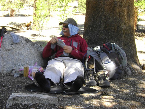
A few other moments from the day:
What everyhing looks like after a 40+ mile day:
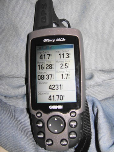
A few stats and elevation profile (someday I'll learn how to upload this info to my computer!). It's off maybe a 1-2 miles and +100-200ft because the batteries died somewhere between Wallace Creek and Crabtree.
The rest of the pics are here. .
From the luckiest girl in the world: Climb hard, Be safe.
-L

