Topics covering photography and videography of the flora, fauna and landscape of the Sierra Nevada mountains. Show off your talent. Post your photos and videos here!
Hi Maverick,
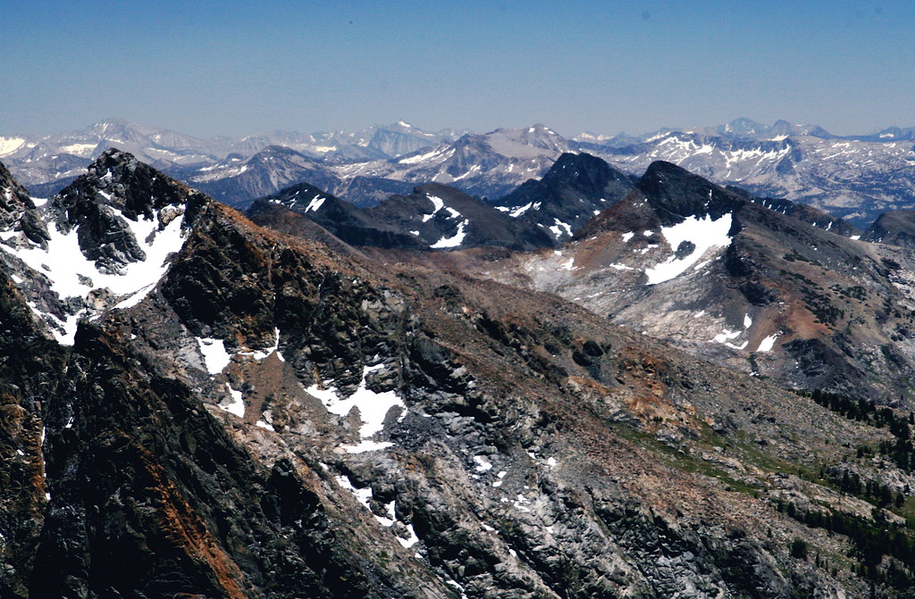
OK, I'm finally getting my brain to work again, and as I pointed out in the postings in the Backpacking forum, I was originally under the mis-impression that this photo (which you also posted in the thread I started in backpacking) was from up in the Hoover wilderness (which did not compute at all). Anyway, it obviously all makes a lot more sense now!
So, having piqued my curiosity: since you were up there in June (probably about a week before we got there), I'm assuming that it was very likely your footprints along the northeast "shore" of the upper Blue lake, and possibly also your bootprints we encountered over in the Lyell Fork of the Merced. Or, I guess it's possible someone else traipsed through there too, but on our meanderings there was very little sign of prior activity this year (and probably even fewer signs when you were there). Finally, if you don't mind, did you enter from the west, or east side? I've always started trips in that area from out of Mammoth (Devil's Postpile/Agnew meadows), but it looks like westside entry might be slightly more expedient. I guess it's still a long slog, however one does it, but if westside is noticeably easier, I'd be keen to give it a try sometime (especially, since I'm very interested in returning to the Lyell Fork area)!
cgundersen
Here is the link to my trip report. Sorry about the misspelled words
but I had just gotten back from my trip and was to tired to proof read it.
And yes the approach is quicker from the west. viewtopic.php?t=1962
Hi Maverick,
Wow, cool trip! And, the more I look at the maps, and from your comments, it looks like west side entry is the easier way to go to get back to that same general area. However, in most "normal" years, the flowers along the high route out of Agnew meadows make the long schlep worth it (to me).
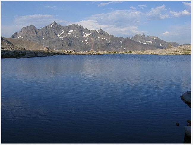
Anyway, based on some of the updates on photo posting, I'm going to try to insert a shot from Blue Lake here, and if it works, I may follow up with some additional shots from the trip that got us back to Blue. [img]"http://farm2.static.flickr.com/1319/979 ... f676_o.jpg"[/img]
cgundersen
Hi Will,
Thanks; I feel like I'm on a very slow asymptote toward the solution. The proof is when it finally works and I'll give it a whirl again,soon!
Thanks!
cameron