A tour through the Western Graian Alps
Date: Juillet 2011
Participants: Tout seul
La météo: Brouillard. Grésil. Soleil Brille du temps en temps. Orages.
Distance and ascent:
Day One: 19km, 12 miles, 1800m
Day Two: 18km, 11 miles, 1540m
Day Three: 19km, 12 miles, 1114m
Day Four: 19km, 12 miles, 1200m
Day Five: 19km, 12 miles, 1650m
Day Six: 23km, 14 miles, 1200m
Day Seven: 23km, 14 miles, 1650m
Day Eight: 7km, 4 miles, 21m

Day 1 in red (confusingly day 8 is too) from bottom right to join Day 2 – orange, then Day 3 to Day 4 – shades of green. Then a gap when my tracker did not work...or perhaps some idiot inadvertently turned it off at a cafe :oops: Day 5 is a fetching light blue which becomes a darker hue of blue on Day 6. The seventh day is a looooong and attractive purple. Day 8 a mere red squiggle to the valley.
There are a couple of classic tours in the Vanoise – and this is neither of them 8)
The trip started well with a train strike.....a tad annoying as I needed to get from Turin to Modane in France; ah well. Italy. Ice cream
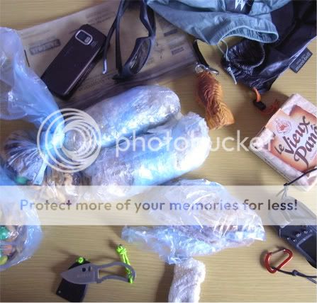
Also a little time to contemplate my footwear choice....

....whilst suffering the rude privations of Base Camp 1...

But all became well and soon after tunnelling through the mountains to cross into France I decanted myself at Modane the day after the Tour du France went through. One can only hope it was a bit more lively then.

Dull and overcast as I begin the steep climb (all 1500m of it) out of the valley.

Its drizzly and cool. Nice...no really as the climb is severe.
I’m hungry....but can only manage a small bite...


Heading up to the 2287m Col du Barbier where I think to camp.
Once there I think again.....


....... and head down to a cosy car park.

Those few that are enjoying the drizzle drift. It rains and hails steadily (I guess as I sleep pretty well) through the night – the morning; snow down to about 2300m....me at 2200m
Day Two: 18km, 11 miles, 1540m
Cessation of precipitation. There is a Refuge about 200m up the hill. Breakfast. It’s a cold and windswept place on this morning.
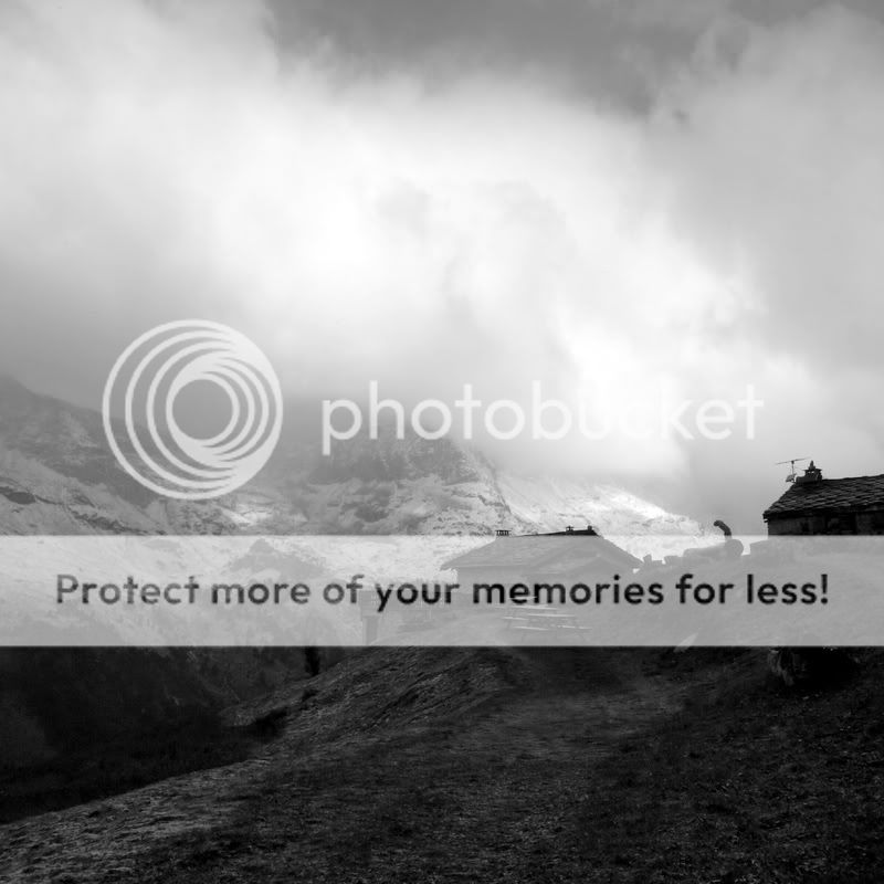
The belvedere around the eastern flank of the Dent Parrachee traverses then lifts in a series of hairpins to more traverses. Fine ice spicules rain down but I am snug in a windproof, contouring through black and white screes.


I’ve outrun all the refugees who were leaving as I took breakfast at the Plan Sec. The sun breaks out for the final drift to the Refuge de l’ Arpont settled on a small rise at 2300m with a sea of glaciers behind it.


...a little refreshment is available......

Of which I don’t partake as I dry the tent and command a demi-pension bivouac....as in Dinner, Bed (camp outside) and Breakfast. I can’t stand refuge dortoirs...they are not for me. And a €400+ fine awaits those who might wild-camp in the park itself....the only National Park in France with such a restriction.
A nice dinner on a completely French table is fun as I gently take the piss....they warm to it..I think. Announcing I have to put my tent up is a surprise to all....I get someone coming out to help me (it is gusting 40mph) which is nice. Back inside it is ‘chapeau’ and a few Genepi (local herby spirit) are lined up for me
I sleep just fine.
Day Three: 19km, 12 miles, 1114m
At 05:00 the light shows begin...

Breakfast is the usual choking on stale bread. Hmm.
An early morning Chamois lightens the gloom....and very soon the sun helps further.

Evidence of the 15cm of snow that fell the day before is scarce...


But this is a fine day of easy wandering through Alpine pastures with views back to decaying glaciers and their spoil and views ahead to Italian mountains and the promise of high passes.
Then its down to the Pont de la Renaudiere and a divergence from established Vanoise trails. For some reason I feel the compunction to climb some higher passes. Idiot.

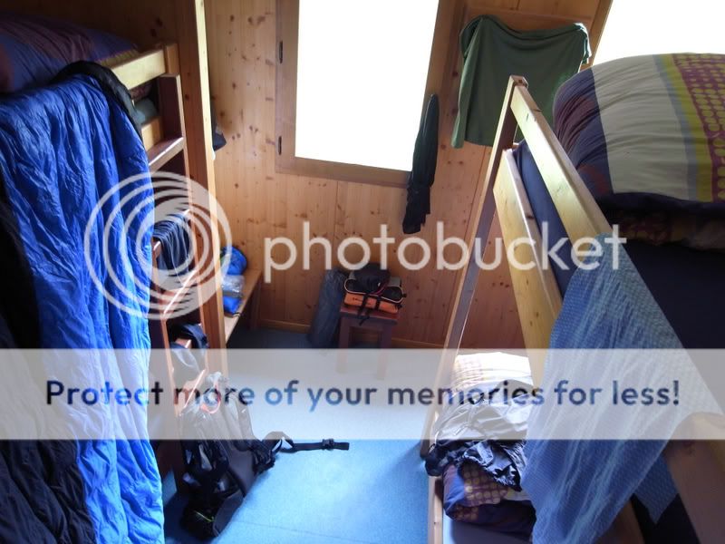
But first it’s a night actually in a refuge – it’s so empty I can get a room all to myself.....such indolent self-indulgence.
Day Four: 19km, 12 miles, 1200m
After a very quiet night I leave the Femma early, heading up towards the Col de la Rocheure.

And it bites. So far altitude has not really hit me, but as my breathing goes sideways and I feel uncomfortable I know it’s there....slow down (barely possible


At about 2800m I arrive at an open glacial pasture, rocky, wet and barren. Wheeze wheeze.

Next a small lake (thought of a dip not uppermost in my mind), and then the 2911m col. Phew. And breathe.

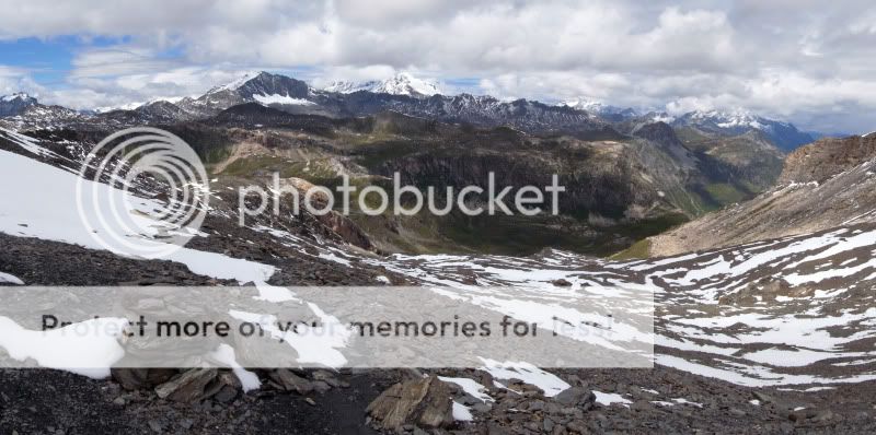
The vista that opens up is absolutely stunning, one of the finest views I have had as yet in the Alps....or maybe I always think that..


It’s warm enough to stand around so I tarry awhile. Then it’s off to the East on a diversion a guide in the hut has told me about, a high alpine traverse across an established ski-rando route that will link me with another refuge then col. Rather than drop down to a nice sunny little ski-town. Quite what I was thinking I don’t know


I’m almost on my arse as I cross the first steep snows – the soft looking footprints across them are iron-hard neve this early in the day; so the alu points are strapped over my shoes as a slide onto the glacial debris yonder does not appeal. I only use them once more then things get lower and more clear.
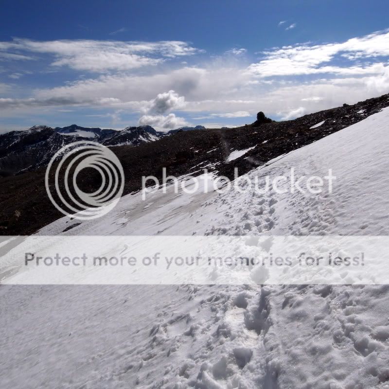
This is another vast glacial bowl where snows linger for 10 months of the year I would guess.


The way has been well-walked and hence my earlier trepidations are put to bed and a fine flat valley ends most of the descent and marks the beginning of the Ruisseau des Fours, a river which runs down to Val d’Isere....cafes, cakes, and coffee.
Not for me that soft life
I get to ford a freezing river and stand with squelchy feet watching a couple of chamois play. Luxury.

After a cheesy omelette at the Refuge des Fours I decide for some idiotic reason that the Col des Fours is well within my alpine walking compass. It seems I don’t understand my limitations and altitude kicks me rather severely backwards as I attempt the crossing.

I have plenty of time to admire the col from below.

Relief and strength return quickly once I am actually at the 2976m col.


I don’t linger as a loooong descent still lies ahead and it is busy, being quite easy to access from the road I am heading down to.
Choice of ways down.....I go for the snowy (soft) one that chops through the terrain the glacier used to inhabit just a decade ago – it’s nice linking medial moraines that snake to the valley floor.


I slip into automaton ‘this isn’t really hurting’ mode for the descent....1700m is a long way down but at last Bonneval-sur-Arc hoves into view.

As does the first real coffee for four hard days....and a piece of Tarte des Myrtilles.......which is strangely absent in the photo

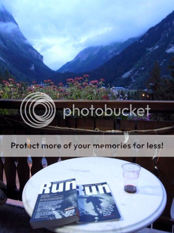
A day off beckons.

Rest, resupply, relax.
Day Five: 19km, 12 miles, 1650m
I leave Bessans in a light to medium rain that will continue most of the day. After a few Km’s the pack goes down next to a font at the bottom of the days major climb. A mumbled ‘Bonjour’ to a couple who have just descended. I look at them, they look at me..’Ed’ say’s she. ‘Indeed’ say I. Friends from Sheffield, not seen them for years 8O
Some time later I am halfway up the climb.

With better company


I’d not realised that was a bull when I had ‘persuaded’ it to get out of my way with the walking pole.....
This is another fine belvedere route contouring West across to the Crete de la Turra at about 2000m.

Once at the aforementioned Cretes a thick mist rolls in for the evening, blanketing the hillside and obscuring all views. As I am not in the Park I bivvy, have a coffee and some hot food and retire for the evening. A fine day, old friends, great walking, soggy campsite.
Day Six: 23km, 14 miles, 1200m
The morning is still dank, but as I brew coffee and decamp the sun burns through....it’s great, like the day is waking up with each second seeing changes in light, space, and clarity of views.


A terrific mountain vista opens up – an inversion obscuring the valley but burning off fast.

These are the hillsides and mountains I was on just a few days ago, the change in perspective means I play little cartographic games in my head for much of the early day.
It’s a bit of a rush to the first hut – the Refuge du Plan de Lac as my powdered breakfast has not really done enough.


And breakfast (only two-hours late) arrives....

Soon I cross my path as I head up the Vallon de la Leisse two-thirds of the way towards completing the wobbly figure-of-eight route I’d planned.

But first the Col de la Vanoise must be crossed – its low, but I still find it hard going. And busy. Very.


There is a fine old stone refuge at the col...which sleeps about 150 I think.....it is counterpointed by a cafe that looks like it has been made from packing cases that is crawling with people. I don’t tarry – it’s a honeypot too far for me.

The valley and a bed tempt. The 1100m descent in sweltering heat tempers that anticipation of comfort somewhat
Nay matter....a commodious accommodation is obtained.
Day Seven: 23km, 14 miles, 1650m
It is hot. Had I known it I could have taken the little motorised tourist train to the trailhead....if I could ever have recovered from the indignity. But it is a pleasant (very steep) walk on good tracks away from Pralognan-la-Vanoise towards the Refuge Peclet Poset.

The crowds thin out higher up the trail, it’s a good area for picnicking.


Alas at the refuge they tell me that bivouacking at this one is not allowed....and as there are rangers about I guess they mean it. Ho hum, tomorrows col suddenly becomes today’s. I re-gird my mental loins as I head up past a rather bizarre ‘garden of cairns’....


This climb, to the 2796m Col de Chaviere is easy in one respect – my lungs have adjusted, but tough in another, there is loose 45 degree scree to play with just before you top out...

Once there, slightly more ‘rural’ grassy vistas open up to the South – skiing territory; but the views are good in all directions.

And the descent straightforward and well marked.

There are a lot of craters around and I wonder if these might be the culprits..

Down.....down....

I am the only guest at the private refuge. I camp outside and eat (a lot) inside.

Day Eight: 7km, 4 miles, 21m
Not a day as such...more like 90 minutes. Straight down to Modane.


Not the most prepossessing place to stay so I hop a train for a day in a nice village before the flight and train home.