Page 1 of 2
Help, 30 mile loop, no snow, nor cal, not on the coast?
Posted: Wed Apr 27, 2011 9:36 pm
by lanceduffy
Sorry for the tedious requirements but those are the ones I am facing. I need a loop hike, preferably 150 miles or less from Chico CA that will have very little snow on it. Total trail length, 25-35 miles suitable to beginner and intermediate backpackers. Thanks for your time!
Re: Help, 30 mile loop, no snow, nor cal, not on the coast?
Posted: Thu Apr 28, 2011 8:52 am
by maverick
Hi Lanceduffy
Welcome to HST!
You did not indicate when you wanted to go on this trip, which is a big factor, especially
this year.
Re: Help, 30 mile loop, no snow, nor cal, not on the coast?
Posted: Thu Apr 28, 2011 9:01 am
by lanceduffy
Sorry, mid May.
Re: Help, 30 mile loop, no snow, nor cal, not on the coast?
Posted: Thu Apr 28, 2011 9:08 am
by maverick
Way to early! Trinity, Marbles, Russian Wilderness will be blanketed with snow into
July.
Even if it was not a big snow year, May would still be to early.
Re: Help, 30 mile loop, no snow, nor cal, not on the coast?
Posted: Thu Apr 28, 2011 9:30 am
by AlmostThere
I know you said, but NO SNOW is going to mean the coast.
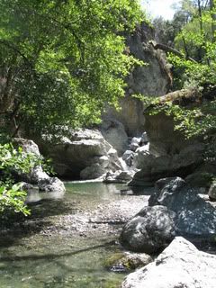
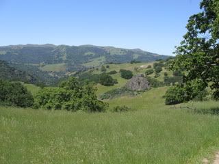
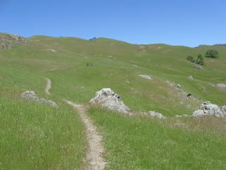
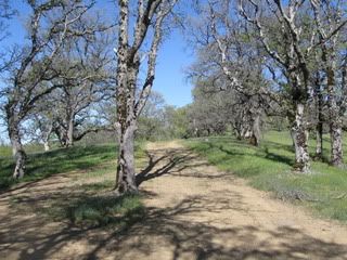
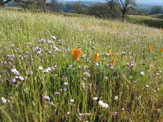
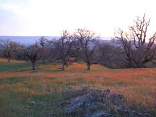
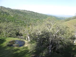
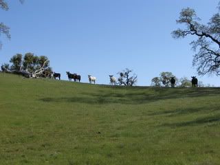
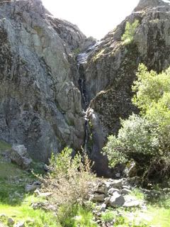
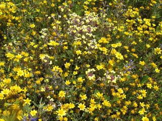
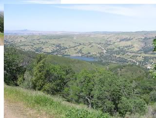
Henry Coe if you are willing to tolerate steep hills. Point Reyes if you want short days and very scenic hiking, tho permits will be a bit of a struggle. And Skyline to Sea should be opening the trail camps in May, it's about 30 miles one way, with a couple of cars you can place one at Castle Rock and another at Waddell, and have a great beginner backpack. You'll want to call the info line as posted on the internet to reserve campsites and determine parking/camping fees for your group. Ohlone will be like Coe, steep inclines, but good in spring for wildflowers. All of these are central coast, SF area, and great for beginners.
I just did a Coe overnight - saw a gray fox, white tail kites, lots and lots of waterfowl and tons of flowers. Plan out the camps fairly close together and the hills will be less arduous. You can make a decent loop from Hunting Hollow with less elevation gain if you are good at eyeballing a map - going out Grizzly Gulch trail is a gradual up and out, and you can return over Lyman Willson and down Hunting Hollow on the way back to the car. The final creek wade is quite refreshing.
Re: Help, 30 mile loop, no snow, nor cal, not on the coast?
Posted: Thu Apr 28, 2011 12:11 pm
by dave54
Your backyard. Ishi.
Shorter than your specs @ 20 miles, & an out & back, is the Yana trail between Redding & Red Bluff.
Re: Help, 30 mile loop, no snow, nor cal, not on the coast?
Posted: Thu Apr 28, 2011 3:01 pm
by lanceduffy
Thanks for the information. Since the trip is happening in May and I want as little snow as possible, it makes sense that the coast would be where its at.
Point Reyes is looking good. Anything else in that area or closer to Chico?
I wish the ishi wilderness would work but it will not.
Re: Help, 30 mile loop, no snow, nor cal, not on the coast?
Posted: Fri Apr 29, 2011 8:20 am
by Ikan Mas
Re: Help, 30 mile loop, no snow, nor cal, not on the coast?
Posted: Fri Apr 29, 2011 9:56 pm
by lanceduffy
Thanks again for everyone's help. I am seriously considering Ohlone. I called the park today, they could not tell me the milage for the wilderness trail. I am looking for that info and wondering if there are any print (outside of quads and their zoomable map) and web resources that will help me research the area. Thanks!
Re: Help, 30 mile loop, no snow, nor cal, not on the coast?
Posted: Sat Apr 30, 2011 7:10 am
by AlmostThere
The zoomable map is the one they give you as a permit. I haven't seen any other map.
The trail from mission peak to del valle is about 30 miles one way. That doesn't include any side trips you do. Sometimes people do the trail from Sunol instead, parking is not safe on the Fremont end. Most people do it from Del Valle to Mission, which is actually easier on the feet - the Big Burn is much, much better up than down. I went down. Toe bang, smash and crash... did not help that it was muddy and slippery.