Elkhart to NF Bull Lake Creek Wind Rivers WY
Posted: Tue Feb 08, 2011 9:44 pm
Elkhart to the North Fork Bull Lake Creek
Aug 11-22, 2009
Hey its winter - not much happening. So here is the complete version of a trip I briefly reported on last year. It is long, so I will put it in installments.
The shortest access to the North Fork of Bull Lake Creek is from the Wind River Indian Reservation but requires a 4wd vehicle and enters from areas that have reported recent Grizzly bear sightings. However, most of the watershed is on public land and can be accessed from the west if you are willing to walk a bit further A longer approach from Elkhart Park juxtaposes the most used trail in the Wind Rivers with one of the most remote and wild destinations. The wild mid-summer weather of 2009 simply added to the ambiance! Although my official destination was the lower North Fork of Bull Lake Creek, the trip was really a trans-Divide tour of the mid-northern Wind River Mountains.

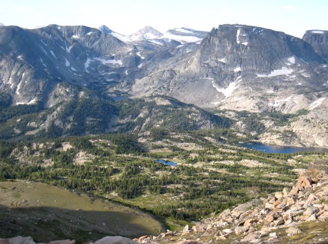
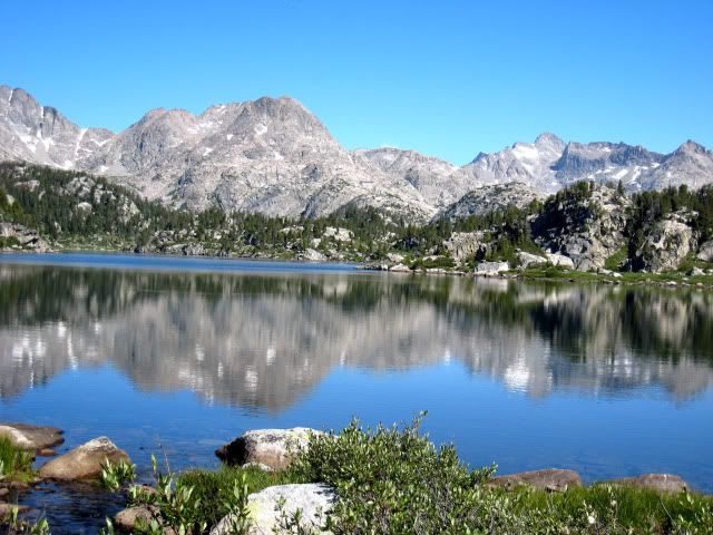
Photographers Point
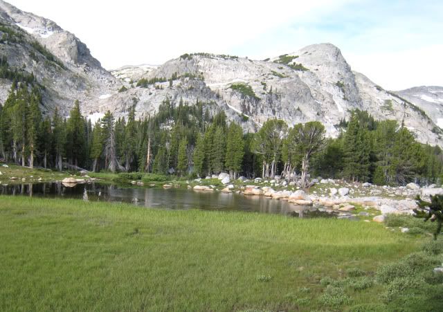
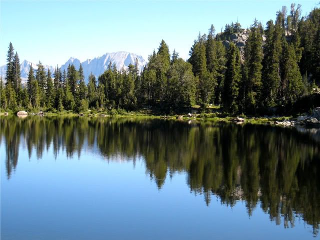
Day 1 I left Lander Wyoming early in the morning getting caught in road construction over South Pass and arrived at Elkhart trailhead just before noon. As I arrived, a major rescue effort (hiker was lost in the recent snowstorm) was underway with helicopters in the air. I lifted my trusty old external frame pack onto my back. It was loaded to the hilt; this was not going to be a fast and light trip! After chasing off a bear less than five feet from my tent a week ago, I decided to take the bear canister. I threw in my down vest and pack cover since a freak early August snow storm hit the mountains earlier this week. Step after step, and two hours later it was a great relief to get the pack off my back to rest at Photographer’s point. Plenty of folks were at the rest stop on this busiest of Wind River trails. There was no lack of unsolicited advice given to me! At Eklund Lake I turned onto the less used and beautiful Pole Creek Trail and reached Mary’s Lake at 3PM. I had never been on this trail and was amazed at the healthy green forest, wildflowers and many beautiful lakes. From here it was two hours of mostly downhill travel to my first camp on Pole Creek just beyond the knee-deep crossing. Another group was camped a short distance downstream. The nine miles carrying a heavy pack on good trails was still exhausting in spite of being totally acclimated from several back-to-back trips. Because of my late start, there was not enough daylight to do much after dinner exploring.

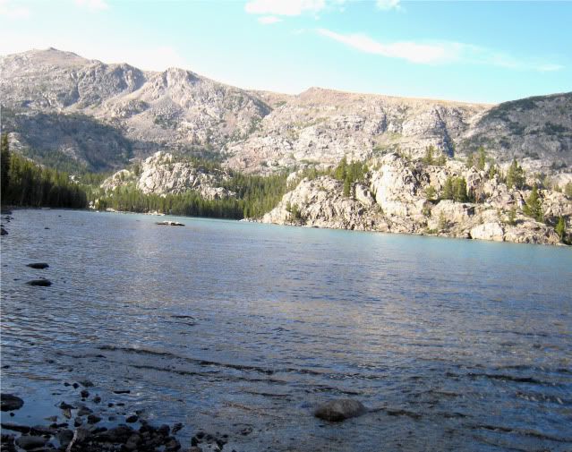
Eklund Lake

Pond on the Pole Creek Trail
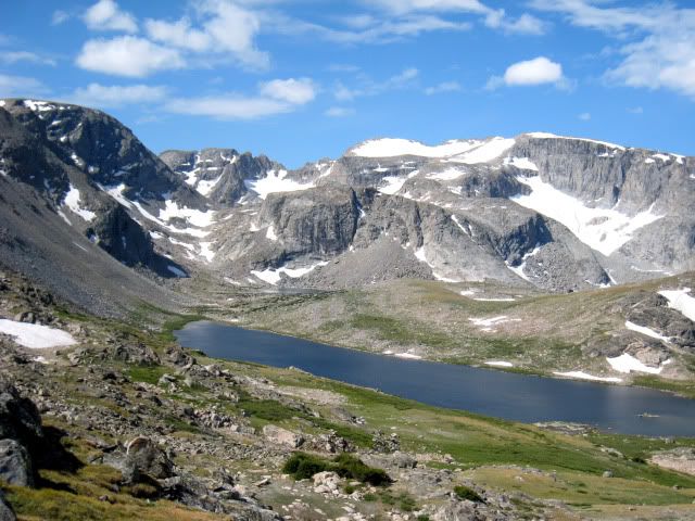
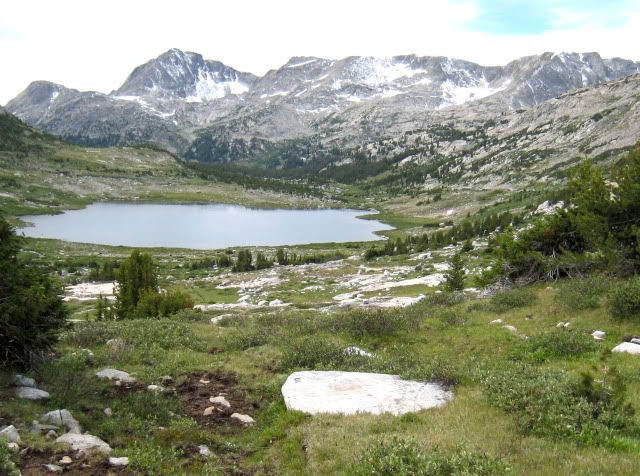
Day 2 I awoke at dawn and at 7:45 and continued up Pole Creek. Where the trail re-crosses the creek an inconspicuous rock cairn showed the start of the faint south-side trail. After tip-toeing through some swampy spots the trail intersected the Fremont Trail where a weathered wooden sign pointed to Hat Pass. I followed the trail to the first lake in Bald Mountain Basin and left the trail, heading to the unnamed pass at 11,663 feet elevation on the Divide north of Angel Pass. I definitely left the crowds not to see anyone for nearly a week! Travel was like an obstacle course finding the way around numerous small ponds and across creeks, mainly walking on grass with lots of little ups and downs. I reached Spider Lake at 10AM and rested only a few minutes before the mosquitoes found me.
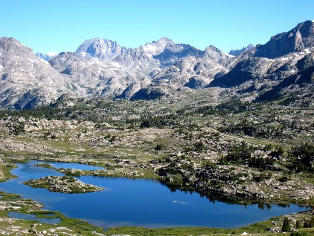
Spider Lake from pass to the south
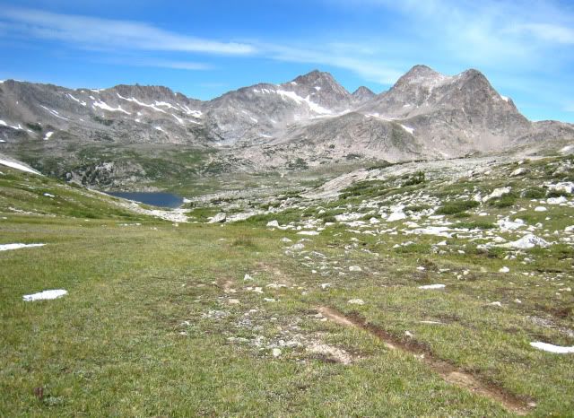
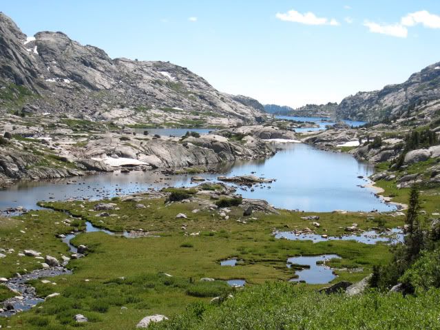
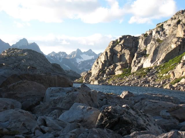
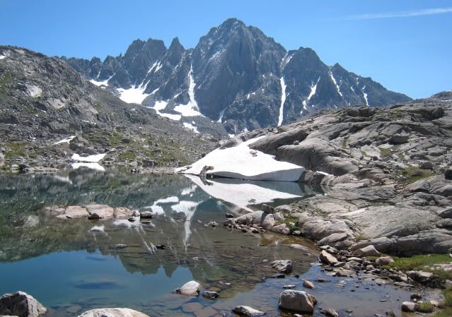
It was another obstacle course to reach Lake 10,950, this time through small cliffs and brush. I started up the steep grassy slopes to the headwall towards the pass. It looked like there was a route on the left side, but I decided to remain in the center and ascending the nearly vertical grass until the slope eased and I entered a moonscape made bleak by the overcast sky. Unfortunately I still had a quarter mile of talus to hop before I reached the pass. Tired of rock-hopping, I stayed on snow as much as I could while descending to the small unnamed lake west of Lake 11,065. After crossing the inlet I took a much needed break. Traversing the north side of these two lakes was a complex exercise. At times I scrambled over huge talus blocks and at times hopped rocks within the lake. The lakes were pretty with patches of green grass and wildflowers but camping was limited to a few lumpy grass spots.

View East from Lake 11065

View west from Lake 11065
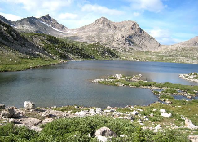
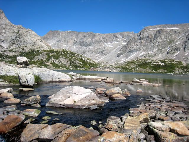
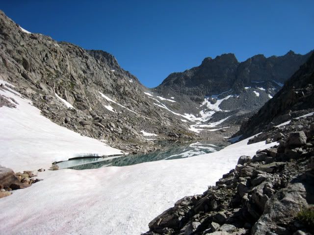
At the outlet of Lake 11,065, I came to a big surprise! Where I had planned to simply hike down the drainage, a huge cornice blocked my path. All the low angle slopes were plastered with firm snow so I had to scramble down rock ledges to the north, lowering my pack at one point. I reached the little “lake” shown on the map at 10,800 feet to find out it was actually two delightful little lakes. Quickly I bathed before I cooled down and while there was still a sliver of sunshine. It began to rain and took a nap. When the rain stopped I cooked dinner and walked around, of course, finding better campsites than the one I had chosen! A pretty sunset ended my 8-mile day of travel through uniquely pristine and challenging off-trail terrain.

Loooking up at the surprise cornice from camp
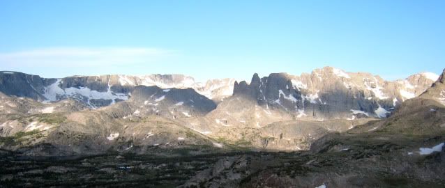
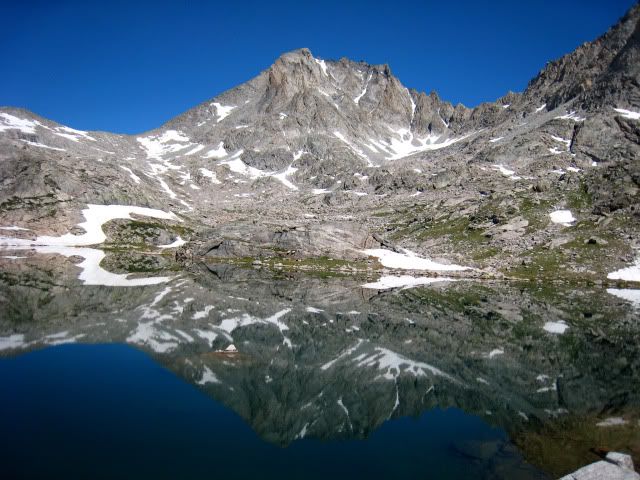
Day 3 I managed to get packed up by 8AM a bit sad to leave my beautiful little home. I traversed northeast, dropping a bit to get around the base of a steep cliff, and in half an hour reached the trail from Golden Lakes. The trail was a delightful path among wildflowers and grass heading to the saddle between the Golden Lakes and Lake 10,787. A well constructed trail descended through a jumble of talus before crossing the outlet stream where I was surprised by a steep snowfield that had not been here in my previous travels! Thankfully it was soft enough to kick steps as I did not bring an ice axe. I continued towards my intended goal of the Brown Cliffs following this old trail, constructed in the 1930’s but not maintained in eons as several collapsed bridges testified. As I dropped to Camp Lake the crystal clear morning gave way to clouds and crossed rocks at the outlet above the first collapsed bridge.

Traverse above the Golden Lakes

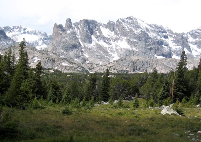
Lake 10787
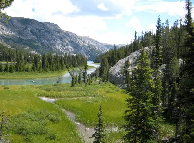
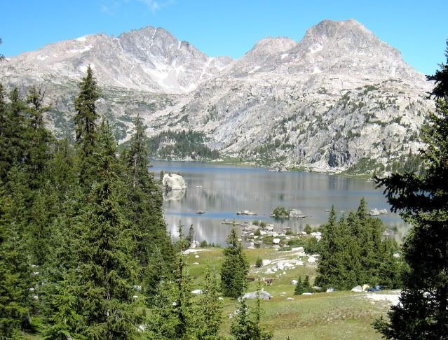
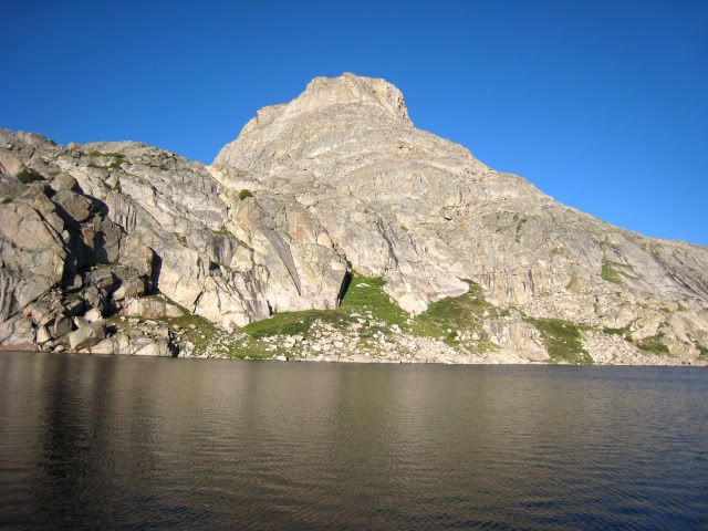
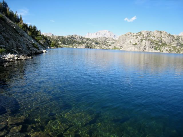
The Brown Cliffs area is popular with the goat packing crowd so the old trail is still quite easy to follow. At Lake 10,239 campers in the distance looked like dots on the green grass. The trail drops another few hundred feet and another creek with an old abutment of another missing bridge. Shortly, I came to the only intact bridge over Snowbridge Creek, with half the logs remaining. Someday what’s left of this bridge will be gone. The creek was roaring, so I was glad the bridge was still there! Ascending the final switchbacks, I got glimpses through the trees of the towering peaks around Alpine Lakes. After hopping rocks across the lowest large lake in the large flat area east of the Brown Cliffs, the trail essentially ends. The entire timbered bench east of the Brown Cliffs is full of game trails, excellent camping, small creeks and ponds and spectacular views. I had planned to camp near Lake 10,590 and took a few photos.

Unnamed lake south of Lake 10239

The Fortress

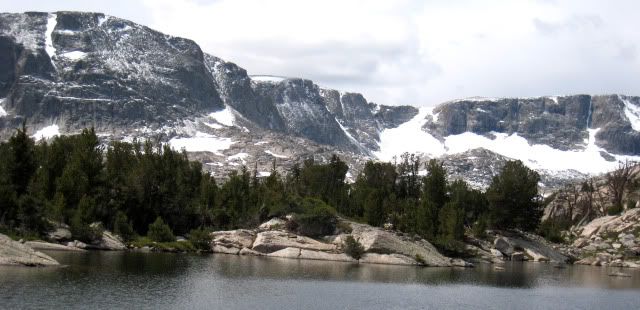
THe Brown CLiffs
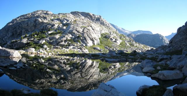
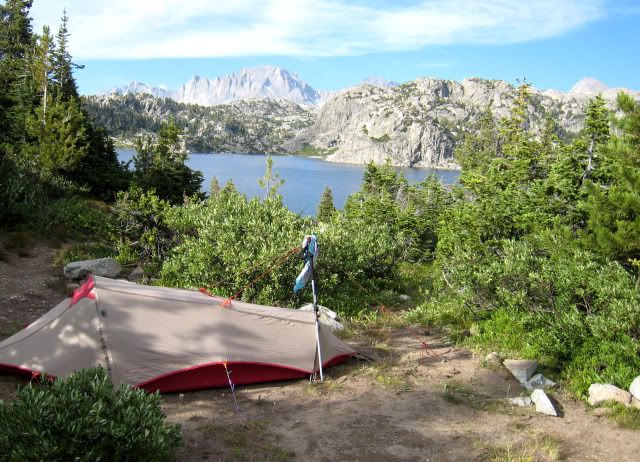
The weather held so I decided to push on to the upper bench containing Lake 11,265, a better position for the next day’s trek over the top. Since I am a hopelessly addicted explorer, instead of following use-trails across the lower bench, I headed up a hideously steep game trail the minute I saw that it directly headed toward Lake 11,265. Half way up the lush green grass that traversed east caught my attention. I dropped into a large meadow with “top of world” ambiance with intense storm lighting. There were easier paths to my campsite but my exploratory choice was “breath taking” in more ways than one! After setting up my tent I quickly hiked up the drainage as a storm was brewing. I returned just in time to cook dinner before rain began just after 5PM – another forced retreat into my tiny tent earlier than I preferred. If only I had a book!

Camp on Bench above Brown CLiffs

Storm approaching the Brown CLiffs
TO BE CONTINUED!
Aug 11-22, 2009
Hey its winter - not much happening. So here is the complete version of a trip I briefly reported on last year. It is long, so I will put it in installments.
The shortest access to the North Fork of Bull Lake Creek is from the Wind River Indian Reservation but requires a 4wd vehicle and enters from areas that have reported recent Grizzly bear sightings. However, most of the watershed is on public land and can be accessed from the west if you are willing to walk a bit further A longer approach from Elkhart Park juxtaposes the most used trail in the Wind Rivers with one of the most remote and wild destinations. The wild mid-summer weather of 2009 simply added to the ambiance! Although my official destination was the lower North Fork of Bull Lake Creek, the trip was really a trans-Divide tour of the mid-northern Wind River Mountains.
Photographers Point
Day 1 I left Lander Wyoming early in the morning getting caught in road construction over South Pass and arrived at Elkhart trailhead just before noon. As I arrived, a major rescue effort (hiker was lost in the recent snowstorm) was underway with helicopters in the air. I lifted my trusty old external frame pack onto my back. It was loaded to the hilt; this was not going to be a fast and light trip! After chasing off a bear less than five feet from my tent a week ago, I decided to take the bear canister. I threw in my down vest and pack cover since a freak early August snow storm hit the mountains earlier this week. Step after step, and two hours later it was a great relief to get the pack off my back to rest at Photographer’s point. Plenty of folks were at the rest stop on this busiest of Wind River trails. There was no lack of unsolicited advice given to me! At Eklund Lake I turned onto the less used and beautiful Pole Creek Trail and reached Mary’s Lake at 3PM. I had never been on this trail and was amazed at the healthy green forest, wildflowers and many beautiful lakes. From here it was two hours of mostly downhill travel to my first camp on Pole Creek just beyond the knee-deep crossing. Another group was camped a short distance downstream. The nine miles carrying a heavy pack on good trails was still exhausting in spite of being totally acclimated from several back-to-back trips. Because of my late start, there was not enough daylight to do much after dinner exploring.
Eklund Lake
Pond on the Pole Creek Trail
Day 2 I awoke at dawn and at 7:45 and continued up Pole Creek. Where the trail re-crosses the creek an inconspicuous rock cairn showed the start of the faint south-side trail. After tip-toeing through some swampy spots the trail intersected the Fremont Trail where a weathered wooden sign pointed to Hat Pass. I followed the trail to the first lake in Bald Mountain Basin and left the trail, heading to the unnamed pass at 11,663 feet elevation on the Divide north of Angel Pass. I definitely left the crowds not to see anyone for nearly a week! Travel was like an obstacle course finding the way around numerous small ponds and across creeks, mainly walking on grass with lots of little ups and downs. I reached Spider Lake at 10AM and rested only a few minutes before the mosquitoes found me.
Spider Lake from pass to the south
It was another obstacle course to reach Lake 10,950, this time through small cliffs and brush. I started up the steep grassy slopes to the headwall towards the pass. It looked like there was a route on the left side, but I decided to remain in the center and ascending the nearly vertical grass until the slope eased and I entered a moonscape made bleak by the overcast sky. Unfortunately I still had a quarter mile of talus to hop before I reached the pass. Tired of rock-hopping, I stayed on snow as much as I could while descending to the small unnamed lake west of Lake 11,065. After crossing the inlet I took a much needed break. Traversing the north side of these two lakes was a complex exercise. At times I scrambled over huge talus blocks and at times hopped rocks within the lake. The lakes were pretty with patches of green grass and wildflowers but camping was limited to a few lumpy grass spots.
View East from Lake 11065
View west from Lake 11065
At the outlet of Lake 11,065, I came to a big surprise! Where I had planned to simply hike down the drainage, a huge cornice blocked my path. All the low angle slopes were plastered with firm snow so I had to scramble down rock ledges to the north, lowering my pack at one point. I reached the little “lake” shown on the map at 10,800 feet to find out it was actually two delightful little lakes. Quickly I bathed before I cooled down and while there was still a sliver of sunshine. It began to rain and took a nap. When the rain stopped I cooked dinner and walked around, of course, finding better campsites than the one I had chosen! A pretty sunset ended my 8-mile day of travel through uniquely pristine and challenging off-trail terrain.
Loooking up at the surprise cornice from camp
Day 3 I managed to get packed up by 8AM a bit sad to leave my beautiful little home. I traversed northeast, dropping a bit to get around the base of a steep cliff, and in half an hour reached the trail from Golden Lakes. The trail was a delightful path among wildflowers and grass heading to the saddle between the Golden Lakes and Lake 10,787. A well constructed trail descended through a jumble of talus before crossing the outlet stream where I was surprised by a steep snowfield that had not been here in my previous travels! Thankfully it was soft enough to kick steps as I did not bring an ice axe. I continued towards my intended goal of the Brown Cliffs following this old trail, constructed in the 1930’s but not maintained in eons as several collapsed bridges testified. As I dropped to Camp Lake the crystal clear morning gave way to clouds and crossed rocks at the outlet above the first collapsed bridge.
Traverse above the Golden Lakes
Lake 10787
The Brown Cliffs area is popular with the goat packing crowd so the old trail is still quite easy to follow. At Lake 10,239 campers in the distance looked like dots on the green grass. The trail drops another few hundred feet and another creek with an old abutment of another missing bridge. Shortly, I came to the only intact bridge over Snowbridge Creek, with half the logs remaining. Someday what’s left of this bridge will be gone. The creek was roaring, so I was glad the bridge was still there! Ascending the final switchbacks, I got glimpses through the trees of the towering peaks around Alpine Lakes. After hopping rocks across the lowest large lake in the large flat area east of the Brown Cliffs, the trail essentially ends. The entire timbered bench east of the Brown Cliffs is full of game trails, excellent camping, small creeks and ponds and spectacular views. I had planned to camp near Lake 10,590 and took a few photos.
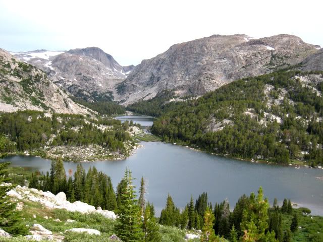
Unnamed lake south of Lake 10239
The Fortress
THe Brown CLiffs
The weather held so I decided to push on to the upper bench containing Lake 11,265, a better position for the next day’s trek over the top. Since I am a hopelessly addicted explorer, instead of following use-trails across the lower bench, I headed up a hideously steep game trail the minute I saw that it directly headed toward Lake 11,265. Half way up the lush green grass that traversed east caught my attention. I dropped into a large meadow with “top of world” ambiance with intense storm lighting. There were easier paths to my campsite but my exploratory choice was “breath taking” in more ways than one! After setting up my tent I quickly hiked up the drainage as a storm was brewing. I returned just in time to cook dinner before rain began just after 5PM – another forced retreat into my tiny tent earlier than I preferred. If only I had a book!
Camp on Bench above Brown CLiffs
Storm approaching the Brown CLiffs
TO BE CONTINUED!