A forum that'll feed your need for exploring the limitless adventure possibilities found in "other" places. Post trip reports or ask questions about outdoor adventures beyond the Sierra Nevada here.
The superbloom on and around the Carrizo Plain is amazing. The Temblor Range, in particular, is spectacular right now. On 4/1 I drove east on HWY 58 to 7 mile road, then south on Elkhorn road for about 10 miles. I hiked up a couple washes near the most crayola part of the hills. It was spectacular! I expect it's still good this weekend, maybe even next weekend too. The rattlesnakes are out en force though so be careful hiking. I nearly stepped on one.
I haven't blogged about it yet but here are few photos.
I don't give out specific route information, my belief is that it takes away from the whole adventure spirit of a trip, if you need every inch planned out, you'll have to get that from someone else.
Have a safer backcountry experience by using the HST ReConn Form 2.0, named after Larry Conn, a HST member:http://reconn.org
50% of the people I saw were stopped right at the intersection of 7 mile & Elkhorn, they didn't drive down Elkhorn. Then another 25% were stopped at Wallace Creek, then 15% at another turnout around 6 miles down. Where I stopped, there were maybe 6 cars parked. As soon as I was a few hundred feet away from the road on a trail, I saw nobody. I did see a drone though
I saw a lot more people and way way more people behaving badly (trampling) in Antelope Valley. I skipped the reserve there because it was insanely crowded. Parking lot full, about a hundred cars parked on the road outside the park. O_O
oh hey! you're reading my signature.
that's nice. want to check out my blog?
here it is: plutoniclove.com
ig: @plutonic_love
Yesterday there were crowds blocking traffic at 7 mile and Elkhorn. And there were crowds in the roads, clogging the parking lot at the visitor center, lining the roads leading to it. The parking area at the trailhead on Caliente Ridge was overflowing. There were a couple dozen backpackers on the trail looking for places to pitch tents. There were campers in all the pullouts on the ridge road. There were people blocking traffic by obliviously walking with their kids down the middle of roads. A steady stream of cars were driving south into the monument.
The rangers were bemused, confused and everywhere -- all BLM. They were very open about the best of the flower displays actually being on private property, not in Carrizo.
They were very open about the best of the flower displays actually being on private property, not in Carrizo.
Which is where?
Professional Sierra Landscape Photographer
I don't give out specific route information, my belief is that it takes away from the whole adventure spirit of a trip, if you need every inch planned out, you'll have to get that from someone else.
Have a safer backcountry experience by using the HST ReConn Form 2.0, named after Larry Conn, a HST member:http://reconn.org
They were very open about the best of the flower displays actually being on private property, not in Carrizo.
Which is where?
They weren't selling maps. Plenty of the surrounding area -- for example, New Cuyama just over Caliente Ridge -- had equal or better flower displays visible from the highway.
Gracias, my info is that New Cuyama is excellent, but not as good as it was in 2010.
Professional Sierra Landscape Photographer
I don't give out specific route information, my belief is that it takes away from the whole adventure spirit of a trip, if you need every inch planned out, you'll have to get that from someone else.
Have a safer backcountry experience by using the HST ReConn Form 2.0, named after Larry Conn, a HST member:http://reconn.org

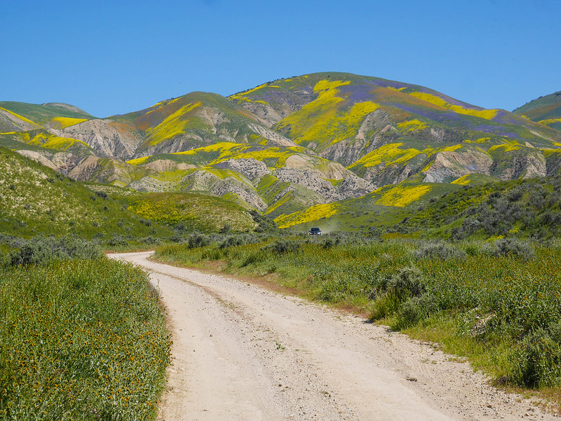 Temblor Range Superbloom 2017 by Maia Averett, on Flickr
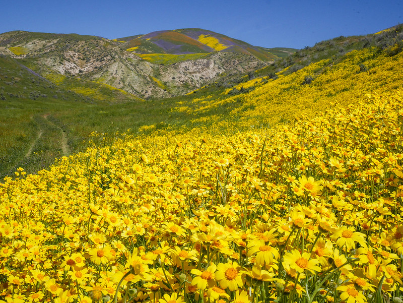 Temblor Range Superbloom 2017 by Maia Averett, on Flickr
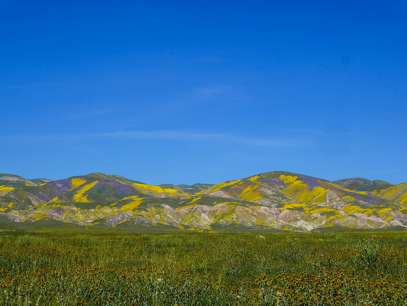 Temblor Range Superbloom 2017 by Maia Averett, on Flickr
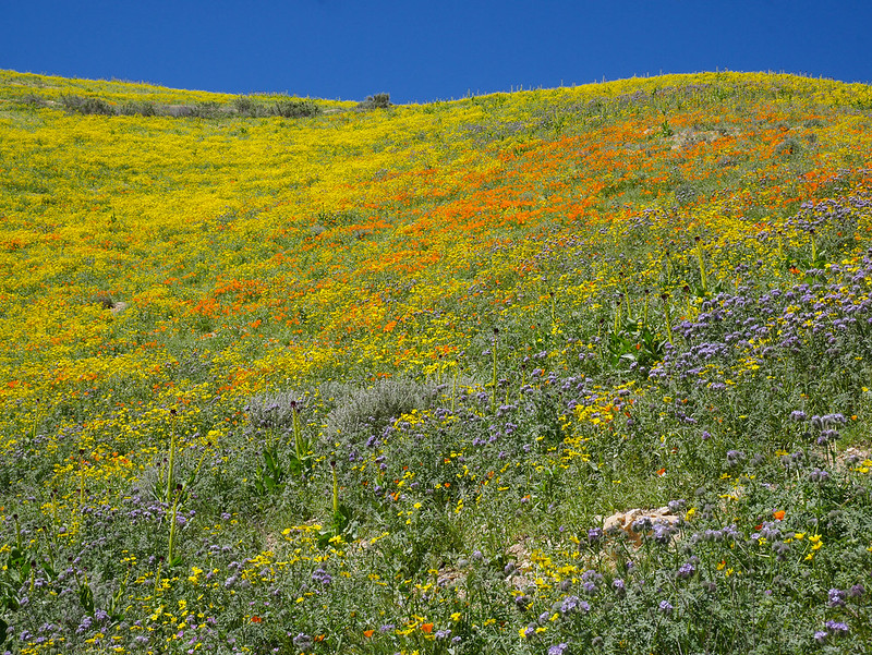 Temblor Range Superbloom 2017 by Maia Averett, on Flickr
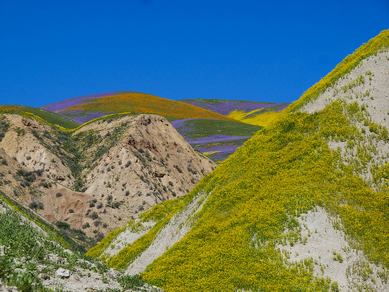 Temblor Range Superbloom 2017 by Maia Averett, on Flickr
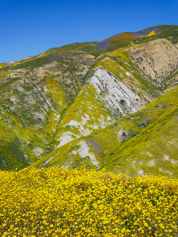 Temblor Range Superbloom 2017 by Maia Averett, on Flickr


