A forum that'll feed your need for exploring the limitless adventure possibilities found in "other" places. Post trip reports or ask questions about outdoor adventures beyond the Sierra Nevada here.
I'm not convinced. FWIW model takes into account more than just annual rainfall (weather station data is pretty comprehensive), and it's validations are solid. Unfortunately it's fit on a limited amount of data, and if it's wrong maybe we can learn something. But if it's wrong flowers could be nill, and to quote your post above:
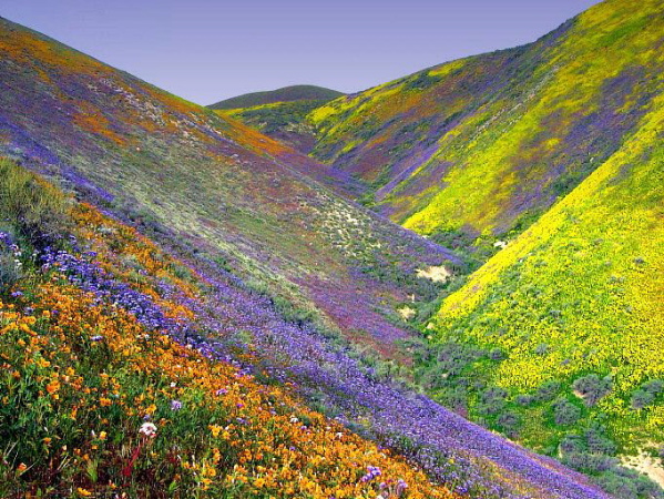
Thanks for the pictures Mountaineer.
Carrizo is supposed to receive some showers on Monday, hopefully that will help things pop in the next couple of weeks.
Professional Sierra Landscape Photographer
I don't give out specific route information, my belief is that it takes away from the whole adventure spirit of a trip, if you need every inch planned out, you'll have to get that from someone else.
Have a safer backcountry experience by using the HST ReConn Form 2.0, named after Larry Conn, a HST member:http://reconn.org
Those are some really stunning photos. I really had no idea the wildflower bloom could be so amazing there. I just think of Carrizo as this really dry place where the San Andreas fault is so nicely expressed in the landscape. I guess I should head over there for a look, but I'm now headed north to the SE Bay Area for 8 days in the field teaching (Sunol Regional Wilderness). Sunol RW during some years has some really amazing blooms on the parts of the park that are underlain by serpentinite. Perhaps this will be one of those years. We'll see.
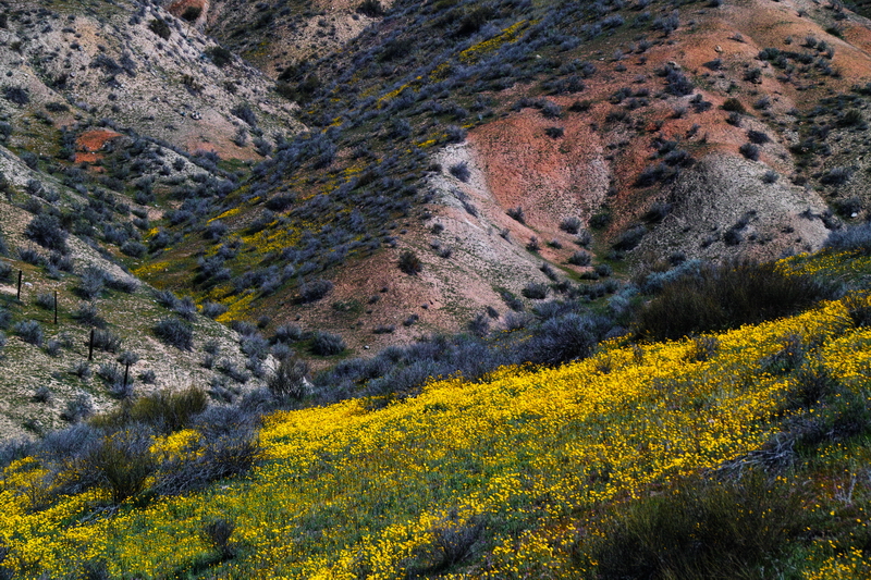
This is the kind of bloom we are waiting for GB, it has been six years, but as you can see, it is quite spectacular. Even though DV was pretty this year, it was just a big carpet of yellow flowers, my preference is carpets of multiple colors like this. http://wedesign.la/wp-content/uploads/2 ... n-east.jpg
Professional Sierra Landscape Photographer
I don't give out specific route information, my belief is that it takes away from the whole adventure spirit of a trip, if you need every inch planned out, you'll have to get that from someone else.
Have a safer backcountry experience by using the HST ReConn Form 2.0, named after Larry Conn, a HST member:http://reconn.org
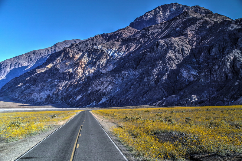
Even though DV was pretty this year, it was just a big carpet of yellow flowers
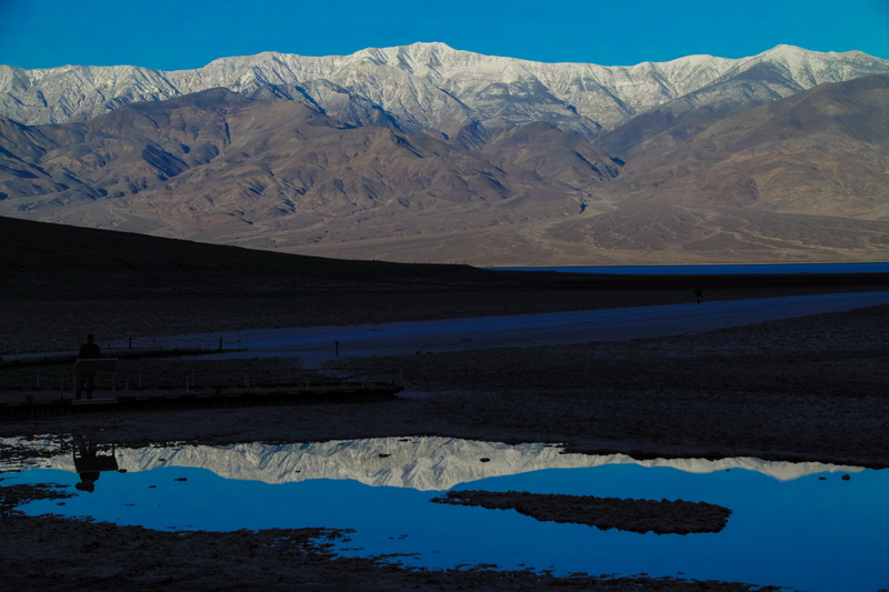
I concur. I heard all these people screaming about a DV "SUPERBLOOM!!!!!!!". I dropped what I was doing and went. Kind of disappointed. Lots of yellow flowers. The only variety I found was in the drainage ditch along the sides Beatty Rd. Not real conducive to photography. I did get a couple of shots where the yellow flowers created a nice contrast and FINALLY got the snow-covered mountains reflection at Badwater Basin!
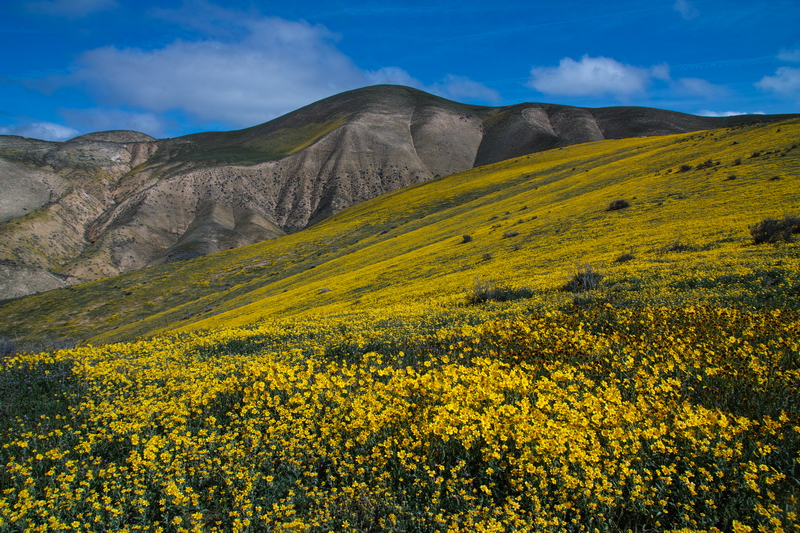
Speaking of Carrizo Plain, it has been absolutely spectacular there the last 18 months or so. I have done more photography there than anywhere else in that time. We might have to start a thread JUST for CP images.
Thanks Eric. Death Valley is my favorite NP now...but only when it is cool and stormy. Carrizo is only about an hour from my house so I spend a lot of time there.
Carrizo is only about an hour from my house so I spend a lot of time there.
Have you seen the damage by the Soda Fire last week Mountaineer, on the southern end of the monument? Approx 2000 acre burned, but it has been contained.
Professional Sierra Landscape Photographer
I don't give out specific route information, my belief is that it takes away from the whole adventure spirit of a trip, if you need every inch planned out, you'll have to get that from someone else.
Have a safer backcountry experience by using the HST ReConn Form 2.0, named after Larry Conn, a HST member:http://reconn.org


