

Date: April 2008
Participants: Mike, Rich, and I
Weather: Sunny for the main. Occasional cloud off the sea. Light overnight rain.
Distance and Ascent:
Day 1. 20km, 12 miles, 1850m
Day 2. 23km, 14 miles, 1300m
Day 3. 14km, 9 miles, 1370m
Day 4. 12km, 7 miles, 600m
Day 5. 20km, 12 miles, 1200m
Day 6. 21km, 13 miles, 1500m
Day 7. 37km, 23 miles, 1400m
There’s a cracked and yellowed copy of June Parker’s ‘Walking on Mallorca’ in my bookcase. It’s been well-thumbed over the last twenty years and perhaps a dozen trips. The first of these were bolt-clipping in the sun. Latterly they have moved through the established paths of the region and then evolved to a few ‘make it up as you go along’ routes.
The high route through the central Tramuntana mountains of Northern Mallorca at the back of June’s book has always intrigued me. Larry and I managed a tough sometimes pathless version of some of it a couple of years ago and this last trip learns from that and extends the route a fair bit as new permissions have been granted for formerly closed estate lands.
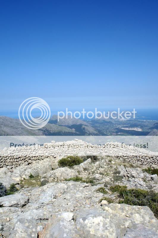
So this is a traverse basically, ticking sundry (OK as many as were humanly possible) peaks along the way and trying to stay with more or less a natural topographic line; whether or not there were paths marked on the maps. A few bits of it include a little casual trespass
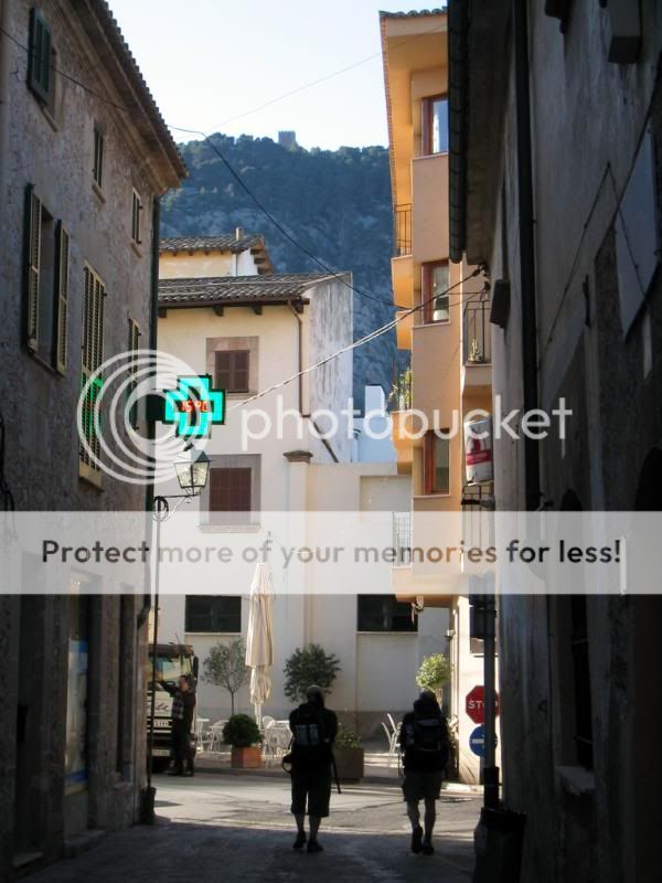
We meet in Palma de Mallorca at the Hotel Colon; a name which hardly inspires confidence.
My good friend Mike (from Edinburgh) and I are there early enough to eat large donuts filled with custard and are further loading with rabbit stew when Rich arrives late that evening from Bristol. Rich has the honour of being my brother. Lucky chap

Day 1. 20km, 12 miles, 1850m
An early bus to Pollensa and coffee work on the divide between the conscious and unconscious. An €8 taxi trip and we are at the kick-off point.
It’s an evil first day – I did it in reverse two years ago and it was harsh....this way it will certainly be interesting.
Easy lanes take us to the back of the house Can Huget and the start of the kind and wooded ascent towards the farm and font at (cue boyish titters) Fartaritx Gran.


It’s hot. We tarry at the font before the first pointy bit – the 711m Cuculla de Fartaritx.


I think my mother slept with the village idiot.

I’ve been over this peak before so it holds no mystery – the Puig de Ca that will follow some time later doesn’t either...it holds horror; a rough and hard peak over ankle-snapping karst limestone and Carritx (a rather unfriendly Mallorcan shrub).


The Puig de Ca is much as I remember, a slither slope ascent up largely pathless and steep limestone scree, then hoppity hop don’t drop towards the summit.
Talking of summits we don’t visit the 876m peak – knock yourself out if you’re a ticker though. Hot, did I mention that? About 30 degrees of it 8)

An easy scramble gains the grassy descent through tough Diss grass (think razor blades at ankle level) to the lovely Coll de Fartraritx. Pause. Survey what lies ahead. Bleed quietly from shallow cuts.

The massive peak of Tomir is next – not a shapely or statuesque hill, but more in the mould of a lumpen monolith. Huge; this is my forth visit but the first from this direction, we breach a short escarpment with a one-move-wonder.


Then it goes as a wander up the eastern ridge towards the summit, pausing en route at a Casa de Neu.

These were the way in which the glitterati kept their G&Ts cold in the summer; more seriously the snow holes were used for ice and the trails up to them form many of the routes up the peaks of the area.
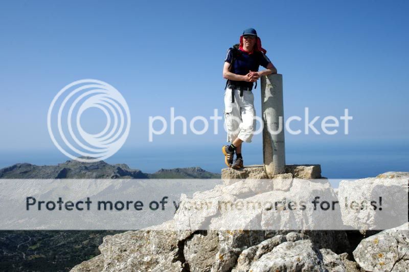
The 1104m summit of Tomir with views East to the coastal ridges (much fun scrambling to be had).
Mike ruins the view.
From the top it’s a nice initial drop to the South-West; this steepens and offers an unnecessary cabled passage or two, then ‘fall on your bum’ screes (if you are me that is) and gentle holm oak forests towards the Monastery at Lluc.

It is getting on when we arrive. So showers, collapsing, revival, some roasted goat, beer and a Carahillio de Amazonas (coffee and the local vanilla rum) are the order of the evening.


Sleep is sound.
Day 2. 23km, 14 miles, 1300m
The average Spanish breakfast leaves a lot – a LOT – to be desired by a backpacker. But I really enjoyed my caster sugar coated stale bready croissant
At least the coffee was good. And the pre-planning that meant a good portion of Shredded Wheat was ‘room service’ breakfast.
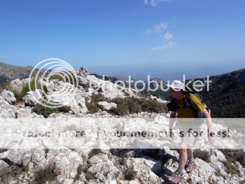
Up the road for a bit and then towards the farm of Comofreda which facilitates access to the 1365m Puig de Massanella; to me the finest peak on Mallorca. Sometimes you have to pay for access (€4) to this peak – depends on the way you go up; most land on Mallorca is private – access problems to some areas ebb and flow.
The initial ascent is grand, a track that morphs to a rutted path into increasingly dense forest which is carpeted with pine needles and interspersed with clearings for Sitjas; charcoal production being another central hub of historical Mallorcan commerce. The old sites are good spots to put a tent in general.
The effect of the vanilla rum is all too evident though.

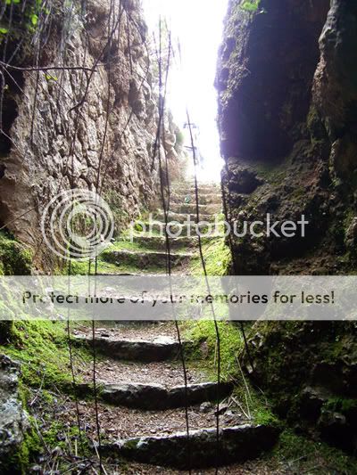
At the 824m Coll de sa Linia the path steepens, switchbacking through trees that gradually thin out as underfoot the going changes from soft years of forest detritus to more rocky limestone. Just as the trees fade, one reaches the Font de s’Avenc; truly a hidden gem.

This deeply buried font is accessed by a little easy caving – this shot is from the bottom of the first set of steps, the second set burrow more deeply into the mountain and you arrive at the font in the dark.

Thence to the summit – a great peak, there are many ways of accessing it; walk up by several routes, a couple (at least) of good scrambles. It’s all rock.

There can be shameless hussies desporting themselves at the top though :oops:

There are quite a few ways off Massanella; the way we had come, another variant of that, and two good scrambles; we chose my favourite, the South-West ridge, which drops down to a col before the Puig des ses Bassetes prior to breaching an escarpment and striking back North-West to join the easy path down to the Font des Prat (I know, I know).


Water is needed; we are aiming for another font a few miles on. Knowing where and what water is available is pretty essential with trips in these mountains.

So we ascend up the good path towards the Puig des Tossals Verdes but swing off North at a casa de neu to head North instead on faintly marked paths to the 1064m peak of Morro d’Allmallutx; rocky, with fine rosemary in bloom.
Interesting navigation that includes the occasional cairn, a few red paint spots (the Spanish are not exactly shy about trail blazing at times), and a drop over a small shattered escarpment lead us around the Western flanks of Morro d’Allmallutx and via a few small hillettes, some very sharp grass, and a big ramp that drops us through the ridgeline to the Puig de sa Font.


Descent towards the Coll de sa Coma des Ases (it just gets better and better) is steep and scrambly. Then not so steep but rough and leg breaking. We tarry a while at this well-named place. Decisions are made – there is a picnic spot below with guaranteed water from the Font des Noguer, we drop down to it for the night.
Dinner. Rich and I sample the delights of a rather too spicy freeze-dried Cajun salmon and Mike a rather too calorie-light Thai rice. There is not a beer in sight.
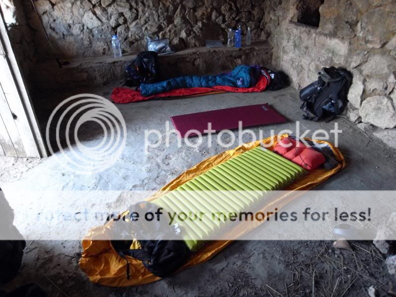
We settle down on a platform above the font and turn-in; the bivvy bags prove their worth as there is fine light rain for much of the night.

Day 3. 14km, 9 miles, 1370m
A fresh morning for some very cold ablutions before we set off for a fine trio of peaks I have done before – sa Rateta ( 1113m), na Franquesa (1067m), and Puig de l’Ofre (1093m). First we wander on an easy track around to an alluringly blue reservoir, the Embassament de Cuber. Then drop down old pipe works from the reservoirs irrigation system.

A convivial breakfast is enjoyed while we cast about looking for the start of the ascent to the first top. The start is a bit of a lottery to be honest, but as luck would have it we find a way through deeply dissected limestone boulders and dense undergrowth and idle our way to the Coll de Bosc (779m).


From here a very fine and well-preserved track snakes up to a Casa de Neu on the Southern skirt of sa Rateta.


A descent to the West gains the Coll des Gats – a place I have bivvied on previous occasions.

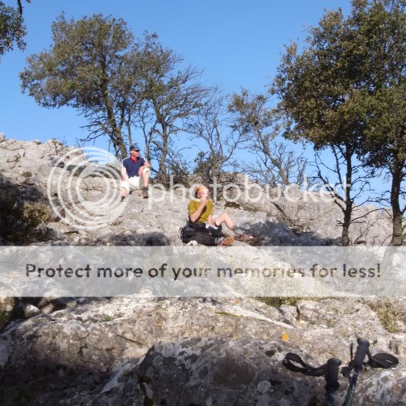
Now a good spot to air our kit.

A homage to she who must be worshipped.

The fine stony ridge of na Franquesa is next and a very rough and slithery down from here drops us to the Coll des Cards and our (almost) final climb of the day.
Now l’Ofre is different to the crunchy stonework that has so far been the order of the day. Bleached limestone melds with trees here, and the ridgeline path is compacted mud in many places; strange to see so much vegetation on this, the highest of the trilogy. It’s a very fine viewpoint.

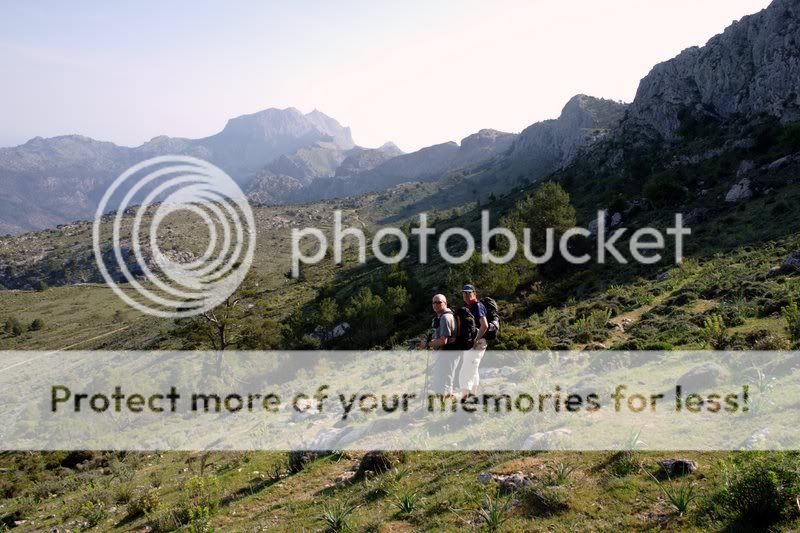
From here we are heading to an old refuge that I spotted several years ago when on the Alfabia Ridge. It is on that lump to the left of centre, the hills beyond are two days away for us as we intend a bit of a rest in the next town.

But first descent and water. The Font de sa Teula provides the latter – and the four litre carry up to the refuge makes me realise the limitations of my OMM 32 shoulder straps. There is no water until lunchtime tomorrow from here-on.

The refuge sits at 920m and is solid enough...

Apart from the roof....

And there is plenty of room...
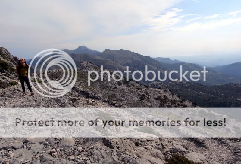
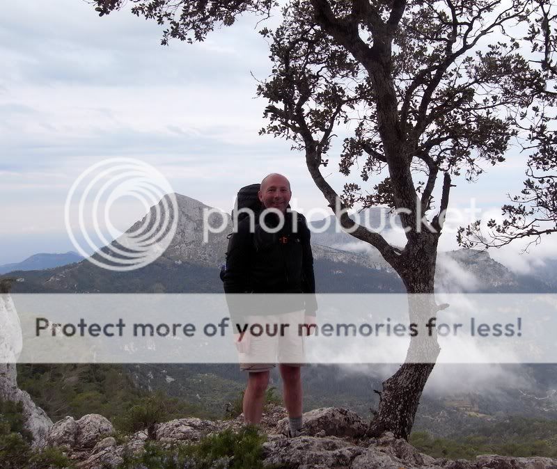
The 956m peak of Cornador Gran offers stupendous views to all horizons....
Back the way we have come with l’Ofre just to the left of the cairn, then na Franquesa, the distant ‘capsized boat’ summit of Massanella, then Puig Major with its listening station just discernible.

To the West the Alfabia Ridge (speak its name quietly and tremble); reputation has it as a very hard traverse, in reality it’s just great fun.

Night falls and the air chills as we wander about, slowing down as the warmth drains from the day.


I sleep pretty badly for some reason....perhaps its fear of the collapsing roof
Day 4. 12km, 7 miles, 600m
A cold morning.


The sunlight bounces off my bald bonce.

Then off for the delights of the Alfabia and its pathless pleasures before a coma-inducing 1600m descent to the town of Soller and frivolity, beer, food, and hot water.

You can’t choose your family alas.

Ah well.


This is a very fine traverse; little height is lost or gained for the main, but the terrain is challenging, deeply riven by erosion channels and with razor sharp edges on the boulder fields.

Much fun too, with boulder-hopping and many runs of smooth limestone slabs that can be connected with forethought.

At last the bachanalian delights of Soller hove into view. Alas the vast descent does too.

A commodious and geet posh as owt Hotel has been secured some weeks previously; the Hotel El Guia. But before we book in a lunchtime feast of chicken and chips with salads and beer seems a good idea. The rest of the afternoon is spent buying food, washing clothes, and (my brothers fault this) drinking beer.
The El Guia has a really good restaurant attached to it; the food is excellent the service is....well, go and see for yourself - definitely entertaining
Day 5. 20km, 12 miles, 1200m
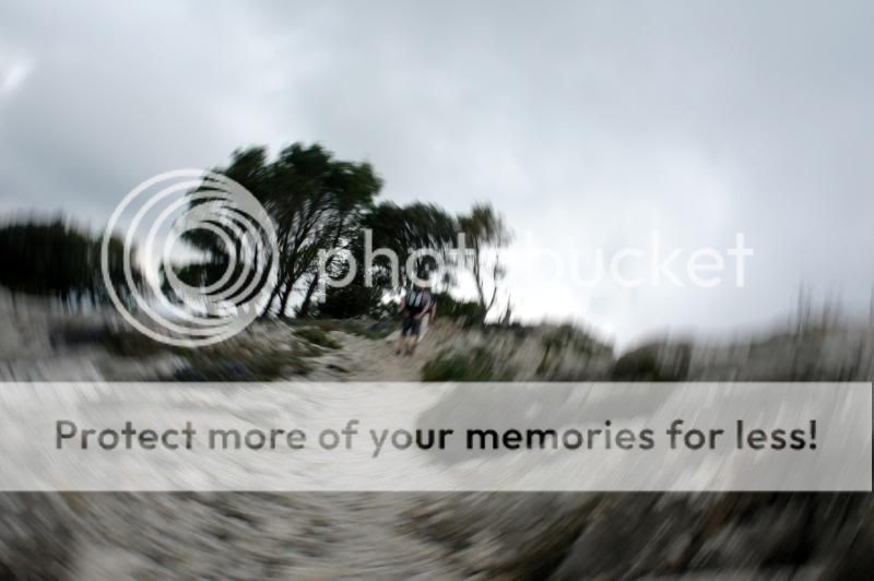
We slowly crank ourselves out of Soller post a hotel breakfast; then a second breakfast on the way to the trail out of the village and over to Valldemossa. I’ll leave that hazy as it’s not a well-known path, and involves a little trespass. But after climbing steep slopes and steeper man-made roads we gain a hanging valley and the start of our route across the es Boixos massif.

It’s hot and ‘thrashy’ going at times yet ere long we gain a fine well-built path that edges along the valley side en route for the 908m sa Galera, our first peak of the day.


From here it is a rolling schlep along a fine and broad limestone ridge to the next peak of the day, Puig Vent (1006m). My shutter-release finger appears to have gone to sleep on this section of our trip (breathe collective sigh of relief).
The Son Morales estate guards their land somewhat jealously (I’ve heard that the situation is improving)....but on we go anyway.

Then we are onto the Archdukes Path to Valldemossa which traverses around the lip of some nice drops. The path is really wide (made for horses) but still rough and hard underfoot in places. We are flying today; much to the surprise of sundry groups of teutonic hikers dressed to the 9s in reversed anfibio leather boots; lederhosen rustling in the wind. OK, I made that last bit up.


Down we go on a fine track that cuts through a flat area of oak before plummeting to the fleshpots of Valldemossa.


Now this is a lovely village....from about 18:00 to 09:00 after which times it succumbs to coach hordes and seems foul, tatty, and cheap. We could blend in
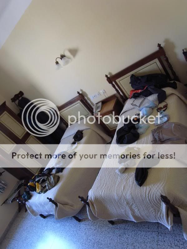
A cheap Pension I have used before gets us a three room billet for €66. Although our wine and dinner are a fair bit more than that.


Mike want’s to take his leopard-print bedspread home.
Day 6. 21km, 13 miles, 1500m
A leisurely double breakfast today. Coffee with Mike who has to leave us post the bus back to Valldemossa as he has to be in London.

To make him feel we’ll miss him we do a celebratory dance as he disappears on the bus
And so to breakfast three.....warm bread, a ripe goat’s cheese, and a buttery avocado. Luxury.

The prior five days have been great, but all of it has been old ground to me so just when I am getting knackered the fun of route-finding and navigation begins. Not that it should be too hard out of Valldemossa as we are following the GR221, a generally lower path than the one we have taken thus far, and a popular route.
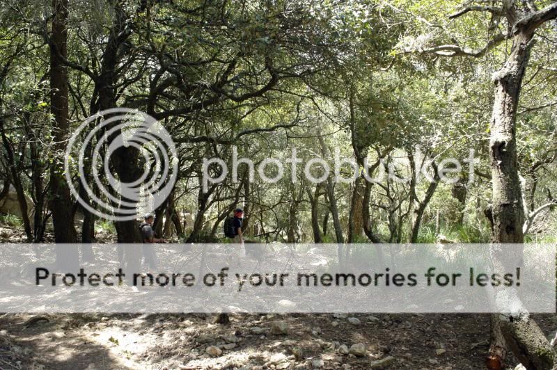
Straight into what is new territory for me, and very nice too, the more harsh landscapes further east are smoothed out here by trees and vegetation that blur lines and make for a softer gaze overall. Straight away too is a very nice looking bivvy site; ah well.

This isn’t it.
So we pad silently through this landscape on centuries of pine needles and desiccated leaves, twigs brushing out shoulders and with the feel of being in a more remote, secure and comfortable place than out on the blasted landscapes thus far trod. This fine path takes us over the 704m top of sa Comuna, down to the Coll de sa Baseta.


It’s been an absorbing morning of walking by the time we hit the village of Esporles and a seemingly interminable wait for a Menu del Dia.

The menu does hold us in good stead though; we won’t need to eat anything else until late that evening. Fortune means it is an easy digestive waddle along the GR221 for a while, on a pleasant (damn it with faint praise) level track.

The GR221 continues down to the coast at Banyalbufar, but we leave it in search of more rocky excrescences a few kilometres out of Esporles. A great path snakes up through the leaf mould and under trees across the flanks of Moleto de sa Granja and onto the plateau of Mola Planicia where the 904m top of Puig de sa Mola is retentively gained.


Down through the woods on very faint paths....so faint in fact that at times we make up our own :oops:
On occasion this can be a tad tiring for the elder generation...

Whilst the younger just get lost up a gully to nowhere...

It’s all good fun.
Prior to the final climb of the day we need water. This will be called ‘froggy water’ by Rich, as it came from a cistern with said incumbent amphibian.

For the next several hours I have to put up with ‘Would you like a drink of froggy water’? You can’t choose...
We’ve done well today as the navigation over this mountain series has not been easy. We reach the scramble down for tomorrow and admire the view.

After looking at the hour it’s a back-track into the woods a few hundred metres and bivvy.

Still sustained by lunch ‘cold collation’ is the supper of the day.

Day 7. 37km, 23 miles, 1400m
Try as I might I can’t stop Rich from posing on the lip of the drop just down from the 893m Puntal de Planicia
Behind him is Galatzo our first peak of the day; behind the trees is our last peak of the day before an easy run down to the sea. ‘The best laid plans n all that....’
The morning is looking good.


First we have the somewhat perpendicular Pas de sa Rata to deal with. Easy if you don’t mind scrambling and exposure....or a view of my ‘builders bum’


I’ve climbed the 1027m Puig de Galatzo a few times, but never from this direction. It’s a great path that switches through the forests, pops up onto ridges and escarpments then contours around slopes to arrive in fields of ‘how the f*ck do I get through this’ grass :oops: eye off the ball and all that.
We get through.

We are getting tired - the toil of seven days along this series of ridges is telling. So its gear behind a bush and hup-la up the hill, saving toting an extra 5kgs up and down 400m – every little helps at this stage. We access the top by swinging round into the tail end of a scramble I’ve done before and pop out amidst a throng of self-congratulatory Germans.
Tarry we not; down to the gear and some water. A real tick....would have been better done en ligne but a navigational error (Rich
Next – that lumpy bit left of centre. Mola de s’Esclop (928m). The last bit. Hopefuly.

It does not seem to get any closer despite efforts; a sure sign of fatigue. The route goes right of centre, looks unlikely and is steep but a nice way up.

Rich loses punch and droops a bit – this is nothing as on the latter seemingly endless track and road sections I was seriously dragging my feet whilst he was all ‘game on’ - I think he could smell the beer

That is Galatzo behind him, and behind that six days of hard work, 80 miles and around 9000m of upness 8)
Call the fashion police... Mola de s’Esclop summit.


The descent from here looks good on the map but is not a relaxed skip down; in reality little on Mallorca is easy going away from the very popular paths. Always need an eye on the ground and a ‘bounce and hop forward’ projection of where and which rock, boulder, or vegetative patch you’ll choose. All exacerbated by speed – and despite our lineage we move quite fast.
And then...the pictures run out as we have around 10 miles of ‘I wish it could be there’ type progress; tiredness causing small navigational errors, not always making the best choices as we are knackered. But get there we do. Into the Hostal Dragonera.
Dinner is when we like? We like soon. ‘Take that freshly poured dewy beer up to your room while you settle in’ is my translation of our friendly hostesses kind words...
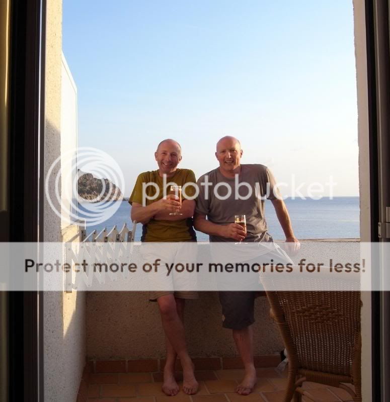
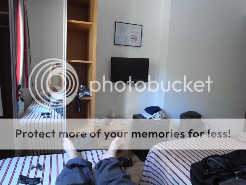
I hoist my 23 mile feet onto the balcony wall.

Beer is enjoyed.

Dinner and cheap Spanish brandy celebrate the day.


