Mt. Eddy and Deadfall Lakes: Trinity-Shasta Divide
Posted: Fri Oct 16, 2015 8:29 pm
On the way back to the bay area from Southern Oregon, I got off I-5 just north of Weed and headed up Stewart Springs Road to the Parks Creek TH to climb Mt. Eddy. This is a really nice climb on trails that gets you up over 9000 feet to view nearby Mt. Shasta. Round trip is just over 10 miles. The Deadfall Lakes along the way enlivens the scenery. The trailhead is where the PCT crosses Stewart Springs Road (Forest Service Road 17) at the summit between the Shasta and Trinity Watersheds.
Here's the southern end of the Marbles off to the west.

Here's Mt. Eddy and the upper of the Deadfall Lakes.

A view of the Upper Deadfall Lake from above.

This is the divide between the Sacramento and Trinity Watersheds. To the left, the Sisson Callahan Trail takes you down to Mt. Shasta City. To the right, the PCT heads north. The PCT heads south directly into the photo. I've put the Sisson Callahan Trail on my list of things to explore in the future. There are also some lakes to the south that are pretty scenic, such as Toad Lake, that merit a look.

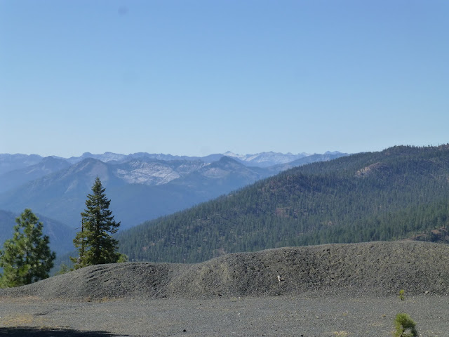
This rocky looking area is the headwaters of the Sacramento River, before it flows into Lake Siskiyou. If you continue south on the PCT, you'll come to Toad Lake.

Mt. Shasta City and Lake Siskiyou in the distance. Foxtail pines in the foreground.

The Shasta Valley.....

.....and the big dog itself, Mt. Shasta from the top of Mt. Eddy.


Another look at Upper Deadfall Lake.

Some Darlingtonia (Pitcher Plant or Cobra Lilly) at the Middle Deadfall Lake. You can find these all over the area where there are springs.


A couple more views of the middle Deadfall Lake. It has fish and I had brought my rod, but the timing wasn't good and nothing was biting.
This is a great day hike if you are in the area. Its about 40 minutes to the trailhead from I-5. There are a number of other lakes and trails in the area that merit exploration.
Here's the southern end of the Marbles off to the west.
Here's Mt. Eddy and the upper of the Deadfall Lakes.
A view of the Upper Deadfall Lake from above.
This is the divide between the Sacramento and Trinity Watersheds. To the left, the Sisson Callahan Trail takes you down to Mt. Shasta City. To the right, the PCT heads north. The PCT heads south directly into the photo. I've put the Sisson Callahan Trail on my list of things to explore in the future. There are also some lakes to the south that are pretty scenic, such as Toad Lake, that merit a look.
This rocky looking area is the headwaters of the Sacramento River, before it flows into Lake Siskiyou. If you continue south on the PCT, you'll come to Toad Lake.
Mt. Shasta City and Lake Siskiyou in the distance. Foxtail pines in the foreground.
The Shasta Valley.....
.....and the big dog itself, Mt. Shasta from the top of Mt. Eddy.
Another look at Upper Deadfall Lake.
Some Darlingtonia (Pitcher Plant or Cobra Lilly) at the Middle Deadfall Lake. You can find these all over the area where there are springs.
A couple more views of the middle Deadfall Lake. It has fish and I had brought my rod, but the timing wasn't good and nothing was biting.
This is a great day hike if you are in the area. Its about 40 minutes to the trailhead from I-5. There are a number of other lakes and trails in the area that merit exploration.


