Wapta Highline Trail
Posted: Sun Aug 23, 2015 11:29 am
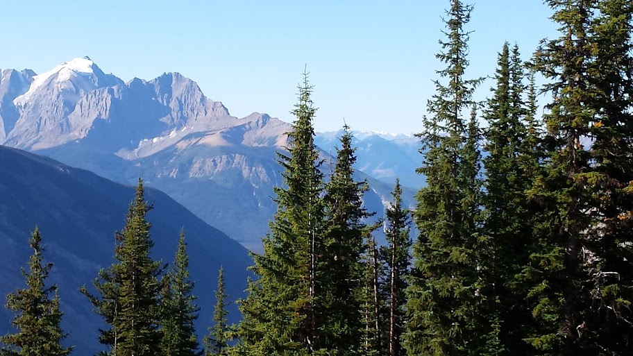
Like the Sierra Nevada, the Canadian Rockies have an international reputation for beautiful lakes, high alpine meadows, soaring mountain peaks and incredible vistas. Unlike the Sierra, the Canadian Rockies are home to hundreds of massive glaciers, the most significant being contained within the Columbia Icefield (https://en.wikipedia.org/wiki/Columbia_Icefield). As it turns out, the CI is the source of 3 major rivers - the Columbia, Athabasca & Saskatchewan - that lead to 3 different oceans: the Pacific, Arctic & Atlantic (via Hudson Bay), respectively.
It's the "rock flour" contained in the glacial snow melt that feeds the rivers which in turn creates the remarkable water colors of opaque jade, emerald & blue seen in the region's lakes. The most famous of these are lake Louise, Moraine & Emerald. Like trying to decide which Yosemite waterfall is more spectacular - Yosemite, Bridal Veil or Nevada - it's futile to compare; they are all incredible.
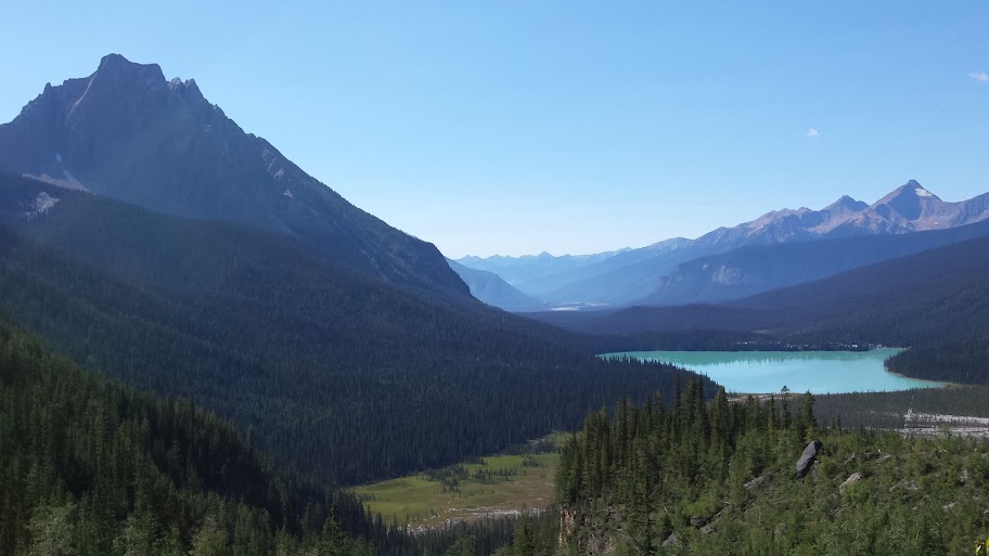
Lake Louise & Moraine are located in Banff national park in Alberta, which is both closer to the town of Banff and very easy to access, which makes the area similar to Yosemite valley in terms of tourist impact. That is, super crowded, over-flow parking, large tourist buses, the whole enchilada. Emerald is another 25 miles, but it's located in Yoho national park in British Columbia - west of the continental divide and down the wild Kicking Horse pass (https://en.wikipedia.org/wiki/Kicking_Horse_Pass).
The net effect is perhaps a 75% reduction in tourism. But perhaps even better, there's only one single (small) lodge, with the nearest town being 10 miles away, so after the day trippers are gone, it's really quiet. We first stayed at the Emerald lake lodge 12 years ago, then returned 5 years ago while on a round-trip car trip from Seattle. Since this was our 3rd visit, I had a pretty good idea of the trails and hikes available, having done portions during our previous trips. But, since we're always rushing, I never had a chance to have a day available to do a longer hike. Not this time, however; this time I was going to do the Wapta Highline, which is one of the marquee hikes in the Canadian Rockies.
All of the major trails in the Canadian Rockies are 120-130 years old, resulting from the earliest scouts searching for routes through the Rockies for the Canadian Pacific Railway (CPR). When the scouts & surveyors where resting horses, waiting out weather, etc, they would take short fishing/hunting trips with native American guides who led them to some of the secluded - and soon to be very famous - rivers, lakes & passes. These sites were so astounding that word got back to CPR headquarters, which in turn realized they could promote the Rockies as a tourist destination once the railway was completed (in 1885).
One of these sites was Takakkaw Falls, which due to restricted access down the very narrow Yoho valley canyon, resulted in the development of an alternative path via either Emerald lake or Burgess pass. Since Emerald had already developed a celebrated reputation, going to Takakkaw falls via Yoho pass became a popular horse camping trip. One thing that should be noted is that early tourism in the CR was distinctly high class. Europeans would take a steamship across the Atlantic, board a train, and be transported to wonderland. Trips often lasted weeks, and the resulting lodges (one built at each lake by the CPR) were tailored around this kind of clientele.
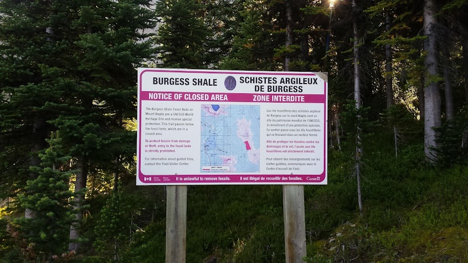
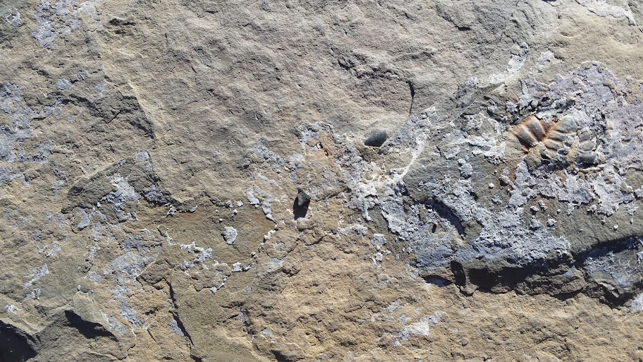
Burgess pass offered an alternative route to Tak falls that originated in Field, a CPR staging station located at the bottom of Kicking Horse pass, where pusher trains would be added to get up and over the grade. The Burgess pass route contoured under Wapta mountain directly for Yoho pass, making it both shorter & quicker. It was on this route that Charles Walcott, then the director of the Smithsonian Institution, discovered the Burgess Shale field (https://en.wikipedia.org/wiki/Burgess_Shale) in 1909.
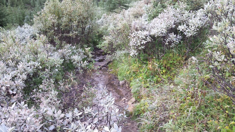
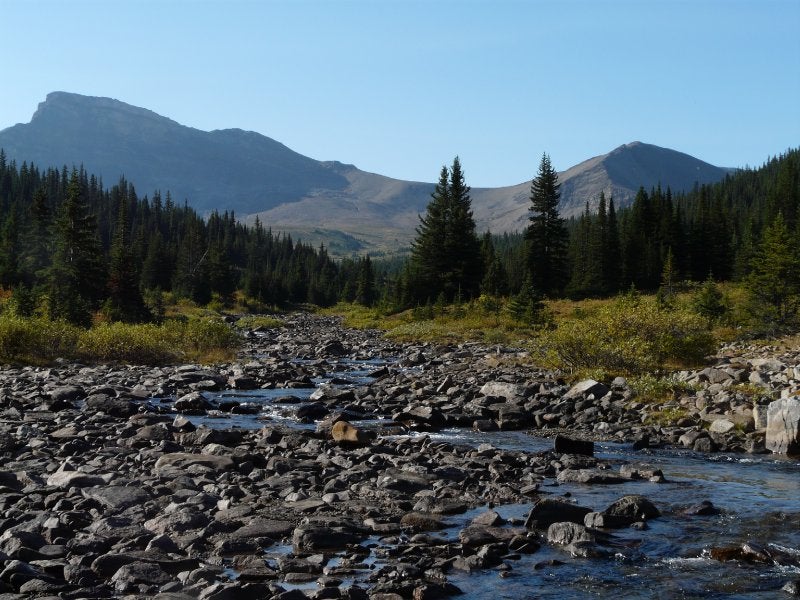
Soon enough, guides & travelers realized that linking Yoho & Burgess passes could create a triangular route around Emerald lake that passed right through the Burgess field while providing spectacular views of the surrounding mountain scenery. This is the hike I did on 8/21.
It's the "rock flour" contained in the glacial snow melt that feeds the rivers which in turn creates the remarkable water colors of opaque jade, emerald & blue seen in the region's lakes. The most famous of these are lake Louise, Moraine & Emerald. Like trying to decide which Yosemite waterfall is more spectacular - Yosemite, Bridal Veil or Nevada - it's futile to compare; they are all incredible.
Lake Louise & Moraine are located in Banff national park in Alberta, which is both closer to the town of Banff and very easy to access, which makes the area similar to Yosemite valley in terms of tourist impact. That is, super crowded, over-flow parking, large tourist buses, the whole enchilada. Emerald is another 25 miles, but it's located in Yoho national park in British Columbia - west of the continental divide and down the wild Kicking Horse pass (https://en.wikipedia.org/wiki/Kicking_Horse_Pass).
The net effect is perhaps a 75% reduction in tourism. But perhaps even better, there's only one single (small) lodge, with the nearest town being 10 miles away, so after the day trippers are gone, it's really quiet. We first stayed at the Emerald lake lodge 12 years ago, then returned 5 years ago while on a round-trip car trip from Seattle. Since this was our 3rd visit, I had a pretty good idea of the trails and hikes available, having done portions during our previous trips. But, since we're always rushing, I never had a chance to have a day available to do a longer hike. Not this time, however; this time I was going to do the Wapta Highline, which is one of the marquee hikes in the Canadian Rockies.
All of the major trails in the Canadian Rockies are 120-130 years old, resulting from the earliest scouts searching for routes through the Rockies for the Canadian Pacific Railway (CPR). When the scouts & surveyors where resting horses, waiting out weather, etc, they would take short fishing/hunting trips with native American guides who led them to some of the secluded - and soon to be very famous - rivers, lakes & passes. These sites were so astounding that word got back to CPR headquarters, which in turn realized they could promote the Rockies as a tourist destination once the railway was completed (in 1885).
One of these sites was Takakkaw Falls, which due to restricted access down the very narrow Yoho valley canyon, resulted in the development of an alternative path via either Emerald lake or Burgess pass. Since Emerald had already developed a celebrated reputation, going to Takakkaw falls via Yoho pass became a popular horse camping trip. One thing that should be noted is that early tourism in the CR was distinctly high class. Europeans would take a steamship across the Atlantic, board a train, and be transported to wonderland. Trips often lasted weeks, and the resulting lodges (one built at each lake by the CPR) were tailored around this kind of clientele.
Burgess pass offered an alternative route to Tak falls that originated in Field, a CPR staging station located at the bottom of Kicking Horse pass, where pusher trains would be added to get up and over the grade. The Burgess pass route contoured under Wapta mountain directly for Yoho pass, making it both shorter & quicker. It was on this route that Charles Walcott, then the director of the Smithsonian Institution, discovered the Burgess Shale field (https://en.wikipedia.org/wiki/Burgess_Shale) in 1909.
Soon enough, guides & travelers realized that linking Yoho & Burgess passes could create a triangular route around Emerald lake that passed right through the Burgess field while providing spectacular views of the surrounding mountain scenery. This is the hike I did on 8/21.