2016 update: Santa Cruz trail is going off with a better than average poppy bloom. On the 40 mile stretch from the top of Alexander saddle to Santa Cruz Station, the bush poppy is putting on quite a show as well.
The front side trail tread conditions are showing some stress from the all the bike traffic, but on the plus side they keep the chaparral from taking over.
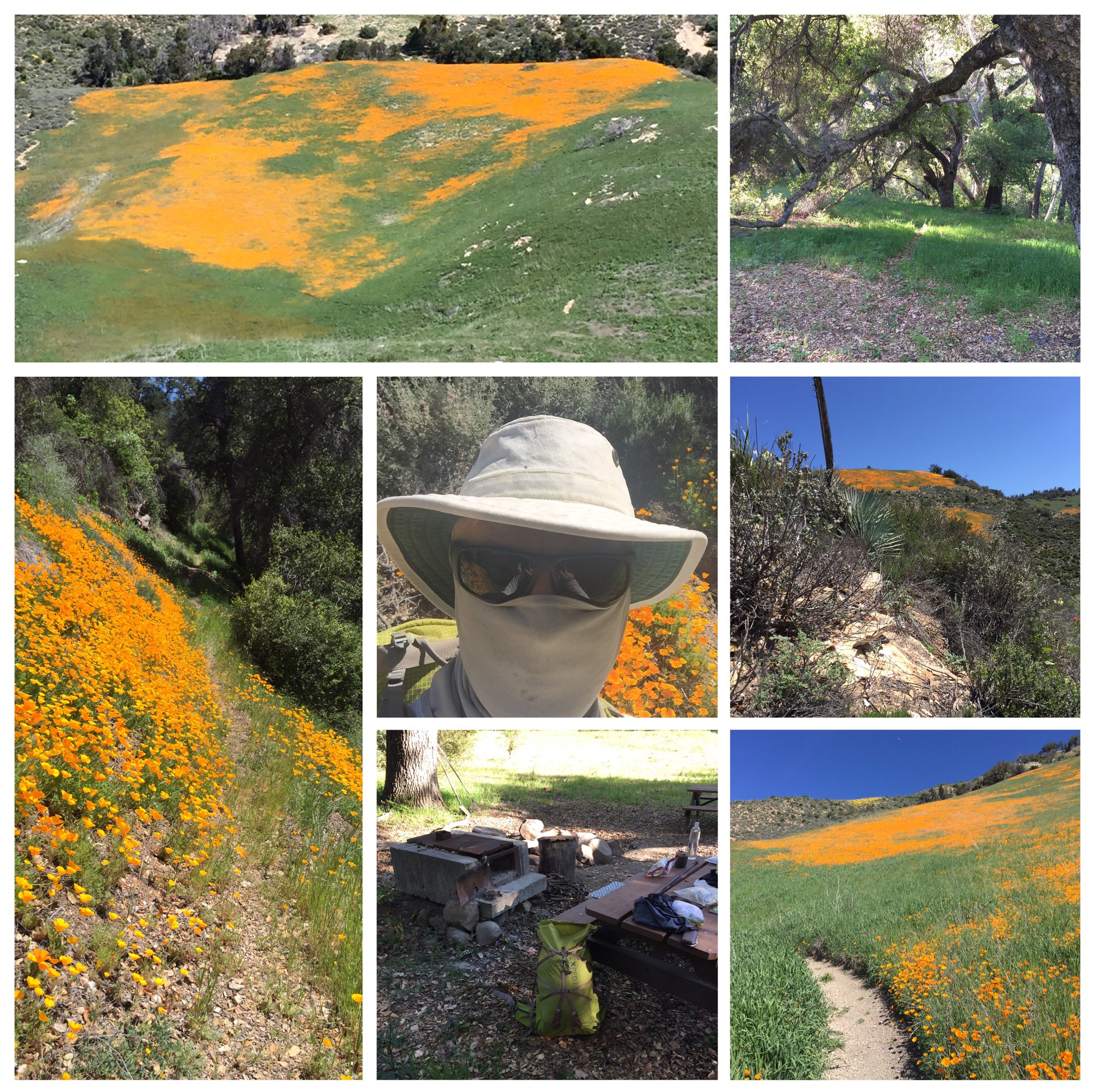
Despite the drought, water is flowing in Santa Cruz creek and there still is, to my utter amazement, a fishery. Decent sized landlocked steelhead and some fry, hanging on. My selfie illustrates the necessities needed to protect skin and sanity from sun, wind, and gnats, the latter ever present from early morning till early evening. This is great trail to prep for the Sierra, having a long steep and steady climb up to the Saddle, then another equally long "40 mile" stretch into the Santa Cruz drainage.
Backpacking Ojai/Santa Barbara area
- freestone
- Topix Expert
- Posts: 963
- Joined: Fri Nov 11, 2005 9:42 pm
- Experience: Level 3 Backpacker
- Location: Santa Barbara
- Contact:
Re: Backpacking Ojai/Santa Barbara area
Short cuts make long delays. JRR Tolkien
- ERIC
- Your Humble Host & Forums Administrator
- Posts: 3254
- Joined: Fri Oct 28, 2005 9:13 am
- Experience: Level 4 Explorer
- Location: between the 916 and 661
Re: Backpacking Ojai/Santa Barbara area
Wow. Looks spectacular.
New members, please consider giving us an intro!
Follow us on Twitter @HighSierraTopix. Use hashtags #SIERRAPHILE #GotSierra? #GotMountains?
Follow us on Facebook: https://www.facebook.com/HighSierraTopix
Follow us on Twitter @HighSierraTopix. Use hashtags #SIERRAPHILE #GotSierra? #GotMountains?
Follow us on Facebook: https://www.facebook.com/HighSierraTopix
- maverick
- Forums Moderator
- Posts: 11835
- Joined: Thu Apr 06, 2006 5:54 pm
- Experience: Level 4 Explorer
Re: Backpacking Ojai/Santa Barbara area
Agreed.Wow. Looks spectacular.
Professional Sierra Landscape Photographer
I don't give out specific route information, my belief is that it takes away from the whole adventure spirit of a trip, if you need every inch planned out, you'll have to get that from someone else.
Have a safer backcountry experience by using the HST ReConn Form 2.0, named after Larry Conn, a HST member: http://reconn.org
Who is online
Users browsing this forum: No registered users and 40 guests