Page 2 of 15
Re: 2013 Fire & Smoke Reports
Posted: Fri Jul 26, 2013 8:40 pm
by TCHN DAD
Here are the campground and road closures @ 10 a.m. on July 26.
http://www.inciweb.org/incident/article/3552/19414/" onclick="window.open(this.href);return false;
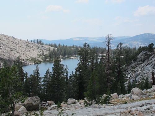
Re: 2013 Fire & Smoke Reports
Posted: Sun Jul 28, 2013 6:52 am
by TehipiteTom
Re: 2013 Fire & Smoke Reports
Posted: Sun Jul 28, 2013 3:58 pm
by AlmostThere
Courtright - was very smoky to the point that there were no views on the way in.
On Sunday there was a light haze, but the views were back... seems to depend on where the wind shifts.
Re: 2013 Fire & Smoke Reports
Posted: Sun Jul 28, 2013 4:31 pm
by Alpenglow
Today 7/28, Mammoth Lakes and 395N past Bridgeport to Rte 108 (Sonora Pass turnoff) was extremely smokey!

Visibility was poor. I've lived in Mammoth for 13 years and this is some of the worst smoke I've ever seen. We wanted to go for a hike and we thought we could get out of the smoke by going north. We were surprised that the conditions weren't much better than Mammoth. Was wondering how conditions are in the Whitney Zone?
Re: 2013 Fire & Smoke Reports
Posted: Sun Jul 28, 2013 6:29 pm
by maverick
Hi Alpenglow,
Welcome to HST! Thank you for your input on this matter.

Re: 2013 Fire & Smoke Reports
Posted: Mon Jul 29, 2013 7:07 am
by tim
Current weather forecast suggests SW winds will continue to feed smoke up the San Joaquin canyon to the Mammoth area for the next several days:
AREA FORECAST DISCUSSION
NATIONAL WEATHER SERVICE RENO NV
618 AM PDT MON JUL 29 2013
SHORT TERM...
SMOKE FROM THE ASPEN FIRE IN FRESNO COUNTY HAS WORSENED VISIBILITY
AND AIR QUALITY AROUND MAMMOTH LAKES AGAIN TONIGHT BASED ON WEB
CAMERA IMAGES AND SPOTTER REPORTS. KMMH DROPPED TO 5 SM AND HAS
REPORTED CEILINGS AROUND 3000-3500 FT AGL DUE TO THIS SMOKE. THIS
FIRE IS LIKELY TO BURN ACTIVELY AGAIN TODAY AND POSSIBLY FOR A
FEW MORE DAYS, WITH SOUTHWEST FLOW ALOFT CONTINUING TO SEND SMOKE
OVER SIMILAR LOCATIONS. WILL CARRY MENTION OF SMOKE SOUTH OF MONO
LAKE INTO TUESDAY NIGHT FOR NOW.
Fire & Smoke Reports-Chain Lakes
Posted: Mon Jul 29, 2013 8:45 am
by BakoGal
Visited Chain Lakes July 27-28. Smoke in the afternoon was tolerable.....
But overnight the smoke became BAD and continued to be miserable well after sunrise....

Re: 2013 Fire & Smoke Reports
Posted: Mon Jul 29, 2013 11:36 am
by no2haven
Smoke was noticeably worse in the Lewis creek canyon in SE Yosemite than on the Tuolumne side Sunday the 28th. Couldn't see the Clark range at all from Lake Bernice/Vogelsang, and it smelled noticeably smokey.
Sent from my SCH-I535 using Tapatalk 2
Re: 2013 Fire & Smoke Reports
Posted: Mon Jul 29, 2013 3:18 pm
by maverick
It seem like there are a lot more active fires than was thought, 10 in Kings Canyon
alone though small in sizes. Click on "Map Legend" tab and zoom in to see what areas
along the Sierra Nevada are effected.
http://sierrafire.cr.usgs.gov/" onclick="window.open(this.href);return false;

Re: 2013 Fire & Smoke Reports
Posted: Mon Jul 29, 2013 3:21 pm
by wildhiker
Another good resource for viewing the smoke distribution from this or any other fire is the NOAA SSD satellite smoke analysis at:
http://www.firedetect.noaa.gov/viewer.htm" onclick="window.open(this.href);return false;
Use the controls on the left side to zoom in and then click the layers you want on the right. Dense smoke is purple-brown, moderately dense is yellow, and thin smoke is green.
Wildfire smoke is just about the worst thing for a backpacking trip, in my opinion. Sort of the opposite of what we go there for - to get away from civilization and pollution. We were planning a backpack in southeastern Yosemite next week, but are going to head further north instead because of this Aspen Fire.
-Phil