Page 1 of 6
2017 River/Stream Crossing Reports
Posted: Sat Feb 11, 2017 12:41 pm
by ERIC
This being a big Water Year, we'd appreciate any and all reports (with photos if you have them) of river and stream crossing conditions in the Sierra. For new members and followers of this site, I highly recommend skimming
this thread which gives good advice from the last big snow year we had.
Re: 2017 River/Stream Crossing Reports
Posted: Sun Jun 04, 2017 6:10 pm
by Wandering Daisy
Merced River is flooding the upper part of Yosemite Valley. North side valley trail flooded: I had to bail out to the road in crotch deep water. Crotch deep (on me) water to access Swinging Bridge from the north side (supposedly going down the next few days). Water to mid-bottom of the bridge- huge log jammed under bridge, this morning. No snow all the way up to Merced Lake. The trail through Echo Valley is flooded as usual, up to 1 foot deep. A section about a mile above LYV (the big waterfall coming off the north cliffs) has washed out the trail with a 5-8 foot gouge. Log crossing downstream.
Side streams with lower elevation watersheds, are drying up fast. Compared to two weeks ago, most smaller snowmelt water sources are gone. Yosemite Creek and Bridalveil Creek appear to have crested and are receding.
Re: 2017 River/Stream Crossing Reports
Posted: Mon Jun 05, 2017 8:52 am
by Troutdog 59
Kaiser Pass is still closed and has lots of snow, but the Vermillion Valley Resort is planning on getting in to the resort by 6/15 and having PCT hiker resupply packages at that time. That said I'm not sure they will have many to resupply. The stream crossings are apparently nasty right now and they are expected to get worse as we haven't gotten to peak melt as of yet. The VVR posted this morning on its FB page that Bear Creek and the North Fork of Mono Creek crossings on the JMT are impassable at this time due to high water. Be safe out there folks.
Re: 2017 River/Stream Crossing Reports
Posted: Mon Jun 05, 2017 7:39 pm
by franklin411
I took a video of the Silliman Creek crossing on the Twin Lakes Trail yesterday @ 8 AM. I'm thinking the crossing would be much more treacherous in the afternoon, when the snowmelt is highest, but the power of the current looked really nasty to me. I'm guessing the water depth is 3-4'.
https://youtu.be/AQqPsWbga_8
Pic taken from 50' downstream of the official crossing. Maybe someone with more courage, better balance, and more than just idle curiosity could boulder-hop it.
https://ibb.co/mJHCxa
Pic taken from maybe 200 feet upstream, from the use trail leading to Silliman Meadow.
https://ibb.co/c0sZAv
Re: 2017 River/Stream Crossing Reports
Posted: Mon Jun 19, 2017 7:41 am
by Troutdog 59
The high temps (100's) in the valley have the snow on insta-melt. Flooding allover the Valley floor (Riverdale, Kingsburg, Minkler, etc, etc) and in the foothills. The news is reporting a 26-year old hiker died yesterday near Lodgepole after being swept away in Sillman Creek. Sillman is typically not a raging river, but is swollen and dangerous due to al of the runoff. Getting out is fine folks, but there is never any shame in turning back and being late. Be safe out there.
Re: 2017 River/Stream Crossing Reports
Posted: Mon Jun 19, 2017 11:56 am
by sambieni
http://www.fresnobee.com/news/local/art ... 48569.html
"National Park Service rangers say they received a report of a 26-year-old woman who had fallen into Silliman Creek along the Twin Lakes Trail and was swept downstream. Rangers said this is the third river fatality this year in Sequoia National Park. No other details about the woman were immediately available."
Re: 2017 River/Stream Crossing Reports
Posted: Mon Jun 19, 2017 12:08 pm
by maverick
http://www.fresnobee.com/news/local/art ... 48569.html
"National Park Service rangers say they received a report of a 26-year-old woman who had fallen into Silliman Creek along the Twin Lakes Trail and was swept downstream. Rangers said this is the third river fatality this year in Sequoia National Park. No other details about the woman were immediately available."
Already been posted here:
http://www.highsierratopix.com/communit ... 37&t=16033
Re: 2017 River/Stream Crossing Reports
Posted: Wed Jun 21, 2017 12:27 pm
by BayHiker
As of June 18, Glen Alpine Creek (Desolation Wilderness) is running high. We went up the Glen Alpine trail to the creek crossing, just before the trail splits off to Gilmore and Susie Lakes, and could not find a safe place to cross - at least safe for us creek-crossing novices. There was a good amount of snow on both sides of the creek obscuring the trail and overhanging the water, and crossing at the clear sections didn't look safe for our skill level:
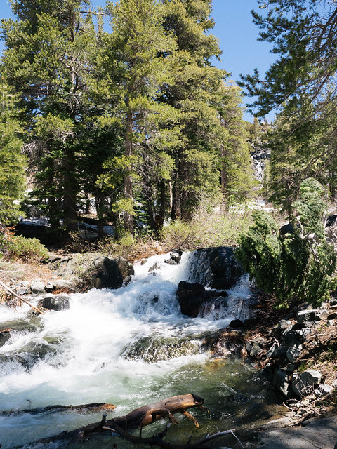
Those pics were taken ~11am. I'd guess the water was 1-2' deep at that point and flowing fast.
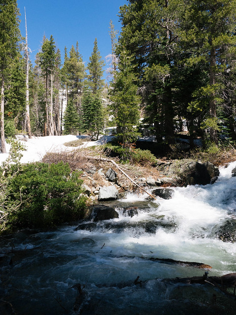
Glen Alpine Creek's feeder streams are stronger and more numerous than I've ever seen at this time of year. Here's one about a mile up from the Grass Lake junction that I don't recall having to negotiate in previous years:

I expect the crossing on the way to Grass Lake is very dicey right now.
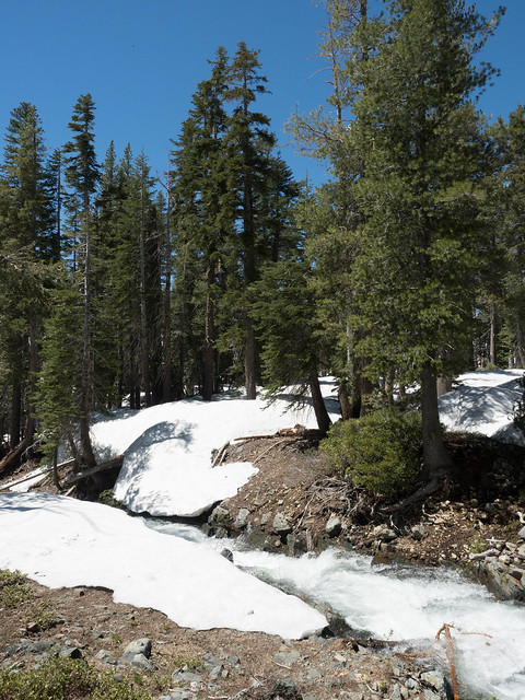
The usual trickle of a stream that crosses the fire road a short way before the historical site is now 6-8" deep but has boards set over it for easy passage:
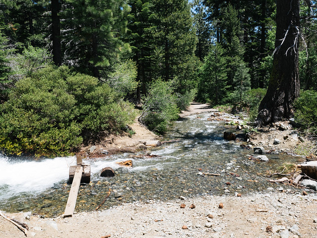
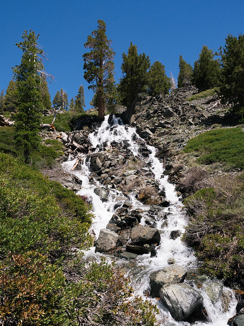
Lastly, I'll note for folks looking to do Mt. Tallac from the Tallac trailhead that Cathedral Creek is absolutely roaring. We went up to Cathedral Lake from the south end of Fallen Leaf Lake and could hear the creek long before we could see it.
Re: 2017 River/Stream Crossing Reports
Posted: Wed Jun 21, 2017 12:32 pm
by maverick
Hi Bayhiker,
Welcome to HST! Thank you for the detailed update of the area, especially for including photos.

Re: 2017 River/Stream Crossing Reports
Posted: Wed Jun 21, 2017 2:37 pm
by Quinning
Comparison of 2011 and 2017 using Mile… Mile and a Half Documentary.
July 10th is when they started. They went for 4 weeks.
So if you have not watched Mile…. Mile and a Half I would recommend watching it. These guys carried WAY to much awesome video equipment for you to not go watch it. While watching their video I decided I would be able to manage any stream crossing they encountered. So I decided to try and make a comparison between 2011 and 2017 to try and find out what the water levels on the Merced were and how long it took for the Merced to drop to the levels seen in the movie.
They started their journey on July 10th 2011. Based on the graph below it looks like the day they started flows were at 2000 cfs. So if your trip starts at with the Merced river at 2000 cfs the stream crossings should be similar to the documentary.
Looking at the graph below in 2011 there were 4 good weeks of high flow rates on the Merced before it hit 2000 cfs. Based on the 2017 graph we have had 4 weeks of high flow rates (it should be noted that the high flow rates in 2017 were slightly lower than those in 2011.)
So I believe if we have 1 or 2 more good weeks (this includes the high flow the last few days that I did not talk about above) followed by a slight cool the creek crossings will be similar to those in the movie sometime in early July.
A note is the variation temperature has on these graphs. At the high temperatures we have been seeing the change in temperature between night and day is causing a 1400 to 1800 cfs difference between peak and minimum flows each day. This is seen more clearly on a graph with 7 days of data.
Graphs were from nwis.waterdata.usgs.gov the Merced site # is 11264500. Hope this helps some people. Not looking to argue, but if there is something crucial I missed let me know and I will try to update.