Member descriptions, photos, and map locations of Cross Country Passes in the High Sierra. This forum is for information only - discussions should be kept in the appropriate categories. This forum is a component of the HST Map. We need your help to complete the database, so please contribute!
GENERAL OVERVIEW: As an alternate to either Wanda Pass or Black Giant Pass as a means to linking the Ionian Basin with the Muir Pass area, Solomans Pass provides a class 2 route.
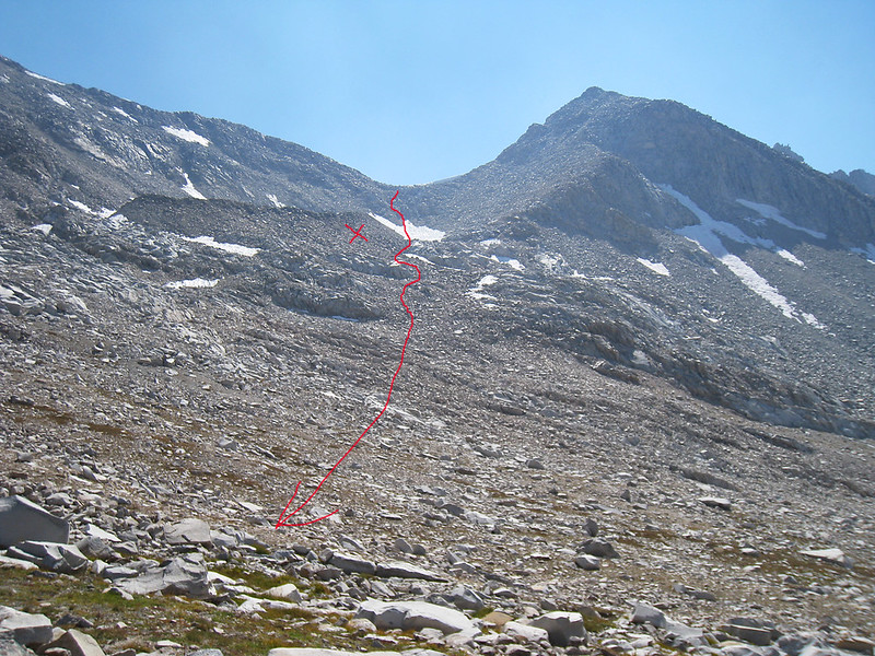
Looking south from the top of the pass towards Lake 11592... simple class 2 with talus hopping in the upper 200 or so feet. It is an 800 foot elevation change between the pass and Lake 11592.
Looking north from the top of the pass, the upper section is often choked with steep snow and if it is, wait for it to become soft in the afternoon sun for easy steps. One year, I descended from the top towards muir pass in a very low snow year. There are some steep chutes that you can go down that will fill up your boots with sand/rock but it is all still class 2 going. The upper 400 feet are around a 30-35 degree slope. Stay away from the moraine (marked with X's in the picture) because these rocks are unstable.
A view of the north side of the pass from near Muir Pass. The moraine is marked with an X.
Did it last year the top towards Muir pass needed crampons and ice axe! steep with a bad runout! My friend did it the month before end of july said it was scary then also! and if you think you can go to the rocks on the left looking up think again!
24DD6F2F-B76E-4672-9135-1D8E4725A068.jpeg
kristine
You do not have the required permissions to view the files attached to this post.
The woman who follows the crowd will usually go no further than the crowd. The woman who walks alone is likely to find herself in places no one has ever been before. Albert Einstein