Wallace Col
Posted: Wed Jul 04, 2012 11:55 am
Wallace Col
GENERAL OVERVIEW: This pass allows access between Sabrina Basin and Evolution Basin.
CLASS/DIFFICULTY: Officially Class 2 but more like Class 3.
LOCATION: Kings Canyon NP HST Map
ELEVATION: 12960 ft
USGS TOPO MAP (7.5'): Mt Darwin, Ca
ROUTE DESCRIPTION: From Moonlight hike toward Echo Lake but ascend southwest to the bench high above the lake. Go west to the low point of the saddle south of Mount Wallace. Descend over loose scree and talus, head northwest, and then west, past some benches, and some small meadows to the JMT. Scree is very loose, steep, and tedious, nasty on both sides of this pass, and is very steep near the top.
PHOTOS: Courtesy of Moonwalker
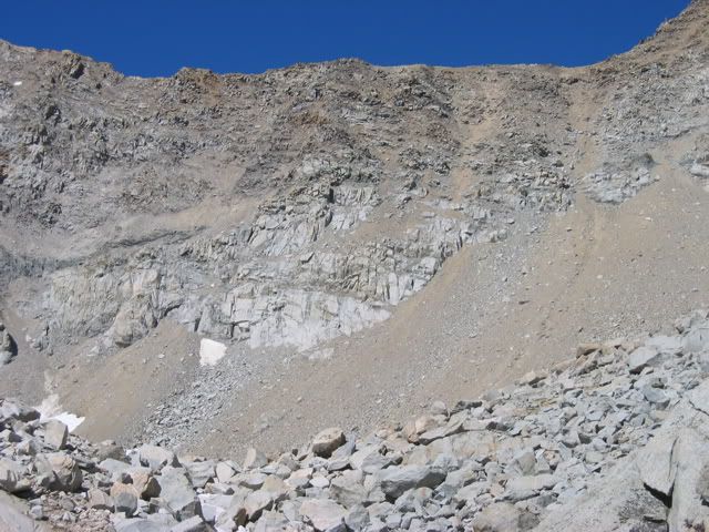
View of the ridge from the east:
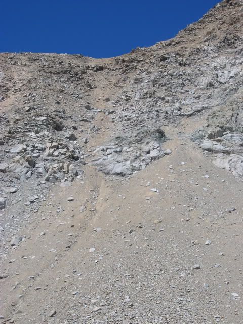
View of route over col:
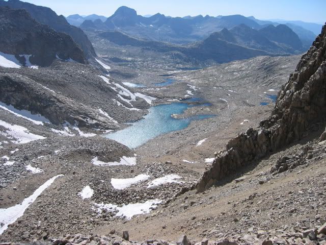
View from the top of col towards the west:
GENERAL OVERVIEW: This pass allows access between Sabrina Basin and Evolution Basin.
CLASS/DIFFICULTY: Officially Class 2 but more like Class 3.
LOCATION: Kings Canyon NP HST Map
ELEVATION: 12960 ft
USGS TOPO MAP (7.5'): Mt Darwin, Ca
ROUTE DESCRIPTION: From Moonlight hike toward Echo Lake but ascend southwest to the bench high above the lake. Go west to the low point of the saddle south of Mount Wallace. Descend over loose scree and talus, head northwest, and then west, past some benches, and some small meadows to the JMT. Scree is very loose, steep, and tedious, nasty on both sides of this pass, and is very steep near the top.
PHOTOS: Courtesy of Moonwalker
View of the ridge from the east:
View of route over col:
View from the top of col towards the west: