Blue Lake Pass
Posted: Sat Jun 23, 2012 11:35 pm
Blue Lake Pass
GENERAL OVERVIEW: Access between Harriet Lake / Forester Creek and Blue Lake / Bench Canyon.
CLASS/DIFFICULTY: Class 2
LOCATION: Border of Yosemite National Park and Sierra National Forest / Ansel Adams Wilderness. HST Map.
ELEVATION: 3,426m (11,240ft)
USGS TOPO MAP (7.5'): Mount Lyell, CA
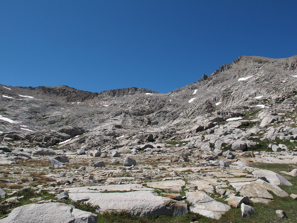
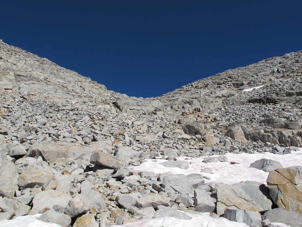
ROUTE DESCRIPTION: From west, following Roper's Sierra High Route from the beautiful gently sloping plateau north from Forester Creek easily approach the small lake at almost 10,880 ft. Climb towards the lowest point of the obvious saddle. I took a route slightly to the left as it seemed easiest.
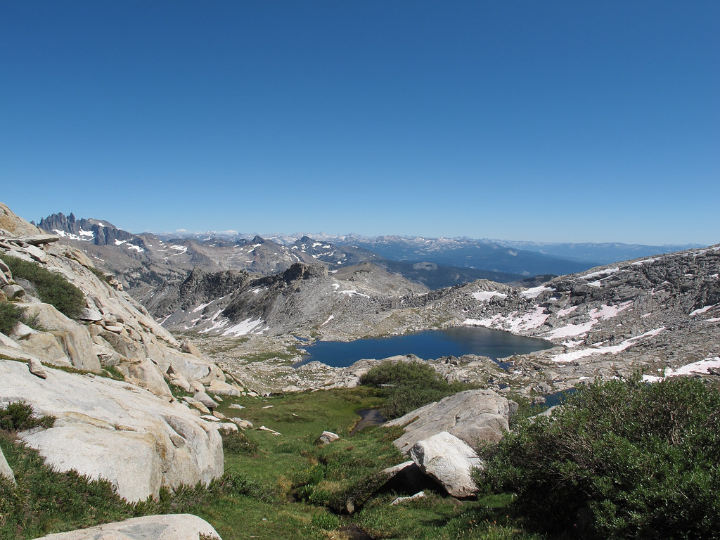
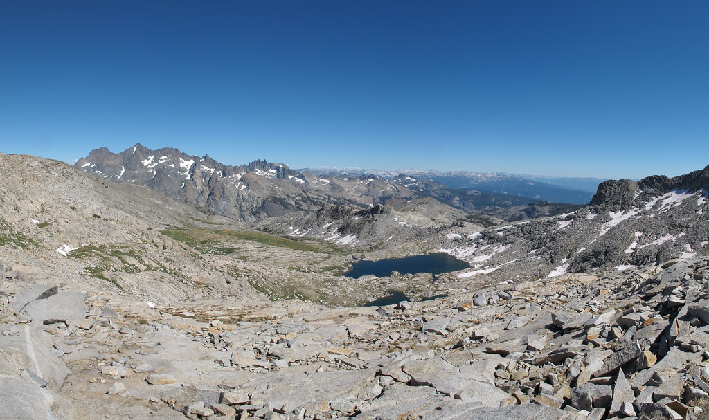
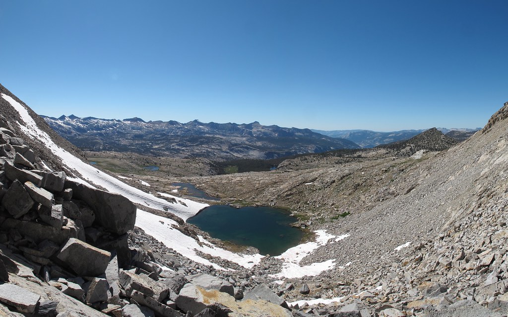
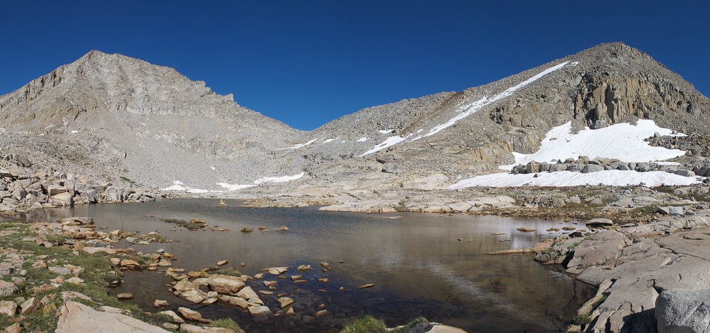
On eastern side, I descended diagonally slightly left, then slightly right, then far left until the minor ridge between the lake above Blue Lake and the strangely shaped lake (the strange shape doesn't show on map) at 10,480+ ft. From there the descent is gentler.
PHOTOS:
Taken on 2012-09-21 - a high snow year (~200%).
View of the pass from west. Close-up from west. View from the pass looking west. View from the pass looking east. The strangely shaped lake at 10,480+ ft. View of the pass from east.
GENERAL OVERVIEW: Access between Harriet Lake / Forester Creek and Blue Lake / Bench Canyon.
CLASS/DIFFICULTY: Class 2
LOCATION: Border of Yosemite National Park and Sierra National Forest / Ansel Adams Wilderness. HST Map.
ELEVATION: 3,426m (11,240ft)
USGS TOPO MAP (7.5'): Mount Lyell, CA
ROUTE DESCRIPTION: From west, following Roper's Sierra High Route from the beautiful gently sloping plateau north from Forester Creek easily approach the small lake at almost 10,880 ft. Climb towards the lowest point of the obvious saddle. I took a route slightly to the left as it seemed easiest.
On eastern side, I descended diagonally slightly left, then slightly right, then far left until the minor ridge between the lake above Blue Lake and the strangely shaped lake (the strange shape doesn't show on map) at 10,480+ ft. From there the descent is gentler.
PHOTOS:
Taken on 2012-09-21 - a high snow year (~200%).
View of the pass from west. Close-up from west. View from the pass looking west. View from the pass looking east. The strangely shaped lake at 10,480+ ft. View of the pass from east.