Pace Col (Grinnell Pass)
Posted: Thu May 31, 2012 1:02 pm
Grinnell Pass
GENERAL OVERVIEW: Pace Col (Grinnell Pass) is located in the Mono Divide
within Sierra NF, and is a direct route between Laurel Creek and the Fish Creek.
CLASS/DIFFICULTY: Class 2
LOCATION: Sierra NF. Pace Col on the HST Map
ELEVATION: 11,600ft
USGS TOPO MAP (7.5'): Mount Abbot, CA
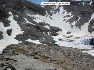
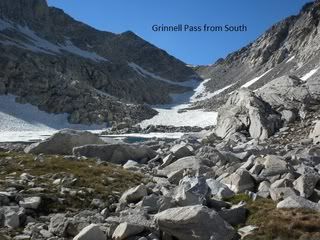
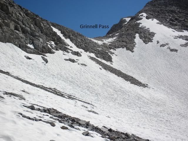
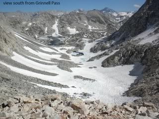
ROUTE DESCRIPTION: Hike north of past both Grinnell Lakes toward the Col.
There is loose shale mixed with patches of snow on the northern side of the Col.
Circle around Red & White Lakes eastern side.
PHOTOS: Courtesy of Cgundersen
GENERAL OVERVIEW: Pace Col (Grinnell Pass) is located in the Mono Divide
within Sierra NF, and is a direct route between Laurel Creek and the Fish Creek.
CLASS/DIFFICULTY: Class 2
LOCATION: Sierra NF. Pace Col on the HST Map
ELEVATION: 11,600ft
USGS TOPO MAP (7.5'): Mount Abbot, CA
ROUTE DESCRIPTION: Hike north of past both Grinnell Lakes toward the Col.
There is loose shale mixed with patches of snow on the northern side of the Col.
Circle around Red & White Lakes eastern side.
PHOTOS: Courtesy of Cgundersen