Page 1 of 1

60 Lakes Col

Posted: Tue Feb 21, 2017 2:24 pm
by zacjust32
TITLE: 60 Lakes Col

GENERAL OVERVIEW: Connects 60 Lakes Basin to Gardiner Basin

CLASS/DIFFICULTY: Class 2

LOCATION: Kings Canyon NP - HST Map

ELEVATION: 11,700 ft.

USGS TOPO MAP (7.5'): Mt. Clarence King

ROUTE DESCRIPTION: From 60 Lakes basin start on the west side of lake 3304 and head up the inlet on the EAST side. It may be hard to cross at first but it allows for easier travel further up. Follow the creek up on easy class 2 slabs and ramps until you get to several small tarns below lake 3435. From there talus hop up to the pass; there's no easy shortcuts, all simple looking ways end up cliffed out. Just bite the bullet and climb up. I haven't gone over the West side but it looks like more of the same. There are cairns and ducks on that side that may help, no confirmation on that though.

PHOTOS:

Image
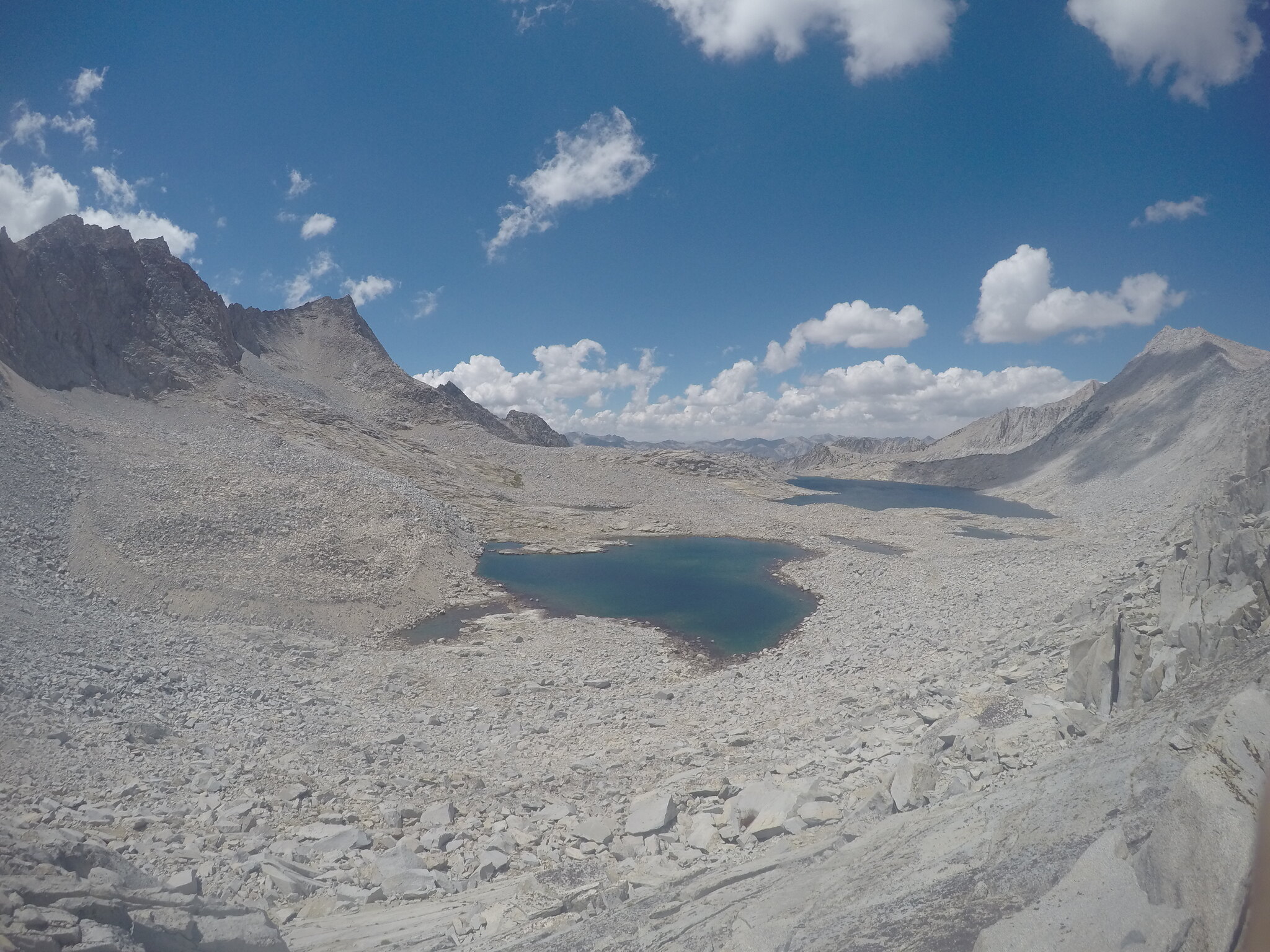
Looking west from the top of the pass.

Image
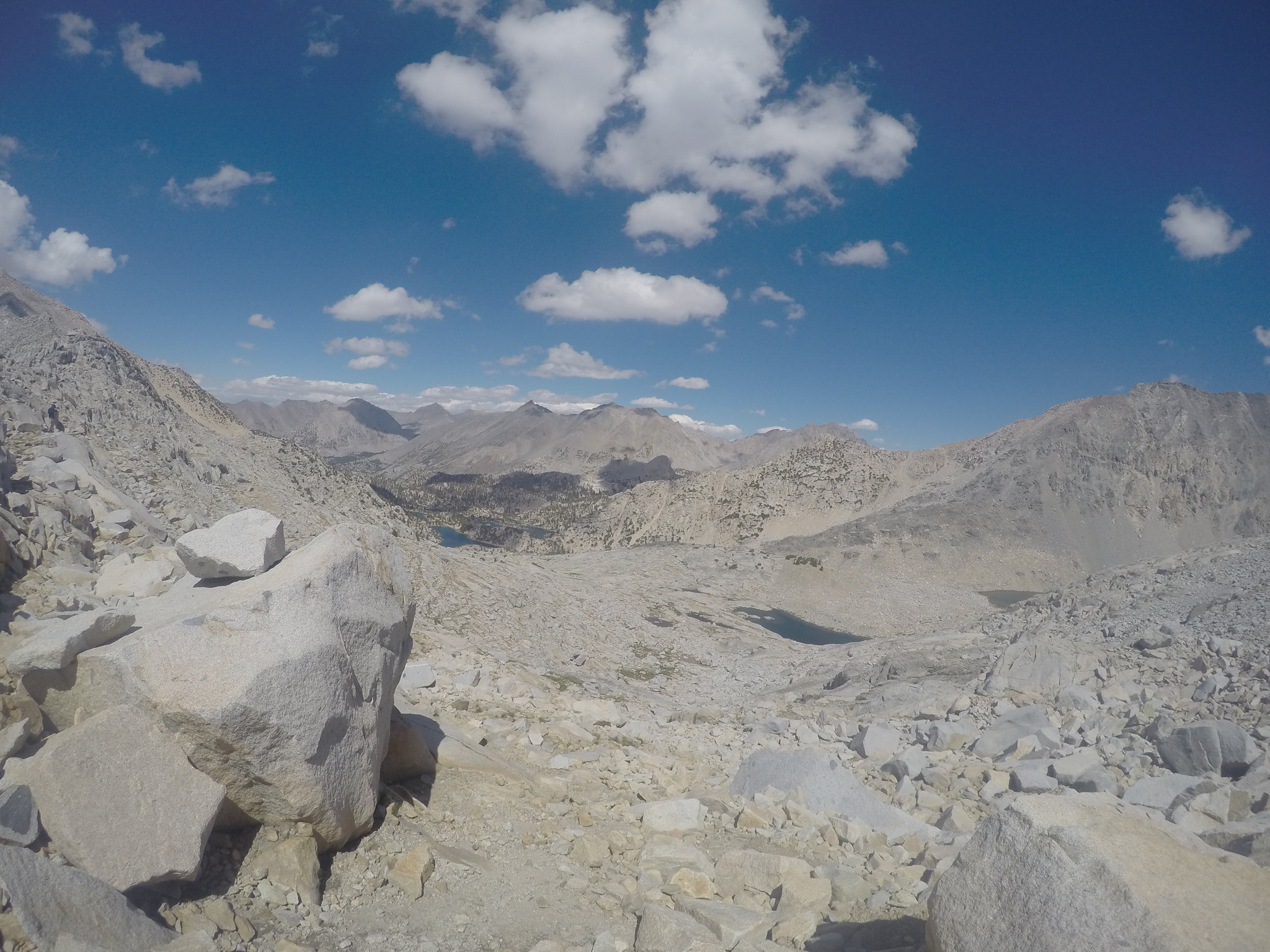
Looking east you can see the tarn you should aim for before turning west up the pass.

Image
Talus field from the top of the pass heading east.

Image
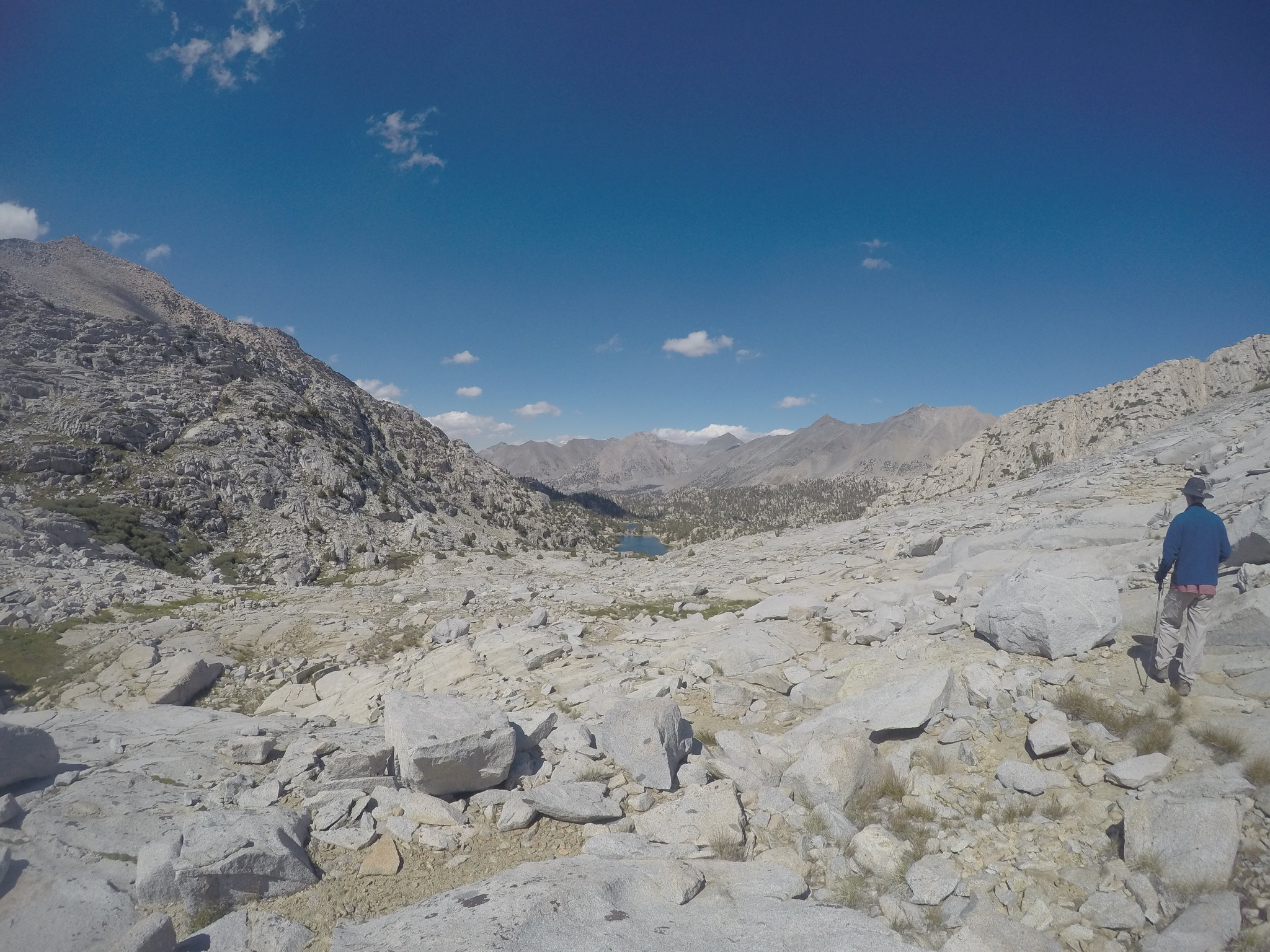
Headed down to 60 Lakes on the East side of the creek.

Re: 60 Lakes Col

Posted: Tue Feb 21, 2017 9:54 pm
by copeg
Been a while since I went over - didn't take detailed notes nor good photos, and was without a full pack which always makes it easier. Recall the east side being a mix of talus and lots of tedious shelves. West side consisted of large boulders and talus, all relatively stable

Re: 60 Lakes Col

Posted: Thu Mar 16, 2017 9:57 am
by Silky Smooth
Blackout! and I were there last June, very buggy and we did some really nice cross country from sixty to rejoin the jmt past dollar lake towards like baxter creek, I'll try and dig up some of her photos. Great area, lots to explore, fin dome, cotter and mr. clarence king. Lighting and thunderstorms changed our plans to bag some peaks.

Re: 60 Lakes Col

Posted: Fri Jun 24, 2022 2:51 am
by shtinkypuppie
I did 60 Lakes Col from west to east, so that's how I'm going to describe it.
60map1.png
Starting from the outlet of Gardiner Lake, I was told to traverse the south shore. This definitely goes, but the north shore looked easier from afar, so YMMV. Moving east, the shoreline will go for about a quarter mile, then cliff out. Look to your right and grip-walk up bare granite until you gain the top of the ridge paralleling the shore.
beginbypass.jpg
Continue along this for a few hundred feet until you can look down a chute that's lined with pines on its left side and takes you down to a flat plain below. Take this down - it's easy going - and then continue along the shore about another quarter mile.
endbypass.jpg
In mid-June of a dry year, there was a very steep snowfield with a sheer drop into the water at its foot. I was able to wade through the lake to get around this, only getting into the water about hip-deep (I'm 5'7"). After this, it's talus all the way to the col.
wade.jpg
60map2.png
It doesn't seem to matter how you proceed from here, just aim toward the low point in the ridge off to the southeast. It's all talus of varying size, so pick whatever way is easiest and make for the col. You'll really want to bend south from here, since the ridge loses elevation and gets less steep to the south.
lookingback.jpg
As you approach the low point, you'll find a relief from the talus in the form of a few granite ledges that make for easier walking, which carry you south and up a little toward the col. After a brief little chute running northeast, you'll come to a broad ledge that's basically on top of the ridge, but has a steep granite fin blocking the view to the east. Walk north along this ledge until you come out from behind the fin and can see down to the east.
thecrossing.jpg
The east side of 60 Lakes Col is intimidating, and looks like it should cliff out. A cursory exploration reveals that a series of serendipitous ledges zigzag down the east side to flatter terrain below. This area definitely could be made into Class 3 terrain by taking the wrong route, but I was able to find and all Class 2 route descending ledge to ledge without any trouble. If it starts to get Class 3, backtrack a bit and find some ledges that connect. There was a pretty decent use trail and cairns at one point, but I lost it quickly and just made my own way, which was easy.
lookingup.jpg
60map3.png
After descending, continue due east over flatter terrain toward the tarn at 11,293', then angle north and down-drainage. I found it easier to stay on the east side of the creek for most of the way down, but I'm sure either side will go.
lookingdowndrainage.jpg
Right before you arrive at Lake 3304 the terrain gets steeper, I crossed to the west side of the creek briefly, then crossed back to the east right before gaining the shore of Lake 3304. From here, cross the inlet stream right where it dumps into the lake and start north along the west shore of Lake 3304. You will find a use trail starting right at the inlet. Follow this until it starts switchbacking aggressively up the slope to a distressing and seemingly unnecessary height. At the very top it gets faint, but seems to run through a little channel between two whitebark pines and out onto a broad, grassy bench.
Follow this bench north until it gives way to a grassy slope leading back down to the shore.
endlowerbypass-min.jpg
Coming over the pass east-to-west, finding the right spot to descend off this bench would probably be difficult, as the use trail kind of ends before gaining the bench. Look for a spot where you can kind of push through dense whitebarks and follow a little trench in the granite down to a cairned use trail below. My map approximates the spot, but isn't a GPS track.

After the bypass, it's easy grass and sand north, across the drainage again, along the east side of the next lake to the 60 Lakes Basin trail.