Ritter / Banner Saddle
Posted: Sat Dec 19, 2015 4:47 pm
TITLE: Ritter / Banner Saddle
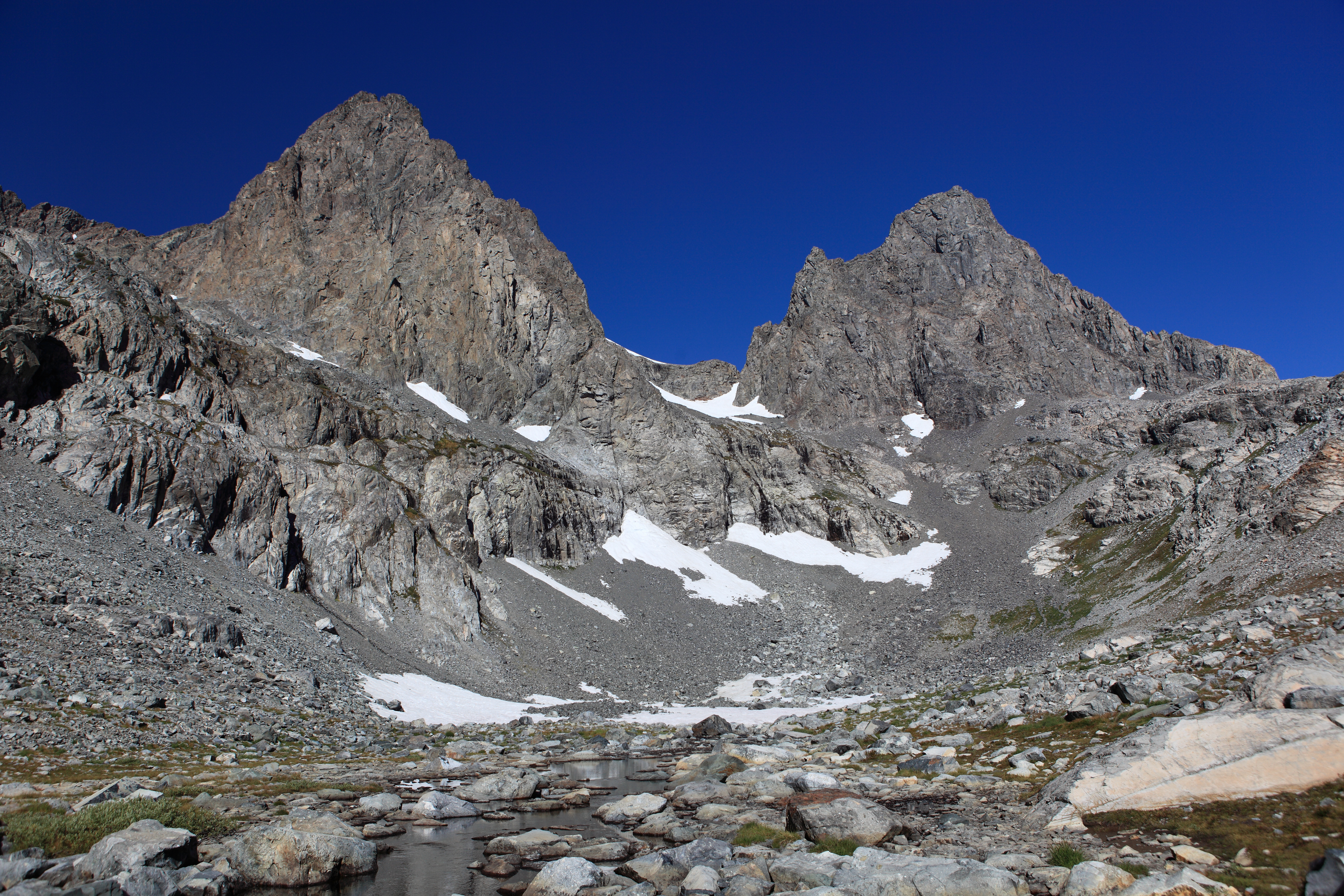
GENERAL OVERVIEW: This Pass crosses the saddle between the upper North branch of Shadow Creek & Ediza Lake and Lake Catherine at one of the upper most heads of the North Fork San Joaquin.
CLASS/DIFFICULTY: Class 2 - Subject to change based on snow and ice conditions. Ice axe and crampons may or may not be required at any given time.
LOCATION: Ansel Adams Wilderness / Inyo Nation Forest. The saddle branching Mt. Ritter & Banner. HST Map
ELEVATION: 12,020
USGS TOPO MAP (7.5'): Mt. Ritter
ROUTE DESCRIPTION: My knowledge of this pass is based off conditions of early September on an above average snow year and is limited to climbing and descending the East side.
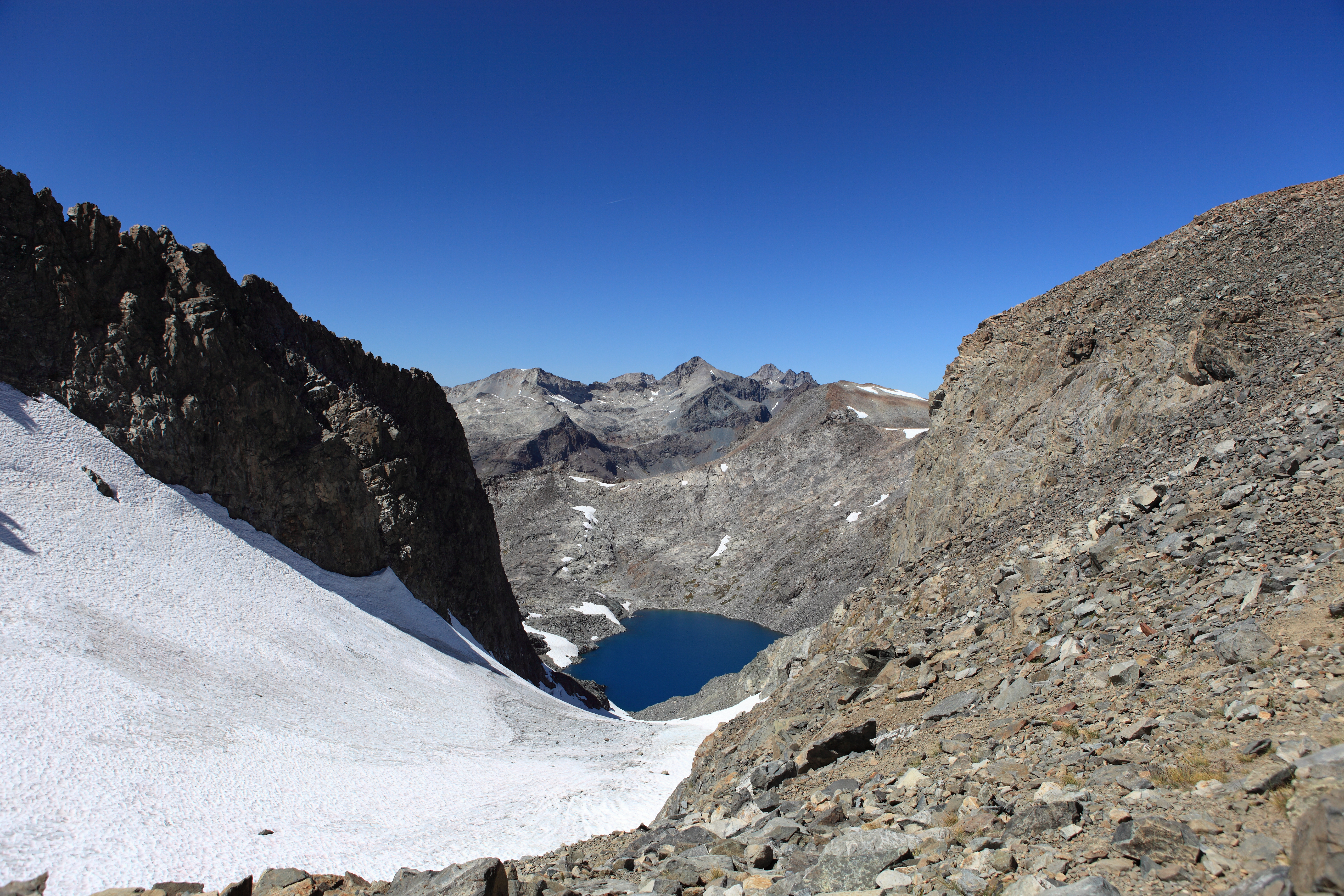
From Ediza Lake take the NW branch of Shadow Creek where some of a use trail can be used to take you into the cirque below the pass. The route I took was a bit to the right where I stayed on grassy slopes as long as I could before I had to cross a rather steep and loose scree slope. This is the only time I have ever fallen and spun my body completely 360 sideways in the air before I hit the ground. Kind of comical considering on my way down the snow I tripped and did a full front flip onto my ass on the snow.
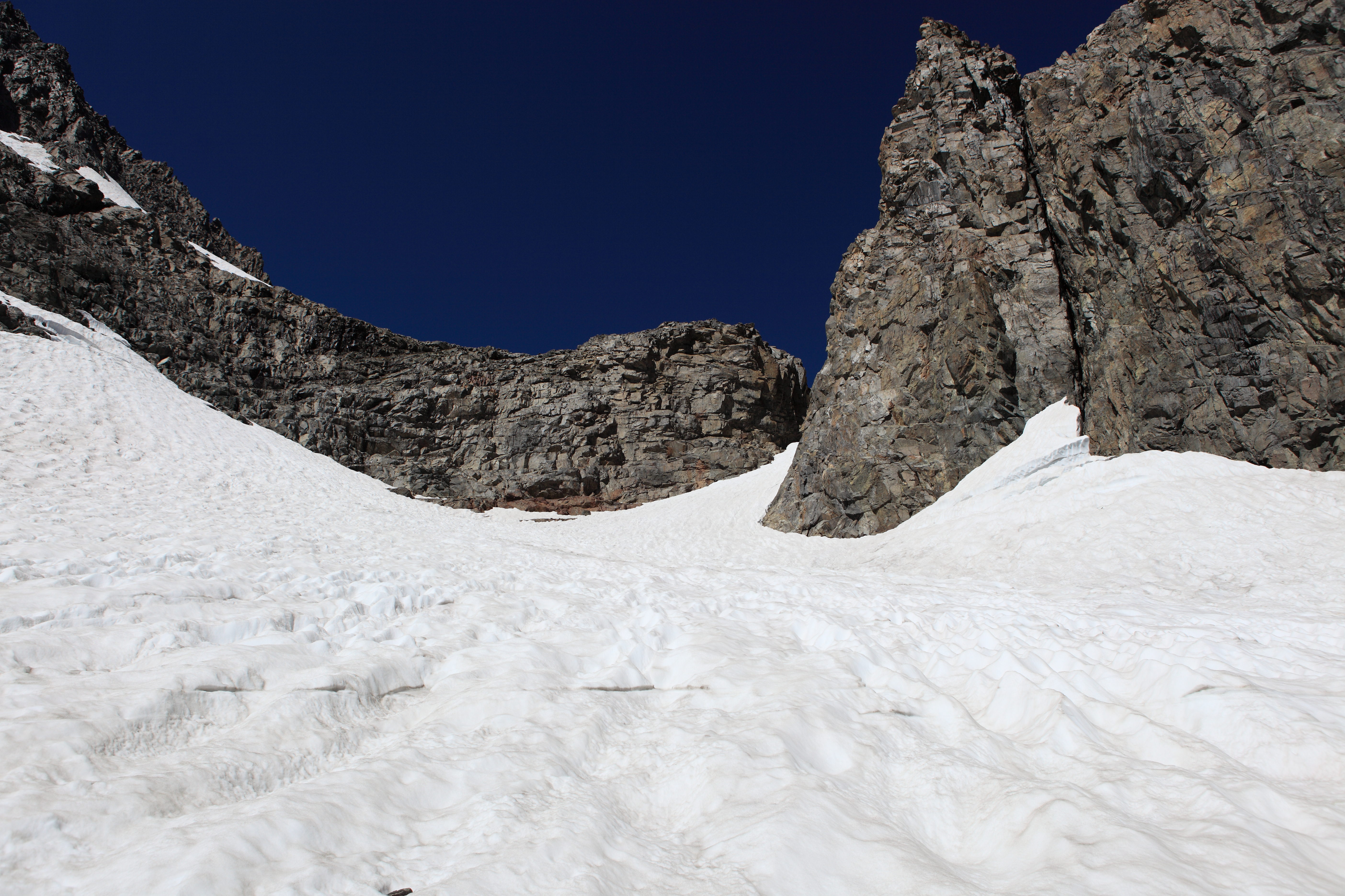
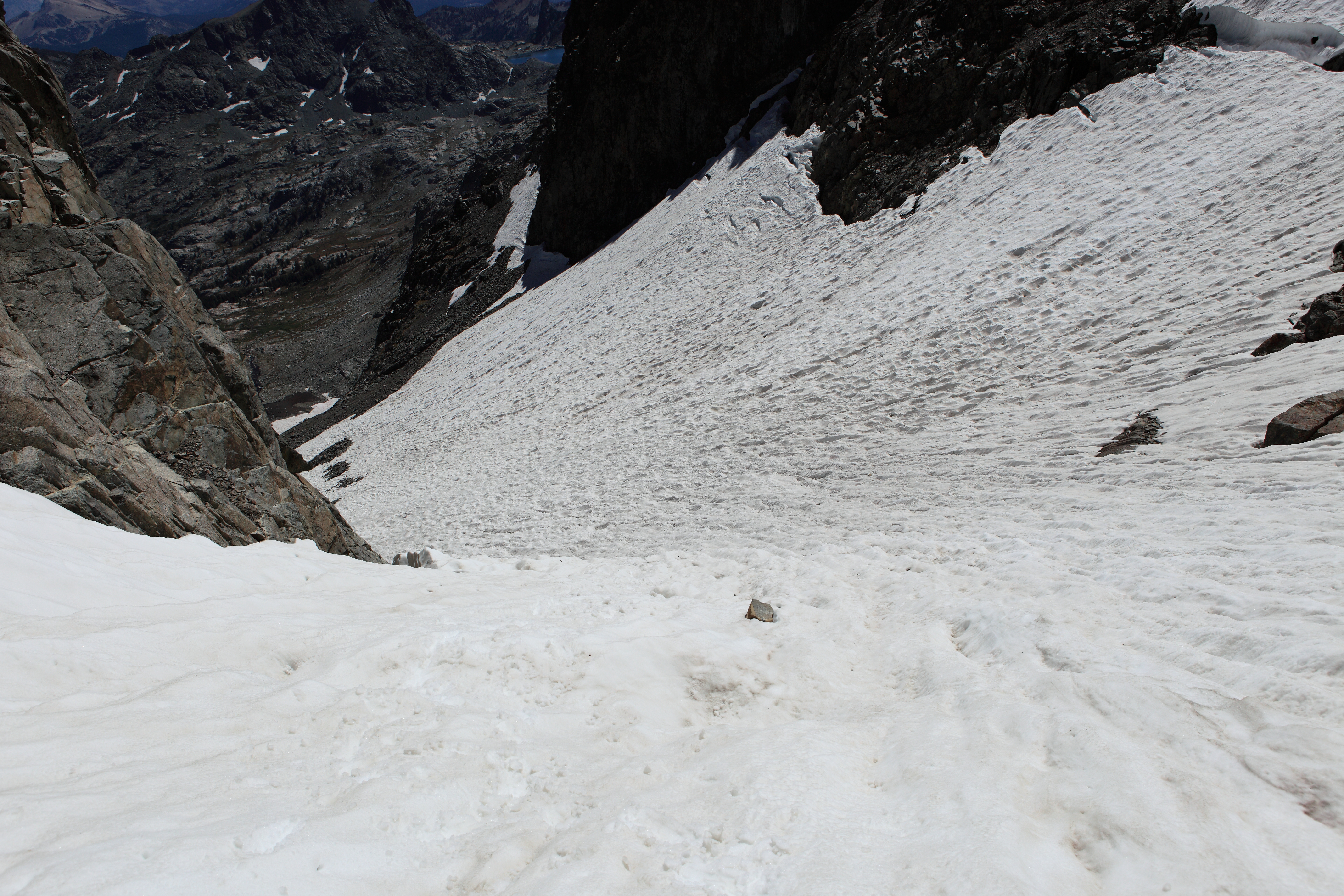
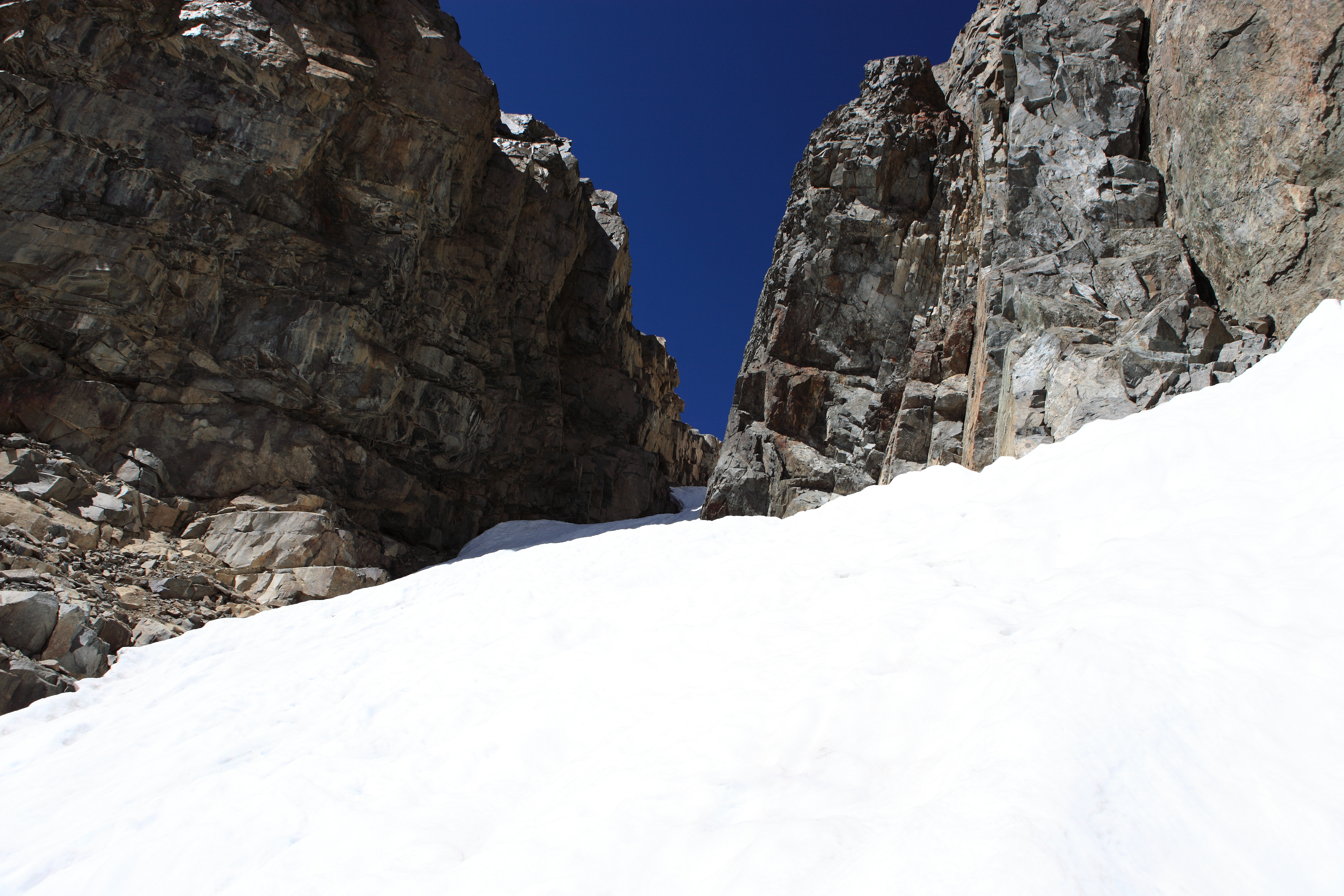
When you cross this scree you'll finally reach granite slabs that will take you to the snow slope. Areas of this snow had solid ice sticking out but I never required the use of crampons although I wore them anyway. Nothing here is an issue until you approach the final narrow push to the top. Here the snow was so steep and soft I just had to crawl my way to the top. Allot of caution is needed though as the snow was melted away from the cliff walls and were quite deep drop offs where if you fell you would likely fall into one of these wells and if you were not seriously injured it could still be quite difficult to get out.
GENERAL OVERVIEW: This Pass crosses the saddle between the upper North branch of Shadow Creek & Ediza Lake and Lake Catherine at one of the upper most heads of the North Fork San Joaquin.
CLASS/DIFFICULTY: Class 2 - Subject to change based on snow and ice conditions. Ice axe and crampons may or may not be required at any given time.
LOCATION: Ansel Adams Wilderness / Inyo Nation Forest. The saddle branching Mt. Ritter & Banner. HST Map
ELEVATION: 12,020
USGS TOPO MAP (7.5'): Mt. Ritter
ROUTE DESCRIPTION: My knowledge of this pass is based off conditions of early September on an above average snow year and is limited to climbing and descending the East side.
From Ediza Lake take the NW branch of Shadow Creek where some of a use trail can be used to take you into the cirque below the pass. The route I took was a bit to the right where I stayed on grassy slopes as long as I could before I had to cross a rather steep and loose scree slope. This is the only time I have ever fallen and spun my body completely 360 sideways in the air before I hit the ground. Kind of comical considering on my way down the snow I tripped and did a full front flip onto my ass on the snow.
When you cross this scree you'll finally reach granite slabs that will take you to the snow slope. Areas of this snow had solid ice sticking out but I never required the use of crampons although I wore them anyway. Nothing here is an issue until you approach the final narrow push to the top. Here the snow was so steep and soft I just had to crawl my way to the top. Allot of caution is needed though as the snow was melted away from the cliff walls and were quite deep drop offs where if you fell you would likely fall into one of these wells and if you were not seriously injured it could still be quite difficult to get out.