Gemini Lake Pass
Posted: Wed Aug 27, 2014 12:11 pm
TITLE: Gemini Lake Pass
GENERAL OVERVIEW: This pass leads from Seven Gables Lakes to the lakes directly East of The Pinnacles.
CLASS/DIFFICULTY: Class 2. Only a few Class 3 moves exist descending the pass to Gemini Lake. There may be a Class 2 route that we didn't find.
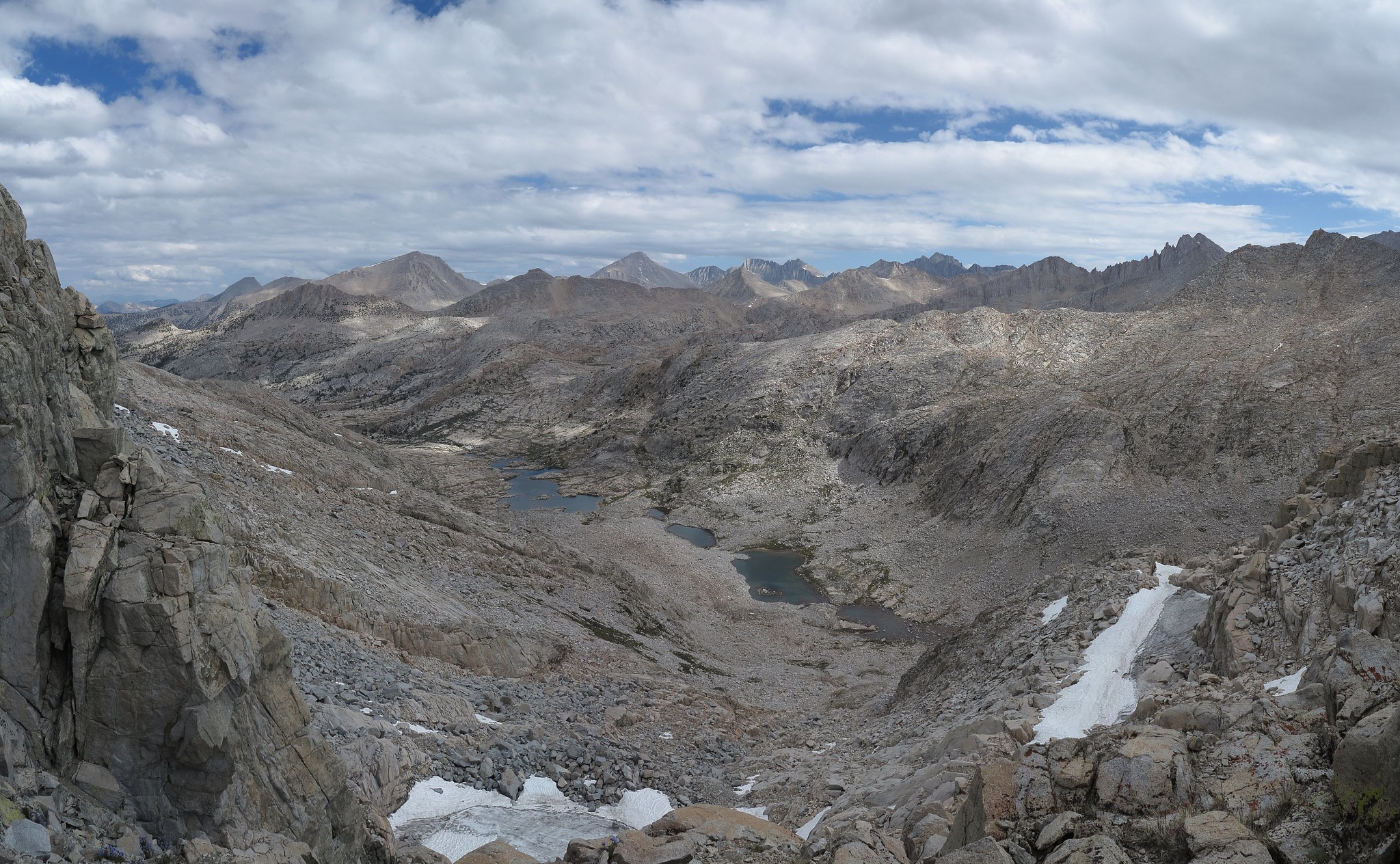
LOCATION: John Muir Wilderness in Sierra National Forest directly North of the lake East of Gemini unofficially known as Gemini Lake. HST Map
ELEVATION: 12,021
USGS TOPO MAP (7.5'): Mt. Hilgard
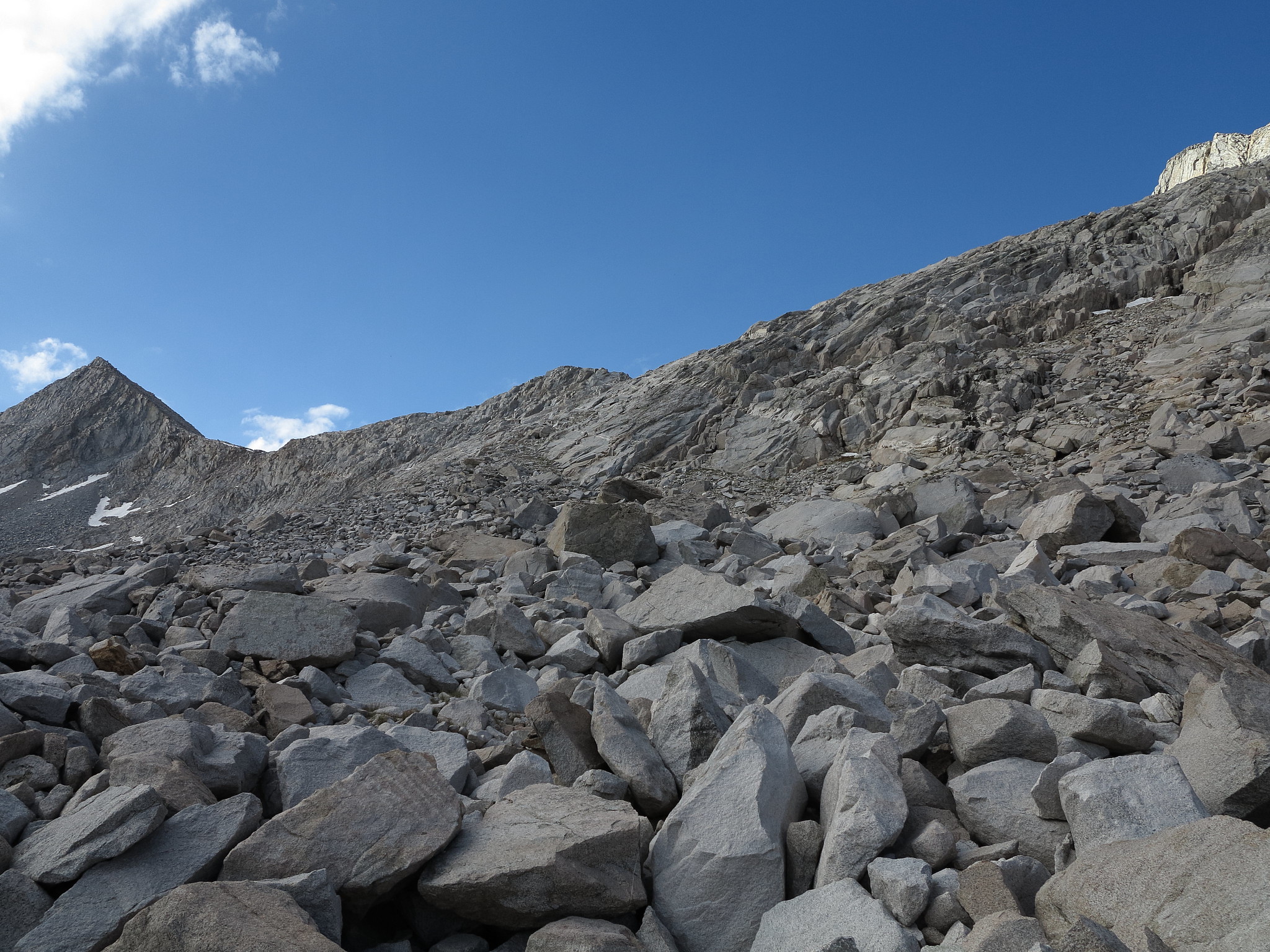
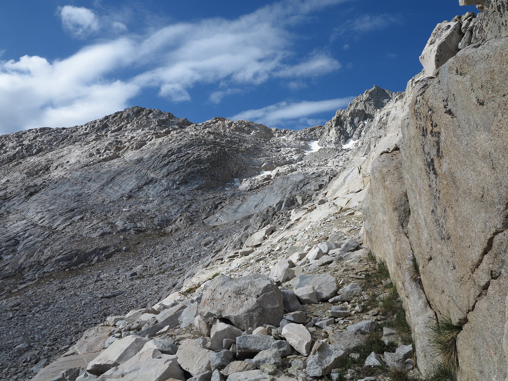
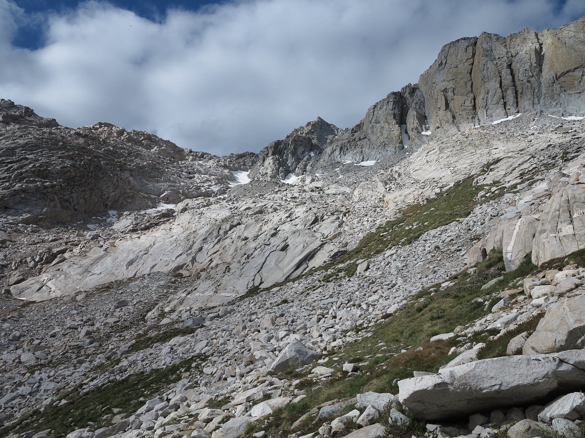
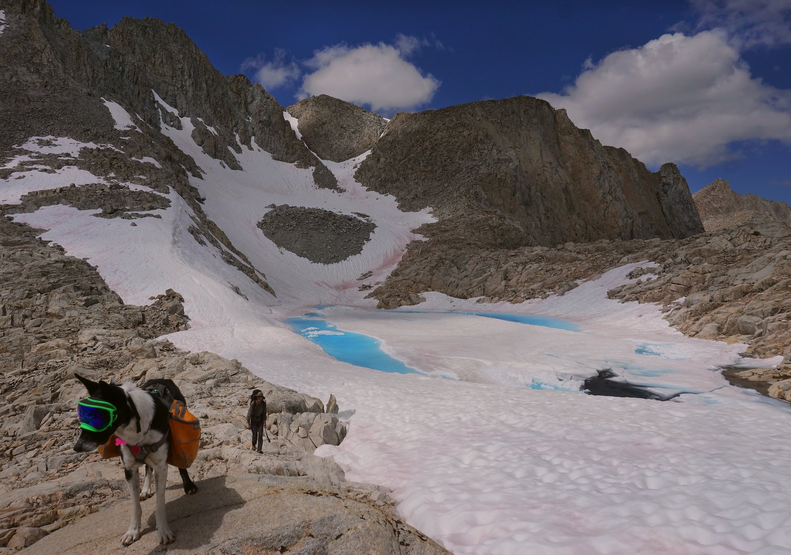
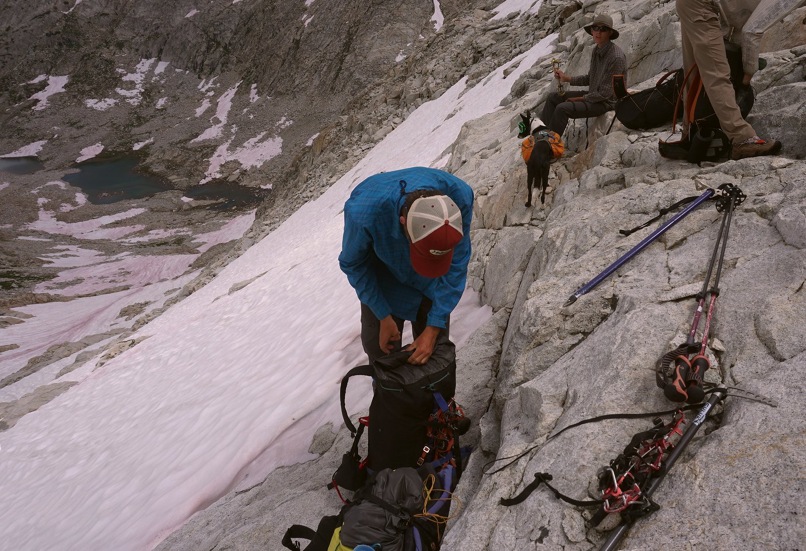
ROUTE DESCRIPTION: From the North side this pass involves talus, boulders, and lots of fairly easy granite benches and ramps towards the top. An ice ax would be necessary in a heavy snow year or early in the season since there is a permanent snow field present. We (RoguePhotonic and I) only crossed snow once for about 30 feet. The grade was gentle and the snow was soft so there was no concern. Avoid angling up too early from the last Seven Gables Lake as you will have to contour around a looser slope and then avoid a large granite cliff face (which is what we did). Another member of our party stayed further toward the bottom until the route became an almost straight shot up via granite boulders and talus.
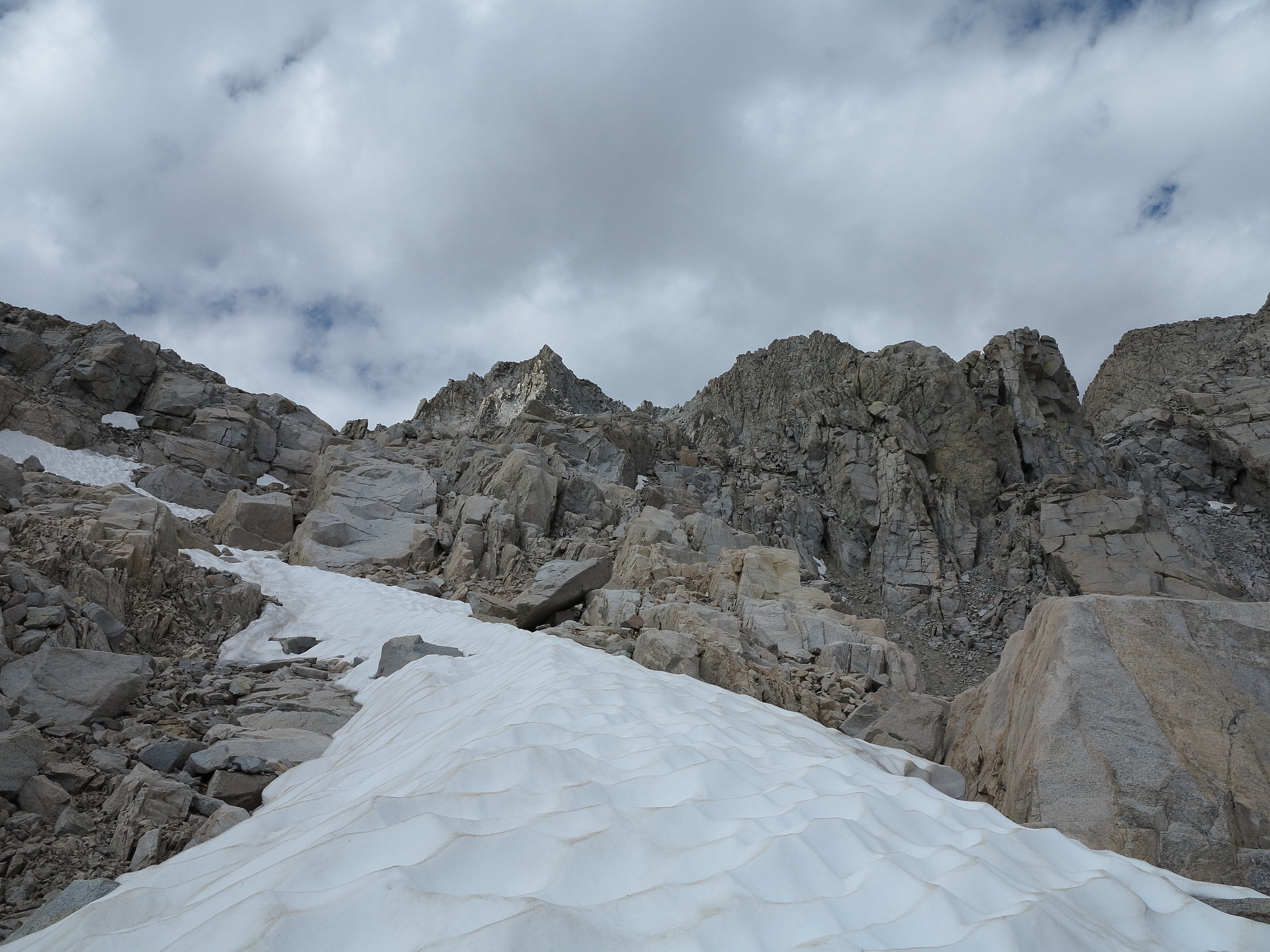
The South side of the pass possess an interesting route. We could not find the class 2 route around the lake although it looked as though there exists one if you stay higher along the ridge-line. The class 3 was easy and only included a couple moves to get around the lake on the Northern side. Once you reach the South side of the lake the route is obvious and easy down lots of talus and granite benches.
GENERAL OVERVIEW: This pass leads from Seven Gables Lakes to the lakes directly East of The Pinnacles.
CLASS/DIFFICULTY: Class 2. Only a few Class 3 moves exist descending the pass to Gemini Lake. There may be a Class 2 route that we didn't find.
LOCATION: John Muir Wilderness in Sierra National Forest directly North of the lake East of Gemini unofficially known as Gemini Lake. HST Map
ELEVATION: 12,021
USGS TOPO MAP (7.5'): Mt. Hilgard
ROUTE DESCRIPTION: From the North side this pass involves talus, boulders, and lots of fairly easy granite benches and ramps towards the top. An ice ax would be necessary in a heavy snow year or early in the season since there is a permanent snow field present. We (RoguePhotonic and I) only crossed snow once for about 30 feet. The grade was gentle and the snow was soft so there was no concern. Avoid angling up too early from the last Seven Gables Lake as you will have to contour around a looser slope and then avoid a large granite cliff face (which is what we did). Another member of our party stayed further toward the bottom until the route became an almost straight shot up via granite boulders and talus.
The South side of the pass possess an interesting route. We could not find the class 2 route around the lake although it looked as though there exists one if you stay higher along the ridge-line. The class 3 was easy and only included a couple moves to get around the lake on the Northern side. Once you reach the South side of the lake the route is obvious and easy down lots of talus and granite benches.