Crystal Pass
Posted: Sun Dec 15, 2013 8:27 pm
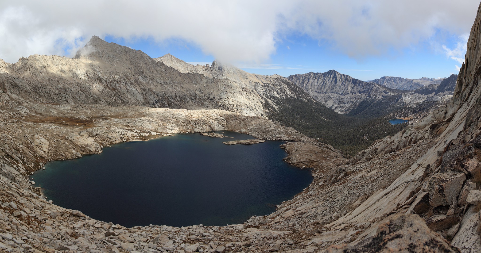
GENERAL OVERVIEW: This Pass leads between Aphitheater Lake / Soda Creek & the Crystal Lakes / Creek
CLASS/DIFFICULTY: Class 3 - The upper West side of this pass should be considered high level technical class 3. The upper East side is mid level class 3.
LOCATION: South Western Sequoia National Park East of Mineral Peak South of Sawtooth Peak. HST Map
ELEVATION: 11,430
USGS TOPO MAP (7.5'): Mineral King
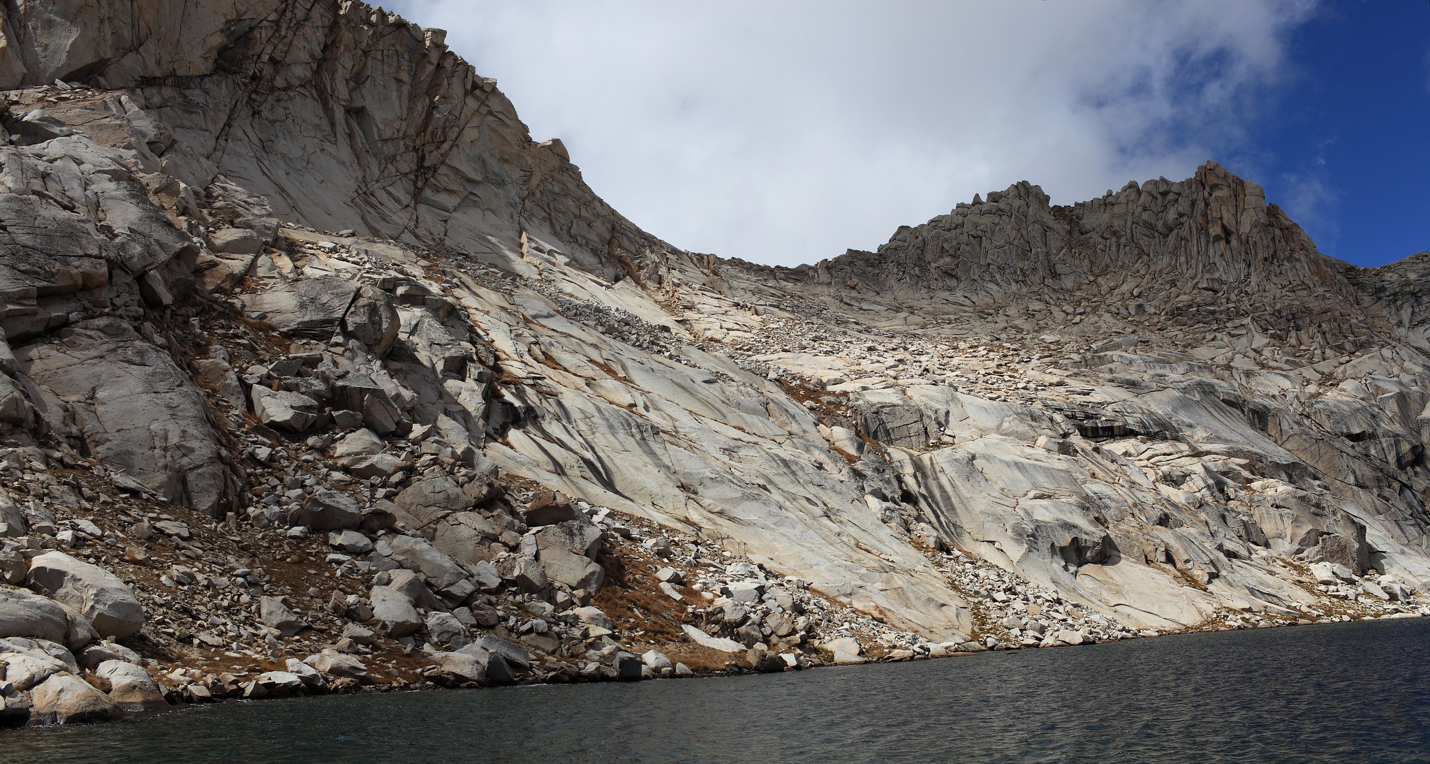
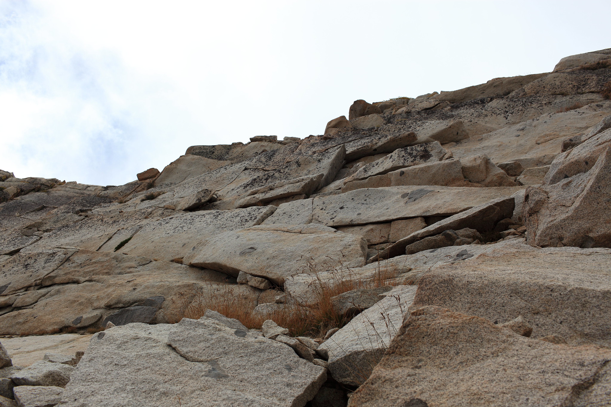
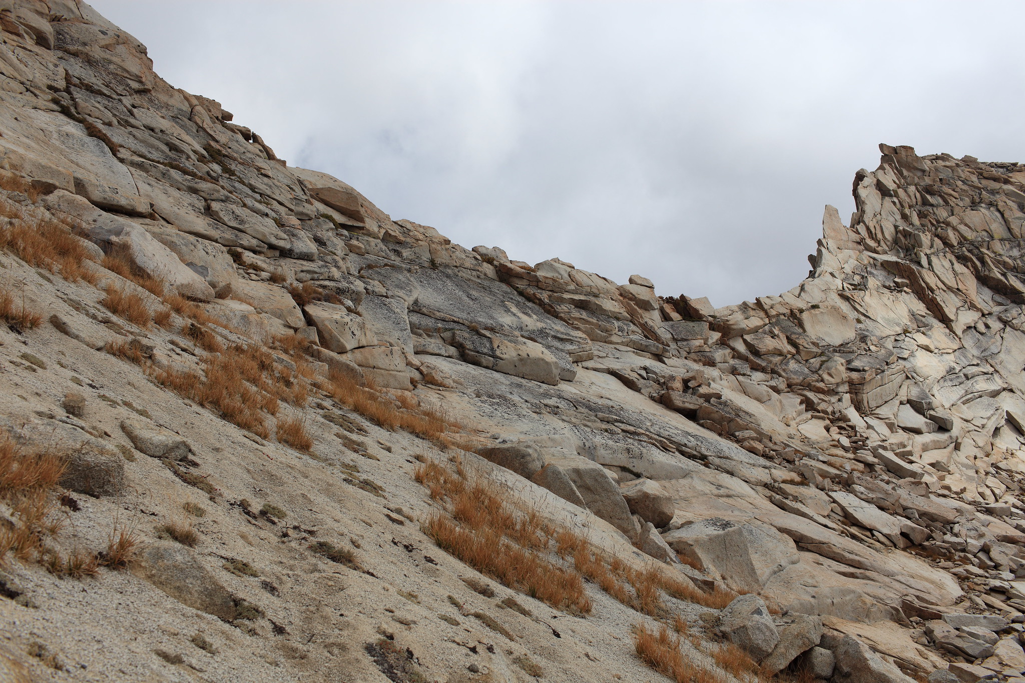
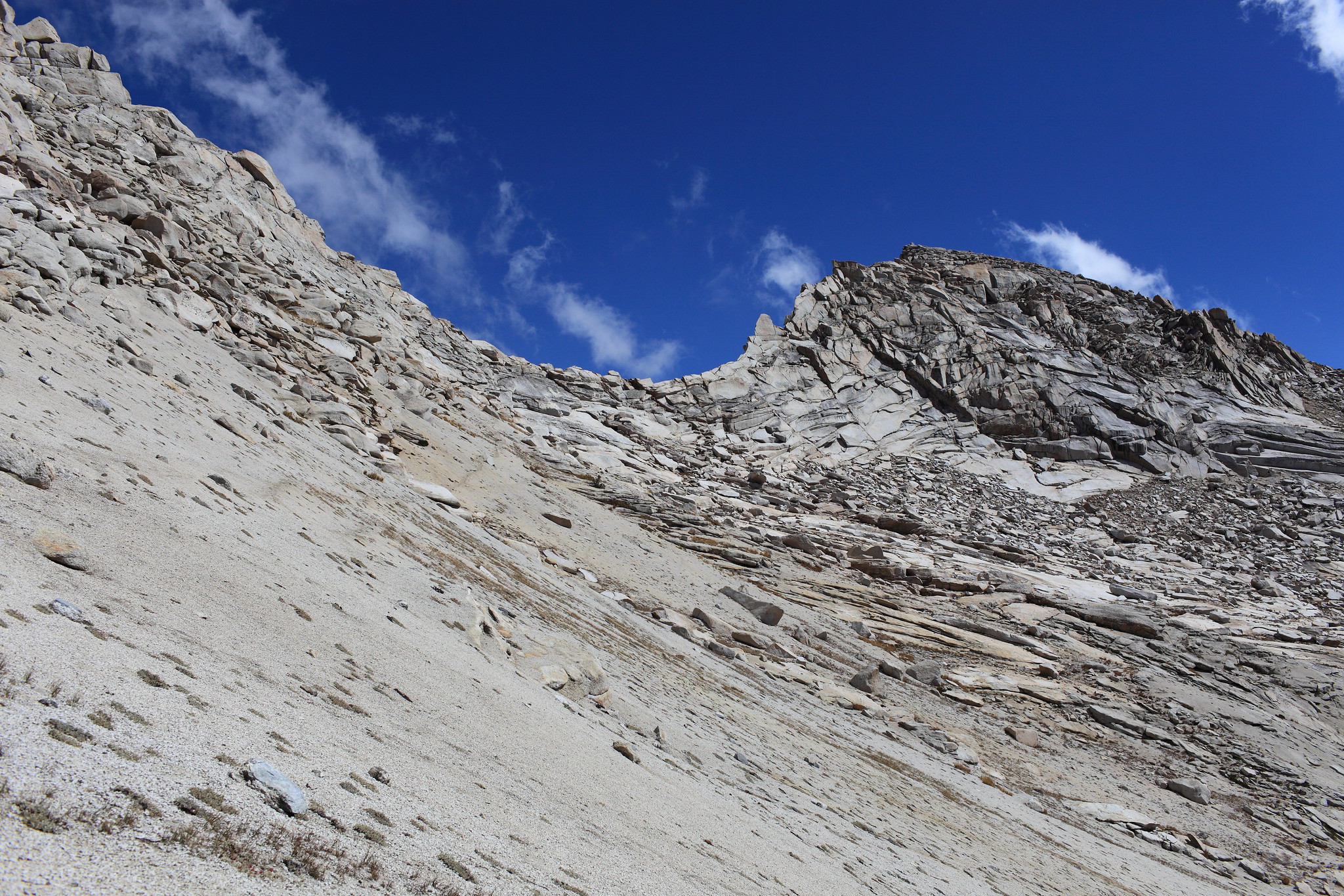
ROUTE DESCRIPTION: If traveling East to West leave Amphitheater Lake on it's SW shore by climbing the only available grass / talus slope. Before you are able to exit this you will have to complete a single class 3 climb. From here begin angling up the easy slabs / talus until your directly under the pass. From here you can pick two basic options. You either have to zig zag up some exposed out sloped granite slabs until you can make the final class 3 blocks to the top or you can pick one or two broken cracks and make a some what vertical ascent.
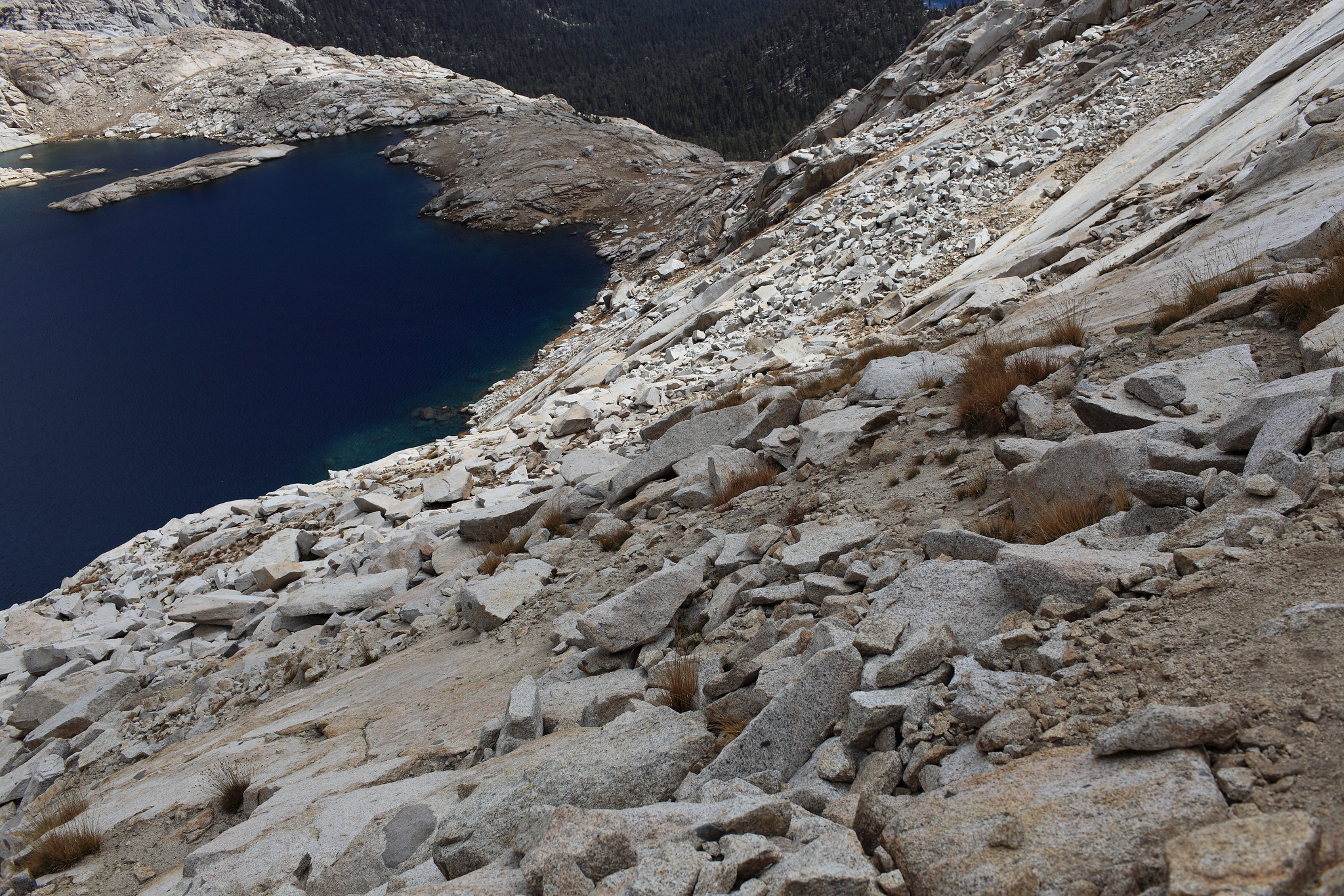
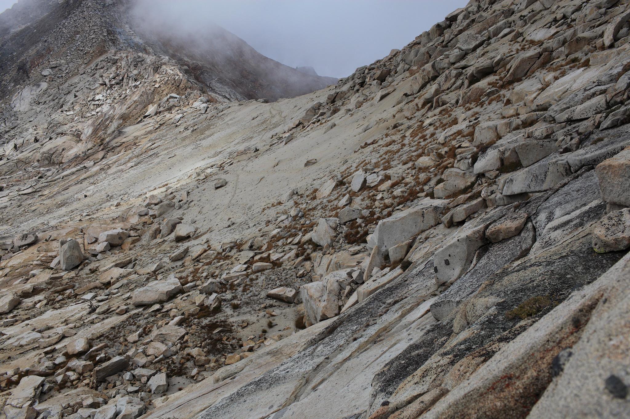
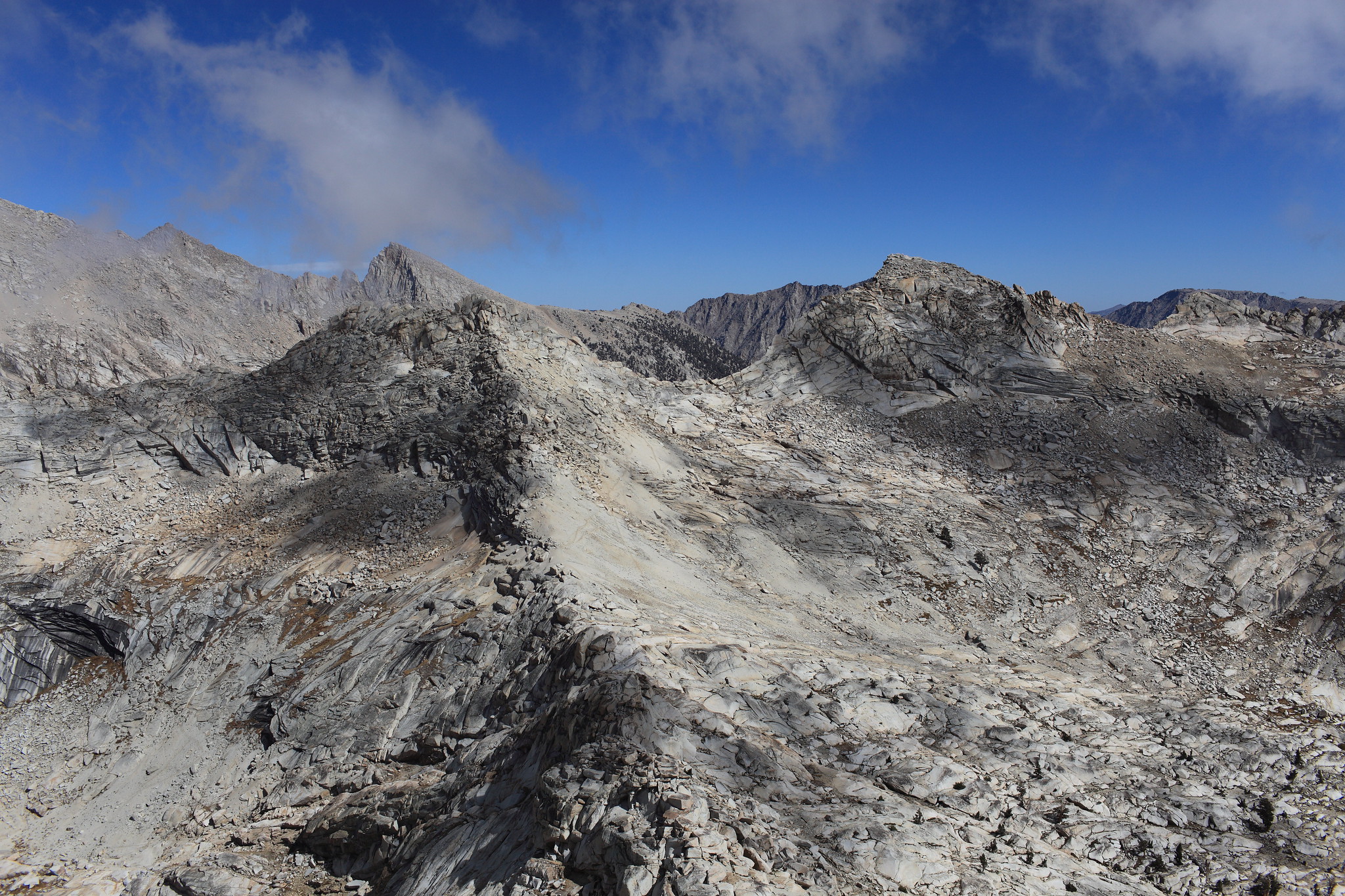
Once on top an obvious route down is not visible nor is there one. Hook hard right and climb along the knife edge ridge of the pass until you find yourself climbing along a 5 inch out crop on the East side of the pass. Shimmey along this rock that will be about waist high until you are blocked by a wall. Climb over the rock your holding onto to get onto the West face. From here you will need to zig zag along this West face which is quite technical and steep so use your best judgement in order to safely make it down. This part of the descent I considered to be the most difficult. Once off the technical faces it will be obvious that you need to pick up some use trails in the sand below. Before you get to them however use allot of caution on these sections of rock. They are covered in sand and are quite slippery.


CLASS/DIFFICULTY: Class 3 - The upper West side of this pass should be considered high level technical class 3. The upper East side is mid level class 3.
LOCATION: South Western Sequoia National Park East of Mineral Peak South of Sawtooth Peak. HST Map
ELEVATION: 11,430
USGS TOPO MAP (7.5'): Mineral King
ROUTE DESCRIPTION: If traveling East to West leave Amphitheater Lake on it's SW shore by climbing the only available grass / talus slope. Before you are able to exit this you will have to complete a single class 3 climb. From here begin angling up the easy slabs / talus until your directly under the pass. From here you can pick two basic options. You either have to zig zag up some exposed out sloped granite slabs until you can make the final class 3 blocks to the top or you can pick one or two broken cracks and make a some what vertical ascent.
Once on top an obvious route down is not visible nor is there one. Hook hard right and climb along the knife edge ridge of the pass until you find yourself climbing along a 5 inch out crop on the East side of the pass. Shimmey along this rock that will be about waist high until you are blocked by a wall. Climb over the rock your holding onto to get onto the West face. From here you will need to zig zag along this West face which is quite technical and steep so use your best judgement in order to safely make it down. This part of the descent I considered to be the most difficult. Once off the technical faces it will be obvious that you need to pick up some use trails in the sand below. Before you get to them however use allot of caution on these sections of rock. They are covered in sand and are quite slippery.