Page 1 of 1
What Road Is This?
Posted: Thu Jun 19, 2014 12:56 pm
by InsaneBoost
Sometimes we leave Yosemite out the 140 and while in the canyon area, I notice there is a road that starts/ends at where the last rock slide happened in 2006? Does anyone know what road this is?
I've been interested in possibly walking around it if it's possible, but I know it's washed out in certain areas, and also has areas missing where bridges used to be.
There are also some homes that are along the road, but besides two or three appear to be abandoned.
Anyone know how to get to that side of the road? How the people who still live there get to their homes, etc?
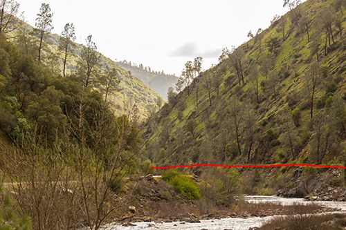
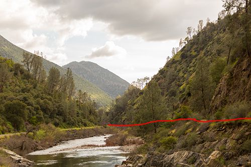
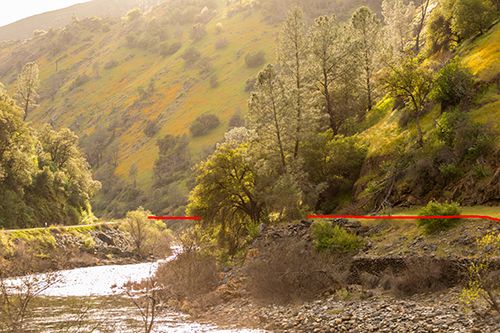
Here are some pictures of it, it's literally directly across the 140 on the otherside of the river. I marked the road in red as it's covered in grass in most of my pictures.
Re: What Road Is This?
Posted: Thu Jun 19, 2014 1:15 pm
by markskor
Not a road but the remains of the right of way/track grade of the old Yosemite RR.
It follows along the far side of the river into El Portal.
Re: What Road Is This?
Posted: Thu Jun 19, 2014 1:16 pm
by InsaneBoost
Oh really. That's really interesting. Is that what connected to the Sugar Pine one? Or two entirely different ones? Is there a hike for it?
Re: What Road Is This?
Posted: Fri Jun 20, 2014 9:01 am
by markskor
Taken from something Google...
More? Do a search: Yosemite Valley Rail Road - (YVRR).
"Merced River canyon - Highway 140 parallels the YV from El Portal to Briceburg (at the bottom of the grade from Midpines/Mariposa). Look across the river along this section of highway and you can see the foundations of a number of railroad bridges. Until the January 1997 floods, several of these bridges were fairly intact. However, all but a couple are now gone."
Re: What Road Is This?
Posted: Fri Jun 20, 2014 2:52 pm
by DoyleWDonehoo
On many occasions I have studied that road/trail from the road, in particular when I was a passenger. I have long thought that hiking that route would make a good off-season hike of exploration. Also along that road is an obvious mule trail that at one time serviced the mines along the river. Well, if anybody gets over there, watch out for snakes.
Re: What Road Is This?
Posted: Sat Jun 21, 2014 9:40 am
by InsaneBoost
Definitely going to look into it more. I thought the same thing about snakes as well. Would think it's infested with them, especially considering it's rocky in parts and the sun hits there hard.
Re: What Road Is This?
Posted: Wed Jun 25, 2014 7:47 pm
by InsaneBoost
After googling, it looks like that area of the railroad, at least in Merced, was part of the Yosemite Portland Cement Co, and I believe one of the buildings there, is actually from when it was active, part of their offices.
Very cool to see.
