Page 2 of 2
Re: Putting Maps on Walls
Posted: Tue Mar 19, 2013 6:54 pm
by John Dittli
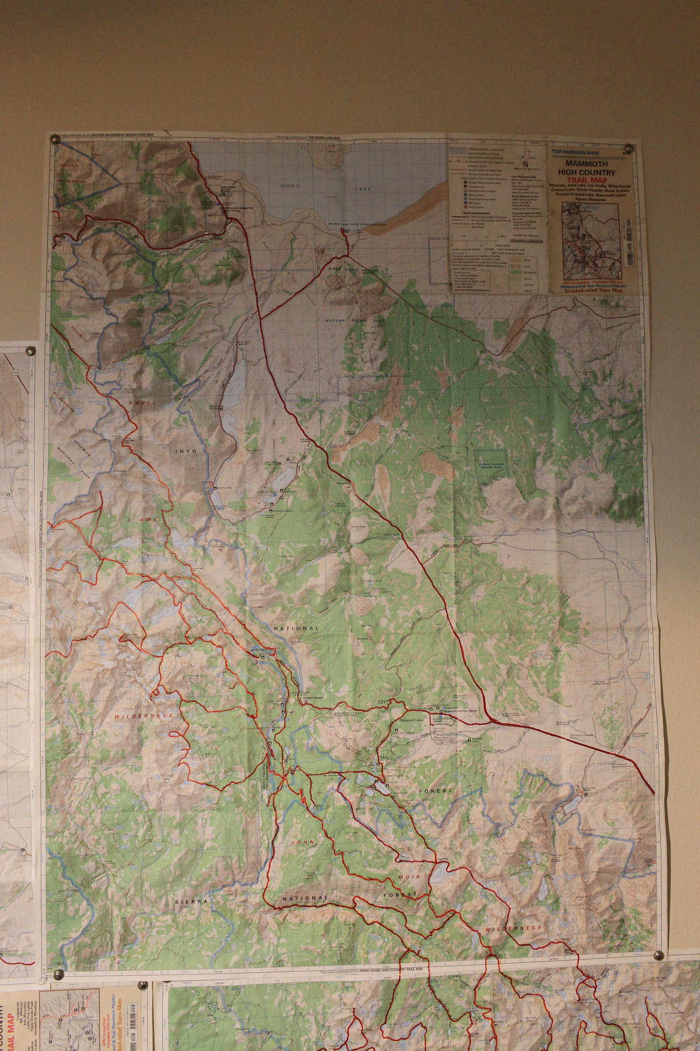
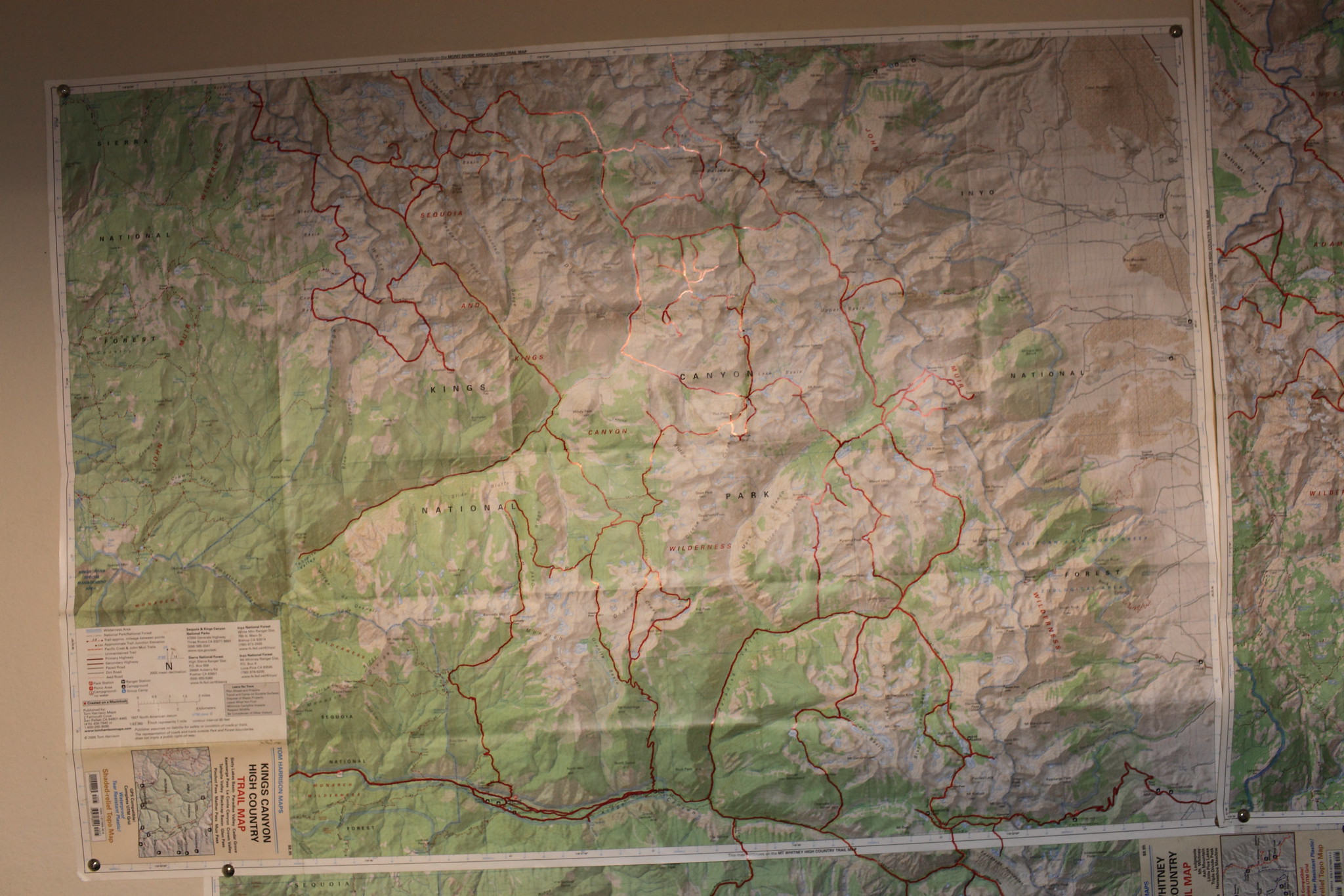
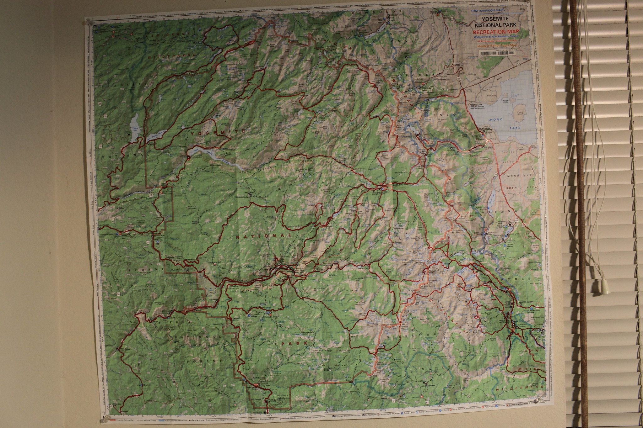
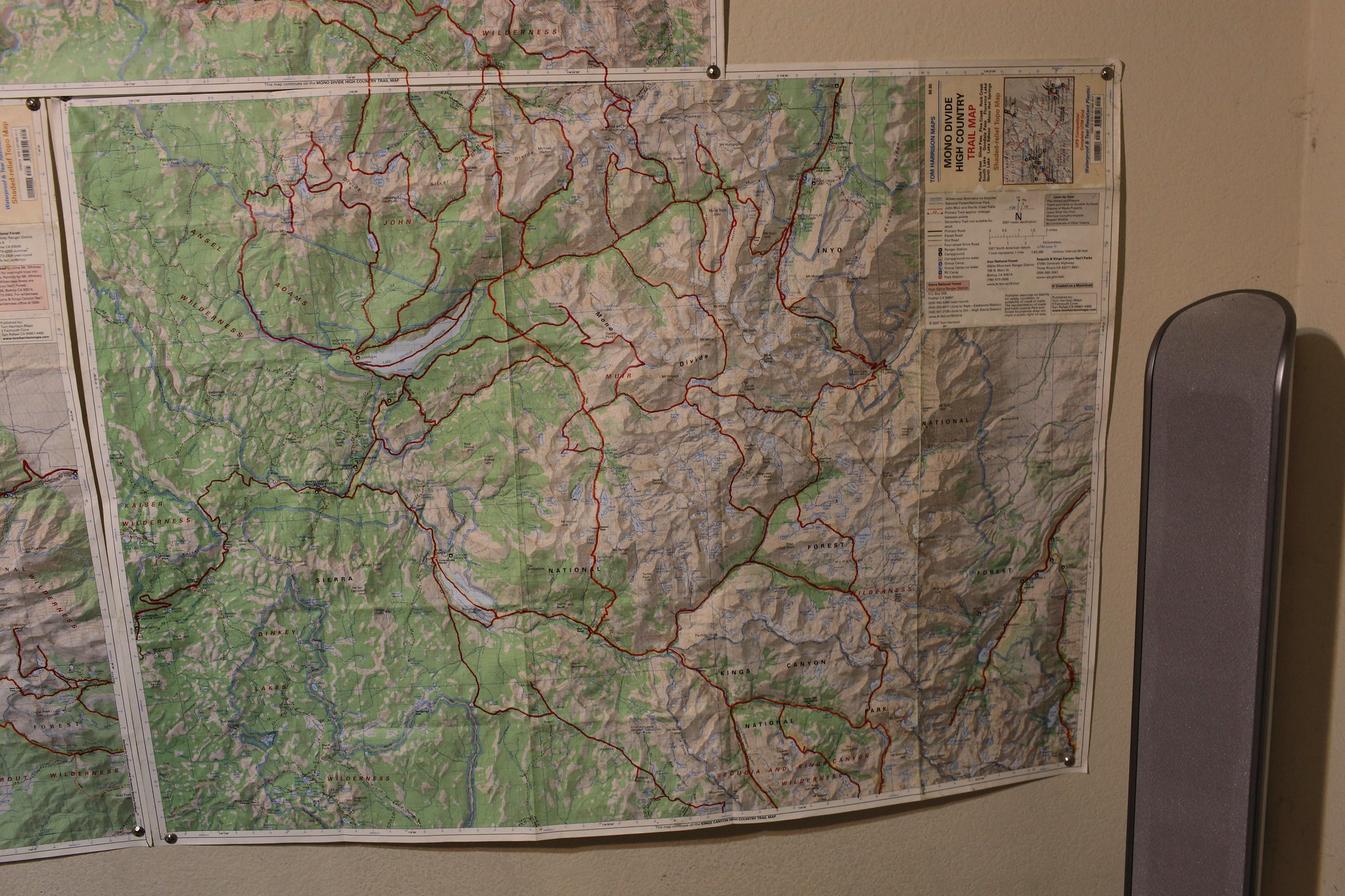
Ha ha! "ego maps" we used to call them. I've been drawing red lines on mine for years too! I'm still using the original USFS: John Muir Wilderness map set, Ansel Adams, and Hoover from the early '80's. I had to fill in with 15' USGS quads for a little of Yosemite. I find the lines useful to jog my memory as I often forget where I've been!
Backpacking with Alden Nash in Death Valley last winter, I pulled out a map the had some notes on it. The notes showed I had already been in this certain canyon, but I had completely forgotten! Nash was incredulous that such a thing could happen!
I've never had wall space big enough for the entire Sierra, so they live rolled up right next to my desk for quick reference. They are pretty dog eared and taped at this point. I also realized several years ago that I should have used blue to differentiate winter from summer trips, but it's a bit late now; maybe next time.....
Re: Putting Maps on Walls
Posted: Fri Oct 18, 2013 7:00 pm
by RoguePhotonic
Re: Putting Maps on Walls
Posted: Fri Oct 18, 2013 7:16 pm
by Timberline
For years, I've had my maps of the Sierra and Inyo NF's posted on the wall in my garage, so I could recall the two summers I worked on these forests while in college. In addition to lines delineating the flight routes for aerial photography of the forest, and outlines of working circles, I've traced routes I followed from trailheads and other starting points to the plot sites I visited. Since a lot of my time was spent off trail in back country, they help remind me of special times and places I got to see that most people don't go to. A lot of fond memories there.
When I need to refer to topography for any of these trips, I pull out my 10 minute quads from their boxes, which I've also kept as keepsakes.
Looking back, I consider that the Forest Service was paying me to go backpacking. In that sense, it was the best job I ever had.
Re: Putting Maps on Walls
Posted: Sun Nov 10, 2013 12:40 pm
by ondafringe
Pretty cool to have all your trips on one map and then sit back and reminisce about all the hikes you've been on!

I like to keep track of the trails I've hiked, as well, along with notes about the trail. But rather than manually use a highlighter to mark the trail, and then write the trail notes on (or on the back of) a printed map, I decided to keep all that information online where it's easy to access.
And I don't put all my hikes together on one map but rather create a new map for each individual hike. And I've started adding markers on the map and include my trail notes with the markers. To keep the maps organized, I put them on my blog in chronological order. Not only does that make it easier for me to find a particular hike, but since I make the map "Public," the map and trail notes are accessible to others who may be interested in doing one of those hikes.
Granted, it does require that I carry a GPS, but I have no problem with that because it makes tracking my hikes so much easier. It also requires a Google account because I use their online map resources to create the maps. But those of you who carry a GPS might want to play around with this alternative.
Here is the map I created for a trip I took this past summer. If you click on the markers, you can see the various trail notes I made along the way.
Re: Putting Maps on Walls
Posted: Sun Nov 10, 2013 12:51 pm
by rlown
Well, some of us dinosaurs predate GPS. So we had paper maps and the trusty highlighter. An example:
Maps 2013 002.jpg
And yes the trusty compass. You can tell this map is not in a reasonable state to put on a wall unless mounted in a frame.
Re: Putting Maps on Walls
Posted: Sun Nov 10, 2013 1:29 pm
by ondafringe
rlown wrote:You can tell this map is not in a reasonable state to put on a wall unless mounted in a frame.
Yeah, but that map has "character," which is something you can never get from an online map!!

And I'm up in the dinosaur age range myself.

Re: Putting Maps on Walls
Posted: Sun Nov 10, 2013 1:35 pm
by rlown
i actually do carry a gps and turn tracking on as it's fun to see "true to course" data later. But it's not wall worthy. Most still want that piece of paper in their pocket.
Re: Putting Maps on Walls
Posted: Sun Nov 10, 2013 2:12 pm
by ondafringe
rlown wrote:i actually do carry a gps and turn tracking on as it's fun to see "true to course" data later. But it's not wall worthy. Most still want that piece of paper in their pocket.
And I'm one of them because complete reliance on technology can get you killed. So even though I carry a GPS, I also carry a compass, a 24k topo, and, as you may recall, a PLB. Wouldn't think about going into the backcountry without all four items, plus backup batteries for the GPS.