Page 1 of 2
Putting Maps on Walls
Posted: Fri Feb 01, 2013 7:19 am
by RoguePhotonic
I have heard some of you say you put maps up on your walls. Do any of you draw lines on them to keep track of where you have gone?
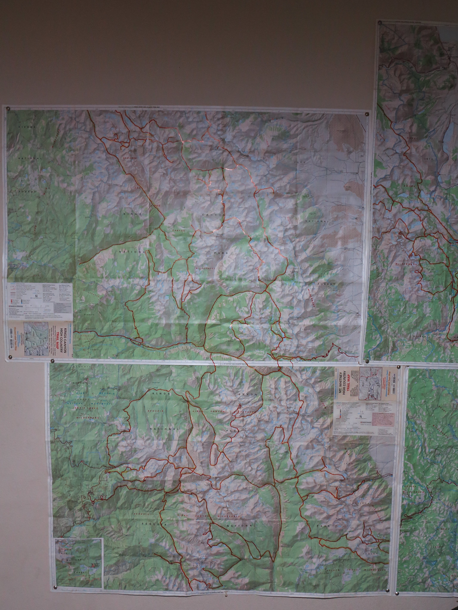
Here is an example of 2 of mine. I think I have most of Sequoia covered.

Re: Putting Maps on Walls
Posted: Fri Feb 01, 2013 1:30 pm
by sparky
I did, while I didnt put lines on them, I had cross country passes numbered, and on the back I have all kinds of route info. It was a painstaking process. I also have the high route info in its entirety. Over the years I have lost a couple maps and some are needing replacement.
I loved having my walls covered with topos. Now that im not a batchlor i dont have sweat stained maps adorning my walls
Re: Putting Maps on Walls
Posted: Fri Feb 01, 2013 1:45 pm
by rlown
I've actually never put a map on a wall, but for a certain topo when I used to buy them, I'd highlight in yellow where i've been. Those are all in storage boxes in the garage. Also annotated specific spots with either triangulation info or whatever. Now, I print small cheater maps for the areas I'm hitting on a specific trip.
Re: Putting Maps on Walls
Posted: Fri Feb 01, 2013 5:54 pm
by Carne_DelMuerto
I don't mark them up, but I do look at them and day dream.
Re: Putting Maps on Walls
Posted: Fri Feb 01, 2013 7:56 pm
by RoguePhotonic
I don't mind marking up those maps because I have a second set of the National Geographic maps I use for on trail. They are damn heavy though.
Re: Putting Maps on Walls
Posted: Fri Feb 01, 2013 11:07 pm
by sparky
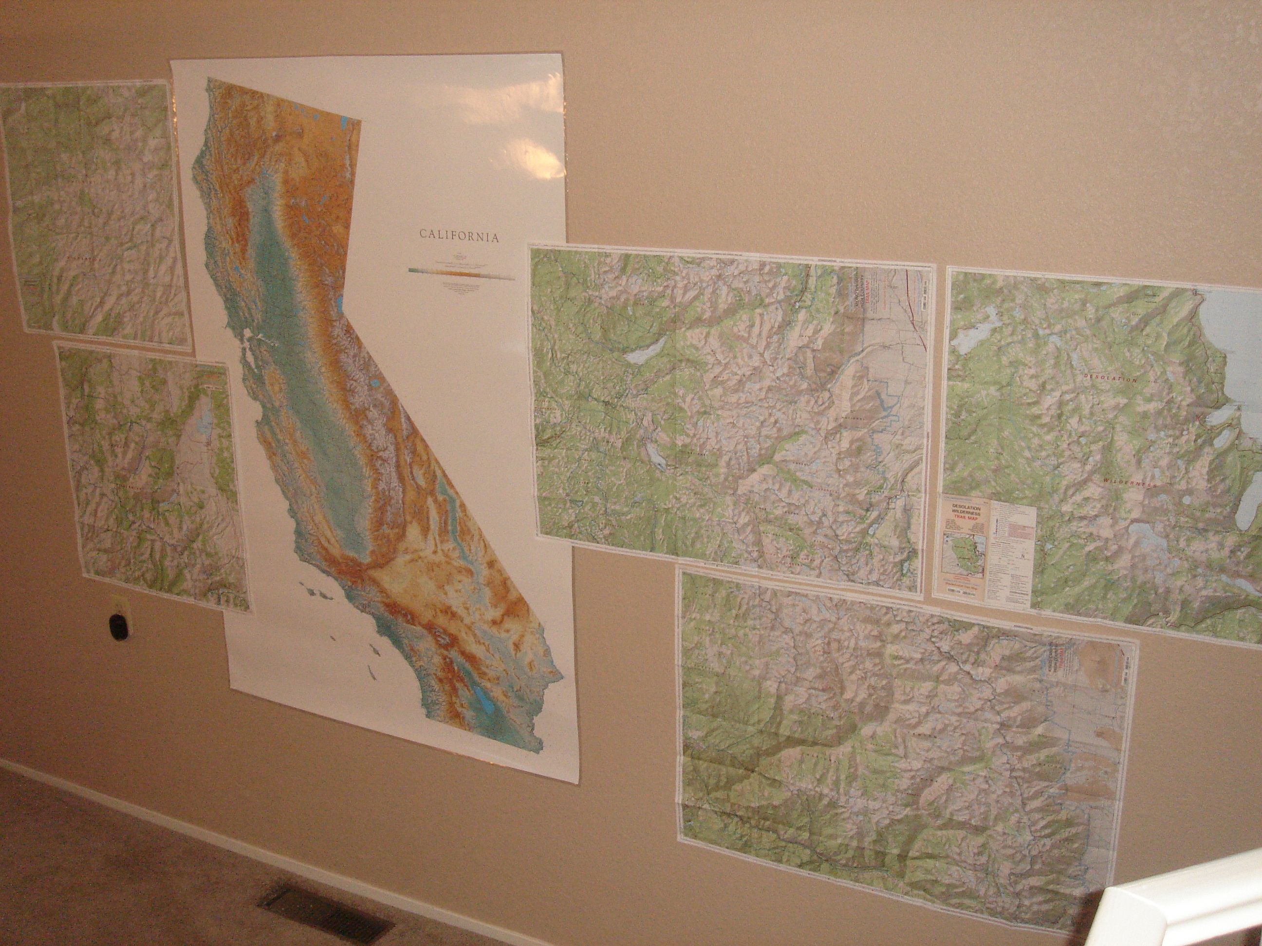
i ended up putting up more maps than this too on these walls, and no pictures of the maps in the bathrooms.

2012-02-26_17-29-46_189.jpg
2012-02-26_17-29-22_902.jpg
2012-02-26_17-29-35_148.jpg
Re: Putting Maps on Walls
Posted: Sat Feb 02, 2013 6:40 am
by oldranger
I have a SEKI map marked up with all the routes I took when a BC Ranger in the 80s. It is mounted on the huge door of my outdoor gear cabinet in the garage. Actually I need to add some more routes I have added in recent years. I probably should add a similar map for yosemite as I have yosemite pretty well covered over the years.
Mike
Re: Putting Maps on Walls
Posted: Sat Feb 02, 2013 12:18 pm
by Ikan Mas
I'm annotating all of my hike routes, marking the trails hiked and keeping my trail journal on the backside. With a Sharpie, the backside of
Tom Harrison map
provides a good tablet, with each panel worth about a day's hiking. The Sharpie is waterproof and won't rub off or smudge. Passes and camps also noted. My Whitney High Country Map actually looks like I know the area.
Rogue, I aspire to fill my maps up as you have. After reading the TR,seeing your maps explains everything!
This all said, I put myself in a tizzie earlier this year when I thought I had lost one of my maps, one with a journal on the back. The map was easily replaceable, but journal was not. As it turned out, it was just my 50+ eyes playing tricks on me. The map was in front of me all along. Makes me think I need to transcribe my journals to a safer medium. Also need to link them with my photos.
Putting Maps on Walls
Posted: Sun Feb 10, 2013 8:53 pm
by bheiser1
I don't have any maps on my walls, but am hoping to find a raised relief map of the Sierra (ideally showing the JMT) to put on my wall.
Re: Putting Maps on Walls
Posted: Mon Feb 11, 2013 7:27 am
by fishmonger
bheiser1 wrote:I don't have any maps on my walls, but am hoping to find a raised relief map of the Sierra (ideally showing the JMT) to put on my wall.
Doug Sr at the Whitney Hostel sells a Sierra raised relief map - rather large scale, but it is unique in being a satellite image rather than topo map coloring. Much cheaper at the hostel (I think I paid $22 in 2011) than online, but if you can't get there, here's the link:
http://www.summitmaps.com/Products/3D-O ... _0018.aspx" onclick="window.open(this.href);return false;
I am still looking for a frame to put it up in. Meanwhile, my hiking buddy uses it for route planning:

This guy is about 6 inches tall, just to show you how small things are. It's more a novelty than a map you can plan trips on.